| Wanxing Subdistrict 万兴街道 | |
|---|---|
| Subdistrict | |
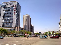
 Intersection of Hongqi Road and Xihu Avenune within the subdistrict, 2014 Intersection of Hongqi Road and Xihu Avenune within the subdistrict, 2014 | |
 Location within Nankai District Location within Nankai District | |
  | |
| Coordinates: 39°07′16″N 117°09′29″E / 39.12111°N 117.15806°E / 39.12111; 117.15806 | |
| Country | China |
| Municipality | Tianjin |
| District | Nankai |
| Village-level Divisions | 22 communities |
| Area | |
| • Total | 3.41 km (1.32 sq mi) |
| Elevation | 7 m (23 ft) |
| Population | |
| • Total | 140,684 |
| • Density | 41,000/km (110,000/sq mi) |
| Time zone | UTC+8 (China Standard) |
| Postal code | 300193 |
| Area code | 022 |
Wanxing Subdistrict (simplified Chinese: 万兴街道; traditional Chinese: 萬興街道; pinyin: Wànxìng Jiēdào) is a subdistrict situated within Nankai District, Tianjin, China. It borders Changhong Subdistrict to the northwest, Guangkai and Xingnan Subdistricts to the north, Nanyingmen Subdistrict to the east, Xuefu Subdistrict to the south, and Jialing Avenue Subdistrict to the west. It had 140,684 residents as of 2010.
Its name Wanxing (Chinese: 万兴; lit. 'Ten Thousand Prosper') is a combination of the first characters of Wandezhuang and Xingyeli, two former subdistricts within the region.
Geography
Wanxing subdistrict is located on the west of Weijin River, and is bypassed by the Jin River on the west.
History
| Year | Status | Belong to |
|---|---|---|
| 1954 - 1956 | Wandezhuang Subdistrict Xingyeli Subdistrict |
7th District, Tianjin |
| 1956 - 1958 | Nankai District, Tianjin | |
| 1958 - 1960 | Wandezhuang Subdistrict | |
| 1960 - 1962 | Wandezhuang People's Commune | |
| 1962 - 1966 | Wandezhuang Subdistrict
Xingyeli Subdistrict | |
| 1966 - 1968 | Dongfanghong District, Tianjin | |
| 1968 - 1978 | Xingyeli Subdistrict | Nankai District, Tianjin |
| 1978 - 1999 | Wandezhuang Subdistrict
Xingyeli Subdistrict | |
| 1999 - present | Wanxing Subdistrict |
Administrative divisions
As of 2021, Wanxing Subdistrict was formed from 22 residential communities. They are, by the order of their Administrative Division Codes:
| Subdivision Names | Name Transliterations |
|---|---|
| 同富 | Tongfu |
| 长江里 | Changjiangli |
| 长宁里 | Changningli |
| 天环里 | Tianhuanli |
| 三潭西里 | Santan Xili |
| 华章里 | Huazhangli |
| 卧龙 | Wolong |
| 三潭东里 | Santan Dongli |
| 风荷园 | Fengheyuan |
| 金融街 | Jinrongjie |
| 兴泰路 | Xingtailu |
| 义兴里 | Yixingli |
| 南丰里 | Nanfengli |
| 龙井里 | Longjingli |
| 玉皇里 | Yuhuangli |
| 紫云里 | Ziyunli |
| 万德 | Wande |
| 双峰里 | Shuangfengli |
| 玉泉里 | Yuquanli |
| 佳音里 | Jiayinli |
| 天大北五村 | Tiandabei Wucun |
| 苏堤路 | Wudilu |
Gallery
-
 Aerial view of Wanxing Subdistrict, 2012
-
 Pinglu Road, 2013
-
 Street view of Xihu Avenue, 2014
-
 Northern section of Baidi Road, 2014
References
- "China: Tiānjīn Municipal Province (Districts and Townships) - Population Statistics, Charts and Map". www.citypopulation.de. Retrieved 2022-11-05.
- ^ 中华人民共和国政区大典:天津市卷 (in Chinese). 中国社会出版社. 2020.
- "2021年统计用区划代码和城乡划分代码". www.stats.gov.cn. Retrieved 2022-11-21.
| Subdivisions of Nankai District, Tianjin | |
|---|---|
| Subdistricts | |