  | |
| Geography | |
|---|---|
| Coordinates | 41°31′00″N 70°44′08″W / 41.5167749°N 70.7355863°W / 41.5167749; -70.7355863 |
| Archipelago | Elizabeth Islands |
| Total islands | 3 |
| Highest elevation | 2 ft (0.6 m) |
| Administration | |
| United States | |
| State | Massachusetts |
| County | Dukes County |
| The Elizabeth Islands |
|---|
 |
| Major islands |
| Minor islands |
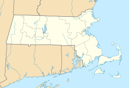
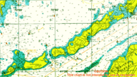
The Weepecket Islands are a group of three islands which are part of the Elizabeth Islands of Dukes County, Massachusetts, United States. They are located off the north shore of Naushon Island, the largest of the Elizabeth Islands. Together the three Weepeckets have a land area of 0.051 km (0.02 sq mi, or 12.6 acres). The islands were used as a United States Navy practice target range (the Weepecket Island Bomb Area) for bombs, rockets, and machine guns from 1941 to 1957.
Today, the islands are uninhabited. and are a popular breeding ground for double-crested cormorants.
See also
References
- "Weepecket Islands". Geographic Names Information System. United States Geological Survey, United States Department of the Interior. Retrieved 2018-08-20.
- "Weepecket Islands-U.S. Navy Bombing Practice Area" (PDF). United States Army Corps of Engineers. Retrieved 20 July 2013.
- "U.S. Census website". United States Census Bureau. Retrieved 2006-06-24.
This Dukes County, Massachusetts geography–related article is a stub. You can help Misplaced Pages by expanding it. |