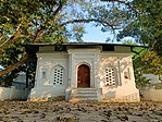
Former District in West Bengal, India
West Dinajpur (Pron: ˈpoʃtʃim dinad͡ʒpur), or sometimes Paschim Dinajpur, is a former district in the Indian state of West Bengal, headquartered in Balurghat. On 1 April 1992, the district was bifurcated into two separate districts namely Uttar Dinajpur and Dakshin Dinajpur.
History
Undivided Dinajpur district was part of the Pundra and Gauda Kingdom of ancient Bengal. The whole of Pundra was part of the Maurya Empire, and Jainism was spread in the region in the fourth century BCE. Their capital was at Pundrabardhan (now in Bangladesh), and two other ancient towns were Gourpur and Kotibarsha, now called Bangarh. Later multiple inscriptions show how the Guptas also controlled Pundra. After the reign of Gauda Kingdom, the district was then ruled by Pala Empire from 750 CE. The Senas overthrew the Palas in 1143. In 1204, Muhammad bin Bakhtiyar Khalji defeated the Senas and had Bangarh as its capital. After his murder, it was controlled by various governors sent by the Delhi Sultan from Gauda. In 1586, Mughal Emperor Akbar conquered Bengal and Dinajpur was controlled by the sarkars of Tajpur and Panjara. In 1765, it fell under the rule of the East India Company and was ruled from Murshidabad. In the later part of the 18th century, the district was home to the Sanyasi-Fakir rebellion until the early 19th century. At the time of India's independence, the former Dinajpur district of undivided Bengal was partitioned along religious lines, and West Dinajpur became one of the 14 districts of West Bengal. The other part of the district continues as Dinajpur district of Bangladesh.
With the States Reorganisation Act of 1956, some Bengali-speaking areas from Bihar were added to this district. On 1 April 1992, the West Dinajpur district was divided into Uttar Dinajpur district and Dakshin Dinajpur district.
Demographics
| Year | Pop. | ±% p.a. |
|---|---|---|
| 1901 | 741,284 | — |
| 1911 | 791,512 | +0.66% |
| 1921 | 695,536 | −1.28% |
| 1931 | 745,821 | +0.70% |
| 1941 | 834,726 | +1.13% |
| 1951 | 976,882 | +1.59% |
| 1961 | 1,323,797 | +3.09% |
| 1971 | 1,859,887 | +3.46% |
| 1981 | 2,404,947 | +2.60% |
| 1991 | 3,127,653 | +2.66% |
| Note: After 1991, the West Dinajpur district was bifurcated into two separate districts namely Uttar Dinajpur and Dakshin Dinajpur. The census data is addition of two splitted districts. Source: Census of India | ||
References
- ^ "Fact and Figures". Wb.gov.in. Retrieved 5 July 2019.
- "52nd Report of the Commissioner for Linguistic Minorities in India" (PDF). Nclm.nic.in. Ministry of Minority Affairs. p. 85. Archived from the original (PDF) on 25 May 2017. Retrieved 5 July 2019.
- "Census of India 1981, West Bengal, District Census Handbook, West Dinajpur, Series – 23, Part XIII-A, Village and Town Directory" (PDF). Directorate of Census Operations, West Bengal. Retrieved 28 May 2021.
- "Census of India 1981, West Bengal, District Census Handbook, West Dinajpur, Series – 23, Part XIII-B, Village and Town Wise Primary Census Abstract" (PDF). Directorate of Census Operations, West Bengal. Retrieved 28 May 2021.
- Harun-or-Rashid. "Partition of Bengal, 1947". Banglapedia. Asiatic Society of Bangladesh. Retrieved 26 October 2006.
- Chatterji, Joya (2007). The Spoils of Partition: Bengal and India, 1947–1967. Cambridge University Press. p. 58. ISBN 978-0-521-87536-3. Retrieved 8 December 2008.
- "History of Uttar Dinajpur". Official website of Uttar Dinajpur district. Retrieved 1 September 2008.
- "History of Dakshin Dinajpur". Official website of Dakshin Dinajpur district. Retrieved 1 September 2008.
- "A-02: Decadal variation in population 1901-2011, West Bengal, India, 2011" (PDF). www.censusindia.gov.in.
External links
 Media related to West Dinajpur district at Wikimedia Commons
| Districts of British India | |
|---|---|
| Districts in the Madras Presidency | |
| Districts in the Bengal Presidency | |
| Districts in the Bombay Presidency | |
| Other districts |
|
| Post independence historical districts | |
This article about a location in West Bengal is a stub. You can help Misplaced Pages by expanding it. |


