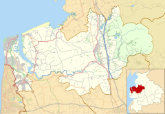
Human settlement in England
| Winmarleigh | |
|---|---|
 St Luke's Church, Winmarleigh St Luke's Church, Winmarleigh | |
  | |
| Population | 273 (2011) |
| OS grid reference | SD467447 |
| Civil parish |
|
| District | |
| Shire county | |
| Region | |
| Country | England |
| Sovereign state | United Kingdom |
| Post town | PRESTON |
| Postcode district | PR3 |
| Dialling code | 01995 |
| Police | Lancashire |
| Fire | Lancashire |
| Ambulance | North West |
| UK Parliament | |
| Website | Winmarleigh Parish Council |
| |
Winmarleigh is a village and civil parish of the Borough of Wyre in Lancashire, England. The population taken at the 2011 census was 273. The village, which is north-west of Garstang, has an agricultural college, and the Duchy of Lancaster has an estate here. This includes the local pub, the Patten Arms. It is home to the great manor of Winmarleigh Hall. Constructed to the order of the Duchy of Lancaster, it was given to the first Lord Winmarleigh. Since then the house has been donated to NST Travel Group, who have turned the grounds into an outdoor education programme for schools across the country.
Winmarleigh railway station opened in 1870 on the Garstang and Knot-End Railway. It was renamed Nateby railway station in 1902 and closed in 1930.
The school and school house, which date from 1870, were designed by Lancaster architects Paley and Austin.
Estate
The Winmarleigh Estate is an estate of the Duchy of Lancaster holding as part of The Lancashire Survey. The estate holds ownership to the Patten Arms pub.
In March 2011, ten estate farms were offered to the tenant farmers for purchase as a part of a Duchy re-balancing asset plan to reduce its rural assets. Six of the farms were close to closing by June 2012 to their tenant farmers while New Hall Farm's tenant wished to retire. Also a portion of the estate was transferred to the Village Hall Committee as it's adjacent to the Hall and is used for recreation.
See also
References
- UK Census (2011). "Local Area Report – Winmarleigh Parish (E04005339)". Nomis. Office for National Statistics. Retrieved 27 March 2021.
- "Winmarleigh History". Wyre Borough Council. 7 May 2016. Archived from the original on 12 March 2005.
- Butt, R. V. J. (October 1995). The Directory of Railway Stations: details every public and private passenger station, halt, platform and stopping place, past and present (1st ed.). Sparkford: Patrick Stephens Ltd. ISBN 978-1-85260-508-7. OCLC 60251199. OL 11956311M.
- Price, James (1998). Sharpe, Paley and Austin: A Lancaster Architectural Practice 1836–1942. Lancaster: Centre for North-West Regional Studies. p. 89. ISBN 1-86220-054-8.
- Unger, Paul (5 June 2009). "Duchy courage". Property Week. Retrieved 31 August 2014.
- ^ "Duchy land farm sell-off". Garstang Courier. 31 March 2011. Retrieved 31 August 2014.
- "The Duchy nears completion of Winmarleigh sales". Duchy of Lancaster. 21 June 2012. Retrieved 31 August 2014.
External links
![]() Media related to Winmarleigh at Wikimedia Commons
Media related to Winmarleigh at Wikimedia Commons
| Geography of the Borough of Wyre | |||||||
|---|---|---|---|---|---|---|---|
| Towns | |||||||
| Villages |
| ||||||
| Parishes | |||||||
| Topography |
| ||||||
| Duchy of Lancaster | |||||||||||
|---|---|---|---|---|---|---|---|---|---|---|---|
| Offices |
| ||||||||||
| Major holdings |
| ||||||||||
This Lancashire location article is a stub. You can help Misplaced Pages by expanding it. |