You can help expand this article with text translated from the corresponding article in Vietnamese. (March 2009) Click for important translation instructions.
|
| Yên Thành district Huyện Yên Thành | |
|---|---|
| District | |
 Seal Seal | |
| Country | |
| Region | North Central Coast |
| Province | Nghệ An |
| Capital | Yên Thành |
| Area | |
| • Total | 212.3179 sq mi (549.9008 km) |
| Population | |
| • Total | 302,500 |
| • Density | 1,270/sq mi (489/km) |
| Time zone | UTC+07:00 (Indochina Time) |
| Website | http://nguoiyenthanh.com |
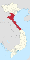
Yên Thành is a rural district of Nghệ An province, in the North Central Coast region of Vietnam. As of 2019, the district had a population of 302,500. The district covers an area of 549 km². The district capital lies at Yên Thành.
Geography
Yên Thành has both mountains and plains. It is bordered by Tân Kỳ, Quỳnh Lưu and Diễn Châu districts to the north, Diễn Châu District to the east, Nghi Lộc District to the southeast, Đô Lương District to the south, and Tân Kỳ District to the west.
The administrative unit
Yên Thành district has 39 administrative units, including Yên Thành commune:
|
|
|
|
Transportation
Highway 7A: 18 km from Vinh Thanh My Thanh commune to Provincial Road 534 (Highway 7A connected to National Highway 1A ): 14 km from the town of Yen Thanh Son Thanh Provincial Road 538 (Highway 7A connected with National Highway 1A): 15 km from commune to commune Hop Thanh Cong Thanh.
References
- ^ "Districts of Vietnam". Statoids. Retrieved March 20, 2009.
19°00′00″N 105°25′01″E / 19.000°N 105.417°E / 19.000; 105.417
| Districts of North Central Coast of Vietnam | ||
|---|---|---|
| Thanh Hóa province |  | |
| Nghệ An province | ||
| Hà Tĩnh province | ||
| Quảng Bình province |
| |
| Quảng Trị province | ||
| Huế |
| |
| denotes provincial seat. | ||
This article about a location in Nghệ An Province, Vietnam is a stub. You can help Misplaced Pages by expanding it. |