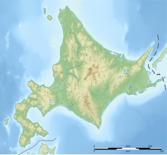
| Yūbetsu River 湧別川 | |
|---|---|
 | |
  | |
| Native name | Yūbetsu-gawa (Japanese) |
| Location | |
| Country | Japan |
| State | Hokkaidō |
| Region | Abashiri |
| District | Monbetsu |
| Municipalities | Engaru, Kamiyūbetsu, Yūbetsu |
| Physical characteristics | |
| Source | Mount Tengu (Ishikari) |
| • location | Engaru, Hokkaidō, Japan |
| • coordinates | 43°49′2″N 143°3′38″E / 43.81722°N 143.06056°E / 43.81722; 143.06056 |
| • elevation | 1,553 m (5,095 ft) |
| Mouth | Sea of Okhotsk |
| • location | Yūbetsu, Hokkaidō, Japan |
| • coordinates | 44°13′56″N 143°37′16″E / 44.23222°N 143.62111°E / 44.23222; 143.62111 |
| • elevation | 0 m (0 ft) |
| Length | 87 km (54 mi) |
| Basin size | 1,480 km (570 sq mi) |
| Discharge | |
| • average | 33.56 m/s (1,185 cu ft/s) |
Yūbetsu River (湧別川, Yūbetsu-gawa) is a river in Hokkaidō, Japan.
As of 2005, some 34,000 people live in its watershed of 1,480 square kilometres (570 sq mi).
Course
Yūbetsu River rises in the Kitami Mountains on the slopes of Mount Tengu. The river travels some 87 kilometres (54 mi) to the Sea of Okhotsk.
References
- ^ 湧別川 (in Japanese). Ministry of Land,Infrastructure and Transport and Tourism Hokkaido Regional Development Bureau. Retrieved 2009-06-17.
| |||||||||||||||
| |||||||||||||||
| |||||||||||||||
| |||||||||||||||
This Hokkaidō location article is a stub. You can help Misplaced Pages by expanding it. |
This article related to a river in Japan is a stub. You can help Misplaced Pages by expanding it. |