| Doğanşehir | |
|---|---|
| District and municipality | |
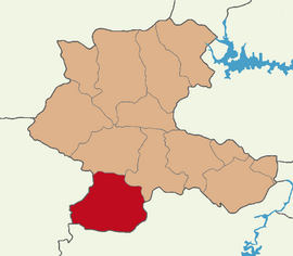
 Map showing Doğanşehir District in Malatya Province Map showing Doğanşehir District in Malatya Province | |
 | |
| Coordinates: 38°05′45″N 37°52′45″E / 38.09583°N 37.87917°E / 38.09583; 37.87917 | |
| Country | Turkey |
| Province | Malatya |
| Government | |
| • Mayor | Memet Bayram (CHP) |
| Area | 1,364 km (527 sq mi) |
| Population | 37,697 |
| • Density | 28/km (72/sq mi) |
| Time zone | UTC+3 (TRT) |
| Postal code | 44500 |
| Area code | 0422 |
| Website | www |
Doğanşehir (Kurdish: Wêranşar/Mûhacîr, formerly known as Muhacir and Viranşehir) is a municipality and district of Malatya Province, Turkey. Its area is 1,364 km (526.6 sq mi), and its population is 37,697 (2022). The mayor is Memet Bayram (CHP). Historically the city was known as Sozopetra (Greek: Σωζόπετρα).
Geography
The altitude of the town is 1,290 meters (4232 feet) above mean sea level. Both plains and mountains are part of the landscape. It borders Çelikhan District to the east, Adıyaman District to the southeast, Tut District to the south, Gölbaşı District to the southwest, Nurhak and Elbistan to the west, Akçadağ to the north and Yeşilyurt to the northeast. The reservoirs at Polat Dam and Sürgü Dam are situated in the district.
Climate
Doğanşehir has a dry-summer continental climate (Köppen: Dsa) with hot, dry summers, and cold, snowy winters.
| Climate data for Doğanşehir (1991–2020) | |||||||||||||
|---|---|---|---|---|---|---|---|---|---|---|---|---|---|
| Month | Jan | Feb | Mar | Apr | May | Jun | Jul | Aug | Sep | Oct | Nov | Dec | Year |
| Mean daily maximum °C (°F) | 2.6 (36.7) |
5.0 (41.0) |
10.8 (51.4) |
16.7 (62.1) |
21.9 (71.4) |
28.4 (83.1) |
32.5 (90.5) |
32.8 (91.0) |
27.8 (82.0) |
20.0 (68.0) |
11.4 (52.5) |
4.6 (40.3) |
17.9 (64.2) |
| Daily mean °C (°F) | −1.6 (29.1) |
0.0 (32.0) |
5.3 (41.5) |
10.5 (50.9) |
14.8 (58.6) |
20.3 (68.5) |
23.7 (74.7) |
23.3 (73.9) |
18.3 (64.9) |
12.1 (53.8) |
5.2 (41.4) |
0.2 (32.4) |
11.1 (52.0) |
| Mean daily minimum °C (°F) | −5.7 (21.7) |
−4.7 (23.5) |
−0.1 (31.8) |
4.0 (39.2) |
7.2 (45.0) |
10.9 (51.6) |
13.6 (56.5) |
13.3 (55.9) |
9.0 (48.2) |
5.0 (41.0) |
−0.3 (31.5) |
−3.7 (25.3) |
4.1 (39.4) |
| Average precipitation mm (inches) | 73.21 (2.88) |
64.63 (2.54) |
67.6 (2.66) |
55.82 (2.20) |
46.58 (1.83) |
13.0 (0.51) |
2.46 (0.10) |
3.14 (0.12) |
10.85 (0.43) |
39.09 (1.54) |
57.53 (2.26) |
69.39 (2.73) |
503.3 (19.81) |
| Average precipitation days (≥ 1.0 mm) | 8.7 | 8.3 | 8.0 | 8.3 | 6.5 | 3.1 | 1.4 | 1.5 | 2.2 | 5.5 | 6.4 | 8.1 | 68.0 |
| Source: NOAA | |||||||||||||
Composition
There are 39 neighbourhoods in Doğanşehir District:
- Altıntop
- Beğre
- Bıçakcı
- Çavuşlu
- Çığlık
- Çömlekoba
- Dedeyazı
- Doğu
- Elmalı
- Erkenek
- Esentepe
- Eskiköy
- Fındıkköy
- Gövdeli
- Günedoğru
- Gürobası
- Güzelköy
- Hudut
- Kadılı
- Kapıdere
- Karanlıkdere
- Karaterzi
- Karşıyaka
- Kelhalil
- Küçüklü
- Kurucaova
- Örencik
- Polat
- Polatderesi
- Reşadiye
- Şatırobası
- Savaklı
- Söğüt
- Suçatı
- Sürgü
- Topraktepe
- Yeni
- Yolkoru
- Yuvalı
History
The 2nd-century geographer Claudius Ptolemy records the city as Zizoatra (Greek: Ζιζόατρα), part of the province (strategia) of Lauiansene in Cappadocia. In Byzantine times, it was known as Sozopetra (Σωζόπετρα) and Zapetra (Ζάπετρα, Zibatra in Arabic).
Economy
Significant improvements in the fruit industry has made agriculture the District's most important source of income. It includes apricots and an increase in the production of apples. Livestock is usually farmed in the village. Both the district and the villages of central and traditional values, importance is given to local custom. Tourism, mountaineering and monitoring local wildlife are also new attractions.
Transport
Doğanşehir has a railway station on the line from Malatya to Adana. State road D.850 passes through the district.
See also
References
- ^ "Address-based population registration system (ADNKS) results dated 31 December 2022, Favorite Reports" (XLS). TÜİK. Retrieved 19 September 2023.
- adem Avcıkıran (2009). Kürtçe Anamnez Anamneza bi Kurmancî (PDF) (in Turkish and Kurdish). p. 55. Retrieved 17 December 2019.
- "Doğanşehir". Nisanyan Yeradları. Retrieved 25 September 2023.
- Büyükşehir İlçe Belediyesi, Turkey Civil Administration Departments Inventory. Retrieved 19 September 2023.
- "İl ve İlçe Yüz ölçümleri". General Directorate of Mapping. Retrieved 19 September 2023.
- "Table 1 Overview of the Köppen-Geiger climate classes including the defining criteria". Nature: Scientific Data.
- "Kar Örtülü Gün Sayısı" (PDF). MGM.
- "World Meteorological Organization Climate Normals for 1991-2020 — Doğanşehir". National Oceanic and Atmospheric Administration. Retrieved January 14, 2024.
- Mahalle, Turkey Civil Administration Departments Inventory. Retrieved 19 September 2023.
- Lund University. Digital Atlas of the Roman Empire.
- ^ E. Honigmann: Σωζόπετρα.(in German) In: Realencyclopädie der classischen Altertumswissenschaft (RE). Vol. III A,1, Stuttgart 1927, col. 1256.
External sources
| Doğanşehir in Malatya Province of Turkey | ||
|---|---|---|
| Districts |  | |
| Metropolitan municipalities are bolded. | ||
