| Zvyozdny Звёздный | |
|---|---|
| Settlement (abolished) | |
 | |
| Location of Zvyozdny | |
  | |
| Coordinates: 70°56′00″N 179°36′00″W / 70.93333°N 179.60000°W / 70.93333; -179.60000 | |
| Country | Russia |
| Federal subject | Chukotka Autonomous Okrug |
| Administrative district | Iultinsky |
| Founded | 1960s |
| Abolished | 1970s |
| Municipal status | |
| • Municipal district | Iultinsky |
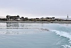
Zvyozdny (Russian: Звёздный, lit. 'Star') is an abandoned settlement on Wrangel Island, in Chukotka Autonomous Okrug, Russia. It was abandoned in the 1970s.
Geography
Zvyozdny is located on the southern shore of Wrangel Island, west of Ushakovskoye. It is approximately 702 km from Anadyr, and approximately 5,634 km from Moscow.
History
See also: Wrangel Island § HistoryEarly history
The earliest evidence of human habitation in area the dates back to between 2,850 and 3,360 years ago, in the form of knives, harpoons, and other tools from the Paleo-Inuit culture. These ancient inhabitants hunted marine mammals to survive.
Modern history
Wrangel Island was first discovered by Thomas Long, an American whaler. It was claimed by the Russian Empire in 1916, and then by the U.S.S.R. in 1924. The settlement was founded by the Soviet government in the 1960s, but then abolished in the 1970s. The only remaining inhabited area is the Zvyozdny airbase, which was constructed by the Soviets at Cape Hawaii. The base is equipped with S-300 air defence systems, Pantsir-S1 anti-aircraft systems, and Rubezh anti-ship coastal systems, as well as radar and electronic warfare capabilities. Training has been held there in recent years.
Climate
The climate of Zvyozdny is arctic, or ET under the Köppen climate classification.
References
- ^ "История и развитие Острова Врангеля". Министерство Природних Ресурсов Российской Федерации. 2005-02-27. Archived from the original on 2005-02-27. Retrieved 2021-07-13.
- "Google Earth". earth.google.com. Retrieved 2021-07-14.
- "Google Earth". earth.google.com. Retrieved 2021-07-14.
- "Google Earth". earth.google.com. Retrieved 2021-07-14.
- ^ Dikov, N. N. (1988). "The Earliest Sea Mammal Hunters of Wrangell Island". Arctic Anthropology. 25 (1): 80–93. ISSN 0066-6939. JSTOR 40316156.
- ^ Boulègue, Mathieu (June 2019). "Russia'a Military Posture in the Arctic" (PDF). Chatham House. Retrieved 2021-07-14.
- "В Арктике проведена тренировка по обнаружению авиагруппы условного противника". Центр анализа мировой торговли оружием. 2018-07-25. Retrieved 2021-07-15.
- "Köppen climate classification map". Encyclopædia Britannica. Retrieved 2021-07-15.
This Chukotka Autonomous Okrug location article is a stub. You can help Misplaced Pages by expanding it. |