| Revision as of 17:38, 4 December 2017 editKolbertBot (talk | contribs)Bots1,166,042 editsm Bot: HTTP→HTTPS (v477)← Previous edit | Revision as of 23:40, 27 April 2021 edit undoHuldra (talk | contribs)Autopatrolled, Extended confirmed users, Page movers, Pending changes reviewers, Rollbackers83,885 editsm →Bibliography: ceNext edit → | ||
| Line 132: | Line 132: | ||
| {{ref begin}} | {{ref begin}} | ||
| *{{cite book | last1= Hütteroth |first1=Wolf-Dieter |first2=Kamal | last2=Abdulfattah | title = Historical Geography of Palestine, Transjordan and Southern Syria in the Late 16th Century |url= https://books.google.com/books?id=wqULAAAAIAAJ | year = 1977 | publisher = Erlanger Geographische Arbeiten, Sonderband 5. Erlangen, Germany: Vorstand der Fränkischen Geographischen Gesellschaft|isbn= 3-920405-41-2}} | *{{cite book | last1= Hütteroth |first1=Wolf-Dieter |first2=Kamal | last2=Abdulfattah | title = Historical Geography of Palestine, Transjordan and Southern Syria in the Late 16th Century |url= https://books.google.com/books?id=wqULAAAAIAAJ | year = 1977 | publisher = Erlanger Geographische Arbeiten, Sonderband 5. Erlangen, Germany: Vorstand der Fränkischen Geographischen Gesellschaft|isbn= 3-920405-41-2}} | ||
| *{{cite |
*{{cite thesis|type=PhD |last=Rhode |first=H.|authorlink=Harold Rhode | ||
| |date=1979 |url=https://www.academia.edu/2026845/The_Administration_and_Population_of_the_Sancak_of_Safed_in_the_Sixteenth_Century |title=Administration and Population of the Sancak of Safed in the Sixteenth Century |publisher=]}} | |||
| {{refend}} |
{{refend}} | ||
| ==External links== | ==External links== | ||
| *, Localiban | *, Localiban | ||
Revision as of 23:40, 27 April 2021
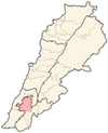
Village in Nabatieh Governorate, Lebanon| Qaaqaait Al Jisr قعقعية الجسر | |
|---|---|
| village | |
 | |
| Coordinates: 33°19′32″N 35°25′5″E / 33.32556°N 35.41806°E / 33.32556; 35.41806 | |
| Grid position | 120/154 L |
| Country | |
| Governorate | Nabatieh Governorate |
| District | Nabatieh District |
| Time zone | UTC+2 (EET) |
| • Summer (DST) | +3 |
Qaaqaait Al Jisr (Template:Lang-ar) is a village in the Nabatieh District in southern Lebanon.
History
In the 1596 tax records, it was named as a village, Qa'qayit an-Nahr, in the Ottoman nahiya (subdistrict) of Sagif under the liwa' (district) of Safad, with a population of 40 households, all Muslim. The villagers paid a fixed tax-rate of 25 % on agricultural products, such as wheat, barley, fruit trees, goats and beehives, in addition to "occasional revenues" and a press for olive oil or grape syrup; a total of 3,695 akçe.
References
- Hütteroth and Abdulfattah, 1977, p. 184
- Note that Rhode, 1979, p. 6 writes that the register that Hütteroth and Abdulfattah studied was not from 1595/6, but from 1548/9
Bibliography
- Hütteroth, Wolf-Dieter; Abdulfattah, Kamal (1977). Historical Geography of Palestine, Transjordan and Southern Syria in the Late 16th Century. Erlanger Geographische Arbeiten, Sonderband 5. Erlangen, Germany: Vorstand der Fränkischen Geographischen Gesellschaft. ISBN 3-920405-41-2.
- Rhode, H. (1979). Administration and Population of the Sancak of Safed in the Sixteenth Century (PhD). Columbia University.
External links
- Qaaqaiyeh Ej Jisr, Localiban
