| This article needs additional citations for verification. Please help improve this article by adding citations to reliable sources. Unsourced material may be challenged and removed. Find sources: "Attala, Hungary" – news · newspapers · books · scholar · JSTOR (June 2018) (Learn how and when to remove this message) |
| Attala | |
|---|---|
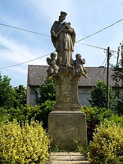
 Monument of St. John of Nepomuk Monument of St. John of Nepomuk | |
 Coat of arms Coat of arms | |
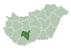
 Location of Tolna county in Hungary Location of Tolna county in Hungary | |
 | |
| Coordinates: 46°22′39″N 18°04′02″E / 46.37757°N 18.06721°E / 46.37757; 18.06721 | |
| Country | |
| County | Tolna |
| Area | |
| • Total | 20.64 km (7.97 sq mi) |
| Population | |
| • Total | 820 |
| • Density | 40/km (100/sq mi) |
| Time zone | UTC+1 (CET) |
| • Summer (DST) | UTC+2 (CEST) |
| Postal code | 7252 |
| Area code | 74 |
| Website | http://www.attala.hu/ |
Attala is a village in Tolna County, Hungary.
Etymology
According to the local legends the name comes from the name of the mistress of Sülledvár. Her name could be Atala. She committed blasphemy as the legend says and her castle sank into the ground. There was indeed a castle during the Roman times.
The accepted theory states that the name could came from the person name Attila.
History
According to László Szita the settlement was completely Hungarian in the 18th century.
References
- Lajos Király : Somogyi helységnevek népi és ...
- László Szita : Somogy megyei nemzetiségek településtörténete a XVIII-XIX. században - Somogyi Almanach 52. (Kaposvár, 1993)
External links
- Street map (in Hungarian)
This Tolna location article is a stub. You can help Misplaced Pages by expanding it. |

