| Kurd | |
|---|---|
 Coat of arms Coat of arms | |
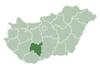
 Location of Tolna county in Hungary Location of Tolna county in Hungary | |
 | |
| Coordinates: 46°26′41″N 18°18′59″E / 46.44471°N 18.31631°E / 46.44471; 18.31631 | |
| Country | |
| County | Tolna |
| Area | |
| • Total | 31.19 km (12.04 sq mi) |
| Population | |
| • Total | 1,223 |
| • Density | 39.21/km (101.6/sq mi) |
| Time zone | UTC+1 (CET) |
| • Summer (DST) | UTC+2 (CEST) |
| Postal code | 7226 |
| Area code | 74 |
| Website | www |
Kurd is a village in Tolna County, Hungary.
Kurdish tribal chiefs were present in Hungary during the Ottoman–Hungarian Wars and fought the Hungarian army from 1440 to 1442. The village of Kurd can be bound to the legendary Kurdish military chief Kurd Pasha, whose grave is located near the city. In 1729, migrants from central Hungary of Hungarian, Slavic, Serbian and Slovak origin settled in the village. Until World War II Germans from Rheinland and Romas constituted the majority of the village. Whether the local population is of Kurdish descent is doubtful, but the mayor István Cser and locals expressed their awareness of Kurdish affairs during an interview in 1998.
References
- ^ Zurab Aloian. "The Kurds in the Ottoman Hungary". transoxiana. Retrieved 5 July 2016.
- Cser István (1998). "Kurd község története" (in Hungarian). Manuscript.
{{cite web}}: Missing or empty|url=(help)
Further reading
- Kaczián, János, ed. "Kurd" . Tolna megye kézikönyve. Magyarország megyei kézikönyvei, 16. Hatvan: CEBA, pp. 482–484.
- Vanly, Ismet Chériff. "Between Europe and Asia. The Kurdish Question". Lêkolîn (Journal of Kurdish Studies of Kurdish Institute in Berlin), 3, 1996, pp. 9–29.
- Hegyi, Klára and Pál Fodor. "Sikeretlen török adószerzési kísérlet a királyi Magyarországon" . Keletkutatás, tavasz, 1995, pp. 97–103
- Várkonyi, Ágnes R. Török világ és magyar külpolitika . Budapest: Magvető, 1975.
This Hungarian geography article is a stub. You can help Misplaced Pages by expanding it. |

