Commune in Normandy, France
| Beaumont-le-Roger | |
|---|---|
| Commune | |
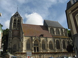
 The Church Saint-Nicolas (2010) The Church Saint-Nicolas (2010) | |
 Coat of arms Coat of arms | |
| Location of Beaumont-le-Roger | |
  | |
| Coordinates: 49°04′51″N 0°46′41″E / 49.0808°N 0.7781°E / 49.0808; 0.7781 | |
| Country | France |
| Region | Normandy |
| Department | Eure |
| Arrondissement | Bernay |
| Canton | Brionne |
| Government | |
| • Mayor (2020–2026) | Jean-Pierre Le Roux |
| Area | 36.42 km (14.06 sq mi) |
| Population | 2,767 |
| • Density | 76/km (200/sq mi) |
| Time zone | UTC+01:00 (CET) |
| • Summer (DST) | UTC+02:00 (CEST) |
| INSEE/Postal code | 27051 /27170 |
| Elevation | 84–163 m (276–535 ft) (avg. 80 m or 260 ft) |
| French Land Register data, which excludes lakes, ponds, glaciers > 1 km (0.386 sq mi or 247 acres) and river estuaries. | |
Beaumont-le-Roger (French pronunciation: [bomɔ̃ lə ʁɔʒe]) is a commune in the department of Eure in Normandy region in northern France.
Geography
The commune is located in the valley of the Risle on the edge of the forest with which it shares its name. It is crossed by the Paris-Cherbourg railway line, on which it has a station. The Beaumont forest covers four communes; it is the largest private forest in Normandy.
The commune along with another 69 communes shares part of a 4,747 hectare, Natura 2000 conservation area, called Risle, Guiel, Charentonne.
History
Humphrey (or Honfroy, Onfroi or Umfrid) de Vieilles (died c. 1044) was the first holder of the "grand honneur" of Beaumont-le-Roger, one of the most important groups of domains in eastern Normandy and the founder of the House of Beaumont. He was married to Albreda or Alberée de la Haye Auberie. His son, Roger de Beaumont, a powerful 11th century lord and adviser to William the Conqueror, derived his family name from Beaumont, of which his family were lords.
Population
| Year | Pop. | ±% p.a. |
|---|---|---|
| 1968 | 2,871 | — |
| 1975 | 2,828 | −0.22% |
| 1982 | 2,711 | −0.60% |
| 1990 | 2,694 | −0.08% |
| 1999 | 2,818 | +0.50% |
| 2007 | 2,928 | +0.48% |
| 2012 | 2,978 | +0.34% |
| 2017 | 2,879 | −0.67% |
| Source: INSEE | ||
See also
References
- "Répertoire national des élus: les maires". data.gouv.fr, Plateforme ouverte des données publiques françaises (in French). 2 December 2020.
- "Populations de référence 2022" (in French). The National Institute of Statistics and Economic Studies. 19 December 2024.
- "INPN - FSD Natura 2000 - FR2300150 - Risle, Guiel, Charentonne - Description".
- Population en historique depuis 1968, INSEE
External links
This Eure geographical article is a stub. You can help Misplaced Pages by expanding it. |