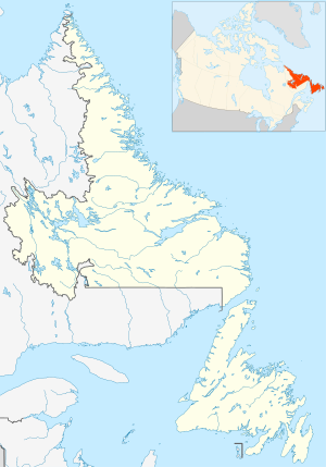
Cape Kakiviak Radar Site (LAB-1) | |
|---|---|
| Part of North Warning System | |
| Labrador, Canada | |
 | |
| Coordinates | 59°59′15″N 064°09′55″W / 59.98750°N 64.16528°W / 59.98750; -64.16528 (Cape Kakiviak LRR LAB-1) |
| Type | Short Range Radar Station |
| Code | LAB-1 |
| Site information | |
| Controlled by | North American Aerospace Defense Command |
| Site history | |
| Built | July 1992 |
| Built by | Royal Canadian Air Force |
| In use | 1992-present |

Download coordinates as:
Cape Kakiviak Short Range Radar Site (LAB-1) is a Royal Canadian Air Force Short Range Radar Site located in the Torngat Mountains of northern Labrador, 505 miles (813 km) north of CFB Goose Bay, Newfoundland and Labrador.
Facilities
The facility contains a Short Range AN/FPS-124 doppler airborne target surveillance radar that was installed in July 1992 as part of the North Warning System. The site (LAB-1) also consists of radar towers, communications facility, and storage and tunnel connected buildings for personnel.
See also
References
![]() This article incorporates public domain material from the Air Force Historical Research Agency
This article incorporates public domain material from the Air Force Historical Research Agency
- "North Warning System". 1swilson.ca. Retrieved 2013-09-22.
- "The DEW LINE Sites in Canada, Alaska & Greenland". Lswilson.ca. Retrieved 2013-09-22.
| Military installations in Newfoundland & Labrador | |||||||||||||||
|---|---|---|---|---|---|---|---|---|---|---|---|---|---|---|---|
| Current |
|  | |||||||||||||
| Defunct |
| ||||||||||||||
External links
- About NORAD Public information
- Radar Information AN/FPS-117 Radar information from FAS
- Technical Radar Information AN/FPS-124 Radar information from FAS