St. Bride's Radar Station | |
|---|---|
| Part of United States General Surveillance Radar | |
| Newfoundland | |
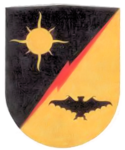
 Emblem of the 685th Air Warning Squadron Emblem of the 685th Air Warning Squadron | |
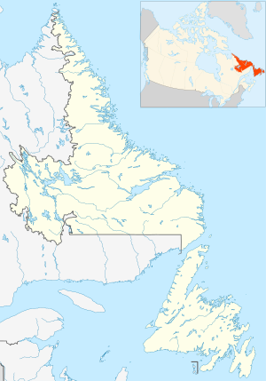
| Coordinates | 46°55′54.7″N 054°10′49.2″W / 46.931861°N 54.180333°W / 46.931861; -54.180333 (St. Bride's Radar Station) |
| Type | Radar Station |
| Code | Trio |
| Site information | |
| Controlled by | Newfoundland Base Command |
| Site history | |
| Built | 1942 |
| Built by | United States Army |
| In use | 1943-1945 |
| Garrison information | |
| Garrison | 685th Air Warning Company |

Download coordinates as:
St. Bride's Radar Station was a United States Army General Surveillance Ground Radar Early Warning Station in the Dominion of Newfoundland. It was built during World War II and responsible for monitoring air traffic from Naval Station Argentia to RCAF Torbay and into the Atlantic Ocean. It was located in St. Bride's, 135 kilometres (84 mi) southwest of St. John's. It was closed in 1945.
History
The site was established in 1942 as a United States Ground Radar Early Warning Station, funded by the United States Army, which stationed the 685th Air Warning Squadron on the site under operational control of Newfoundland Base Command at Pepperrell Air Force Base. Fifty-two members (three officers and 49 enlisted men) of the 685th were assigned to St Bride's. It operated an SCR-271 manned early-warning radar with information sent by radio to a plotting center at Pepperrell AFB to track aircraft. St Bride's was the third of a chain of four stations around the Newfoundland coast and was accordingly given the radio code name of "Trio". The station was assigned to Royal Canadian Air Force on 1 November 1944, and was given designation "No 41 RU". The RCAF operated the station until 7 October 1945.
United States Army Air Forces units and assignments
Units:
- Inactivated November 1944
Assignments:
- Newfoundland Base Command, Winter 1943
References
- Cardoulis, John N (1990). A Friendly Invasion (The American Military in Newfoundland: 1940-1990). St John's: Breakwater Books Ltd. p. 25. ISBN 0-920911-85-4.
- "Searching the Skies, The Legacy of the United States Cold War Defense Radar Program" (PDF).
- Cuff, Robert (1981). Encyclopedia of Newfoundland and Labrador (PDF). St John's: Newfoundland Book Publishers (1967) Ltd. p. 14. ISBN 0920508146.
- "The CADIN Pinetree Line Locations".
- "A Handbook of Aerospace Defense Organization 1946 - 1980" (PDF).
- Group, NBC (1997). A History of the Air Defence of Canada 1948-1997. Washington, DC: Commander Fighter Group. p. 148. ISBN 0-9681973-0-2.
{{cite book}}:|last=has generic name (help) - "Other American Stations". www.heritage.nf.ca.
- Cardoulis (1990) p. 134
![]() This article incorporates public domain material from the Air Force Historical Research Agency
This article incorporates public domain material from the Air Force Historical Research Agency
- Cornett, Lloyd H. and Johnson, Mildred W., A Handbook of Aerospace Defense Organization 1946 - 1980, Office of History, Aerospace Defense Center, Peterson AFB, CO (1980)
| Military installations in Newfoundland & Labrador | |||||||||||||||
|---|---|---|---|---|---|---|---|---|---|---|---|---|---|---|---|
| Current |
|  | |||||||||||||
| Defunct |
| ||||||||||||||
- Radar stations of the United States Air Force
- Foreign military bases in Canada
- Military installations closed in 1945
- Military installations in Newfoundland and Labrador
- Military installations established in 1943
- 1940s establishments in Newfoundland
- 1943 establishments in North America
- 1943 establishments in the British Empire
- 1945 disestablishments in the British Empire
- 1945 disestablishments in North America
- 1940s disestablishments in Newfoundland