| This article needs additional citations for verification. Please help improve this article by adding citations to reliable sources. Unsourced material may be challenged and removed. Find sources: "Carr, Colorado" – news · newspapers · books · scholar · JSTOR (February 2024) (Learn how and when to remove this message) |
Unincorporated community in State of Colorado, United States
| Carr, Colorado | |
|---|---|
| Unincorporated community | |
 Post office in Carr Post office in Carr | |
 | |
| Coordinates: 40°53′47″N 104°52′32″W / 40.89639°N 104.87556°W / 40.89639; -104.87556 | |
| Country | |
| State | |
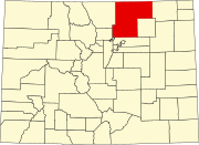
| County | Weld County |
| Established | 1872 |
| Elevation | 5,712 ft (1,741 m) |
| Time zone | UTC-7 (MST) |
| • Summer (DST) | UTC-6 (MDT) |
| ZIP Code | 80612 |
Carr is an unincorporated community that used to have a U.S. Post Office in Weld County, Colorado, United States. The ZIP Code of Carr is 80612. Some consider Carr a ghost town. Today, a few old houses remain plus a church and the schoolhouse, but the old store fronts are gone. There are some scattered old foundations throughout the town. There are a growing number of year-round residents, so the town no longer appears abandoned.
History
The town of Carr was established by the Union Pacific Railroad in 1872. Carr was named for Robert E. Carr of the Union Pacific, who managed the construction of the rail line through the town. The Carr Post Office opened on March 26, 1872.
From 1920 until 1939, the town carried Old Colorado State Highway 5, which was meant as an access route. However, during this time, routes numbered 1–19 were major cross state highways, making it a somewhat useless route.
The U. S. Post Office was closed circa 2021 when the privately owned building, that was being leased by the USPS, became uninhabitable.
One of the local landmarks was a Geodesic Dome greenhouse just south of the post office on County Road 21 (a.k.a. 2nd Street.). The structure was torn down circa 2022 after the new Post Office building owners took possession.
Circa 2022, County Road 21 (a.k.a. 2nd Street) was paved from County Road 126 (a.k.a. Stevenson Avenue) to County Road 124. It is the first paved north/south road.
Geography
Carr is located at 40°53′47″N 104°52′32″W / 40.89639°N 104.87556°W / 40.89639; -104.87556 (40.896257,-104.875488). Just north of the Carr turnoff on I-25 is the Carr Natural Fort. It is a natural limestone formation where many noted Indian battles took place between the Crow and Blackfeet tribes.
The town sits in the bottom of the Lone Tree Creek valley. When just passing through, the size of the valley may seem relatively insignificant, but it is large enough for a temperature inversion to hold cold air in place in the wintertime.
See also
References
- ^ Eichler, Geo. R. (1977). Colorado Place Names. Johnson Publishing Company.
- "US Board on Geographic Names". United States Geological Survey. October 25, 2007. Retrieved January 31, 2008.
- ^ "ZIP Code Lookup". United States Postal Service. Archived from the original (JavaScript/HTML) on September 3, 2007. Retrieved September 4, 2007.
- "Carr". Atjeu Publishing. Retrieved January 9, 2013.
- Bauer, William H.; James L. Ozment; John H. Willard (1990). Colorado Post Offices 1859-1989. The Colorado Railroad Museum. ISBN 0-918654-42-4.
- "Carr - Colorado Ghost Town". www.ghosttowns.com. Retrieved April 2, 2018.
External links
| Municipalities and communities of Weld County, Colorado, United States | ||
|---|---|---|
| County seat: Greeley | ||
| Cities |  | |
| Towns | ||
| CDPs | ||
| Unincorporated communities | ||
| Ghost towns | ||
| Trading posts | ||
| Footnotes | ‡This populated place also has portions in an adjacent county or counties | |