Commune in Provence-Alpes-Côte d'Azur, France For the given name, see Caros. For the surname, see Karros. Commune in Provence-Alpes-Côte d'Azur, France
| Carros | |
|---|---|
| Commune | |
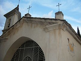
 The chapel of Notre Dame des Selves, in Carros The chapel of Notre Dame des Selves, in Carros | |
 Coat of arms Coat of arms | |
| Location of Carros | |
  | |
| Coordinates: 43°47′36″N 7°11′18″E / 43.7933°N 7.1883°E / 43.7933; 7.1883 | |
| Country | France |
| Region | Provence-Alpes-Côte d'Azur |
| Department | Alpes-Maritimes |
| Arrondissement | Grasse |
| Canton | Nice-3 |
| Intercommunality | Métropole Nice Côte d'Azur |
| Government | |
| • Mayor (2022–2026) | Yannick Bernard |
| Area | 15.11 km (5.83 sq mi) |
| Population | 13,729 |
| • Density | 910/km (2,400/sq mi) |
| Time zone | UTC+01:00 (CET) |
| • Summer (DST) | UTC+02:00 (CEST) |
| INSEE/Postal code | 06033 /06510 |
| Elevation | 63–945 m (207–3,100 ft) (avg. 385 m or 1,263 ft) |
| French Land Register data, which excludes lakes, ponds, glaciers > 1 km (0.386 sq mi or 247 acres) and river estuaries. | |
Carros (French pronunciation: [kaʁɔs]; Occitan: Carròs) is a commune in the Alpes-Maritimes department in southeastern France. Carros is one of sixteen villages grouped together by the Métropole Nice Côte d'Azur tourist department as the Route des Villages Perchés (Route of Perched Villages). The others are: Aspremont, Castagniers, Coaraze, Colomars, Duranus, Èze, Falicon, La Gaude, Lantosque, Levens, La Roquette-sur-Var, Saint-Blaise, Saint-Jeannet, Tourrette-Levens and Utelle.
Population
The inhabitants are called Carrossois.
|
| |||||||||||||||||||||||||||||||||||||||||||||||||||||||||||||||||||||||||||||||||||||||||||||||||||||||||
| ||||||||||||||||||||||||||||||||||||||||||||||||||||||||||||||||||||||||||||||||||||||||||||||||||||||||||
| Source: EHESS and INSEE (1968-2017) | ||||||||||||||||||||||||||||||||||||||||||||||||||||||||||||||||||||||||||||||||||||||||||||||||||||||||||
See also
References
- "Répertoire national des élus: les maires" (in French). data.gouv.fr, Plateforme ouverte des données publiques françaises. 4 May 2022.
- "Populations de référence 2022" (in French). The National Institute of Statistics and Economic Studies. 19 December 2024.
- "The route of perched villages" (PDF). Métropole Nice Côte d'Azur. 2013.
- Des villages de Cassini aux communes d'aujourd'hui: Commune data sheet Carros, EHESS (in French).
- Population en historique depuis 1968, INSEE
This Alpes-Maritimes geographical article is a stub. You can help Misplaced Pages by expanding it. |