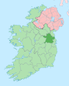
Village in Leinster, Ireland
| Donore Dún Uabhair | |
|---|---|
| Village | |
 Housing at Donore, County Meath Housing at Donore, County Meath | |
 | |
| Coordinates: 53°41′31″N 6°24′59″W / 53.692°N 6.4165°W / 53.692; -6.4165 | |
| Country | Ireland |
| Province | Leinster |
| County | County Meath |
| Population | 767 |
Donore (Irish: Dún Uabhair, meaning "fort of pride"), historically Dunower, is a small village in County Meath, Ireland. It lies near Drogheda on the border between County Meath and County Louth, in the Boyne Valley on the road between Drogheda and the Brú na Bóinne heritage site. The village is in a civil parish of the same name.
History
The Irish name of the village, Dún Uabhair meaning "fort of pride", likely refers to a ringfort in the vicinity. Evidence of ancient settlement in the area includes several ringfort, fulacht fiadh, cairn and burnt mound sites in the townlands of Donore, Sheephouse, Stalleen and Cruicerath.
During the late 17th century, the village was used as a defensive position by the Jacobite army of King James II against King William III during the Battle of the Boyne (1690). The Battle of the Boyne Visitor Centre is located in the restored 18th century Oldbridge House, which is on the battle site at Oldbridge, approximately 3 km north of Donore.
St. Mary's Roman Catholic Church, which is in the center of Donore village, was built c.1840.
As of the late 20th century, Donore had a population of approximately 280 people. The village has since more than doubled in population, growing from 334 inhabitants as of the 2002 census to 767 as of the 2022 census.
Amenities
Donore village has a pub and restaurant, shops, a take-away and a hairdresser. The local Gaelic Athletic Association club is St Mary's GFC.
Public transport
Donore is served by Bus Éireann route 163 operating between Drogheda and the Brú na Bóinne Visitor Centre. The nearest railway station is Drogheda railway station approximately 6 kilometres distant.
References
- ^ "Census Interactive Map - Towns: Donore - Population Snapshot". visual.cso.ie. Central Statistics Office. 2022. Retrieved 3 October 2024.
- Mills, A.D (2011). A Dictionary of British Place Names. Oxford: Oxford University Press. ISBN 9780199609086.
Donore (Dún Uabhair) Meath. 'Fort of pride'.
- "Dún Uabhair/Donore". Placenames Database of Ireland. Retrieved 28 April 2024.
- "Donore Parish History". donorerossnareeparish.com. 9 September 2020. Retrieved 12 September 2024.
- Moore, Michael J., ed. (1987). Archaeological Inventory of County Meath. Dublin: Government Stationery Office. ISBN 9780707600314.
- "Saint Mary's Roman Catholic Church, Donore, County Meath". buildingsofireland.ie. National Inventory of Architectural Heritage. Retrieved 13 February 2020.
- ^ "Donore (Ireland) Census Town". City Population. Retrieved 3 October 2024.
- "History - St Marys". stmarysgfc.ie. Retrieved 3 October 2024.
- "Christmas & New Year Travel Arrangements - Travel anywhere in Ireland by bus or coach with Bus Éireann e.g. Dublin, Cork, Galway, etc". Archived from the original on 29 December 2010.
