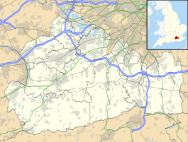
| Earlswood (Surrey) | |
|---|---|
 | |
 | |
| Location | Earlswood |
| Local authority | Reigate and Banstead |
| Grid reference | TQ278491 |
| Managed by | Southern |
| Station code(s) | ELD |
| DfT category | E |
| Number of platforms | 2 |
| Accessible | Yes, Northbound only |
| Fare zone | D |
| National Rail annual entry and exit | |
| 2019–20 | |
| 2020–21 | |
| 2021–22 | |
| 2022–23 | |
| 2023–24 | |
| Railway companies | |
| Original company | London, Brighton and South Coast Railway |
| Pre-grouping | London, Brighton and South Coast Railway |
| Post-grouping | Southern Railway |
| Key dates | |
| 1 August 1868 | Station opened |
| Other information | |
| External links | |
| Coordinates | 51°13′37″N 0°10′16″W / 51.227°N 0.171°W / 51.227; -0.171 |
Earlswood railway station serves Earlswood, south of Redhill, in Surrey, England. It is on the Brighton Main Line, 21 miles 50 chains (34.8 km) down the line from London Bridge via Redhill and south of the junction between the Redhill line and the Quarry line. Train services are provided by Thameslink and Southern.
History
Earlswood station was opened by the London Brighton and South Coast Railway on 1 August 1868. The station was rebuilt with four platforms in 1906 at the time of the quadrupling of the main line. The platforms on the fast lines were closed in the 1980s.
On 11 January 2016, payment using Oyster and contactless payment cards was introduced at the station, as part of the Oyster extension from Merstham to Gatwick Airport. The station is outside the London Fare Zone area, and special fares apply.
Some Oyster photocards (as well as Freedom Passes) are not valid here: the nearest station that these cards can be used is Coulsdon South, only in the northbound direction.
Services
Off-peak, all services at Earlswood are operated by Thameslink using Class 700 EMUs.
The typical off-peak service in trains per hour is:
- 2 tph to Bedford via London Bridge
- 2 tph to Three Bridges
During the peak hours, the station is served by an additional half-hourly Southern service between London Victoria and Gatwick Airport.
On Sundays, the service is reduced to hourly but southbound services are extended beyond Three Bridges to and from Horsham.
| Preceding station | Following station | |||
|---|---|---|---|---|
| Redhill | ThameslinkBrighton Main Line | Salfords | ||
| SouthernBrighton Main LinePeak Hours Only | ||||
References
- "Earlswood (ELD)". National Rail Enquiries. Archived from the original on 23 August 2017. Retrieved 23 August 2017.
- ^ "Estimates of station usage". Rail statistics. Office of Rail Regulation. Please note: Some methodology may vary year on year.
- Butt, R.V.J. (1995). The Directory of Railway Stations. Yeovil: Patrick Stephens Ltd. p. 87. ISBN 1-85260-508-1. R508.
- "Oyster Card | Purchase Oyster Card | Using Oyster | Southern Railway".
- "11-15 Oyster Card fares" (PDF). content.tfl.gov.uk. Retrieved 29 August 2022.
- Table 183 National Rail timetable, May 2023
External links
- Train times and station information for Earlswood railway station (Surrey) from National Rail
| Borough of Reigate and Banstead | ||||||||||||||||
|---|---|---|---|---|---|---|---|---|---|---|---|---|---|---|---|---|
| Towns, villages, neighbourhoods and hamlets |
|  | ||||||||||||||
| Most notable parks | ||||||||||||||||
| Places of worship | ||||||||||||||||
| Education | ||||||||||||||||
| Transport |
| |||||||||||||||
| Buildings and structures | ||||||||||||||||
| Sport | ||||||||||||||||
| Politics and Administration | ||||||||||||||||
| Places listed are articles notable as settlements, arranged by post town The two principal towns are emboldened The M23 motorway follows approximately a boundary and is chiefly included for its regional importance. | ||||||||||||||||
| Thameslink, Great Northern, Southern and Southeastern routes | |
|---|---|
| Stations in italics are served on limited occasions, at peak hours or on Sundays only. | |