| Ewell East | |
|---|---|
 Station building Station building | |
 | |
| Location | Ewell |
| Local authority | Borough of Epsom and Ewell |
| Managed by | Southern |
| Station code(s) | EWE |
| DfT category | E |
| Number of platforms | 2 |
| Accessible | Yes |
| Fare zone | 6 |
| National Rail annual entry and exit | |
| 2019–20 | |
| 2020–21 | |
| 2021–22 | |
| 2022–23 | |
| 2023–24 | |
| Key dates | |
| 10 May 1847 | Opened |
| Other information | |
| External links | |
| Coordinates | 51°20′42″N 0°14′31″W / 51.3451°N 0.2419°W / 51.3451; -0.2419 |
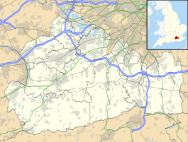
Ewell East is one of two stations serving the town of Ewell in Surrey, England. It has two platforms, one for services to Sutton, West Croydon and London, the other for services to Epsom. The ticket office and main entrance is on the London-bound side, accessed from Cheam Road. On the Epsom-bound side, there is an additional entrance from a footpath linking the Cheam Road with Reigate Road near the North East Surrey College of Technology.
It was opened on 10 May 1847 with the Croydon and Epsom Railway. This was subsumed into the London, Brighton and South Coast Railway. Train service is now provided by Southern.
Ewell East has been part of Travelcard Zone 6 since January 2008.
Services
All services at Ewell East are operated by Southern using Class 377 EMUs.
The typical off-peak service in trains per hour is:
- 1 tph to London Victoria via Hackbridge
- 2 tph to London Bridge via West Croydon
- 2 tph to Epsom
- 1 tph to Horsham via Dorking
On Saturday evenings (after approximately 18:45) and on Sundays, there is no service south of Dorking to Horsham.
| Preceding station | Following station | |||
|---|---|---|---|---|
| Cheam | SouthernSutton & Mole Valley Lines | Epsom | ||
Gallery
-
Platforms looking south
-
The footbridge and platforms, looking south towards Epsom
-
Platforms looking north
-
Platform signage in Southern colours
See also
References
- "London and South East" (PDF). National Rail. September 2006. Archived from the original (PDF) on 6 March 2009.
- ^ "Estimates of station usage". Rail statistics. Office of Rail Regulation. Please note: Some methodology may vary year on year.
- Table 180 National Rail timetable, December 2021
External links
- Train times and station information for Ewell East railway station from National Rail
| Borough of Epsom and Ewell | ||
|---|---|---|
| Towns, villages and hamlets |
|  |
| Parks | ||
| Places of worship | ||
| Education | ||
| Transport | ||
| Buildings and structures | ||
| Sport | ||
| People | ||
| Thameslink, Great Northern, Southern and Southeastern routes | |||||
|---|---|---|---|---|---|
| |||||
| Stations in italics are served on limited occasions, at peak hours or on Sundays only. | |||||
| Transport in Surrey | |||||||||||
|---|---|---|---|---|---|---|---|---|---|---|---|
| Road |
| ||||||||||
| Airports | |||||||||||
| Rail |
| ||||||||||
| Buses |
| ||||||||||
| Waterways |
| ||||||||||
| Footpaths |
| ||||||||||
- Rail transport stations in London fare zone 6
- DfT Category E stations
- Transport in Epsom and Ewell
- Railway stations in Surrey
- Former London, Brighton and South Coast Railway stations
- Railway stations in Great Britain opened in 1847
- Railway stations served by Govia Thameslink Railway
- 1847 establishments in England