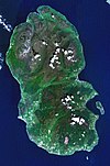
| Goat Fell | |
|---|---|
 Goat Fell as seen from Brodick shore. Goat Fell as seen from Brodick shore. | |
| Highest point | |
| Elevation | 874 m (2,867 ft) |
| Prominence | 874 m (2,867 ft) Ranked 16th in British Isles |
| Listing | Corbett, Marilyn, Hardy, council top (North Ayrshire), county top (Bute) |
| Coordinates | 55°37′33.5″N 5°11′26″W / 55.625972°N 5.19056°W / 55.625972; -5.19056 |
| Geography | |
 | |
| OS grid | NR991415 |
| Topo map | OS Explorer 361; Landrangers 62, 69 |
Goat Fell (Scottish Gaelic: Gaoitbheinn) is the highest point on the Isle of Arran. At 874 metres (2,867 ft), it is one of four Corbetts on the island. The mountain, along with nearby Brodick Castle, is now owned by the National Trust for Scotland.
Ascent
Due to the popularity of "Scotland in miniature" (Arran), Goat Fell is a very popular peak and there are many possible routes of ascent, some of which may be combined with visits to the summits of other nearby peaks. The most commonly used route, a constructed path of just over 3 miles (5 km) in length, starts from near Brodick Castle in Cladach. Initially the path leads up through the forested grounds of the castle, passing many rhododendron bushes. At just under 1,000 ft (300 m) above sea level the path leaves the forestry, and the route continues through bare moorland, reaching the summit by way of the east ridge of the mountain. There is a viewpoint table at the summit: on a clear day Northern Ireland may be seen.

An alternative shorter and steeper route comes up from the village of Corrie. This route joins the main path on the east ridge. Goat Fell may also be climbed from the north, where it is linked by a ridge to the subsidiary top of North Goatfell, a point from which three ridges radiate. In addition to the ridge leading south to the main summit, there is a ridge heading northeast, providing some very easy scrambling as it passes over Cìoch na h-Òighe (the Young Maiden's Breast). Finally, the western ridge drops down to a bealach known as The Saddle, before climbing again towards the summit of Cìr Mhòr. The right-of-way between Glen Rosa and Glen Sannox passes over The Saddle.
The mountain was the scene of the death of English tourist Edwin Rose who was murdered by John Watson Laurie in 1889 on the mountain. Laurie was sentenced to death, later commuted to a life sentence and spent the rest of his life in prison.
References
- "Goatfell". Ainmean-Àite na h-Alba: Gaelic Place-Names of Scotland. Retrieved 10 October 2023.
- "Mountain-top death: Did he slip or was he pushed?". The Scotsman. 8 October 2005. Archived from the original on 14 October 2019.
External links
- Goat Fell tourist trail, map and large images
- Goat Fell - site information
- Computer-generated virtual panoramas North South Index
| Isle of Arran | ||
|---|---|---|
| Main villages |  | |
| Smaller villages and settlements | ||
| Mountains and hills | ||
| History |
| |
| Environment | ||
| Economy | ||
| Surrounding islands | ||
| Most prominent mountains of Britain and Ireland (the P600s) | ||
|---|---|---|
| Northern Highlands (20) |    | |
| Western Highlands (20) | ||
| Central and Eastern Highlands (13) | ||
| Southern Highlands (15) | ||
| Islands (13) | ||
| Scottish Lowlands, England and Wales (13) | ||
| Republic of Ireland, Northern Ireland (25) | ||