Name
Location
Type
Completed Date designated
Grid ref. Entry number Image
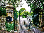
Friends' Meeting House
Addingham Friends' meeting house
1689
10 September 1954
SE0761051790 53°57′44″N 1°53′08″W / 53.962139°N 1.885501°W / 53.962139; -1.885501 (Friends' Meeting House)
1199556 Friends' Meeting House More images
Baildon Hall
Baildon Cross-wing house
Late 15th century
25 May 1966
SE1553039347 53°51′00″N 1°45′56″W / 53.850129°N 1.765417°W / 53.850129; -1.765417 (Baildon Hall)
1199151 Upload Photo
Harden Hall
Harden House
Early–mid-17th century
9 August 1966
SE0866337846 53°50′12″N 1°52′11″W / 53.836797°N 1.869841°W / 53.836797; -1.869841 (Harden Hall)
1134140 Harden Hall More images
Church of St Michael and All Angels
Haworth , Cross Roads and StanburyChurch
16th century
23 February 1955
SE0298737215 53°49′52″N 1°57′22″W / 53.831188°N 1.956099°W / 53.831188; -1.956099 (Church of St Michael and All Angels)
1283403 Church of St Michael and All Angels More images
Ponden Hall
Scar Top , Haworth, Cross Roads and Stanbury Farmhouse
1801
23 February 1955
SD9867737266 53°49′54″N 2°01′18″W / 53.831652°N 2.021584°W / 53.831652; -2.021584 (Ponden Hall)
1313937 Ponden Hall More images
Church of St Margaret
Ilkley Parish church
1878–79
20 May 1976
SE1149047251 53°55′17″N 1°49′36″W / 53.921273°N 1.826534°W / 53.921273; -1.826534 (Church of St Margaret)
1200770 Church of St Margaret More images
Low Hall
Ilkley
House
17th century
18 July 1949
SE1150448524 53°55′58″N 1°49′35″W / 53.932714°N 1.826274°W / 53.932714; -1.826274 (Low Hall)
1314214 Low Hall
Parish Church of All Saints
Ilkley
Parish church
13th century
18 July 1949
SE1164547825 53°55′35″N 1°49′27″W / 53.926429°N 1.824152°W / 53.926429; -1.824152 (Parish Church of All Saints)
1133506 Parish Church of All Saints More images
Mill buildings at Low Mills
Keighley Mill
Late 18th century
12 February 1979
SE0655241165 53°52′00″N 1°54′07″W / 53.866658°N 1.90185°W / 53.866658; -1.90185 (Mill buildings at Low Mills)
1200162 Mill buildings at Low Mills More images
Menston Old Hall (Fairfax Hall)
Menston Detached house
17th century
18 July 1949
SE1673244023 53°53′32″N 1°44′49″W / 53.892119°N 1.746893°W / 53.892119; -1.746893 (Menston Old Hall (Fairfax Hall))
1314210 Upload Photo
Barn, 15 metres south of Holden Gate Farmhouse
Silsden Barn
1641
27 September 1965
SE0661544200 53°53′38″N 1°54′03″W / 53.893935°N 1.900828°W / 53.893935; -1.900828 (Barn, 15 metres south of Holden Gate Farmhouse)
1267373 Upload Photo
Waterloo Mill and attached engine house
Silsden
Mill
1867–84
25 January 1985
SE0431646149 53°54′41″N 1°56′09″W / 53.911476°N 1.935784°W / 53.911476; -1.935784 (Waterloo Mill and attached engine house)
1266636 Waterloo Mill and attached engine house More images
18–26 Bradley Road
Silsden
House
1682
27 September 1965
SE0401246651 53°54′58″N 1°56′25″W / 53.915991°N 1.940405°W / 53.915991; -1.940405 (18–26 Bradley Road)
1223261 18–26 Bradley Road More images
Church of All Saints
Little Horton , Trident Church
1864
9 August 1983
SE1569932050 53°47′04″N 1°45′48″W / 53.78454°N 1.763218°W / 53.78454; -1.763218 (Church of All Saints)
1207967 Church of All Saints More images
30 and 31 Little Horton Green (Little Horton Hall)
Little Horton, Trident
House
Mid- to late 17th century
4 September 1952
SE1558132116 53°47′06″N 1°45′54″W / 53.785137°N 1.765006°W / 53.785137; -1.765006 (30 and 31 Little Horton Green (Little Horton Hall))
1133011 30 and 31 Little Horton Green (Little Horton Hall) More images
54 Little Horton Lane
Trident
Villa
Circa 1850–60
9 August 1983
SE1598932553 53°47′21″N 1°45′32″W / 53.789052°N 1.758791°W / 53.789052; -1.758791 (54 Little Horton Lane)
1133017 Upload Photo
Bolton Old Hall
Gaisby, Wrose
House
1627
4 September 1952
SE1663336285 53°49′21″N 1°44′56″W / 53.822575°N 1.748816°W / 53.822575; -1.748816 (Bolton Old Hall)
1314357 Bolton Old Hall More images
Bolton Old Hall Cottage
Gaisby, Wrose
Timber-framed house
Early to mid-17th century
18 July 1975
SE1663836294 53°49′22″N 1°44′55″W / 53.822656°N 1.748739°W / 53.822656; -1.748739 (Bolton Old Hall Cottage)
1115592 Upload Photo
Aldersley Farmhouse
Allerton Upper Green
Farmhouse
Latter part of 17th century
4 September 1952
SE1030333759 53°48′00″N 1°50′42″W / 53.800034°N 1.845056°W / 53.800034; -1.845056 (Aldersley Farmhouse)
1133647 Aldersley Farmhouse More images
Barn immediately east of New Close Farmhouse
Nab Wood
Aisled barn
17th century
7 May 1976
SE1235036946 53°49′43″N 1°48′50″W / 53.828634°N 1.813851°W / 53.828634; -1.813851 (Barn immediately east of New Close Farmhouse)
1133576 Upload Photo
Behrens Warehouse
Little Germany Warehouse
1873
9 August 1983
SE1695433118 53°47′39″N 1°44′39″W / 53.7941°N 1.744113°W / 53.7941; -1.744113 (Behrens Warehouse)
1314395 Behrens Warehouse More images
Bradford Reform Synagogue
Manningham Synagogue
1880–81
6 December 1989
SE1574833882 53°48′04″N 1°45′45″W / 53.801004°N 1.762381°W / 53.801004; -1.762381 (Bradford Reform Synagogue)
1227613 Bradford Reform Synagogue More images
Building immediately to north of present Home Farmhouse at Esholt Hall Home Farm
Esholt Farmhouse
1691
4 September 1952
SE1905639612 53°51′09″N 1°42′42″W / 53.852395°N 1.711804°W / 53.852395; -1.711804 (Building immediately to north of present Home Farmhouse at Esholt Hall Home Farm)
1133156 Upload Photo
Church of All Saints
Bingley Church
Late 15th century
9 August 1966
SE1053939474 53°51′05″N 1°50′29″W / 53.851395°N 1.841279°W / 53.851395; -1.841279 (Church of All Saints)
1200095 Church of All Saints More images
Church of St Clement
Barkerend Church
1892–94
9 June 1981
SE1779133549 53°47′53″N 1°43′53″W / 53.797946°N 1.731382°W / 53.797946; -1.731382 (Church of St Clement)
1184649 Church of St Clement More images
Church of St Cuthbert (Roman Catholic)
Bradford Roman Catholic church
1890–91
2 September 1998
SE1451135117 53°48′44″N 1°46′52″W / 53.81214°N 1.781105°W / 53.81214; -1.781105 (Church of St Cuthbert (Roman Catholic))
1376263 Church of St Cuthbert (Roman Catholic)
Church of St John
Bierley Chapel
1766
4 September 1952
SE1773730496 53°46′14″N 1°43′57″W / 53.770508°N 1.732377°W / 53.770508; -1.732377 (Church of St John)
1314522 Church of St John More images
Dean House
Allerton LanesHouse
1605
4 September 1952
SE1116533695 53°47′58″N 1°49′55″W / 53.799441°N 1.831971°W / 53.799441; -1.831971 (Dean House)
1133313 Dean House More images
Devere House
Little Germany Warehouse
1871
9 August 1983
SE1678633094 53°47′38″N 1°44′48″W / 53.79389°N 1.746664°W / 53.79389; -1.746664 (Devere House)
1133650 Devere House More images
Esholt Hall with terrace and adjoining conservatory
Esholt EstateCountry house
1706–07
4 September 1952
SE1885839670 53°51′11″N 1°42′53″W / 53.852923°N 1.71481°W / 53.852923; -1.71481 (Esholt Hall with terrace and adjoining conservatory)
1133190 Esholt Hall with terrace and adjoining conservatory
Feversham Street First School
Bradford
School
1873
9 August 1983
SE1714532926 53°47′33″N 1°44′28″W / 53.792368°N 1.741224°W / 53.792368; -1.741224 (Feversham Street First School)
1133162 Feversham Street First School More images
Frizingley Hall
Frizinghall House
c .1730–509 August 1983
SE1523235817 53°49′06″N 1°46′12″W / 53.818411°N 1.770121°W / 53.818411; -1.770121 (Frizingley Hall)
1133166 Upload Photo
Frizley Old Hall
Frizinghall House
1727
9 August 1983
SE1524535824 53°49′07″N 1°46′12″W / 53.818474°N 1.769923°W / 53.818474; -1.769923 (Frizley Old Hall)
1119622 Upload Photo
Gate piers at entrance to Tong Hall drive
Tong Gate pier
18th century
4 September 1952
SE2186730510 53°46′14″N 1°40′11″W / 53.770478°N 1.669717°W / 53.770478; -1.669717 (Gate piers at entrance to Tong Hall drive)
1133659 Gate piers at entrance to Tong Hall drive
Gawthorpe Hall including south wing
Bingley Manor house
Mid-17th century
9 August 1966
SE1094340134 53°51′26″N 1°50′06″W / 53.857319°N 1.835115°W / 53.857319; -1.835115 (Gawthorpe Hall including south wing)
1199532 Upload Photo
Idle Young Men's Christian Association Youth Community Centre
Idle Sunday school
1630
4 September 1952
SE1767137941 53°50′15″N 1°43′59″W / 53.837425°N 1.732953°W / 53.837425; -1.732953 (Idle Young Men's Christian Association Youth Community Centre)
1133673 Idle Young Men's Christian Association Youth Community Centre More images
Ireland Bridge
Bingley Road bridge
1686
9 August 1966
SE1052439354 53°51′01″N 1°50′29″W / 53.850317°N 1.841511°W / 53.850317; -1.841511 (Ireland Bridge)
1133377 Ireland Bridge More images
Law Russell Warehouse
Little Germany Warehouse
1873
9 August 1983
SE1676033137 53°47′39″N 1°44′49″W / 53.794277°N 1.747057°W / 53.794277; -1.747057 (Law Russell Warehouse)
1133652 Law Russell Warehouse More images
Three Rise Locks with overflow channel
Leeds and Liverpool Canal , Bingley Canal locks
c .177318 October 1985
SE1072639477 53°51′05″N 1°50′18″W / 53.851418°N 1.838436°W / 53.851418; -1.838436 (Three Rise Locks with overflow channel)
1133361 Three Rise Locks with overflow channelMore images
Two Rise Locks with overflow channel, Dowley Gap
Leeds and Liverpool Canal
Canal locks
c .177318 October 1985
SE1196738319 53°50′28″N 1°49′11″W / 53.840983°N 1.819617°W / 53.840983; -1.819617 (Two Rise Locks with overflow channel, Dowley Gap)
1133359 Two Rise Locks with overflow channel, Dowley Gap More images
Leventhorpe Hall
Lower Grange
House
Late 17th century
4 September 1952
SE1171732800 53°47′29″N 1°49′25″W / 53.791385°N 1.823624°W / 53.791385; -1.823624 (Leventhorpe Hall)
1133692 Leventhorpe Hall
Lower Bailey Fold Farmhouse
Allerton Farmhouse
Late 17th century
4 September 1952
SE1099233969 53°48′07″N 1°50′05″W / 53.801908°N 1.834588°W / 53.801908; -1.834588 (Lower Bailey Fold Farmhouse)
1314364 Lower Bailey Fold Farmhouse
Manningham Mills
Manningham
Factory
1873
14 June 1963
SE1445434910 53°48′37″N 1°46′55″W / 53.810281°N 1.78198°W / 53.810281; -1.78198 (Manningham Mills)
1314426 Manningham Mills More images
Midland Bank
Bradford
Bank (financial)
1858
9 August 1983
SE1634533210 53°47′42″N 1°45′12″W / 53.794946°N 1.753353°W / 53.794946; -1.753353 (Midland Bank)
1133211 Midland Bank More images
Newhall West Bowling Golf Club
Newhall
House
Late 17th century
4 September 1952
SE1703530254 53°46′06″N 1°44′35″W / 53.768356°N 1.74304°W / 53.768356; -1.74304 (Newhall West Bowling Golf Club)
1314521 Upload Photo
Number 74 with front garden wall and railings (also known as Brontë Birthplace )
Thornton House
1802
4 September 1952
SE1006732756 53°47′28″N 1°50′55″W / 53.791024°N 1.848671°W / 53.791024; -1.848671 (Number 74 with front garden wall and railings (also known as Brontë Birthplace) )
1132988 Number 74 with front garden wall and railings (also known as Brontë Birthplace ) More images
Numbers 3 to 11 (Esholt Old Hall) and adjoining barn
Esholt
House
Late 16th century
4 September 1952
SE1820240170 53°51′27″N 1°43′29″W / 53.85744°N 1.724753°W / 53.85744; -1.724753 (Numbers 3 to 11 (Esholt Old Hall) and adjoining barn)
1133252 Numbers 3 to 11 (Esholt Old Hall) and adjoining barn More images
Paper Hall
Bradford
House
1643
4 September 1952
SE1691333425 53°47′49″N 1°44′41″W / 53.796861°N 1.744718°W / 53.796861; -1.744718 (Paper Hall)
1314310 Paper Hall More images
Royds Hall
Low Moor Cross-wing house
1656
4 September 1952
SE1435628230 53°45′01″N 1°47′02″W / 53.750245°N 1.783777°W / 53.750245; -1.783777 (Royds Hall)
1132910 Royds Hall More images
Main L-shaped block of stable, coach house and barn enclosing the court to north of the hall outbuildings at Royds Hall
Low Moor
Barn
1663
4 September 1952
SE1434128266 53°45′02″N 1°47′02″W / 53.750569°N 1.784002°W / 53.750569; -1.784002 (Main L-shaped block of stable, coach house and barn enclosing the court to north of the hall outbuildings at Royds Hall)
1291670 Upload Photo
Royds Hall Farmhouse
Heaton Farmhouse
Late 17th century
4 September 1952
SE1366936069 53°49′15″N 1°47′38″W / 53.820719°N 1.79385°W / 53.820719; -1.79385 (Royds Hall Farmhouse)
1133739 Upload Photo
Ryecroft Hall
Holme Shay
House
Mid-17th century
4 September 1952
SE2012230575 53°46′16″N 1°41′46″W / 53.771132°N 1.696187°W / 53.771132; -1.696187 (Ryecroft Hall)
1068660 Ryecroft Hall More images
Ryshworth Hall
Crossflatts House
Late 16th century
9 August 1966
SE1007740806 53°51′48″N 1°50′54″W / 53.863376°N 1.848259°W / 53.863376; -1.848259 (Ryshworth Hall)
1133397 Upload Photo
Saltaire Mills – main block including sheds
Saltaire Mill
1851–53
22 November 1966
SE1408238039 53°50′18″N 1°47′15″W / 53.838414°N 1.787487°W / 53.838414; -1.787487 (Saltaire Mills – main block including sheds)
1133523 Saltaire Mills – main block including shedsMore images
Saltaire Mills – the entrance block
Saltaire
Mill
1851–53
7 March 1985
SE1397638092 53°50′20″N 1°47′21″W / 53.838894°N 1.789096°W / 53.838894; -1.789096 (Saltaire Mills – the entrance block)
1300744 Saltaire Mills – the entrance block More images
Saltaire School including wall, gate piers and sculpted lions to front area, and gate to south side
Saltaire
Gate
1869
22 November 1966
SE1388737896 53°50′14″N 1°47′26″W / 53.837134°N 1.790457°W / 53.837134; -1.790457 (Saltaire School including wall, gate piers and sculpted lions to front area, and gate to south side)
1300666 Saltaire School including wall, gate piers and sculpted lions to front area, and gate to south side More images
St George's Hall
Bradford
Meeting hall
1851–53
14 June 1963
SE1650332941 53°47′33″N 1°45′03″W / 53.792524°N 1.750968°W / 53.792524; -1.750968 (St George's Hall)
1338589 St George's Hall More images
Stable Court and Home Farmhouse at Tong Hall
Tong
Farmhouse
Early to mid-18th century
9 August 1983
SE2174830706 53°46′20″N 1°40′17″W / 53.772244°N 1.671508°W / 53.772244; -1.671508 (Stable Court and Home Farmhouse at Tong Hall)
1133658 Upload Photo
The National Westminster Bank
Bradford
Bank (financial)
1868
9 August 1983
SE1637533155 53°47′40″N 1°45′10″W / 53.794451°N 1.7529°W / 53.794451; -1.7529 (The National Westminster Bank)
1133063 The National Westminster Bank More images
The Old Manor House
Wyke Manor house
17th/18th century
4 September 1952
SE1523525988 53°43′48″N 1°46′14″W / 53.730069°N 1.770557°W / 53.730069; -1.770557 (The Old Manor House)
1133000 The Old Manor House More images
Thornton Hall
Thornton House
Late 17th century
4 September 1952
SE1056332633 53°47′24″N 1°50′28″W / 53.789908°N 1.841147°W / 53.789908; -1.841147 (Thornton Hall)
1220076 Upload Photo
Victoria Hall Including wall, gate piers and sculpted lions to front area, and railings to rear
Saltaire
Institute
1867–71
22 November 1966
SE1397137883 53°50′13″N 1°47′21″W / 53.837015°N 1.789181°W / 53.837015; -1.789181 (Victoria Hall Including wall, gate piers and sculpted lions to front area, and railings to rear)
1314205 Victoria Hall Including wall, gate piers and sculpted lions to front area, and railings to rearMore images
West Scholes House and Cottage
Yews Green
House
Late 17th century
4 September 1952
SE0990531428 53°46′45″N 1°51′04″W / 53.779091°N 1.851172°W / 53.779091; -1.851172 (West Scholes House and Cottage)
1314162 West Scholes House and Cottage More images
Woodside Cottage and Woodside Farmhouse
Wyke Farmhouse
Late 17th century
4 September 1952
SE1468627350 53°44′32″N 1°46′44″W / 53.742326°N 1.778814°W / 53.742326; -1.778814 (Woodside Cottage and Woodside Farmhouse)
1133094 Upload Photo
439–443 Shetcliffe Lane
Bierley
House
1625
4 September 1952
SE1780629496 53°45′41″N 1°43′53″W / 53.761518°N 1.731387°W / 53.761518; -1.731387 (439–443 Shetcliffe Lane)
1219429 439–443 Shetcliffe Lane
7–10 Chapel Fold
Wibsey House
c .16354 September 1952
SE1472430307 53°46′08″N 1°46′41″W / 53.768902°N 1.778098°W / 53.768902; -1.778098 (7–10 Chapel Fold)
1133238 Upload Photo
670 and 670a Great Horton Road
Great Horton , BradfordHouse
1746
4 September 1952
SE1417431558 53°46′49″N 1°47′11″W / 53.780161°N 1.786385°W / 53.780161; -1.786385 (670 and 670a Great Horton Road)
1133138 670 and 670a Great Horton Road
Keighley War Memorial
Keighley , BradfordWar memorial
1924
4 December 1986
SE0607741300 53°52′04″N 1°54′33″W / 53.867877°N 1.9090707°W / 53.867877; -1.9090707 (Keighley War Memorial)
1313949 Keighley War Memorial More images


