Name
Location
Type
Completed Date designated
Grid ref. Entry number Image
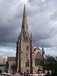
All Saints Church
Four Oaks Anglican Church
1907-1909
26 August 1976
SP1091698740 52°35′11″N 1°50′25″W / 52.586358°N 1.840316°W / 52.586358; -1.840316 (All Saints Church)
1343304 All Saints Church More images
Anglican Church of All Saints (formerly St Aiden)
Small Heath Anglican Church
1894
21 January 1970
SP0916485860 52°28′14″N 1°51′59″W / 52.470601°N 1.866525°W / 52.470601; -1.866525 (Anglican Church of All Saints (formerly St Aiden))
1343050 Anglican Church of All Saints (formerly St Aiden) More images
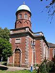
Anglican Church of SS Peter and Paul
Witton Church
15th century
25 April 1952
SP0826289910 52°30′25″N 1°52′47″W / 52.507024°N 1.879705°W / 52.507024; -1.879705 (Anglican Church of SS Peter and Paul)
1290008 Anglican Church of SS Peter and Paul More images
Anglican Church of St Augustine
Edgbaston Anglican Church
1868
21 January 1970
SP0377686158 52°28′24″N 1°56′45″W / 52.473342°N 1.945839°W / 52.473342; -1.945839 (Anglican Church of St Augustine)
1076255 Anglican Church of St Augustine More images
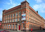
Aquinas House, 62-64 Warstone Lane
Jewellery Quarter Jewellery Workshop
1882
29 April 2004
SP0595987646 52°29′12″N 1°54′49″W / 52.4867°N 1.913675°W / 52.4867; -1.913675 (Aquinas House, 62-64 Warstone Lane)
1392830 Aquinas House, 62-64 Warstone Lane More images
Ashford and Sons , 16-18 Great Hampton Street, B18
Hockley Jewellery Workshop
1912
8 July 1982
SP0637787947 52°29′22″N 1°54′27″W / 52.489402°N 1.907513°W / 52.489402; -1.907513 (Ashford and Sons, 16-18 Great Hampton Street, B18)
1075540 Ashford and Sons , 16-18 Great Hampton Street, B18More images
Great Hampton Street Works, 80-82, Great Hampton Street, B18 (Pelican Works)
Hockley Jewellery Workshop
1880
8 July 1982
SP0615888088 52°29′26″N 1°54′39″W / 52.490672°N 1.910736°W / 52.490672; -1.910736 (Great Hampton Street Works, 80-82, Great Hampton Street, B18 (Pelican Works))
1075544 Great Hampton Street Works, 80-82, Great Hampton Street, B18 (Pelican Works) More images
Ashfurlong Hall
Sutton Coldfield House
Early 16th century
18 October 1949
SP1350498142 52°34′51″N 1°48′08″W / 52.580925°N 1.802142°W / 52.580925; -1.802142 (Ashfurlong Hall)
1075807 Upload Photo
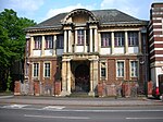
Balsall Heath Library
Balsall Heath Public Library
1895
8 July 1982
SP0783984411 52°27′27″N 1°53′10″W / 52.457595°N 1.886064°W / 52.457595; -1.886064 (Balsall Heath Library)
1076274 Balsall Heath Library More images
Barn Range approximately 50 Metres West of New Shipton Farmhouse (not included)
Sutton Coldfield Barn
19th century
11 October 1988
SP1347794261 52°32′46″N 1°48′10″W / 52.546036°N 1.802697°W / 52.546036; -1.802697 (Barn Range approximately 50 Metres West of New Shipton Farmhouse (not included))
1343353 Upload Photo
Bell's Farmhouse
Druids Heath Farmhouse
1595
25 April 1952
SP0636178755 52°24′24″N 1°54′29″W / 52.406766°N 1.907921°W / 52.406766; -1.907921 (Bell's Farmhouse)
1075751 Bell's Farmhouse More images
Berrow Court Hotel, Berrow Drive, B15
Edgbaston House
1870-5
8 July 1982
SP0423885415 52°28′00″N 1°56′21″W / 52.46666°N 1.939046°W / 52.46666; -1.939046 (Berrow Court Hotel, Berrow Drive, B15)
1075755 Berrow Court Hotel, Berrow Drive, B15
Birmingham Gun Barrel Proof House
Digbeth Gate Lodge
1813
21 January 1970
SP0792986942 52°28′49″N 1°53′05″W / 52.480347°N 1.88468°W / 52.480347; -1.88468 (Birmingham Gun Barrel Proof House)
1291262 Birmingham Gun Barrel Proof House More images
Art Gallery , Council House & Council House Extension
City Centre
Council House
1874-79
25 April 1952
SP0658387044 52°28′53″N 1°54′16″W / 52.481281°N 1.904497°W / 52.481281; -1.904497 (Art Gallery, Council House & Council House Extension)
1210333 Art Gallery , Council House & Council House ExtensionMore images
Birmingham and Midland Institute
City Centre
Institute
1899
21 January 1970
SP0663487055 52°28′53″N 1°54′13″W / 52.48138°N 1.903746°W / 52.48138; -1.903746 (Birmingham and Midland Institute)
1343095 Birmingham and Midland Institute More images
Bishop Latimer Memorial Church of All Saints
Winson Green Church
1903-4
21 January 1970
SP0418488792 52°29′49″N 1°56′23″W / 52.497019°N 1.9398°W / 52.497019; -1.9398 (Bishop Latimer Memorial Church of All Saints)
1343061 Bishop Latimer Memorial Church of All Saints More images
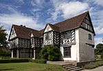
Blakesley Hall
Yardley Farmhouse
Last quarter, 16th century
29 April 1952
SP1304286185 52°28′24″N 1°48′34″W / 52.473444°N 1.809425°W / 52.473444; -1.809425 (Blakesley Hall)
1075711 Blakesley Hall More images
Roman Catholic Cathedral of St Chad
City Centre
Roman Catholic Church
1839-41
25 April 1952
SP0696687522 52°29′08″N 1°53′56″W / 52.485574°N 1.898848°W / 52.485574; -1.898848 (Roman Catholic Cathedral of St Chad)
1220729 Roman Catholic Cathedral of St Chad More images
Church of St Alban the Martyr
Highgate Church
1879-81
25 April 1952
SP0766485337 52°27′57″N 1°53′19″W / 52.465922°N 1.888619°W / 52.465922; -1.888619 (Church of St Alban the Martyr)
1290539 Church of St Alban the Martyr More images
Church of St Mary
Lozells Church
12th to early 13th century
25 April 1952
SP0557190308 52°30′38″N 1°55′10″W / 52.510636°N 1.919345°W / 52.510636; -1.919345 (Church of St Mary)
1076358 Church of St Mary More images
Church of St Oswald
Small Heath Church/School
1892
21 January 1970
SP1016985610 52°28′06″N 1°51′06″W / 52.468336°N 1.851738°W / 52.468336; -1.851738 (Church of St Oswald)
1343113 Church of St Oswald More images
The Church of the Immaculate Conception (The Oratory ), The Oratory Priests' House and the former Oratory School Buildings
Edgbaston Church
1850-1 (Priests' House)
25 April 1952
SP0483586073 52°28′20″N 1°55′44″W / 52.4722°N 1.9288°W / 52.4722; -1.9288 (The Church of the Immaculate Conception (The Oratory), The Oratory Priests' House and the former Oratory School Buildings)
1076349 The Church of the Immaculate Conception (The Oratory ), The Oratory Priests' House and the former Oratory School Buildings More images
City Arcade
City Centre
Shopping arcade
1898–1901
8 July 1982
SP0713786877 52°28′47″N 1°53′47″W / 52.479773°N 1.896343°W / 52.479773; -1.896343 (City Arcade)
1289578 City Arcade More images
Coffin Furniture Works, 13-15, Fleet Street
City Centre
Plating Works
1892
18 April 2000
SP0638487121 52°28′55″N 1°54′27″W / 52.481976°N 1.907426°W / 52.481976; -1.907426 (Coffin Furniture Works, 13-15, Fleet Street)
1380231 Coffin Furniture Works, 13-15, Fleet Street More images
Convent of Our Lady of Mercy
Lozells Nunnery
1840-1
25 April 1952
SP0586488903 52°29′53″N 1°54′54″W / 52.498002°N 1.915052°W / 52.498002; -1.915052 (Convent of Our Lady of Mercy)
1076306 Convent of Our Lady of Mercy More images
Emmanuel Church
Wylde Green Parish Hall
1967
26 August 1976
SP1182593352 52°32′16″N 1°49′38″W / 52.537902°N 1.827089°W / 52.537902; -1.827089 (Emmanuel Church)
1075819 Emmanuel Church More images
Former Gas Retort House
Birmingham Retort House
1822
30 June 1993
SP0624686513 52°28′35″N 1°54′34″W / 52.476512°N 1.909469°W / 52.476512; -1.909469 (Former Gas Retort House)
1234330 Former Gas Retort House More images
Friends' Institute buildings
Birmingham
Society of Friends meeting house etc.1897
17 September 2014
52°27′56″N 1°52′57″W / 52.465443°N 1.882387°W / 52.465443; -1.882387 (Friends' Institute buildings)
1418995 Friends' Institute buildings More images
Garth House, 47, Edgbaston Park Road, B15
Edgbaston House
1901
21 January 1970
SP0502784089 52°27′17″N 1°55′39″W / 52.454732°N 1.927452°W / 52.454732; -1.927452 (Garth House, 47, Edgbaston Park Road, B15)
1075616 Garth House, 47, Edgbaston Park Road, B15 More images
Giles House, 83 Harborne Road, B15
Edgbaston House
1855
8 July 1982
SP0513785845 52°28′14″N 1°55′33″W / 52.470518°N 1.925807°W / 52.470518; -1.925807 (Giles House, 83 Harborne Road, B15)
1076326 Upload Photo
Great Hall and Quadrant Range (University of Birmingham )
Edgbaston University
1900-1909
21 January 1970
SP0480183468 52°26′57″N 1°55′51″W / 52.449151°N 1.930786°W / 52.449151; -1.930786 (Great Hall and Quadrant Range (University of Birmingham))
1076133 Great Hall and Quadrant Range (University of Birmingham ) More images
Highbury Hall
Moseley House
1879
21 January 1970
SP0682082690 52°26′32″N 1°54′04″W / 52.442136°N 1.901095°W / 52.442136; -1.901095 (Highbury Hall)
1076076 Highbury Hall More images
Holy Trinity Church
Birchfield , Witton Anglican Church
1864
8 January 1999
SP0669490103 52°30′32″N 1°54′10″W / 52.50878°N 1.902802°W / 52.50878; -1.902802 (Holy Trinity Church)
1272059 Holy Trinity Church More images
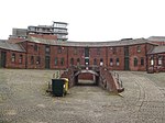
Horseshoe Shaped Former Stables and Stores (City of Birmingham Engineers Depot) - 23 Sheepcote Street, B16
Ladywood Local Government Office
1840
22 November 1976
SP0563586790 52°28′44″N 1°55′06″W / 52.479008°N 1.91846°W / 52.479008; -1.91846 (Horseshoe Shaped Former Stables and Stores (City of Birmingham Engineers Depot) - 23 Sheepcote Street, B16)
1220997 Horseshoe Shaped Former Stables and Stores (City of Birmingham Engineers Depot) - 23 Sheepcote Street, B16 More images
Former Icknield Street School (a Birmingham board school )
Hockley School
1883
16 September 1981
SP0582888465 52°29′39″N 1°54′56″W / 52.494065°N 1.91559°W / 52.494065; -1.91559 (Former Icknield Street School (a Birmingham board school))
1076315 Former Icknield Street School (a Birmingham board school )
King Edward's School Chapel
Edgbaston School
1938-40
8 July 1982
SP0542283654 52°27′03″N 1°55′18″W / 52.450818°N 1.921646°W / 52.450818; -1.921646 (King Edward's School Chapel)
1343402 King Edward's School Chapel More images
Kings Norton Guillotine Stop Lock East of Junction of Stratford on Avon Canal with the Worcester and Birmingham Canal
Kings Norton Stop Lock
1794-1802
8 July 1982
SP0557479470 52°24′48″N 1°55′10″W / 52.413202°N 1.919478°W / 52.413202; -1.919478 (Kings Norton Guillotine Stop Lock East of Junction of Stratford on Avon Canal with the Worcester and Birmingham Canal)
1076290 Kings Norton Guillotine Stop Lock East of Junction of Stratford on Avon Canal with the Worcester and Birmingham CanalMore images
Knutsford Lodge, 25 Somerset Road, B15
Edgbaston House
Mid to late 19th century
8 July 1982
SP0463384533 52°27′31″N 1°56′00″W / 52.458727°N 1.933244°W / 52.458727; -1.933244 (Knutsford Lodge, 25 Somerset Road, B15)
1076157 Knutsford Lodge, 25 Somerset Road, B15
Ladypool Primary School (a Birmingham board school )
Sparkbrook Elementary School
1885
8 July 1982
SP0863084816 52°27′40″N 1°52′28″W / 52.461224°N 1.874413°W / 52.461224; -1.874413 (Ladypool Primary School (a Birmingham board school))
1343133 Ladypool Primary School (a Birmingham board school )More images
Lloyd's Farmhouse Farm Park, Sampson Road, B11
Sparkhill Farmhouse
Mid 18th century
30 June 1976
SP0873585233 52°27′54″N 1°52′22″W / 52.464971°N 1.872857°W / 52.464971; -1.872857 (Lloyd's Farmhouse Farm Park, Sampson Road, B11)
1076180 Lloyd's Farmhouse Farm Park, Sampson Road, B11 More images
Main Block to Oscott College
New Oscott Theological College
1835-8
25 April 1952
SP0988894038 52°32′39″N 1°51′20″W / 52.544107°N 1.855627°W / 52.544107; -1.855627 (Main Block to Oscott College)
1075635 Main Block to Oscott College More images
Maryvale Institute
Old Oscott Bishops Palace
1752
25 April 1952
SP0741594534 52°32′55″N 1°53′31″W / 52.548605°N 1.892082°W / 52.548605; -1.892082 (Maryvale Institute)
1076213 Maryvale Institute More images
Metchley Abbey
Selly Oak House
Early 19th century
25 April 1952
SP0379684364 52°27′26″N 1°56′44″W / 52.457214°N 1.945564°W / 52.457214; -1.945564 (Metchley Abbey)
1076261 Metchley Abbey More images
Methodist Central Hall
City Centre
Methodist Church
1903-4
21 January 1970
SP0739587311 52°29′01″N 1°53′33″W / 52.483671°N 1.892535°W / 52.483671; -1.892535 (Methodist Central Hall)
1075607 Methodist Central Hall More images
Moat House
Sutton Coldfield House
1680
18 October 1949
SP1213496698 52°34′05″N 1°49′21″W / 52.567975°N 1.822412°W / 52.567975; -1.822412 (Moat House)
1343333 Moat House More images
Monument to Lord Nelson
City Centre
Sculpture
1809
25 April 1952
SP0729886616 52°28′39″N 1°53′38″W / 52.477425°N 1.893978°W / 52.477425; -1.893978 (Monument to Lord Nelson)
1343362 Monument to Lord Nelson More images
Moor Hall Farmhouse
Sutton Coldfield Farmhouse
Late 14th or 15th century
18 October 1949
SP1251498117 52°34′51″N 1°49′00″W / 52.580723°N 1.816753°W / 52.580723; -1.816753 (Moor Hall Farmhouse)
1075803 Upload Photo
Murdoch Chambers and Pitman Chambers, 155-161 Corporation Street, B3
City Centre
Shop
1896-7
21 January 1970
SP0726987214 52°28′58″N 1°53′40″W / 52.482801°N 1.894392°W / 52.482801; -1.894392 (Murdoch Chambers and Pitman Chambers, 155-161 Corporation Street, B3)
1075604 Murdoch Chambers and Pitman Chambers, 155-161 Corporation Street, B3 More images
National Westminster Bank
City Centre
Bank
1869
21 January 1970
SP0682986898 52°28′48″N 1°54′03″W / 52.479966°N 1.900878°W / 52.479966; -1.900878 (National Westminster Bank)
1291206 National Westminster Bank More images
Newhall Mill
Sutton Coldfield Mill House
18th century
10 December 1973
SP1322294504 52°32′54″N 1°48′23″W / 52.548227°N 1.806447°W / 52.548227; -1.806447 (Newhall Mill)
1343322 Newhall Mill More images
Number 20, High St. and Front Railings
Sutton Coldfield House
1675
18 October 1949
SP1212096432 52°33′56″N 1°49′21″W / 52.565584°N 1.822629°W / 52.565584; -1.822629 (Number 20, High St. and Front Railings)
1116386 Upload Photo
Nos 36a and 37, Waterloo St. (Wellesley House) and Screen Cut into Waterloo Court
City Centre
House
1830
25 April 1952
SP0682186927 52°28′49″N 1°54′04″W / 52.480227°N 1.900995°W / 52.480227; -1.900995 (Nos 36a and 37, Waterloo St. (Wellesley House) and Screen Cut into Waterloo Court)
1343153 Nos 36a and 37, Waterloo St. (Wellesley House) and Screen Cut into Waterloo Court
Old Grammar School on the North Side of the Churchyard to the Church of St Nicolas
Kings Norton Priests House
Early 15th century
25 April 1952
SP0496378997 52°24′32″N 1°55′42″W / 52.408956°N 1.928468°W / 52.408956; -1.928468 (Old Grammar School on the North Side of the Churchyard to the Church of St Nicolas)
1211444 Old Grammar School on the North Side of the Churchyard to the Church of St Nicolas More images
Our Lady Help of Christians Church
Tile Cross Church
1967
18 February 1999 (Grade II);
SP1563786988 52°28′50″N 1°46′16″W / 52.480578°N 1.771189°W / 52.480578; -1.771189 (Our Lady Help of Christians Church)
1245546 Our Lady Help of Christians Church More images
Parish Church of St Giles
Sheldon Parish Church
Early 14th century
25 April 1952
SP1520984649 52°27′34″N 1°46′39″W / 52.45958°N 1.777592°W / 52.45958; -1.777592 (Parish Church of St Giles)
1075659 Parish Church of St Giles More images
Parish Church of St Martin
City Centre
Church
Late 13th century
25 April 1952
SP0735286566 52°28′37″N 1°53′35″W / 52.476975°N 1.893184°W / 52.476975; -1.893184 (Parish Church of St Martin)
1075690 Parish Church of St Martin More images
Parish Church of the Ascension
Hall Green Parish Church
18th century
25 April 1952
SP1099481789 52°26′02″N 1°50′23″W / 52.433969°N 1.839719°W / 52.433969; -1.839719 (Parish Church of the Ascension)
1076183 Parish Church of the Ascension More images
Premises occupied by Gallen Kamp (Argent Works)
Hockley Works
1862-3
8 July 1982
SP0608587418 52°29′05″N 1°54′43″W / 52.484649°N 1.911823°W / 52.484649; -1.911823 (Premises occupied by Gallen Kamp (Argent Works))
1290277 Premises occupied by Gallen Kamp (Argent Works) More images
Primrose Hill Farmhouse
Kings Norton Farmhouse
Late 15th century
22 January 1973
SP0499677785 52°23′53″N 1°55′41″W / 52.398059°N 1.928°W / 52.398059; -1.928 (Primrose Hill Farmhouse)
1076230 Upload Photo
Spring Hill Library
Ladywood Public Library
1893
22 May 1972
SP0556487464 52°29′06″N 1°55′10″W / 52.485068°N 1.919495°W / 52.485068; -1.919495 (Spring Hill Library)
1076161 Spring Hill Library More images
School of Art
Balsall Heath Art School
1899
8 July 1982
SP0789684370 52°27′26″N 1°53′07″W / 52.457225°N 1.885226°W / 52.457225; -1.885226 (School of Art)
1343102 School of Art More images
Sheldon Hall
Kitts Green House
Early 16th century
25 April 1952
SP1623987443 52°29′05″N 1°45′44″W / 52.484668°N 1.762299°W / 52.484668; -1.762299 (Sheldon Hall)
1075555 Sheldon Hall More images
Small Heath Lower School (a former Birmingham board school )
Small Heath Board School
1892
8 July 1982
SP0976585201 52°27′53″N 1°51′28″W / 52.464666°N 1.857697°W / 52.464666; -1.857697 (Small Heath Lower School (a former Birmingham board school))
1211189 Small Heath Lower School (a former Birmingham board school )More images
Small Heath Lower School, Learning Zone (a former Birmingham board school )
Small Heath Teachers House
1892
8 July 1982
SP0972385197 52°27′53″N 1°51′30″W / 52.464631°N 1.858315°W / 52.464631; -1.858315 (Small Heath Lower School, Learning Zone (a former Birmingham board school))
1075691 Upload Photo
Soho House
Handsworth House
Mid 18th century
25 April 1952
SP0533289078 52°29′58″N 1°55′22″W / 52.49958°N 1.922886°W / 52.49958; -1.922886 (Soho House)
1076151 Soho House More images
Stables to the North East of Number 12
Edgbaston Stable
1855
22 April 1976
SP0563985228 52°27′54″N 1°55′06″W / 52.464966°N 1.918427°W / 52.464966; -1.918427 (Stables to the North East of Number 12)
1075741 Stables to the North East of Number 12
Statue of the Virgin Mary in Front of the Tower of Oscott College
New Oscott Statue
1837-40
8 July 1982
SP0987694018 52°32′38″N 1°51′21″W / 52.543928°N 1.855805°W / 52.543928; -1.855805 (Statue of the Virgin Mary in Front of the Tower of Oscott College)
1075636 Upload Photo
Stone House
Sutton Coldfield House
Early 16th century
26 August 1976
SP1308994399 52°32′50″N 1°48′30″W / 52.547286°N 1.808413°W / 52.547286; -1.808413 (Stone House)
1075773 Upload Photo
Stratford House
Highgate Manor House
1601
25 April 1952
SP0818185548 52°28′04″N 1°52′52″W / 52.467811°N 1.881004°W / 52.467811; -1.881004 (Stratford House)
1076165 Stratford House More images
Summerfield Community Centre and Job Preparation Unit - a former Birmingham board school (Dudley Road)
Winson Green House
1878
8 July 1982
SP0427687693 52°29′14″N 1°56′18″W / 52.487138°N 1.938458°W / 52.487138; -1.938458 (Summerfield Community Centre and Job Preparation Unit - a former Birmingham board school (Dudley Road))
1343401 Summerfield Community Centre and Job Preparation Unit - a former Birmingham board school (Dudley Road) More images
The Anchorage
Handsworth House
1899
8 July 1982
SP0486291181 52°31′07″N 1°55′47″W / 52.51849°N 1.929779°W / 52.51849; -1.929779 (The Anchorage)
1076319 The Anchorage More images
The Bartons Arms
Aston Public House 1900-01
31 March 1976
SP0721889042 52°29′57″N 1°53′42″W / 52.499235°N 1.895104°W / 52.499235; -1.895104 (The Bartons Arms)
1076341 The Bartons Arms More images
The Bordesley Centre (former Camp Hill Boys' and Girls' schools)
Bordesley Grammar School
1883
8 July 1982
SP0839985563 52°28′05″N 1°52′40″W / 52.467943°N 1.877794°W / 52.467943; -1.877794 (The Bordesley Centre (former Camp Hill Boys' and Girls' schools))
1210202 The Bordesley Centre (former Camp Hill Boys' and Girls' schools) More images
The Grand Hotel
City Centre Hotel
1876
4 May 2004
SP0692787116 52°28′55″N 1°53′58″W / 52.481924°N 1.89943°W / 52.481924; -1.89943 (The Grand Hotel)
1391246 The Grand Hotel More images
The Grove
Sutton Coldfield House
17th or early 18th century
18 October 1949
SP1665594979 52°33′09″N 1°45′21″W / 52.552403°N 1.755798°W / 52.552403; -1.755798 (The Grove)
1319945 Upload Photo
The Listed Building (formerly Floodgate School), Digbeth Campus, South Birmingham College - a former Birmingham board school
Digbeth Technical College
1982
8 July 1982
SP0785086412 52°28′32″N 1°53′09″W / 52.475583°N 1.885856°W / 52.475583; -1.885856 (The Listed Building (formerly Floodgate School), Digbeth Campus, South Birmingham College - a former Birmingham board school)
1219510 The Listed Building (formerly Floodgate School), Digbeth Campus, South Birmingham College - a former Birmingham board school More images
Perrot's Folly - The Monument (observatory)
Edgbaston Folly
1758
25 April 1952
SP0476886277 52°28′28″N 1°55′52″W / 52.474405°N 1.931233°W / 52.474405; -1.931233 (Perrot's Folly - The Monument (observatory))
1076123 Perrot's Folly - The Monument (observatory)More images
The Old Crown Public House
Deritend Jettied House
1368
25 April 1952
SP0801886323 52°28′29″N 1°53′00″W / 52.474781°N 1.883385°W / 52.474781; -1.883385 (The Old Crown Public House)
1076298 The Old Crown Public House More images
The Old Stone House
Sutton Coldfield House
Early 16th century
18 October 1949
SP1187495270 52°33′19″N 1°49′35″W / 52.555144°N 1.826299°W / 52.555144; -1.826299 (The Old Stone House)
1075806 Upload Photo
The Red Lion Public House
Handsworth Public House
1901-2
17 January 1985
SP0430489589 52°30′15″N 1°56′17″W / 52.504183°N 1.938022°W / 52.504183; -1.938022 (The Red Lion Public House)
1276278 The Red Lion Public House More images
Saracen's Head
Kings Norton Courtyard
Late 15th century
25 April 1952
SP0491478901 52°24′29″N 1°55′45″W / 52.408093°N 1.929189°W / 52.408093; -1.929189 (Saracen's Head)
1343450 Saracen's Head More images
Singers Hill Synagogue
City Centre
Courtyard
1856
21 January 1970
SP0664386416 52°28′32″N 1°54′13″W / 52.475635°N 1.903626°W / 52.475635; -1.903626 (Singers Hill Synagogue)
1075712 Singers Hill Synagogue More images
Trust School
Yardley House
19th century
25 April 1952
SP1350086268 52°28′27″N 1°48′10″W / 52.474179°N 1.802679°W / 52.474179; -1.802679 (Trust School)
1343388 Trust School More images
Vesey Cottage
High Heath House
Early 16th century
18 October 1949
SP1442597760 52°34′39″N 1°47′19″W / 52.577467°N 1.788566°W / 52.577467; -1.788566 (Vesey Cottage)
1075772 Upload Photo
Vesey Grange
High Heath House
Early 16th century
26 August 1976
SP1344499106 52°35′23″N 1°48′11″W / 52.589592°N 1.802989°W / 52.589592; -1.802989 (Vesey Grange)
1320023 Upload Photo
Water Orton Bridge (that Part in the City of Birmingham)
Birmingham
Bridge
1520
18 October 1949
SP1740691424 52°31′14″N 1°44′42″W / 52.520421°N 1.744907°W / 52.520421; -1.744907 (Water Orton Bridge (that Part in the City of Birmingham))
1075812 Water Orton Bridge (that Part in the City of Birmingham) More images
54–57, Albion Street B1
Hockley Terrace
1837
8 July 1982
SP0603187461 52°29′06″N 1°54′45″W / 52.485036°N 1.912618°W / 52.485036; -1.912618 (54–57, Albion Street B1)
1075759 Upload Photo
12 New Market Street/45 Great Charles Street Queensway B3
City Centre
Building
1895
21 January 1970
SP0671687198 52°28′58″N 1°54′09″W / 52.482664°N 1.902536°W / 52.482664; -1.902536 (12 New Market Street/45 Great Charles Street Queensway B3)
1075582 12 New Market Street/45 Great Charles Street Queensway B3 More images
93 Cornwall Street B3
City Centre
House
1902
21 January 1970
SP0665387072 52°28′54″N 1°54′12″W / 52.481532°N 1.903466°W / 52.481532; -1.903466 (93 Cornwall Street B3)
1075645 93 Cornwall Street B3 More images
100 Sampson Road B11
Sparkhill Apartment
1982
8 July 1982
SP0870585151 52°27′51″N 1°52′24″W / 52.464234°N 1.873301°W / 52.464234; -1.873301 (100 Sampson Road B11)
1076179 Upload Photo
17 & 19, Rotton Park Road B16
Edgbaston Semi Detached House
1896
8 July 1982
SP0390986212 52°28′26″N 1°56′38″W / 52.473827°N 1.94388°W / 52.473827; -1.94388 (17 & 19, Rotton Park Road B16)
1076203 17 & 19, Rotton Park Road B16 More images
12 Ampton Road B15
Edgbaston House
1855
22 April 1976
SP0562285228 52°27′54″N 1°55′07″W / 52.464966°N 1.918677°W / 52.464966; -1.918677 (12 Ampton Road B15)
1075740 Upload Photo
36 Calthorpe Road B15
Edgbaston Villa
1835
21 January 1970
SP0541485609 52°28′06″N 1°55′18″W / 52.468393°N 1.921733°W / 52.468393; -1.921733 (36 Calthorpe Road B15)
1075700 Upload Photo
44 Waterloo Street B2
City Centre
House
1900
5 November 1981
SP0690886973 52°28′50″N 1°53′59″W / 52.480639°N 1.899713°W / 52.480639; -1.899713 (44 Waterloo Street B2)
1211181 44 Waterloo Street B2 More images
56, 58, & 60 Newhall Street B3
City Centre
House
circa 1900
21 January 1970
SP0665887110 52°28′55″N 1°54′12″W / 52.481874°N 1.903391°W / 52.481874; -1.903391 (56, 58, & 60 Newhall Street B3)
1219711 56, 58, & 60 Newhall Street B3 More images
35 Calthorpe Road B15
Edgbaston Villa
circa 1835
21 January 1970
SP0540585583 52°28′05″N 1°55′19″W / 52.46816°N 1.921866°W / 52.46816; -1.921866 (35 Calthorpe Road B15)
1220385 35 Calthorpe Road B15 More images
57 & 59 Church Street B3
City Centre
Building
1909
8 July 1982
SP0679587251 52°28′59″N 1°54′05″W / 52.48314°N 1.901371°W / 52.48314; -1.901371 (57 & 59 Church Street B3)
1221016 57 & 59 Church Street B3 More images
85 & 87 Cornwall Street B3
City Centre
House
1899
21 January 1970
SP0665687093 52°28′54″N 1°54′12″W / 52.481721°N 1.903421°W / 52.481721; -1.903421 (85 & 87 Cornwall Street B3)
1290474 85 & 87 Cornwall Street B3 More images
41 & 43 Church Street B3
City Centre
House
1900
21 January 1970
SP0683587205 52°28′58″N 1°54′03″W / 52.482726°N 1.900783°W / 52.482726; -1.900783 (41 & 43 Church Street B3)
1290722 41 & 43 Church Street B3 More images
Former Icknield Street School , 303 Icknield Street B18 (a former Birmingham board school )
Hockley Teacher's House
1883
16 September 1981
SP0583588442 52°29′38″N 1°54′56″W / 52.493858°N 1.915487°W / 52.493858; -1.915487 (Former Icknield Street School, 303 Icknield Street B18 (a former Birmingham board school))
1291556 Former Icknield Street School , 303 Icknield Street B18 (a former Birmingham board school ) More images
6 Bennett's Hill B2
City Centre
Detached House
1827
21 January 1970
SP0683686951 52°28′50″N 1°54′03″W / 52.480442°N 1.900774°W / 52.480442; -1.900774 (6 Bennett's Hill B2)
1343350 6 Bennett's Hill B2 More images
89 & 91 Cornwall Street B3
City Centre
House
1904
21 January 1970
SP0665287088 52°28′54″N 1°54′13″W / 52.481676°N 1.90348°W / 52.481676; -1.90348 (89 & 91 Cornwall Street B3)
1343379 89 & 91 Cornwall Street B3 More images
9, 10, & 11 Legge Lane
Jewellery Quarter Jewellery Workshop
1891-2
29 April 2004
SP0596887389 52°29′04″N 1°54′49″W / 52.48439°N 1.913547°W / 52.48439; -1.913547 (9, 10, & 11 Legge Lane)
1391290 9, 10, & 11 Legge Lane More images
95 Cornwall Street B3
City Centre
House
1901
21 January 1970
SP0665087067 52°28′53″N 1°54′13″W / 52.481487°N 1.90351°W / 52.481487; -1.90351 (95 Cornwall Street B3)
1210401 95 Cornwall Street B3 More images
98 Edmund Street B3
City Centre
Office
1875
21 January 1970
SP0670387038 52°28′52″N 1°54′10″W / 52.481226°N 1.90273°W / 52.481226; -1.90273 (98 Edmund Street B3)
1210578 98 Edmund Street B3 More images

![]() Media related to Grade II* listed buildings in the West Midlands (county) at Wikimedia Commons
Media related to Grade II* listed buildings in the West Midlands (county) at Wikimedia Commons


