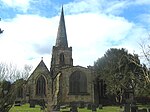
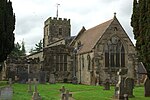
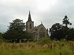
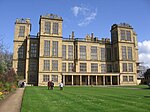
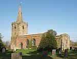
Name
Location
Type
Completed Date designated
Grid ref. Entry number Image
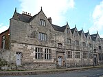
Old Grammar School
Ashbourne Former school
1586
15 June 1951
SK1769846526 53°00′57″N 1°44′16″W / 53.015747°N 1.737646°W / 53.015747; -1.737646 (Old Grammar School)
1207596 Old Grammar School More images
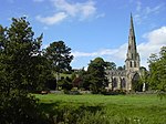
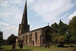
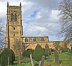
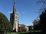
Parish Church of St Oswald
Ashbourne
Parish church
Mainly c .1200
15 June 1951
SK1762846439 53°00′54″N 1°44′19″W / 53.014967°N 1.738694°W / 53.014967; -1.738694 (Parish Church of St Oswald)
1207715 Parish Church of St Oswald More images
The Mansion including coach house wall
Ashbourne
House
c .168515 June 1951
SK1772946509 53°00′56″N 1°44′14″W / 53.015593°N 1.737185°W / 53.015593; -1.737185 (The Mansion including coach house wall)
1335139 The Mansion including coach house wall More images
Bakewell Bridge
Bakewell Bridge
c .130013 March 1951
SK2194968652 53°12′52″N 1°40′22″W / 53.214478°N 1.672777°W / 53.214478; -1.672777 (Bakewell Bridge)
1148112 Bakewell Bridge More images
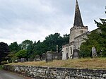
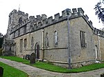
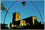
Church of All Saints
Bakewell
Parish church
18th century
13 March 1951
SK2155668483 53°12′47″N 1°40′43″W / 53.212975°N 1.678674°W / 53.212975; -1.678674 (Church of All Saints)
1316489 Church of All Saints More images
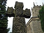
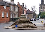
Cross situated 12 metres to south of porch of Church of All Saints
Bakewell
Cross
Early 10th century
7 January 1970
SK2154568457 53°12′46″N 1°40′44″W / 53.212742°N 1.67884°W / 53.212742; -1.67884 (Cross situated 12 metres to south of porch of Church of All Saints)
1316491 Cross situated 12 metres to south of porch of Church of All Saints More images
Holme Bridge
Bakewell
Packhorse bridge
1664
13 March 1951
SK2154668988 53°13′03″N 1°40′44″W / 53.217514°N 1.678789°W / 53.217514; -1.678789 (Holme Bridge)
1247518 Holme Bridge More images
Holme Hall
Bakewell
Country house
1626–28
13 March 1951
SK2154769106 53°13′07″N 1°40′44″W / 53.218575°N 1.678766°W / 53.218575; -1.678766 (Holme Hall)
1246166 Holme Hall More images
The Great Cross and railed enclosure
Bakewell
Cross
Early 9th century
13 January 1951
SK2157068465 53°12′46″N 1°40′42″W / 53.212812°N 1.678465°W / 53.212812; -1.678465 (The Great Cross and railed enclosure)
1316492 The Great Cross and railed enclosure More images
Baslow Bridge
Baslow and BubnellBridge
Early 17th century
12 July 1967
SK2510472369 53°14′52″N 1°37′31″W / 53.24775°N 1.625242°W / 53.24775; -1.625242 (Baslow Bridge)
1088195 Baslow Bridge More images
Church of All Saints
Bradbourne Church
12th century
13 September 1967
SK2080752756 53°04′18″N 1°41′27″W / 53.071637°N 1.690905°W / 53.071637; -1.690905 (Church of All Saints)
1109479 Church of All Saints More images
Church of All Saints
Brailsford Parish church
12th century
13 September 1967
SK2449241274 52°58′06″N 1°38′12″W / 52.968271°N 1.636774°W / 52.968271; -1.636774 (Church of All Saints)
1109734 Church of All Saints More images
Ednaston Manor and attached walls and terracing
Brailsford
Country house
1912–19 by Lutyens
13 September 1967
SK2384642276 52°58′38″N 1°38′47″W / 52.977307°N 1.646319°W / 52.977307; -1.646319 (Ednaston Manor and attached walls and terracing)
1109745 Upload Photo
Chatsworth House
Chatsworth Country house
1687–89
29 September 1951
SK2602270104 53°13′38″N 1°36′42″W / 53.227346°N 1.611669°W / 53.227346; -1.611669 (Chatsworth House)
1373871 Chatsworth House More images
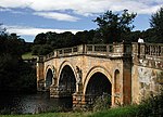
Bridge on main approach to Chatsworth House
Chatsworth
Bridge
1759–74
12 July 1967
SK2571870176 53°13′41″N 1°36′58″W / 53.228008°N 1.616216°W / 53.228008; -1.616216 (Bridge on main approach to Chatsworth House)
1049093 Bridge on main approach to Chatsworth House More images
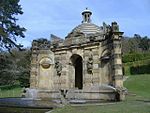
Conduit House, Cascade and adjoining statues
Chatsworth
Cascade and bridge
c .169612 July 1967
SK2630470050 53°13′37″N 1°36′27″W / 53.226847°N 1.607449°W / 53.226847; -1.607449 (Conduit House, Cascade and adjoining statues)
1088181 Conduit House, Cascade and adjoining statues More images
Egyptian statue (now indoors)
Chatsworth
Statue
Egyptian c.1570–1304 BC
19 June 1987
SK2613070181 53°13′41″N 1°36′36″W / 53.228033°N 1.610045°W / 53.228033; -1.610045 (Egyptian statue (now indoors))
1067714 Egyptian statue (now indoors)
Egyptian statue (now indoors)
Chatsworth
Statue
Egyptian c.1570–1304 BC
19 June 1987
SK2614070182 53°13′41″N 1°36′36″W / 53.228042°N 1.609895°W / 53.228042; -1.609895 (Egyptian statue (now indoors))
1334742 Upload Photo
Former stables at Chatsworth House
Chatsworth
Former stables
1758–63 by James Paine
12 July 1967
SK2619670269 53°13′44″N 1°36′33″W / 53.228821°N 1.609049°W / 53.228821; -1.609049 (Former stables at Chatsworth House)
1088184 Former stables at Chatsworth House More images
Series of herms and altars laid out in a Y to the east of the Ring Pond
Chatsworth
Herms
c .173019 June 1987
SK2616969906 53°13′32″N 1°36′34″W / 53.225559°N 1.609483°W / 53.225559; -1.609483 (Series of herms and altars laid out in a Y to the east of the Ring Pond)
1334743 Series of herms and altars laid out in a Y to the east of the Ring Pond
Temple of Flora
Chatsworth
Temple
1693–95
12 July 1967
SK2607270232 53°13′43″N 1°36′39″W / 53.228495°N 1.610909°W / 53.228495; -1.610909 (Temple of Flora)
1088176 Temple of Flora More images
Cromford Mill
Cromford Mill
1771
22 June 1950
SK2985156982 53°06′33″N 1°33′20″W / 53.109197°N 1.555535°W / 53.109197; -1.555535 (Cromford Mill)
1248010 Cromford Mill More images
Church of St Mary
Cromford
Parish church
1792–97
22 June 1950
SK2996657116 53°06′37″N 1°33′14″W / 53.110395°N 1.553804°W / 53.110395; -1.553804 (Church of St Mary)
1248052 Church of St Mary More images
Church of St Andrew
Cubley Parish church
Late 15th century
13 September 1967
SK1649337692 52°56′11″N 1°45′22″W / 52.936376°N 1.756055°W / 52.936376; -1.756055 (Church of St Andrew)
1203949 Church of St Andrew More images
Church of St Cuthbert
Doveridge Parish church
Late 12th century
13 September 1967
SK1138534102 52°54′15″N 1°49′56″W / 52.904236°N 1.832178°W / 52.904236; -1.832178 (Church of St Cuthbert)
1274523 Church of St Cuthbert More images
Church of St Peter
Edensor Parish church
12th century
12 July 1967
SK2506769901 53°13′32″N 1°37′34″W / 53.225567°N 1.625989°W / 53.225567; -1.625989 (Church of St Peter)
1088158 Church of St Peter More images
Churchyard cross 6 metres east of church porch
Eyam Cross
Early 9th century
29 September 1951
SK2178576398 53°17′03″N 1°40′29″W / 53.284111°N 1.674706°W / 53.284111; -1.674706 (Churchyard cross 6 metres east of church porch)
1100263 Churchyard cross 6 metres east of church porch More images
Church of St Giles
Great Longstone Parish church
13th century
12 July 1967
SK2002171910 53°14′38″N 1°42′05″W / 53.243839°N 1.701445°W / 53.243839; -1.701445 (Church of St Giles)
1109899 Church of St Giles More images
Padley Chapel
Upper Padley, Grindleford
Chapel
14th and 15th century
29 September 1951
SK2467878954 53°18′25″N 1°37′52″W / 53.306959°N 1.631117°W / 53.306959; -1.631117 (Padley Chapel)
1335033 Padley Chapel More images
Church of All Saints
Hassop Roman Catholic church
1816–17
12 July 1967
SK2234472322 53°14′51″N 1°40′00″W / 53.24745°N 1.666606°W / 53.24745; -1.666606 (Church of All Saints)
1253035 Church of All Saints More images
Church of St Michael and All Angels
Bank Top, Hathersage
Church
14th century
12 July 1967
SK2339881854 53°19′59″N 1°39′00″W / 53.333084°N 1.650112°W / 53.333084; -1.650112 (Church of St Michael and All Angels)
1109793 Church of St Michael and All Angels More images
Holy Trinity Church
Kirk Ireton Parish church
12th century
13 September 1967
SK2689850211 53°02′55″N 1°36′01″W / 53.04849°N 1.60021°W / 53.04849; -1.60021 (Holy Trinity Church)
1335168 Holy Trinity Church More images
Church of St Michael
Kniveton Church
12th century
13 September 1967
SK2099850395 53°03′01″N 1°41′18″W / 53.050407°N 1.688207°W / 53.050407; -1.688207 (Church of St Michael)
1146435 Church of St Michael More images
Church of St Chad
Longford Church
15th century
13 September 1967
SK2148038322 52°56′31″N 1°40′55″W / 52.941863°N 1.681815°W / 52.941863; -1.681815 (Church of St Chad)
1109790 Church of St Chad More images
Haddon Hall
Nether Haddon Fortified manor house
Mainly 14th and 15th century
29 September 1951
SK2350566337 53°11′37″N 1°38′59″W / 53.193603°N 1.649647°W / 53.193603; -1.649647 (Haddon Hall)
1334982 Haddon Hall More images
Church of St Mary and St Barlok
Norbury Hollow, Norbury and Roston
Church
Early 15th century
13 September 1967
SK1254942395 52°58′44″N 1°48′52″W / 52.978758°N 1.814555°W / 52.978758; -1.814555 (Church of St Mary and St Barlok)
1109764 Church of St Mary and St Barlok More images
The Old Manor and attached garden wall
Norbury Hollow
Country house
Late 17th century
5 February 1952
SK1252542357 52°58′42″N 1°48′54″W / 52.978417°N 1.814914°W / 52.978417; -1.814914 (The Old Manor and attached garden wall)
1281200 The Old Manor and attached garden wallMore images
Somersal Herbert Hall
Somersal Herbert Country house
Early 16th century
5 February 1982
SK1356935231 52°54′52″N 1°47′59″W / 52.914334°N 1.799661°W / 52.914334; -1.799661 (Somersal Herbert Hall)
1274325 Somersal Herbert Hall More images
Snitterton Hall
Snitterton , South Darley Country house
Late 16th century
22 June 1950
SK2784760341 53°08′22″N 1°35′07″W / 53.139498°N 1.585179°W / 53.139498; -1.585179 (Snitterton Hall)
1248141 Snitterton Hall More images
Sudbury Hall and attached stable block
Sudbury Country house
1660–70
5 February 1952
SK1586832111 52°53′10″N 1°45′56″W / 52.886225°N 1.765624°W / 52.886225; -1.765624 (Sudbury Hall and attached stable block)
1273995 Sudbury Hall and attached stable blockMore images
Church of St Michael
Taddington Church
14th century
12 July 1967
SK1412871159 53°14′14″N 1°47′23″W / 53.237276°N 1.789783°W / 53.237276; -1.789783 (Church of St Michael)
1109887 Church of St Michael More images
Church of St Leonard
Thorpe Church
Early 12th century
13 September 1984
SK1562850160 53°02′55″N 1°46′06″W / 53.048477°N 1.768326°W / 53.048477; -1.768326 (Church of St Leonard)
1203690 Church of St Leonard More images
Church of St John the Baptist
Tideswell Church
14th century
12 July 1967
SK1525675774 53°16′43″N 1°46′22″W / 53.278728°N 1.772663°W / 53.278728; -1.772663 (Church of St John the Baptist)
1215255 Church of St John the Baptist More images
Church of St Mary
Wirksworth Church
Early English to Perpendicular
24 October 1950
SK2874853942 53°04′55″N 1°34′20″W / 53.081931°N 1.572282°W / 53.081931; -1.572282 (Church of St Mary)
1335090 Church of St Mary More images
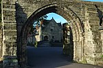
Remains of Chapel of St Mary and St John the Baptist to south of Stydd Hall
Yeaveley
Chapel
Early 13th century
13 September 1967
SK1719839963 52°57′24″N 1°44′44″W / 52.956768°N 1.745446°W / 52.956768; -1.745446 (Remains of Chapel of St Mary and St John the Baptist to south of Stydd Hall)
1109732 Remains of Chapel of St Mary and St John the Baptist to south of Stydd Hall More images
Church of All Saints
Youlgreave Parish church
Late 12th century
12 July 1967
SK2120564372 53°10′34″N 1°41′03″W / 53.176036°N 1.684201°W / 53.176036; -1.684201 (Church of All Saints)
1109853 Church of All Saints More images


![]() Media related to Grade I listed buildings in Derbyshire at Wikimedia Commons
Media related to Grade I listed buildings in Derbyshire at Wikimedia Commons


