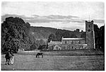
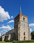
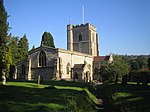
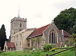
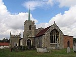
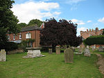
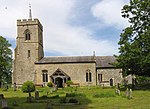
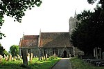
Name
Location
Type
Completed Date designated
Grid ref. Entry number Image
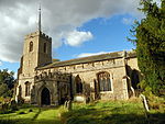
Church of St George
Anstey Parish Church
Late 12th century
22 February 1967
TL4042832890 51°58′36″N 0°02′35″E / 51.976738°N 0.043123°E / 51.976738; 0.043123 (Church of St George)
1101870 Church of St George More images
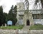
Parish Church of St Lawrence
Ardeley Parish Church
13th century or earlier
22 February 1967
TL3081727138 51°55′39″N 0°05′56″W / 51.927395°N 0.098907°W / 51.927395; -0.098907 (Parish Church of St Lawrence)
1174231 Parish Church of St Lawrence More images
Parish Church of St Mary
Aspenden Parish Church
11th century
22 February 1967
TL3536428392 51°56′15″N 0°01′56″W / 51.937577°N 0.032328°W / 51.937577; -0.032328 (Parish Church of St Mary)
1347966 Parish Church of St Mary More images
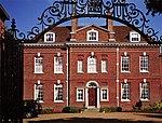
Aston Bury Manor
Aston Manor House
Mid 17th century
20 October 1952
TL2760621702 51°52′45″N 0°08′51″W / 51.879291°N 0.14759°W / 51.879291; -0.14759 (Aston Bury Manor)
1174988 Aston Bury Manor More images
Church of St Peter
Benington Church
Late 13th century or early 14th century
24 November 1966
TL2969223579 51°53′44″N 0°07′00″W / 51.895677°N 0.116598°W / 51.895677; -0.116598 (Church of St Peter)
1101403 Church of St Peter More images
Remains of Benington Castle (in Grounds of the Lordship 15 Metres to South East of House)
Benington Castle
1130S
24 November 1966
TL2968023633 51°53′46″N 0°07′00″W / 51.896165°N 0.116752°W / 51.896165; -0.116752 (Remains of Benington Castle (in Grounds of the Lordship 15 Metres to South East of House))
1175349 Remains of Benington Castle (in Grounds of the Lordship 15 Metres to South East of House) More images
Church of St Michael
Bishop's Stortford Church
Early 15th century
18 October 1949
TL4862321336 51°52′15″N 0°09′27″E / 51.870803°N 0.157363°E / 51.870803; 0.157363 (Church of St Michael)
1101613 Church of St Michael More images
Remains of Waytemore Castle
Bishop's Stortford Keep
12th century
18 October 1949
TL4897621447 51°52′18″N 0°09′45″E / 51.871706°N 0.162535°E / 51.871706; 0.162535 (Remains of Waytemore Castle)
1101603 Remains of Waytemore Castle More images
Church of St Mary the Virgin
Braughing Church
1971
22 February 1967
TL3961925204 51°54′28″N 0°01′42″E / 51.907882°N 0.028235°E / 51.907882; 0.028235 (Church of St Mary the Virgin)
1347516 Church of St Mary the Virgin More images
Brent Pelham Hall, Gate Piers and Boundary Wall from North West Front of Hall, turning to South West and then South East to Gate
Brent Pelham House
Late 17th century
19 October 1951
TL4335830863 51°57′28″N 0°05′06″E / 51.957778°N 0.084906°E / 51.957778; 0.084906 (Brent Pelham Hall, Gate Piers and Boundary Wall from North West Front of Hall, turning to South West and then South East to Gate)
1101916 Brent Pelham Hall, Gate Piers and Boundary Wall from North West Front of Hall, turning to South West and then South East to Gate
Church of St Peter
Buntingford Church
c. 1615
22 February 1967
TL3630729324 51°56′45″N 0°01′06″W / 51.945721°N 0.01825°W / 51.945721; -0.01825 (Church of St Peter)
1348000 Church of St Peter More images
The Lordship
Cottered Farmhouse
Early-mid 15th century
19 October 1951
TL3189829194 51°56′44″N 0°04′57″W / 51.945615°N 0.082408°W / 51.945615; -0.082408 (The Lordship)
1348017 Upload Photo
Johnston Monument
Gilston Commemorative Monument
1923
19 September 1984
TL4395213512 51°48′06″N 0°05′11″E / 51.801728°N 0.086314°E / 51.801728; 0.086314 (Johnston Monument)
1101277 Upload Photo
Church of St Mary
Gilston Church
Early 13th century
24 January 1967
TL4398113526 51°48′07″N 0°05′12″E / 51.801846°N 0.08674°E / 51.801846; 0.08674 (Church of St Mary)
1308248 Church of St Mary More images
Balls Park
Hertford House
Early 18th century
10 February 1950
TL3371111928 51°47′24″N 0°03′46″W / 51.790035°N 0.062725°W / 51.790035; -0.062725 (Balls Park)
1269013 Balls Park More images
Church of St Leonard
Bengeo , Hertford Church
1695
10 February 1950
TL3301813638 51°48′20″N 0°04′20″W / 51.805566°N 0.072112°W / 51.805566; -0.072112 (Church of St Leonard)
1268717 Church of St Leonard More images
Friends Meeting House
Hertford
Friends Meeting House
1670
9 May 2019
TL3281212705 51°47′50″N 0°04′32″W / 51.797231°N 0.075455°W / 51.797231; -0.075455 (Friends Meeting House)
1268759 Friends Meeting House More images
Gatehouse to Hertford Castle
Hertford Castle
Later
10 February 1950
TL3245712465 51°47′43″N 0°04′50″W / 51.795158°N 0.080691°W / 51.795158; -0.080691 (Gatehouse to Hertford Castle)
1269027 Gatehouse to Hertford Castle More images
Shire Hall
Hertford Assembly Rooms
1767–1771
10 February 1950
TL3267212596 51°47′47″N 0°04′39″W / 51.796285°N 0.077525°W / 51.796285; -0.077525 (Shire Hall)
1268930 Shire Hall More images
Church of St Mary Little Hormead
Little Hormead Parish Church
11th century
22 February 1967
TL3984929104 51°56′34″N 0°01′59″E / 51.942866°N 0.033159°E / 51.942866; 0.033159 (Church of St Mary Little Hormead)
1176874 Church of St Mary Little Hormead More images
Hunsdon House
Hunsdon Country House
Mid 15th century
4 December 1951
TL4190412744 51°47′43″N 0°03′23″E / 51.79535°N 0.056319°E / 51.79535; 0.056319 (Hunsdon House)
1347687 Hunsdon House More images
Parish Church of St Dunstan
Hunsdon Parish Church
Early 14th century
24 January 1967
TL4181512710 51°47′42″N 0°03′18″E / 51.795067°N 0.055015°E / 51.795067; 0.055015 (Parish Church of St Dunstan)
1101973 Parish Church of St Dunstan More images
Parish Church of St Cecilia
Church End, Little Hadham
Church
Medieval
22 February 1967
TL4462022778 51°53′05″N 0°06′00″E / 51.88481°N 0.099866°E / 51.88481; 0.099866 (Parish Church of St Cecilia)
1290608 Parish Church of St Cecilia More images
Parish Church of All Saints
Little Munden Parish Church
11th century
24 January 1967
TL3345121887 51°52′47″N 0°03′46″W / 51.879587°N 0.062655°W / 51.879587; -0.062655 (Parish Church of All Saints)
1102260 Parish Church of All Saints More images
Boundary Wall at Yewtree Farm
Hadham Cross, Much Hadham
Boundary Wall
Mid-late 19th century
30 April 1985
TL4266918553 51°50′50″N 0°04′11″E / 51.84735°N 0.069795°E / 51.84735; 0.069795 (Boundary Wall at Yewtree Farm)
1289112 Upload Photo
Moor Place
Kettle Green, Much Hadham
Country House
1775-9
22 February 1967
TL4215318918 51°51′03″N 0°03′45″E / 51.850761°N 0.062459°E / 51.850761; 0.062459 (Moor Place)
1289132 Moor Place More images
Much Hadham Hall
Much Hadham Country House
1726-9
22 February 1967
TL4283219368 51°51′17″N 0°04′21″E / 51.854632°N 0.072496°E / 51.854632; 0.072496 (Much Hadham Hall)
1212633 Much Hadham Hall More images
Parish Church of St Andrew
Much Hadham Parish Church
12th century
22 February 1967
TL4303319674 51°51′26″N 0°04′32″E / 51.85733°N 0.075539°E / 51.85733; 0.075539 (Parish Church of St Andrew)
1289691 Parish Church of St Andrew More images
Parish Church of Great St Mary's
Sawbridgeworth Anglican Church
13th century
6 June 1952
TL4850014822 51°48′44″N 0°09′10″E / 51.81231°N 0.152784°E / 51.81231; 0.152784 (Parish Church of Great St Mary's)
1101668 Parish Church of Great St Mary's More images
Church of St Mary
Standon Church
15th century
24 January 1967
TL3964922257 51°52′53″N 0°01′39″E / 51.881395°N 0.027478°E / 51.881395; 0.027478 (Church of St Mary)
1102348 Church of St Mary More images
Old Church of St James
Stanstead Abbotts Church
12th century
24 January 1967
TL3997211061 51°46′51″N 0°01′40″E / 51.780714°N 0.027644°E / 51.780714; 0.027644 (Old Church of St James)
1078730 Old Church of St James More images
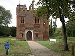
Rye House Gatehouse
Lea Valley Park, Stanstead Abbotts
Moat
15th century
4 December 1951
TL3857309955 51°46′16″N 0°00′25″E / 51.771124°N 0.006936°E / 51.771124; 0.006936 (Rye House Gatehouse)
1341877 Rye House GatehouseMore images
Church of St Peter
Tewin Church
11th century
24 November 1966
TL2681214256 51°48′45″N 0°09′43″W / 51.81256°N 0.161846°W / 51.81256; -0.161846 (Church of St Peter)
1341477 Church of St Peter More images
Parish Church of St James the Great
Thorley Moat
1834
22 February 1967
TL4760418844 51°50′55″N 0°08′29″E / 51.848683°N 0.14151°E / 51.848683; 0.14151 (Parish Church of St James the Great)
1213947 Parish Church of St James the Great More images
Parish Church of St Mary the Virgin
Walkern Parish Church
Saxon
24 November 1966
TL2928626565 51°55′21″N 0°07′17″W / 51.922603°N 0.121375°W / 51.922603; -0.121375 (Parish Church of St Mary the Virgin)
1101384 Parish Church of St Mary the Virgin More images
Church of St Mary
Ware Church
1982
8 May 1950
TL3568014430 51°48′43″N 0°02′00″W / 51.812043°N 0.033216°W / 51.812043; -0.033216 (Church of St Mary)
1217410 Church of St Mary More images
Grotto between Nos 28 and 34 (Scott's Grotto)
Ware Grotto
1764–1768
8 May 1950
TL3568813832 51°48′24″N 0°02′00″W / 51.806668°N 0.033334°W / 51.806668; -0.033334 (Grotto between Nos 28 and 34 (Scott's Grotto))
1238171 Grotto between Nos 28 and 34 (Scott's Grotto)More images
Place House
Ware House
17th century
8 May 1950
TL3590314372 51°48′41″N 0°01′48″W / 51.811468°N 0.030006°W / 51.811468; -0.030006 (Place House)
1275417 Place House More images
The Priory (Ware Town Council Offices and Community Centre)
Ware Kitchen
1993-4
8 May 1950
TL3555114312 51°48′40″N 0°02′06″W / 51.811014°N 0.035133°W / 51.811014; -0.035133 (The Priory (Ware Town Council Offices and Community Centre))
1237950 The Priory (Ware Town Council Offices and Community Centre) More images
Woodhall Park (Heath Mount School )
Woodhall Park, Watton-at-Stone
Country House
1777–82
20 October 1952
TL3164518896 51°51′11″N 0°05′24″W / 51.853139°N 0.090016°W / 51.853139; -0.090016 (Woodhall Park (Heath Mount School))
1031363 Woodhall Park (Heath Mount School )More images
Church of St Giles
Wyddial Parish Church
14th century
22 February 1967
TL3741431763 51°58′03″N 0°00′04″W / 51.967364°N 0.00118°W / 51.967364; -0.00118 (Church of St Giles)
1101811 Church of St Giles More images







![]() Media related to Grade I listed buildings in Hertfordshire at Wikimedia Commons
Media related to Grade I listed buildings in Hertfordshire at Wikimedia Commons
