| Kanawha State Forest | |
|---|---|
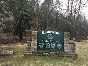
 Kanawha State Forest sign Kanawha State Forest sign | |
 | |
| Location | Kanawha, West Virginia, United States |
| Coordinates | 38°16′53″N 81°38′30″W / 38.28139°N 81.64167°W / 38.28139; -81.64167 |
| Area | 9,300 acres (38 km) |
| Elevation | 741 ft (226 m) |
| Website | wvstateparks |
| Kanawha State Forest | |
| U.S. National Register of Historic Places | |
| U.S. Historic district | |
| Location | South of Charleston, West Virginia |
| Area | 1,503.67 acres (608.51 ha) |
| Built | 1938-1940 |
| Built by | Civilian Conservation Corps |
| NRHP reference No. | 93000228 |
| Added to NRHP | March 25, 1993 |
Kanawha State Forest is a 9,300-acre (38 km) recreation area located near the community of Loudendale, West Virginia, which is about 7 miles (11 km) from downtown Charleston, West Virginia, United States. It is managed by the West Virginia Department of Natural Resources.
While still classified as a "state forest", the West Virginia Legislature has directed that the facility be managed as a state park.
The Davis Creek Road entrance to Kanawha State Forest is located at 38°16′53″N 81°38′30″W / 38.28139°N 81.64167°W / 38.28139; -81.64167 (38.28133, -81.64169).
Recreational facilities include overnight camping, picnicking, hiking, a public shooting-range, mountain biking, cross-country skiing and a swimming pool and playground. Several geocaches are located in the forest.
The central portion of Kanawha State Forest, and its historic structures were listed on the National Register of Historic Places on March 25, 1993.
See also
References
- "National Register Information System". National Register of Historic Places. National Park Service. July 9, 2010.
- "US Gazetteer files: 2010, 2000, and 1990". United States Census Bureau. February 12, 2011. Archived from the original on May 27, 2002. Retrieved April 23, 2011.
- "West Virginia State Parks and Forests Geocaching". West Virginia Division of Natural Resources. Retrieved January 12, 2013.
- "Kanawha State Forest". NPGalley Digital Asset Management System. National Park Service. Retrieved October 4, 2024.
- Marshall, Paul D. (December 8, 1992). "National Register of Historic Places Registration Form: Kanawha State Forest" (PDF). West Virginia Department of Arts, Cuture and History. National Park Service. Retrieved October 4, 2024.
- "National Register of Historic Places Continuation Sheet: Kanawha State Forest" (PDF). West Virginia Department of Arts, Culture and History. National Park Service. Retrieved October 4, 2024.
External links
| City of Charleston | ||
|---|---|---|
| Topics |  | |
| Top subjects | ||
| Neighborhoods | ||
| Suburbs | ||
This article about a location in Kanawha County, West Virginia is a stub. You can help Misplaced Pages by expanding it. |