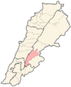
| Lala, Lebanon لالا | |
|---|---|
| Village | |
 | |
| Coordinates: 33°36′01″N 35°45′44″E / 33.60028°N 35.76222°E / 33.60028; 35.76222 | |
| Country | Lebanon |
| Governorate | Beqaa Governorate |
| District | Western Beqaa |
| Area | |
| • Total | 5.31 sq mi (13.74 km) |
| Elevation | 3,670 ft (1,120 m) |
| Time zone | UTC+2 (EET) |
| • Summer (DST) | +3 |
Lala (Arabic: لالا), is a village located in the Western Beqaa District of the Beqaa Governorate in Lebanon.
History
In 1838, Eli Smith noted it as Lala; a Sunni Muslim village in the Beqaa Valley. It remains a Sunni Muslim village in modern times.
The 2,500 residents of Lala relied on the village's 7,500 emigrants living abroad for 70% of their income.
References
- Robinson and Smith, 1841, vol 3, 2nd appendix, p. 141
- "Lala". Libandata. 23 November 2017. Archived from the original on 2 March 2024. Retrieved 4 November 2024.
- Arsan, Andrew (2018). Lebanon: a country in fragments (First published in the United Kingdom ed.). London: Hurst & Company. p. 224. ISBN 978-1-84904-700-5.
Bibliography
- Robinson, E.; Smith, E. (1841). Biblical Researches in Palestine, Mount Sinai and Arabia Petraea: A Journal of Travels in the year 1838. Vol. 3. Boston: Crocker & Brewster.
External links
- Lala, localiban
| Capital: Joub Jannine | ||
| Towns and villages |  | |
| Other | ||
This Lebanon location article is a stub. You can help Misplaced Pages by expanding it. |