| Libbaya لبايا | |
|---|---|
| Town | |
 | |
| Coordinates: 33°28′57″N 35°43′26″E / 33.48250°N 35.72389°E / 33.48250; 35.72389 | |
| Country | |
| Governorate | Beqaa Governorate |
| District | Western Beqaa District |
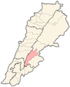
Libbaya (لبايا) is a village in the Beka'a Valley of Lebanon, situated in the Western Beqaa District of the Beqaa Governorate. It lies southeast of Sohmor.
History
There is a Roman temple near the town that was called Ain Libbaya or Ayn Libbaya. It was classified amongst a group of Temples of Mount Hermon by George Taylor.
In 1838, Eli Smith noted Libbaya's population as being Metawileh.
During the war in the 1980s, four Israeli Cobra helicopters backing the attacking force strafed Libbaya and nearby villages, killing a Lebanese soldier.
References
- Taylor, 1971, p.?
- Robinson and Smith, 1841, vol 3, 2nd appendix, p. 138
- Asian Peoples' Anti-Communist League; Asian-Pacific Anti-Communist League (1988). Asian bulletin. APACL Publications. p. 64. Retrieved 23 April 2011.
Bibliography
- Taylor, G. (1971). The Roman temples of Lebanon: a pictorial guide. Les temples romains au Liban; guide illustré. Dar el-Machreq Publishers. Retrieved 18 September 2012.
- Robinson, E.; Smith, E. (1841). Biblical Researches in Palestine, Mount Sinai and Arabia Petraea: A Journal of Travels in the year 1838. Vol. 3. Boston: Crocker & Brewster.
External links
- Libbaya, Localiban
| Capital: Joub Jannine | ||
| Towns and villages |  | |
| Other | ||
This Lebanon location article is a stub. You can help Misplaced Pages by expanding it. |
