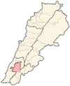
| Kfar Tebnit كفرتبنيت | |
|---|---|
| Municipality | |
| Country | |
| Governorate | South Governorate |
| District | Tyre |
| Time zone | GMT +3 |
| كفرتبنيت | |
 | |
| Alternative name | Kfar Tebnit |
|---|---|
| Location | 4 kilometres (2.5 mi) south southeast of Nabatieh, 37 kilometres (23 mi) southeast of Sidon, Lebanon |
| Coordinates | 33°21′11″N 35°30′48″E / 33.35306°N 35.51333°E / 33.35306; 35.51333 |
| Grid position | 128/157 L |
| History | |
| Periods | Heavy Neolithic, Trihedral Neolithic, Neolithic |
| Cultures | Qaraoun culture |
| Site notes | |
| Excavation dates | 1926 |
| Archaeologists | E. Passemard |
| Public access | Unknown |
Kfar Tebnit or Kfartebnit (Arabic: كفرتبنيت) is a municipality located approximately 4 kilometres (2.5 mi) south southeast of Nabatieh, 37 kilometres (23 mi) southeast of Sidon in Lebanon.
Etymology
Kfar Tebnit takes its name from Tabnit, a Phoenician ruler in the area ca. 280 BC known as the "king of two Sidons". The sarcophagus of his son Eshmun-'azar was found to bear a long inscription aimed to prevent looting with assurances that the tomb contained no treasure.
Archaeology
A Heavy Neolithic archaeological site of the Qaraoun culture was discovered here in 1926 by E. Passemard [fr]. Heavy Neolithic materials were found alongside one Trihedral Neolithic along with more regular Neolithic pieces. The tools were in sharp condition, made of fresh chert or grey-green flint and are stored in the National Museum of Beirut.
History
In 1875 Victor Guérin visited, and found here 130 Metualis.
The Ottoman mosque of the village was totally destroyed as a result of the Israeli attacks in October 2024 in southern Lebanon.
Demographics
In 2014 Muslims made up 99.86% of registered voters in Kfar Tebnit. 98.02% of the voters were Shiite Muslims.
References
- Hitti, 2004, p. 125
- Copeland and Wescombe, 1966, pp. 35-36
- Guérin, 1880, p. 521
- "'Apocalyptic': Israel destroys mosque, bombs market in southern Lebanon". aljazeera.
- Destruction of Cultural Heritage in Lebanon due to the Ongoing War (PDF) (Report). Heritage Education Program. October 2024. p. 24.
- https://lub-anan.com/المحافظات/النبطية/النبطية/كفرتبنيت/المذاهب/
Bibliography
- Copeland, L.; P. Wescombe (1966). Inventory of Stone-Age Sites in Lebanon: North, South and East-Central Lebanon, pp. 35-36. Impr. Catholique. Retrieved 29 August 2011.
- Guérin, V. (1880). Description Géographique Historique et Archéologique de la Palestine (in French). Vol. 3: Galilee, pt. 2. Paris: L'Imprimerie Nationale.
- Hitti, P.K. (30 January 2004). History of Syria, Including Lebanon and Palestine. Gorgias Press LLC. pp. 125–. ISBN 978-1-59333-119-1. Retrieved 4 January 2012.
External links
- Kfar Tibnit, Localiban
This article relating to archaeology in the Near East is a stub. You can help Misplaced Pages by expanding it. |
