| Marechal Thaumaturgo | |
|---|---|
| Municipality | |
 | |
 Flag Flag Coat of arms Coat of arms | |
 Location of municipality in Acre State Location of municipality in Acre State | |
 | |
| Coordinates: 8°56′50″S 72°47′25″W / 8.94722°S 72.79028°W / -8.94722; -72.79028 | |
| Country | |
| State | Acre |
| Government | |
| • Mayor | Isaac Piyãko (PMDB) |
| Area | |
| • Total | 2,990 sq mi (7,744 km) |
| Population | |
| • Total | 19,299 |
| Time zone | UTC−5 (ACT) |
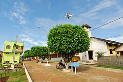
Marechal Thaumaturgo (Portuguese pronunciation: [maɾeˈʃaw tawmɐˈtuʁɡu], English: Marshal Thaumaturgo) is a municipality located in the west of the Brazilian state of Acre. Its population is 19,299 and its area is 7,744 km².
Geography
The municipality contains 5% of the 846,633 hectares (2,092,080 acres) Serra do Divisor National Park, created in 1989.
It contains most of the Alto Juruá Extractive Reserve, created in 1990, and 5% of the Alto Tarauacá Extractive Reserve, created in 2000.
Climate
| Climate data for Marechal Thaumaturgo | |||||||||||||
|---|---|---|---|---|---|---|---|---|---|---|---|---|---|
| Month | Jan | Feb | Mar | Apr | May | Jun | Jul | Aug | Sep | Oct | Nov | Dec | Year |
| Mean daily maximum °C (°F) | 31.1 (88.0) |
30.7 (87.3) |
30.8 (87.4) |
30.9 (87.6) |
30.8 (87.4) |
30.6 (87.1) |
31.0 (87.8) |
32.4 (90.3) |
32.5 (90.5) |
32.1 (89.8) |
31.5 (88.7) |
31.3 (88.3) |
31.3 (88.4) |
| Daily mean °C (°F) | 26.3 (79.3) |
26.1 (79.0) |
26.0 (78.8) |
26.1 (79.0) |
25.6 (78.1) |
24.8 (76.6) |
24.7 (76.5) |
25.8 (78.4) |
26.3 (79.3) |
26.6 (79.9) |
26.4 (79.5) |
26.4 (79.5) |
25.9 (78.7) |
| Mean daily minimum °C (°F) | 21.6 (70.9) |
21.5 (70.7) |
21.3 (70.3) |
21.3 (70.3) |
20.5 (68.9) |
19.1 (66.4) |
18.5 (65.3) |
19.2 (66.6) |
20.2 (68.4) |
21.2 (70.2) |
21.4 (70.5) |
21.5 (70.7) |
20.6 (69.1) |
| Average precipitation mm (inches) | 203 (8.0) |
201 (7.9) |
234 (9.2) |
163 (6.4) |
99 (3.9) |
42 (1.7) |
32 (1.3) |
51 (2.0) |
77 (3.0) |
101 (4.0) |
201 (7.9) |
197 (7.8) |
1,601 (63.1) |
| Source: http://en.climate-data.org/location/32412/ | |||||||||||||
References
- IBGE 2020
- PARNA da Serra do Divisor (in Portuguese), ISA: Instituto Socioambiental, retrieved 2016-08-08
- RESEX do Alto Tarauacá (in Portuguese), ISA: Instituto Socioambiental, retrieved 2016-08-07
| Capital: Rio Branco | |||||||
| Cruzeiro do Sul |
|  | |||||
| Rio Branco |
| ||||||
This Acre, Brazil location article is a stub. You can help Misplaced Pages by expanding it. |