| STC rapid transit | |||||||||||
 Pedestrian bridge as seen from platform, 2008 Pedestrian bridge as seen from platform, 2008 | |||||||||||
| General information | |||||||||||
| Location | Calzada de Tlalpan Benito Juárez Mexico City Mexico | ||||||||||
| Coordinates | 19°22′46″N 99°08′25″W / 19.379474°N 99.140217°W / 19.379474; -99.140217 | ||||||||||
| Line(s) | |||||||||||
| Platforms | 1 island platform | ||||||||||
| Tracks | 2 | ||||||||||
| Construction | |||||||||||
| Structure type | At grade | ||||||||||
| Platform levels | 1 | ||||||||||
| Parking | No | ||||||||||
| Bicycle facilities | No | ||||||||||
| Accessible | Yes | ||||||||||
| History | |||||||||||
| Opened | 1 August 1970 | ||||||||||
| Passengers | |||||||||||
| 2023 | 6,018,409 | ||||||||||
| Rank | 75/195 | ||||||||||
| Services | |||||||||||
| |||||||||||
| |||||||||||
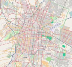
Nativitas is a station on Line 2 of the Mexico City Metro system. It is located in the Colonia Nativitas and Colonia Lago neighborhoods of Benito Juárez borough of Mexico City, directly south of the city centre on Calzada de Tlalpan. It is a surface station.
General information
The station logo depicts a trajinera – a type of small punt-style boat, still used today in the canals of Xochimilco. The name Nativitas refers to a lake that formerly existed here, on which the inhabitants farmed on a network of artificial islands known as chinampas. The name later referred to a small villa built in the outskirts of Mexico City during the first half of the 20th century. The station opened on 1 August 1970.
Exits
- East: Calzada de Tlalpan between Justina street and Don Luis street, Nativitas
- West: Calzada de Tlalpan and Lago Poniente street, Colonia Lago
Ridership
| Annual passenger ridership | |||||
|---|---|---|---|---|---|
| Year | Ridership | Average daily | Rank | % change | Ref. |
| 2023 | 6,018,409 | 16,488 | 75/195 | +27.10% | |
| 2022 | 4,735,197 | 12,973 | 91/195 | +48.41% | |
| 2021 | 3,190,651 | 8,741 | 104/195 | −29.62% | |
| 2020 | 4,533,317 | 12,386 | 74/195 | −36.71% | |
| 2019 | 7,163,027 | 19,624 | 91/195 | −19.37% | |
| 2018 | 8,883,727 | 24,338 | 58/195 | +22.77% | |
| 2017 | 7,236,315 | 19,825 | 88/195 | −6.99% | |
| 2016 | 7,780,389 | 21,257 | 85/195 | +3.33% | |
| 2015 | 7,529,556 | 20,572 | 84/195 | −6.78% | |
| 2014 | 8,077,264 | 22,129 | 75/195 | −4.25% | |
See also
References
- ^ "Afluencia de estación por línea 2023" [Station traffic per line 2023] (in Spanish). Sistema Transporte Colectivo Metro. 2024. Archived from the original on 27 January 2024. Retrieved 24 January 2024.
- ^ "Nativitas" (in Spanish). Sistema de Transporte Colectivo. Archived from the original on 31 January 2012. Retrieved 18 August 2011.
- ^ Archambault, Richard. "Nativitas » Mexico City Metro System". Retrieved 18 August 2011.
- Monroy, Marco. Schwandl, Robert (ed.). "Opening Dates for Mexico City's Subway". Retrieved 18 August 2011.
- "Afluencia de estación por línea 2021" [Station traffic per line 2021] (in Spanish). Sistema Transporte Colectivo Metro. 2022. Archived from the original on 7 March 2022. Retrieved 7 March 2022.
- "Afluencia de estación por línea 2020" [Station traffic per line 2020] (in Spanish). Sistema Transporte Colectivo Metro. 2021. Archived from the original on 21 June 2021. Retrieved 21 June 2021.
- "Afluencia de estación por línea 2019" [Station traffic per line 2019] (in Spanish). Sistema Transporte Colectivo Metro. 2020. Archived from the original on 8 April 2020. Retrieved 3 May 2020.
- "Afluencia de estación por línea 2018" [Station traffic per line 2018] (in Spanish). Sistema Transporte Colectivo Metro. 2019. Archived from the original on 6 June 2019. Retrieved 7 April 2020.
- "Afluencia de estación por línea 2017" [Station traffic per line 2017] (in Spanish). Sistema Transporte Colectivo Metro. 2019. Archived from the original on 3 May 2020. Retrieved 3 May 2020.
- "Afluencia de estación por línea 2016" [Station traffic per line 2016] (in Spanish). Sistema Transporte Colectivo Metro. 2017. Archived from the original on 3 May 2020. Retrieved 3 May 2020.
- "Afluencia de estación por línea 2015" [Station traffic per line 2015] (in Spanish). Sistema Transporte Colectivo Metro. 2016. Archived from the original on 3 May 2020. Retrieved 6 May 2020.
- "Afluencia de estación por línea 2014" [Station traffic per line 2014] (in Spanish). Sistema Transporte Colectivo Metro. 2015. Archived from the original on 3 May 2020. Retrieved 6 May 2020.
External links
| Mexico City Metro stations | |
|---|---|
| |
| Benito Juárez, Mexico City | |
|---|---|
| Areas | |
| Schools |
|
| Universities | |
| Mexico City Metro stations | |
| Landmarks |
|
