Human settlement in England
| Northington | |
|---|---|
 The Grange at Northington The Grange at Northington | |
 | |
| Population | 61 (2001 Census ) 221 (2011 Census including Swarraton) |
| OS grid reference | SU5687337410 |
| District | |
| Shire county | |
| Region | |
| Country | England |
| Sovereign state | United Kingdom |
| Post town | ALRESFORD |
| Postcode district | SO24 |
| Dialling code | 01962 |
| Police | Hampshire and Isle of Wight |
| Fire | Hampshire and Isle of Wight |
| Ambulance | South Central |
| UK Parliament | |
| 51°07′59″N 1°11′19″W / 51.133145°N 1.18856°W / 51.133145; -1.18856 | |
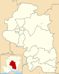
Northington is a village and civil parish in the City of Winchester district of Hampshire, England. It lies half a mile from the neighbouring village, Swarraton. Its nearest railway station is at New Alresford, on the Mid-Hants railway line.
References
- Census data
- "Civil Parish population 2011". Neighbourhood Statistics. Office for National Statistics. Retrieved 31 December 2016.
See also
| Electoral wards and parishes in the City of Winchester District, Hampshire, England (since 2016 boundary changes) | ||
|---|---|---|
 Wards Wards Parishes Parishes | Wonston and Micheldever | |
| The Worthys | ||
| Alresford and Itchen | ||
| Winchester |
| |
| Badger Farm and Oliver's Battery | ||
| Colden Common and Twyford | ||
| Upper Meon Valley | ||
| Bishops Waltham | ||
| Central Meon Valley | ||
| Whiteley and Shedfield | ||
| Denmead | ||
| Southwick and Wickham | ||
| (Wards ordered from north-west corner, across the map, and then progressively south and east) | ||
This Hampshire location article is a stub. You can help Misplaced Pages by expanding it. |
