River in New Zealand
| Oakura River | |
|---|---|
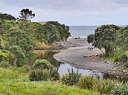
 View of the Oakura River near the town of Ōakura View of the Oakura River near the town of Ōakura | |
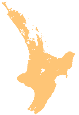
| Route of the Oakura River | |
  | |
| Location | |
| Country | New Zealand |
| Physical characteristics | |
| Source | |
| • location | Mount Taranaki |
| • coordinates | 39°18′15″S 174°04′53″E / 39.30403°S 174.08138°E / -39.30403; 174.08138 |
| Mouth | |
| • location | North Taranaki Bight |
| • coordinates | 39°04′14″S 174°17′29″E / 39.07057°S 174.29143°E / -39.07057; 174.29143 |
| Length | 17 kilometres (11 mi) |
| Basin features | |
| Progression | Oakura River → North Taranaki Bight → Tasman Sea |
| Tributaries | |
| • left | Pirongiha Stream, Te Pikiwati Stream, Wakamure Stream |
| • right | Momona Stream, Kiri Stream, Oraukawa Stream |
| Bridges | Ōakura River Bridge |
The Oakura River, or Ōākuramatapū, is a river of the Taranaki Region of New Zealand's North Island. It flows north from the slopes of Taranaki/Mount Egmont, veering northwest before reaching the Tasman Sea at Oakura, southwest of New Plymouth. On this way it goes by Ōakura and the historical Oakura Pa.
See also
References
- "Oakura River". LAWA.
"Place name detail: Oakura River". New Zealand Gazetteer. New Zealand Geographic Board. Retrieved 12 July 2009.
| Egmont National Park, New Zealand | |
|---|---|
| Mountains and ranges | |
| Swamps | |
| Rivers | |
| Lakes | |
| Waterfalls | |
| Ski fields and structures | |
This article about a river in Taranaki is a stub. You can help Misplaced Pages by expanding it. |