| Pop | |
|---|---|
| City | |
 | |
| Coordinates: 40°52′24.96″N 71°6′32.04″E / 40.8736000°N 71.1089000°E / 40.8736000; 71.1089000 | |
| Country | |
| Region | Namangan Region |
| District | Pop District |
| Town status | 1980 |
| Elevation | 439 m (1,440 ft) |
| Population | |
| • Total | 30,000 |
| Time zone | UTC+5 (UZT) |
| Area code | +9986943 |
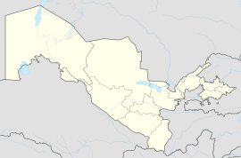
Pop (Uzbek: Pop/Поп, Russian: Пап, romanized: Pap) is a city in Namangan Region, Uzbekistan. It is the administrative center of Pop District. Its population is 26,900 (2016). At Pop, the Angren–Pop railway line (opened in 2016) joins the line from Kokand to Namangan.
Number of secondary schools — six (6): No. 1, No. 8, No. 23, No. 37, No. 40, No. 65, No. 67.
Number of secondary special educational institutions — three (3): boarding school No. 11, Medical college, Business college.
Pop town consists of 14 district-units:
- Kelachi
- Khamza
- Shomazor
- Olmazor
- Obod
- Tinchlik
- Khazrati bob
- Uzbekistan
- Ipak Yuli
- Dustlik
- Pakhtakor
- Alisher Navoi
- Khamid Olimjon
- Abdulla Kakhhar
References
- "Classification system of territorial units of the Republic of Uzbekistan" (in Uzbek and Russian). The State Committee of the Republic of Uzbekistan on statistics. July 2020.
- Soliyev, A.S. Shaharlar geografiyasi [Geography of cities] (PDF) (in Uzbek). p. 144.
| Namangan Region | ||
|---|---|---|
| Capital: Namangan | ||
| Districts |  | |
| Cities | ||
| Towns | ||
This Uzbekistan location article is a stub. You can help Misplaced Pages by expanding it. |