| Rio da Conceição | |
|---|---|
| Municipality | |
| Country | |
| Region | Northern |
| State | Tocantins |
| Mesoregion | Oriental do Tocantins |
| Population | |
| • Total | 2,171 |
| Time zone | UTC−3 (BRT) |
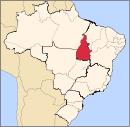
Rio da Conceição is a municipality in the state of Tocantins in the Northern region of Brazil.
The municipality contains part of the 707,079 hectares (1,747,230 acres) Serra Geral do Tocantins Ecological Station, a strictly protected conservation unit created in 2001 to preserve an area of cerrado.
See also
References
- "IBGE 2020". Archived from the original on 26 September 2022. Retrieved 26 January 2021.
- "Divisão Territorial do Brasil" (in Portuguese). Divisão Territorial do Brasil e Limites Territoriais, Instituto Brasileiro de Geografia e Estatística (IBGE). July 1, 2008. Archived from the original on June 14, 2020. Retrieved December 17, 2009.
- "Estimativas da população para 1º de julho de 2009" (PDF) (in Portuguese). Estimativas de População, Instituto Brasileiro de Geografia e Estatística (IBGE). August 14, 2009. Archived (PDF) from the original on September 18, 2017. Retrieved December 17, 2009.
- "Ranking decrescente do IDH-M dos municípios do Brasil" (in Portuguese). Atlas do Desenvolvimento Humano, Programa das Nações Unidas para o Desenvolvimento (PNUD). 2000. Archived from the original on October 3, 2009. Retrieved December 17, 2009.
- "Produto Interno Bruto dos Municípios 2002-2005" (PDF) (in Portuguese). Instituto Brasileiro de Geografia e Estatística (IBGE). December 19, 2007. Archived (PDF) from the original on October 2, 2008. Retrieved December 17, 2009.
- Unidade de Conservação: Estação Ecológica Serra Geral do Tocantins (in Portuguese), MMA: Ministério do Meio Ambiente, archived from the original on 2022-03-31, retrieved 2016-05-28
11°28′S 46°47′W / 11.467°S 46.783°W / -11.467; -46.783
This Tocantins, Brazil location article is a stub. You can help Misplaced Pages by expanding it. |
