Village in Uttar Pradesh, India
| Rohaniya Rohniya, Rohania | |
|---|---|
| Village | |
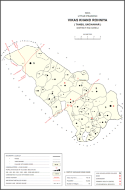
 Map of Rohaniya CD block Map of Rohaniya CD block | |
 | |
| Coordinates: 25°58′45″N 81°22′59″E / 25.979102°N 81.383082°E / 25.979102; 81.383082 | |
| Country India | |
| State | Uttar Pradesh |
| District | Raebareli |
| Area | |
| • Total | 7.705 km (2.975 sq mi) |
| Population | |
| • Total | 3,880 |
| • Density | 500/km (1,300/sq mi) |
| Languages | |
| • Official | Hindi |
| Time zone | UTC+5:30 (IST) |
| Vehicle registration | UP-35 |
Rohaniya is a village and corresponding community development block in Unchahar tehsil of Rae Bareli district, Uttar Pradesh, India. It is located 43 km from Raebareli, the district headquarters. As of 2011, Rohaniya has a population of 3,880 people, in 751 households. It has one primary school and One healthcare facilities.
The 1961 census recorded Rohaniya (as "Rohania") as comprising 8 hamlets, with a total population of 1,488 people (732 male and 756 female), in 337 households and 335 physical houses. The area of the village was given as 1,904 acres and was electrified at that point.
The 1981 census recorded Rohaniya as having a population of 2,126 people, in 430 households, and having an area of 770.52 hectares. The main staple foods were listed as wheat and rice.
Villages
Rohaniya CD block has the following 53 villages:
| Village name | Total land area (hectares) | Population (in 2011) |
|---|---|---|
| Ram Ganj | 172.2 | 0 |
| Itaura Buzurg | 2,014 | 13,851 |
| Salarpur | 74.2 | 442 |
| Aihari Buzurg | 152.7 | 1,101 |
| Tamas Garh | 102 | 400 |
| Khan Alampur Sathara | 138.2 | 605 |
| Dharupur | 152.3 | 318 |
| Mirazapur Aihari | 545.9 | 2,948 |
| Dhamauli | 176.7 | 751 |
| Sikandarabad | 72.7 | 4 |
| Rohaniya (block headquarters) | 770.5 | 3,880 |
| Patti Pitha | 24.7 | 384 |
| Neknampur | 115.2 | 177 |
| Raipur | 312 | 1,256 |
| Sumer Bag | 127 | 337 |
| Dhaurhara | 43.6 | 680 |
| Masaudabad | 140.6 | 422 |
| Usarauna | 532.9 | 3,380 |
| Marha Mau | 213.3 | 0 |
| Rasoolpur | 927.2 | 7,671 |
| Salimpur Baherwar | 102.2 | 1,232 |
| Sarain Akhtiyar | 95.2 | 1,731 |
| Bandai | 168 | 227 |
| Loharani | 26.8 | 187 |
| Matrampur | 204.1 | 1,456 |
| Suhapar | 78.1 | 196 |
| Hari Vanshpur | 38.9 | 286 |
| Itaili | 125.2 | 1,171 |
| Chak Bhira | 48 | 401 |
| Baramjitpur Urf Khwata | 10 | 615 |
| Bhikhnapur Kalapur | 61 | 428 |
| Hamidpur Bara Gaon | 21 | 1,105 |
| Alinagar Askaran | 101.2 | 945 |
| Chhatauna Bhariyani | 150 | 1,775 |
| Raghunathpur Labedawa | 34 | 381 |
| Hajaribag | 31 | 342 |
| Gagahara Gulal Ganj | 291 | 2,361 |
| Raghunathpur Paterwa | 34 | 381 |
| Umaran | 664.1 | 4,786 |
| Dakpur | 67 | 297 |
| Kamalpur | 288 | 1,235 |
| Pure Khiro Dhar | 38 | 651 |
| Bachhaiyyapur | 173 | 505 |
| Lakshman Ganj | 143 | 73 |
| Samasapur Patauna | 97 | 600 |
| Parsipur | 52 | 552 |
| Sarakpur | 139 | 953 |
| Prayagpur Nandaura | 174 | 1,862 |
| Nandaura Mafi | 50 | 583 |
| Sareni | 201 | 1,864 |
| Mawai | 247 | 1,809 |
| Gaura | 44 | 351 |
References
- "GeoNames Search". geonames.nga.mil. Archived from the original on 12 April 2014. Retrieved 29 August 2023.
- ^ "Census of India 2011: Uttar Pradesh District Census Handbook - Rae Bareli, Part A (Village and Town Directory)" (PDF). Census 2011 India. pp. 365–74. Retrieved 21 August 2021.
- ^ Census 1981 Uttar Pradesh: District Census Handbook Part XIII-A: Village & Town Directory, District Rae Bareli (PDF). 1982. pp. 228–9. Retrieved 21 August 2021.
- ^ Census 1961: District Census Handbook, Uttar Pradesh (39 - Raebareli District) (PDF). Lucknow. 1965. pp. cxii-cxiii of section "Salon Tahsil". Retrieved 21 August 2021.
{{cite book}}: CS1 maint: location missing publisher (link)