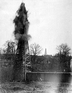
| Taylorstown, Pennsylvania | |
|---|---|
| Census-designated place | |
| Country | United States |
| State | Pennsylvania |
| County | Washington |
| Area | |
| • Total | 1.06 sq mi (2.73 km) |
| • Land | 1.06 sq mi (2.73 km) |
| • Water | 0.00 sq mi (0.00 km) |
| Population | |
| • Total | 213 |
| • Density | 201.70/sq mi (77.89/km) |
| Time zone | UTC-5 (Eastern (EST)) |
| • Summer (DST) | UTC-4 (EDT) |
| ZIP codes | 15323 15365 |
| Area code(s) | 724, 878 |
| FIPS code | 42-76232 |
Taylorstown, Pennsylvania is a census-designated place in Blaine Township, Washington County, Pennsylvania, United States. Taylorstown has been assigned the ZIP codes 15323 and 15365. As of the 2010 census the population of Taylorstown was 217 residents.
It is home to the Taylorstown Historic District. Pennsylvania Route 221 runs through it.

Demographics
| Census | Pop. | Note | %± |
|---|---|---|---|
| 2010 | 217 | — | |
| 2020 | 213 | −1.8% | |
| U.S. Decennial Census | |||
References
- "ArcGIS REST Services Directory". United States Census Bureau. Retrieved October 16, 2022.
- "Census Population API". United States Census Bureau. Retrieved Oct 15, 2022.
- "Census of Population and Housing". Census.gov. Retrieved June 4, 2016.
| Greater Pittsburgh | ||||||||||
|---|---|---|---|---|---|---|---|---|---|---|
| Pittsburgh–New Castle–Weirton combined statistical area | ||||||||||
| Counties |
|  | ||||||||
| Major cities | ||||||||||
| Cities and towns 15k–50k (in 2010) | ||||||||||
| Airports | ||||||||||
| Topics | ||||||||||
40°09′35″N 80°22′41″W / 40.15972°N 80.37806°W / 40.15972; -80.37806
This Washington County, Pennsylvania state location article is a stub. You can help Misplaced Pages by expanding it. |
