Wadi El Natrun
| |
|---|---|
 Monastery of the Syriacs in Wadi el Natrun Monastery of the Syriacs in Wadi el Natrun | |
 | |
| Coordinates: 30°35′N 30°20′E / 30.583°N 30.333°E / 30.583; 30.333 | |
| Country | Egypt |
| Governorate | Beheira |
| Area | |
| • Total | 265.7 sq mi (688.2 km) |
| Population | |
| • Total | 88,380 |
| • Density | 330/sq mi (130/km) |
| Time zone | UTC+2 (EET) |
Wadi El Natrun (Arabic: وادي النطرون "Valley of Natron"; Coptic: Ϣⲓϩⲏⲧ Šihēt, "measure of the hearts") is a depression in northern Egypt that is located 23 m (75 ft) below sea level and 38 m (125 ft) below the Nile River level. The valley contains several alkaline lakes, natron-rich salt deposits, salt marshes and freshwater marshes.
In Christian literature it is usually known as Scetis (Σκήτις in Hellenistic Greek) or Skete (Σκήτη, plural Σκήτες in ecclesiastical Greek). It is one of the three early Christian monastic centers located in the Nitrian Desert of the northwestern Nile Delta. The other two monastic centers are Nitria and Kellia. Scetis, now called Wadi El Natrun, is best known today because its ancient monasteries remain in use, unlike Nitria and Kellia which have only archaeological remains. The desertified valley around Scetis in particular may be called the Desert of Scetis.
Fossil discoveries
The area is one of the best known sites containing large numbers of fossils of large pre-historic animals in Egypt, and was known for this in the first century AD and probably much earlier.
Geography
Wadi al-Natrun is the common name for a desert valley located west of the Nile Delta, along the El Tahrir markaz, which is about 10 km west of the entrance to Sadat City on the Cairo-Alexandria Desert Road, and about 50 km from Khattabah on the Nile (Rashid Branch), and it falls below the level of the plateau surface surrounding it about 50 meters. The length of this depression ranges between 5, 55 and 60 km, while its average width is 10 km, and its deepest point reaches 24 meters below sea level. The depression is the smallest depression in the Egyptian Western Desert, with an area of about 500 km2. Therefore, it is true that it is a depression and not a valley, because the region is a closed depression that has a beginning and an end, and it has no source, estuary or tributaries, so the launch of the word "Wadi" on the depression is not topographically correct.
The Wadi contains 12 lakes, the total surface area of which is 10 km square and their average depth is only 2 m. The color of these lakes is reddish blue because its water is saturated with the Natron salt.
History
Ancient history
| ||||||||||
| sḫt ḥmꜣwt in hieroglyphs | ||||||||||
|---|---|---|---|---|---|---|---|---|---|---|
| Era: 1st Intermediate Period (2181–2055 BC) | ||||||||||
Natron valley is first attested in the story of the Eloquent Peasant, and it is mentioned among the list of seven oases in the Temple of Edfu. In Ptolemaic times it constituted part of the Nitrite nome (Ancient Greek: Νιτριώτης νομός). It was also known in Coptic as Mountain of Salt (Coptic: ⲡⲧⲱⲟⲩ ⲙⲡϩⲙⲟⲩ) or Phanihosem (Coptic: ⲫⲁⲛⲓϩⲟⲥⲉⲙ, lit. 'the one (place) on the natron').
The importance of the Natrun valley dates back to the Pharaonic era, as the ancient Egyptians and the Libyans fought many battles there. And this ended up with the Egyptians overcoming them and annexed the eastern side of the desert, which still belongs to Egypt. Then, Wadi al-Natrun became an administrative part of the country in the Pharaonic era, but there is no information about its history during their reign, and the latest writings on the wars between the libu and the Egyptians indicate that the last of them was in 1170 BC during the reign of Ramesses III.
As for the religious significance of Wadi al-Natrun, there are many discoveries that indicate that this area was considered sacred as early as year 2000 BC at the very least. Among these discoveries is a bust of black granite dating back to the era of the Seventeenth Dynasty of the Pharaohs, and there is also a granite gate and stones from the lintel of a door bearing cartridges for King Amenemhat I, in a place called the backbone.
Economic history
The alkali lakes of the Natron Valley provided the Ancient Egyptians with the sodium bicarbonate used in mummification and in Egyptian faience, and later by the Romans as a flux for glass making.
The Egyptian Salt and Soda Company Railway was built at the end of the 19th century as a 33 miles (54 km) long narrow gauge railway with a gauge of 750 mm, which attracted the first tourists to the wadi.
Monastic history
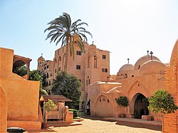
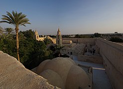
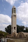
The desolate region became one of Christianity's most sacred areas. The desert fathers and cenobitic monastic communities used the desert's solitude and privations to develop self-discipline (asceticism). Hermit monks believed that desert life would teach them to eschew the things of this world and follow God's call. Between the 4th and 7th century AD, hundreds of thousands of people from the world over joined the hundreds of Christian monasteries in the Nitrian Desert, centered on Nitria, Kellia and Scetis (Wadi El Natrun).
Saint Macarius of Egypt first came to Scetis (Wadi El Natrun) around 330 AD where he established a solitary monastic site. His reputation attracted a loose band of anchorites, hermits and monks who settled nearby in individual cells. Many of them came from nearby Nitria and Kellia where they had previous experience in solitary desert living; thus the earliest cenobitic communities were a loose consolidation of like-minded monks. By the end of the fourth century, four distinct communities had developed: Baramus, Macarius, Bishoi and John Kolobos. At first these communities were groupings of cells centered on a communal church and facilities, but enclosed walls and watchtowers developed over time and in response to raids from desert nomads. Nitria, Kellia, and Scellis also experienced internal fractures related to doctrinal disputes in Egypt. At its peak the place contained 700 monasteries. The monasteries flourished during the Muslim conquest of Egypt (639–642), but in the eighth and ninth centuries taxation and administration concerns led to conflicts with the Muslim government.
Invasion of Scetis
Scetis was attacked by the Mazices who "came sweeping off the Libyan desert" in 407-408 AD and was decimated, causing many notable Desert Fathers to leave the region, such as Abba Anoub. One of the survivors, St. Arsenius the Great, remarked in 410 that, "The world has lost Rome and the monks have lost Scetis." As the Jesuit historian and Professor Willian J. Harmless said, "Scetis’s destruction marked a turning point in the history of early Christian monasticism. The site would be resettled a few years later, and in fact would suffer other raids, notably in 434, 444, and 570."
Nitria and Kellia were eventually abandoned in the 7th and 9th centuries respectively, but Scetis continued throughout the Medieval period. Although some of the individual monasteries were eventually abandoned or destroyed, four have remained in use to the present day:
Some of the most renowned saints of the region include the various Desert Fathers, including Saint Amun, Saint Arsenius, Saint Isidore of Scété, Saint John the Dwarf, Saint Macarius of Egypt, Saint Macarius of Alexandria, Saint Moses the Black, Saint Pishoy, Sts. Maximos and Domatios, Saint Poimen The Great and Saint Samuel the Confessor.
To this day Wadi El Natrun remains the most important center of Coptic monasticism.
Saint-Exupéry's plane crash
The environs of Wadi Natrun have been identified as the likely site of where the plane of French aviator Antoine de Saint-Exupéry crashed on December 30, 1935. After miraculously surviving the crash, he and his plane's mechanic nearly died of thirst before being rescued by a nomad. Saint-Exupéry documented his experience in his book Wind, Sand and Stars. The event is thought to have inspired his most famous work, The Little Prince.
Gallery
-
 Monastery of Saint Pishoy, Scetes, Egypt
-
 Monastery of Saint Pishoy, Scetes, Egypt
-
 Monastery of Saint Pishoy, Scetes, Egypt
-
 Monastery of Saint Macarius the Great, Scetes, Egypt
-
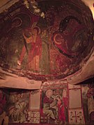
 Frescos at the Syrian Monastery, Scetes, Egypt
-
 Frescos at the Syrian Monastery, Scetes, Egypt
-
Naba' El-Hamra Lake
See also
References
- ^ "Wadi an-Natrun (Markaz, Egypt) - Population Statistics, Charts, Map and Location". citypopulation.de. Retrieved 18 March 2023.
- WĀDĪ NAṬRŪN in: Oxford Dictionary of Byzantium
- Taher, A. G. (1999). "Inland saline lakes of Wadi el Natrun depression, Egypt". International Journal of Salt Lake Research. 8 (2): 149–169. doi:10.1007/BF02442128.
- ^ Roger S. Bagnall, etc. Egypt from Alexander to the early Christians: An Archaeological and Historical Guide, Getty Publications, 2004. pp. 108–112
- René-Georges Coquin (2005) , "Scetis, Desert of", in André Vauchez (ed.), Encyclopedia of the Middle Ages, James Clarke & Co, ISBN 9780227679319.
- Adrienne Mayor, The First Fossil Hunters - Paleontology in the Greek and Roman Times, 2000.
- جمال حمدان، مرجع سابق، صـ: 416.
- جمال حمدان، مرجع سابق، صـ: 420.
- ^ Gauthier, Henri (1928). Dictionnaire des Noms Géographiques Contenus dans les Textes Hiéroglyphiques Vol. 5. p. 56.
- Butler, Alfred Joshua (1884). The ancient Coptic churches of Egypt. University of Michigan. Oxford, Clarendon press. p. 288.
- نيفين عبد الجواد، أديرة وادي النطرون، الهيئة المصرية العامة للكتاب، القاهرة، 2007، صـ: 27.
- Meinardus, (Otto F.A), Monks and Moasteries of
- "The first monk to settle in Wadi Natrun was Macarius the Egyptian, whose retirement to the desert took place in 330 A.D.." (Hugh G. Evelyn-White, "The Egyptian Expedition 1916–1919: IV. The Monasteries of the Wadi Natrun" The Metropolitan Museum of Art Bulletin, 15.7, Part 2: The Egyptian Expedition 1916–1919 p 34; Evelyn White's article gives a brief overview of Wadi Natrun from literary sources.
- ^ Harmless, William (September 2000). "Remembering Poemen Remembering: The Desert Fathers and the Spirituality of Memory". Church History. 69 (3): 483–518. doi:10.2307/3169395. ISSN 0009-6407. JSTOR 3169395. S2CID 162955580.
- ^ Ward, Benedicta (1980). The desert Christian : sayings of the Desert Fathers : the alphabetical collection. Macmillan. ISBN 0-02-623860-8. OCLC 5170172.
- "Contents", Apophthegmata, Toronto: University of Toronto Press, 2014-01-31, doi:10.3138/9781442622791-toc, ISBN 9781442622791, retrieved 2022-03-27
- Johanna Pink, Geschichte Ägyptens – Von der Spätantike bis zur Gegenwart, C.H. Beck, 2014 p. 20
- Saint-Exupéry, A. de. 1939. Terre des hommes (English title: Wind, Sand and Stars). Paris.
Further reading
- M. Cappozzo, I monasteri del deserto di Scete, Todi 2009 (Tau Editore).
External links
- The monasteries of the Arab Desert and Wadi Natrun UNESCO World Heritage Centre 1992–2012