| Yeya | |
|---|---|
 | |
  | |
| Location | |
| Country | Russia |
| Physical characteristics | |
| Mouth | Sea of Azov |
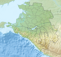
| • coordinates | 46°39′26″N 38°35′28″E / 46.6571°N 38.591°E / 46.6571; 38.591 |
| Length | 311 km (193 mi) |
| Basin size | 8,650 km (3,340 sq mi) |
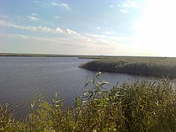
The Yeya (Russian: Éя) is a river in Krasnodar Krai, Russia. It falls into the Yeya Firth of Taganrog Bay, Sea of Azov. It is 311 kilometres (193 mi) long with a drainage basin of 8,650 square kilometres (3,340 sq mi). It dries up in summer. The port town of Yeysk is located by the Yeya Firth at the neck of the Yeya Spit.
References
- Ея, Great Soviet Encyclopedia
- Sergei R. Grinevetsky; Igor S. Zonn; Sergei S. Zhiltsov; Aleksey N. Kosarev; Andrey G. Kostianoy (2015). The Black Sea Encyclopedia. Springer-Verlag Berlin Heidelberg.
This Krasnodar Krai location article is a stub. You can help Misplaced Pages by expanding it. |
This article related to a river in Southern Russia is a stub. You can help Misplaced Pages by expanding it. |