| Dionísio | |
|---|---|
| Municipality | |
| Municipality of Dionísio | |
 | |
 Flag Flag Seal Seal | |
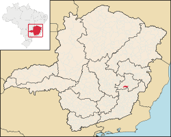
 Location in Minas Gerais Location in Minas Gerais | |
| Country | |
| State | |
| Region | Southeast |
| Intermediate Region | Ipatinga |
| Immediate Region | Ipatinga |
| Founded | 27 December 1948 |
| Government | |
| • Mayor | Francisco Castro Souza Filho (MDB) |
| Area | |
| • Total | 339.375 km (131.033 sq mi) |
| Elevation | 376 m (1,234 ft) |
| Population | |
| • Total | 7,493 |
| • Density | 22/km (57/sq mi) |
| Demonym | dionisiano |
| Time zone | UTC−3 (BRT) |
| Postal Code | 35984-000 to 35985-999 |
| HDI (2010) | 0.702 – high |
| Website | dionisio |
Dionísio is a municipality in the state of Minas Gerais, Brazil. The city belongs to the mesoregion Metropolitana de Belo Horizonte and to the microregion of Itabira. As of 2020, the estimated population was 7,609.
The municipality contains part of the 35,970 hectares (88,900 acres) Rio Doce State Park, created in 1944, the first state-level conservation unit in Minas Gerais.
Geography
Climate
| Climate data for Ponte Alta (Dionísio), elevation 320 m (1,050 ft), (1981–2010) | |||||||||||||
|---|---|---|---|---|---|---|---|---|---|---|---|---|---|
| Month | Jan | Feb | Mar | Apr | May | Jun | Jul | Aug | Sep | Oct | Nov | Dec | Year |
| Mean daily maximum °C (°F) | 31.1 (88.0) |
32.1 (89.8) |
31.6 (88.9) |
30.2 (86.4) |
28.3 (82.9) |
27.0 (80.6) |
27.0 (80.6) |
27.5 (81.5) |
28.7 (83.7) |
30.0 (86.0) |
30.6 (87.1) |
30.7 (87.3) |
29.6 (85.3) |
| Daily mean °C (°F) | 25.3 (77.5) |
25.7 (78.3) |
25.2 (77.4) |
23.9 (75.0) |
21.6 (70.9) |
19.7 (67.5) |
19.5 (67.1) |
19.7 (67.5) |
21.8 (71.2) |
23.5 (74.3) |
24.4 (75.9) |
24.9 (76.8) |
22.9 (73.2) |
| Mean daily minimum °C (°F) | 21.2 (70.2) |
21.1 (70.0) |
20.8 (69.4) |
19.6 (67.3) |
16.9 (62.4) |
14.5 (58.1) |
14.0 (57.2) |
13.0 (55.4) |
16.6 (61.9) |
18.7 (65.7) |
19.9 (67.8) |
20.8 (69.4) |
18.1 (64.6) |
| Average precipitation mm (inches) | 282.4 (11.12) |
146.1 (5.75) |
126.7 (4.99) |
68.9 (2.71) |
32.1 (1.26) |
8.2 (0.32) |
14.2 (0.56) |
17.5 (0.69) |
35.5 (1.40) |
96.2 (3.79) |
231.5 (9.11) |
274.3 (10.80) |
1,333.6 (52.50) |
| Average precipitation days (≥ 1.0 mm) | 13 | 7 | 8 | 5 | 3 | 2 | 2 | 2 | 4 | 6 | 12 | 15 | 79 |
| Average relative humidity (%) | 82.2 | 81.1 | 82.0 | 82.5 | 82.5 | 81.9 | 80.2 | 77.7 | 76.4 | 77.0 | 80.0 | 82.3 | 80.5 |
| Source: Instituto Nacional de Meteorologia | |||||||||||||
See also
References
- ^ "IBGE Dionísio". IBGE. Retrieved 29 May 2023.
- "Município de Dionísio". cidade-Brasil. Retrieved 29 May 2023.
- "Archived copy" (PDF). United Nations Development Programme (UNDP). Archived from the original (PDF) on 8 July 2014. Retrieved 13 March 2022.
{{cite web}}: CS1 maint: archived copy as title (link) - IBGE 2020
- Parque Estadual do Rio Doce (in Portuguese), IEF: Instituto Estadual de Florestas MG, archived from the original on 2022-05-27, retrieved 2017-02-06
- "Normais Climatológicas Do Brasil 1981–2010" (in Portuguese). Instituto Nacional de Meteorologia. Retrieved 21 May 2024.
19°50′34″S 42°46′37″W / 19.84278°S 42.77694°W / -19.84278; -42.77694
This geographical article relating to Minas Gerais is a stub. You can help Misplaced Pages by expanding it. |
