| Muzambinho | |
|---|---|
| Municipality | |
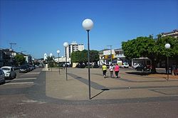
 View of Dr. Américo Luz avenue View of Dr. Américo Luz avenue | |
 Flag Flag Seal Seal | |
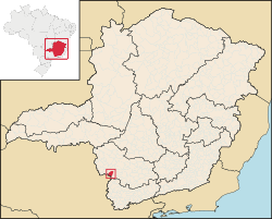
 Location in Minas Gerais Location in Minas Gerais | |
 | |
| Coordinates: 21°22′33″S 46°31′33″W / 21.37583°S 46.52583°W / -21.37583; -46.52583 | |
| Country | |
| Region | Southeast |
| State | Minas Gerais |
| Mesoregion | South and Southwest of Minas Gerais |
| Microregion | São Sebastião do Paraíso |
| Founded | October 8th, 1860 |
| Incorporated | November 12th, 1878 |
| Government | |
| • Mayor | Ivan Antônio de Freitas |
| Area | |
| • Total | 157,930 sq mi (409,036 km) |
| Elevation | 3,600 ft (1,100 m) |
| Population | |
| • Total | 20,545 |
| Time zone | UTC−3 (BRT) |
| CEP postal code | 37890-000 |
| Area code | 35 |
| HDI (2008) | 0.801 |
| Website | Official Website |
Muzambinho is a municipality in the state of Minas Gerais in the Southeast region of Brazil.
See also
References
- IBGE (2002-10-10). "Área territorial oficial" (in Portuguese). IBGE. Retrieved 2015-03-30.
- IBGE 2020
- ^ "Ranking decrescente do IDH-M dos municípios do Brasil" (in Portuguese). Programa das Nações Unidas para o Desenvolvimento (PNUD). 2000. Archived from the original on 2009-10-03. Retrieved 2008-10-11.
- "Divisão Territorial do Brasil" (in Portuguese). Divisão Territorial do Brasil e Limites Territoriais, Instituto Brasileiro de Geografia e Estatística (IBGE). July 1, 2008. Retrieved December 17, 2009.
- "Estimativas da população para 1º de julho de 2009" (PDF) (in Portuguese). Estimativas de População, Instituto Brasileiro de Geografia e Estatística (IBGE). August 14, 2009. Retrieved December 17, 2009.
- "Produto Interno Bruto dos Municípios 2002-2005" (PDF) (in Portuguese). Instituto Brasileiro de Geografia e Estatística (IBGE). December 19, 2007. Retrieved December 17, 2009.
This geographical article relating to Minas Gerais is a stub. You can help Misplaced Pages by expanding it. |
