Name
Location
Type
Completed Date designated
Grid ref. Entry number Image
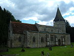
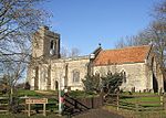
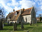
Church of St Mary
Addington Church
14th century
13 July 1966
SP7426128492 51°57′00″N 0°55′15″W / 51.949974°N 0.920904°W / 51.949974; -0.920904 (Church of St Mary)
1214530 Church of St Mary More images
Church of St James
Aston Abbotts Church
Late 15th–early 16th century
18 October 1966
SP8473920239 51°52′27″N 0°46′14″W / 51.874294°N 0.770512°W / 51.874294; -0.770512 (Church of St James)
1116023 Church of St James More images
Church of St Michael and All Angels
Aston Clinton Church
13th century
21 December 1967
SP8793111948 51°47′57″N 0°43′35″W / 51.799275°N 0.726262°W / 51.799275; -0.726262 (Church of St Michael and All Angels)
1124228 Church of St Michael and All Angels More images
Parish Church of St Michael
Aston Sandford Church
13th century
21 December 1967
SP7564507876 51°45′52″N 0°54′19″W / 51.764465°N 0.905277°W / 51.764465; -0.905277 (Parish Church of St Michael)
1118340 Parish Church of St Michael More images
Ceely House
Aylesbury House
Early 18th century
7 April 1952
SP8177413846 51°49′02″N 0°48′54″W / 51.817269°N 0.81508°W / 51.817269; -0.81508 (Ceely House)
1160059 Ceely House More images
Greenend House
Aylesbury
House
Late 18th century
7 April 1952
SP8176513705 51°48′58″N 0°48′55″W / 51.816003°N 0.815244°W / 51.816003; -0.815244 (Greenend House)
1117950 Upload Photo
Prebendal House School
Aylesbury
Clergy house
18th century
7 April 1952
SP8165913882 51°49′03″N 0°49′00″W / 51.81761°N 0.816739°W / 51.81761; -0.816739 (Prebendal House School)
1117941 Upload Photo
The County Hall , including the former Town Hall , the former County Constabulary Headquarters and the Judge's Lodgings
Aylesbury
County hall
1722–40
7 April 1952
SP8198613675 51°48′57″N 0°48′43″W / 51.815701°N 0.812045°W / 51.815701; -0.812045 (The County Hall, including the former Town Hall, the former County Constabulary Headquarters and the Judge's Lodgings)
1117935 The County Hall , including the former Town Hall , the former County Constabulary Headquarters and the Judge's Lodgings More images
The Derby Arms Public House
Aylesbury
Former public house
18th century
7 April 1952
SP8173313949 51°49′06″N 0°48′56″W / 51.818201°N 0.81565°W / 51.818201; -0.81565 (The Derby Arms Public House)
1319191 The Derby Arms Public House
The Kings Head Hotel
Aylesbury
Public house
15th–16th century
7 April 1952
SP8188413773 51°49′00″N 0°48′49″W / 51.816597°N 0.813502°W / 51.816597; -0.813502 (The Kings Head Hotel)
1160205 The Kings Head Hotel More images
The Museum
Aylesbury
Grammar school
1719
7 April 1952
SP8176413861 51°49′03″N 0°48′55″W / 51.817406°N 0.815221°W / 51.817406; -0.815221 (The Museum)
1117970 The Museum More images
26 Temple Street
Aylesbury
House
17th century
7 April 1952
SP8182313763 51°48′59″N 0°48′52″W / 51.816516°N 0.814389°W / 51.816516; -0.814389 (26 Temple Street)
1310418 26 Temple Street
28 Temple Street
Aylesbury
House
Early 18th century
7 April 1952
SP8181913769 51°49′00″N 0°48′52″W / 51.816571°N 0.814445°W / 51.816571; -0.814445 (28 Temple Street)
1117925 28 Temple Street
1 Church Street
Aylesbury
House
1739
7 April 1952
SP8180313809 51°49′01″N 0°48′53″W / 51.816933°N 0.814668°W / 51.816933; -0.814668 (1 Church Street)
1117968 Upload Photo
10 Church Street
Aylesbury
House
15th century or 16th century
7 April 1952
SP8174313837 51°49′02″N 0°48′56″W / 51.817193°N 0.815532°W / 51.817193; -0.815532 (10 Church Street)
1160097 10 Church Street More images
Church of St Mary
Beachampton Church
14th century
13 July 1966
SP7705337069 52°01′36″N 0°52′42″W / 52.026693°N 0.878365°W / 52.026693; -0.878365 (Church of St Mary)
1288408 Church of St Mary More images
Hall Farmhouse
Beachampton Country house
Late 15th century
25 September 1951
SP7705237356 52°01′45″N 0°52′42″W / 52.029273°N 0.878315°W / 52.029273; -0.878315 (Hall Farmhouse)
1214834 Upload Photo
Biddlesden Park House
Biddlesden Country house
1731
25 September 1951
SP6324339902 52°03′14″N 1°04′45″W / 52.053904°N 1.079091°W / 52.053904; -1.079091 (Biddlesden Park House)
1211458 Upload Photo
Church of St Margaret and linking wing to Biddlesden Park House
Biddlesden
Chapel
1735
13 July 1966
SP6329539862 52°03′13″N 1°04′42″W / 52.053538°N 1.07834°W / 52.053538; -1.07834 (Church of St Margaret and linking wing to Biddlesden Park House)
1211493 Upload Photo
Barn at New Manor Farm
Broughton , Bierton with Broughton Aisled barn
c .117425 October 1951
SP8456413728 51°48′57″N 0°46′29″W / 51.815794°N 0.774643°W / 51.815794; -0.774643 (Barn at New Manor Farm)
1310584 Upload Photo
Church of St James
Boarstall Church
1818
21 December 1967
SP6248214164 51°49′21″N 1°05′41″W / 51.822614°N 1.094855°W / 51.822614; -1.094855 (Church of St James)
1124282 Church of St James More images
Church of All Saints
Brill Church
12th century
21 December 1967
SP6562813854 51°49′10″N 1°02′57″W / 51.819467°N 1.049275°W / 51.819467; -1.049275 (Church of All Saints)
1124287 Church of All Saints More images
Flats, the Manor House
Brill
House
Early 17th century
25 October 1951
SP6533013718 51°49′06″N 1°03′13″W / 51.81828°N 1.053623°W / 51.81828; -1.053623 (Flats, the Manor House)
1332781 Upload Photo
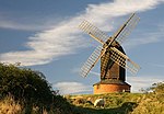
Brill Windmill
Brill
Windmill
Late 17th century
25 October 1951
SP6519814146 51°49′20″N 1°03′20″W / 51.822143°N 1.055458°W / 51.822143; -1.055458 (Brill Windmill)
1124265 Brill Windmill More images
Old Latin School
Buckingham
School
Late 18th century
13 October 1952
SP6957234024 52°00′01″N 0°59′17″W / 52.000308°N 0.987998°W / 52.000308; -0.987998 (Old Latin School)
1201391 Old Latin School More images
Old Town Hall
Buckingham
Town hall
1748
13 October 1952
SP6956933960 51°59′59″N 0°59′17″W / 51.999733°N 0.988055°W / 51.999733; -0.988055 (Old Town Hall)
1282685 Old Town Hall More images
The Manor House, Twisted Chimneys
Buckingham
Clergy house
Early 16th century
13 October 1952
SP6942333631 51°59′48″N 0°59′25″W / 51.996794°N 0.990248°W / 51.996794; -0.990248 (The Manor House, Twisted Chimneys)
1282715 The Manor House, Twisted Chimneys More images
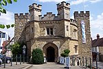
The Old Gaol
Buckingham
Former gaol
1748
13 October 1952
SP6967534092 52°00′03″N 0°59′11″W / 52.000906°N 0.986484°W / 52.000906; -0.986484 (The Old Gaol)
1201392 The Old Gaol More images
The Vicarage
Buckingham
Open hall house
c .14453 April 1973
SP6943033652 51°59′49″N 0°59′25″W / 51.996982°N 0.990142°W / 51.996982; -0.990142 (The Vicarage)
1282716 The Vicarage
Trinity House
Buckingham
House
16th century
13 October 1952
SP6943133670 51°59′50″N 0°59′24″W / 51.997143°N 0.990123°W / 51.997143; -0.990123 (Trinity House)
1201373 Trinity House More images
Trolly Hall
Buckingham
House
1670
13 October 1952
SP6953233888 51°59′57″N 0°59′19″W / 51.99909°N 0.988608°W / 51.99909; -0.988608 (Trolly Hall)
1204476 Trolly Hall
29 and 30 West Street
Buckingham
Town house
Early 19th century
3 April 1973
SP6954433984 52°00′00″N 0°59′18″W / 51.999952°N 0.988414°W / 51.999952; -0.988414 (29 and 30 West Street)
1201425 29 and 30 West Street
Church of All Saints
Buckland Church
13th–19th century
21 December 1967
SP8879012446 51°48′13″N 0°42′49″W / 51.803616°N 0.713681°W / 51.803616; -0.713681 (Church of All Saints)
1160591 Church of All Saints More images
Parish Church of St Nicholas
Chearsley Church
12th century
21 December 1967
SP7202510313 51°47′13″N 0°57′26″W / 51.786849°N 0.957218°W / 51.786849; -0.957218 (Parish Church of St Nicholas)
1118344 Parish Church of St Nicholas More images
Church of St Giles
Cheddington Church
12th century
18 October 1966
SP9222118007 51°51′11″N 0°39′45″W / 51.853047°N 0.662456°W / 51.853047; -0.662456 (Church of St Giles)
1310457 Church of St Giles More images
Chilton House including forecourt walls, gates, railings and pavilions (Clock Tower)
Chilton House
c .174025 October 1951
SP6872911624 51°47′57″N 1°00′17″W / 51.799048°N 1.004734°W / 51.799048; -1.004734 (Chilton House including forecourt walls, gates, railings and pavilions (Clock Tower))
1118316 Chilton House including forecourt walls, gates, railings and pavilions (Clock Tower) More images
The Gatehouse
Chilton
House
1683
26 October 1951
SP6883611558 51°47′54″N 1°00′12″W / 51.798442°N 1.003196°W / 51.798442; -1.003196 (The Gatehouse)
1118320 The Gatehouse
Chapel at Manor House
Creslow Chapel
13th–14th century
25 October 1951
SP8110621867 51°53′22″N 0°49′22″W / 51.889468°N 0.822889°W / 51.889468; -0.822889 (Chapel at Manor House)
1034375 Chapel at Manor House More images
Church of St Nicholas
Cublington Church
Early 15th century
18 October 1966
SP8387622202 51°53′31″N 0°46′57″W / 51.89207°N 0.782568°W / 51.89207; -0.782568 (Church of St Nicholas)
1320123 Church of St Nicholas More images
Parish Church of St Nicholas
Cuddington Church
13th century
21 December 1967
SP7373711209 51°47′41″N 0°55′56″W / 51.794681°N 0.932212°W / 51.794681; -0.932212 (Parish Church of St Nicholas)
1118334 Parish Church of St Nicholas More images
Tyringham Hall
Cuddington
Country house
16th century
25 October 1951
SP7368811228 51°47′41″N 0°55′59″W / 51.794858°N 0.932919°W / 51.794858; -0.932919 (Tyringham Hall)
1118328 Tyringham Hall More images
Dinton Castle
Dinton-with-Ford and Upton
Folly
1769
25 October 1951
SP7654011548 51°47′50″N 0°53′29″W / 51.797352°N 0.891502°W / 51.797352; -0.891502 (Dinton Castle)
1118308 Dinton Castle More images
Dinton Hall
Dinton , Dinton-with-Ford and UptonCountry house
c .150025 October 1951
SP7664111038 51°47′34″N 0°53′25″W / 51.792754°N 0.89015°W / 51.792754; -0.89015 (Dinton Hall)
1158977 Dinton Hall More images
Waldridge Manor
Meadle , Dinton-with-Ford and UptonHouse
1925
25 October 1951
SP7817507273 51°45′31″N 0°52′08″W / 51.758697°N 0.868759°W / 51.758697; -0.868759 (Waldridge Manor)
1118307 Waldridge Manor
Church of St John the Baptist
Dorton Church
Mid-17th century
21 December 1967
SP6788713944 51°49′12″N 1°00′59″W / 51.820007°N 1.016489°W / 51.820007; -1.016489 (Church of St John the Baptist)
1158465 Church of St John the Baptist More images
Church of Holy Trinity
Drayton Parslow Church
12th century
19 August 1959
SP8373228412 51°56′52″N 0°46′59″W / 51.947912°N 0.783152°W / 51.947912; -0.783152 (Church of Holy Trinity)
1289256 Church of Holy Trinity More images
The Old Rectory
Drayton Parslow
House
1753
19 August 1959
SP8375828352 51°56′51″N 0°46′58″W / 51.947368°N 0.782788°W / 51.947368; -0.782788 (The Old Rectory)
1289258 Upload Photo
Church of St Martin
Dunton Church
12th century
19 August 1959
SP8237824372 51°54′42″N 0°48′14″W / 51.911799°N 0.803813°W / 51.911799; -0.803813 (Church of St Martin)
1211972 Church of St Martin More images
Botolph House
Botolph Claydon , East ClaydonHouse
c .171219 August 1959
SP7341924828 51°55′02″N 0°56′02″W / 51.917149°N 0.933934°W / 51.917149; -0.933934 (Botolph House)
1212143 Upload Photo
Church of St Mary
East Claydon Church
14th century
19 August 1959
SP7400325534 51°55′24″N 0°55′31″W / 51.923418°N 0.925293°W / 51.923418; -0.925293 (Church of St Mary)
1289625 Church of St Mary More images
Church of St Michael
Edgcott Church
12th century
13 July 1966
SP6800022796 51°53′58″N 1°00′47″W / 51.899569°N 1.013111°W / 51.899569; -1.013111 (Church of St Michael)
1214280 Church of St Michael More images
Barn at Church Farm
Edlesborough Barn
15th–16th century
26 September 1951
SP9719919265 51°51′49″N 0°35′23″W / 51.86351°N 0.58985°W / 51.86351; -0.58985 (Barn at Church Farm)
1319209 Barn at Church Farm
House adjacent to west boundary of Whipsnade Zoo to east of B4506, about 0.25 kilometres to north of Dagnall
Dagnall , EdlesboroughDetached house
1933–36
1 September 1988
SP9971416887 51°50′30″N 0°33′14″W / 51.841693°N 0.554024°W / 51.841693; -0.554024 (House adjacent to west boundary of Whipsnade Zoo to east of B4506, about 0.25 kilometres to north of Dagnall)
1300803 Upload Photo
Church of St Mary
Fleet Marston Church
12th century
21 December 1967
SP7796715966 51°50′13″N 0°52′11″W / 51.83687°N 0.869821°W / 51.83687; -0.869821 (Church of St Mary)
1117838 Church of St Mary More images
St Leonard's
Foscott House
12th century
13 July 1966
SP7168135761 52°00′56″N 0°57′25″W / 52.015654°N 0.95692°W / 52.015654; -0.95692 (St Leonard's)
1214918 St Leonard's More images
Church of Holy Trinity, attached walls and railings
Gawcott , Gawcott with LenboroughChurch
1827
13 October 1952
SP6799431829 51°58′51″N 1°00′41″W / 51.980772°N 1.011415°W / 51.980772; -1.011415 (Church of Holy Trinity, attached walls and railings)
1205788 Church of Holy Trinity, attached walls and railings More images
Church of St John the Baptist
Green End, Granborough
Church
14th century
19 August 1959
SP7678025000 51°55′06″N 0°53′06″W / 51.918242°N 0.885038°W / 51.918242; -0.885038 (Church of St John the Baptist)
1212350 Church of St John the Baptist More images
Church of St Mary
Great Brickhill Church
Mid-13th century
18 October 1966
SP9011430786 51°58′06″N 0°41′23″W / 51.968254°N 0.6897°W / 51.968254; -0.6897 (Church of St Mary)
1115994 Church of St Mary More images
Church of St James
Great Horwood Church
14th century
19 August 1959
SP7707331206 51°58′26″N 0°52′46″W / 51.973988°N 0.87939°W / 51.973988; -0.87939 (Church of St James)
1213275 Church of St James More images
Manor Farmhouse
Great Horwood
House
17th century
4 June 1952
SP7729631557 51°58′38″N 0°52′34″W / 51.977112°N 0.876065°W / 51.977112; -0.876065 (Manor Farmhouse)
1213486 Upload Photo
Church of St Leonard
Grendon Underwood Church
15th century
21 December 1967
SP6772020985 51°53′00″N 1°01′03″W / 51.883323°N 1.017534°W / 51.883323; -1.017534 (Church of St Leonard)
1332808 Church of St Leonard More images
Shakespeare Farmhouse
Grendon Underwood
Farmhouse
Late 16th century and 17th century
25 October 1951
SP6784620856 51°52′56″N 1°00′57″W / 51.882148°N 1.015729°W / 51.882148; -1.015729 (Shakespeare Farmhouse)
1124272 Upload Photo
Barn to south west of Manor Farmhouse
Church End, Haddenham
Barn
15th century
25 October 1951
SP7406307892 51°45′53″N 0°55′41″W / 51.76482°N 0.928193°W / 51.76482; -0.928193 (Barn to south west of Manor Farmhouse)
1159107 Upload Photo
Church Farmhouse
Haddenham
Farmhouse
15th century
25 October 1951
SP7419608025 51°45′58″N 0°55′34″W / 51.765998°N 0.926238°W / 51.765998; -0.926238 (Church Farmhouse)
1233925 Upload Photo
Grenville Manor
Haddenham
House
18th century
25 October 1951
SP7428008045 51°45′58″N 0°55′30″W / 51.766167°N 0.925016°W / 51.766167; -0.925016 (Grenville Manor)
1118281 Upload Photo
Middle Turn, The Turn, Turn End and retaining walls and pool
Haddenham
House
1964–67
15 July 1998
SP7395408666 51°46′18″N 0°55′47″W / 51.771792°N 0.929608°W / 51.771792; -0.929608 (Middle Turn, The Turn, Turn End and retaining walls and pool)
1375663 Upload Photo
Halton House
Halton Country house
1881–83
11 October 1985
SP8803310108 51°46′58″N 0°43′31″W / 51.78272°N 0.72525°W / 51.78272; -0.72525 (Halton House)
1332843 Halton House More images
Church of St Mary
Hardwick Church
Late Pre-Conquest
21 December 1967
SP8065418982 51°51′49″N 0°49′48″W / 51.8636°N 0.830129°W / 51.8636; -0.830129 (Church of St Mary)
1319256 Church of St Mary More images
Hardwick Place
Hardwick
Vicarage
16th–17th century
25 October 1951
SP8048819154 51°51′55″N 0°49′57″W / 51.86517°N 0.832499°W / 51.86517; -0.832499 (Hardwick Place)
1319255 Upload Photo
Church of the Holy Cross
Hoggeston Church
12th century
19 August 1959
SP8084025027 51°55′04″N 0°49′34″W / 51.917911°N 0.826013°W / 51.917911; -0.826013 (Church of the Holy Cross)
1213255 Church of the Holy Cross More images
Manor Farmhouse
Hoggeston
Farmhouse
Early 17th century
4 June 1952
SP8083824970 51°55′03″N 0°49′34″W / 51.917399°N 0.826056°W / 51.917399; -0.826056 (Manor Farmhouse)
1213256 Manor Farmhouse More images
The Old Rectory
Hoggeston
House
1784
19 August 1959
SP8089125024 51°55′04″N 0°49′31″W / 51.917877°N 0.825272°W / 51.917877; -0.825272 (The Old Rectory)
1213178 The Old Rectory
Church of All Saints
The Green, Hulcott
Church
14th century
21 December 1967
SP8532916684 51°50′32″N 0°45′46″W / 51.842249°N 0.76282°W / 51.842249; -0.76282 (Church of All Saints)
1281503 Church of All Saints More images
New Manor House
Little Ickford, Ickford
House
1675
25 October 1951
SP6529707147 51°45′33″N 1°03′19″W / 51.759212°N 1.055336°W / 51.759212; -1.055336 (New Manor House)
1319080 Upload Photo
12 and 14 Station Road
Ivinghoe House
Later 13th to early 14th century
15 October 1984
SP9446716225 51°50′12″N 0°37′49″W / 51.836654°N 0.630343°W / 51.836654; -0.630343 (12 and 14 Station Road)
1352692 12 and 14 Station Road
Church of St Nicholas
Little Horwood Church
Early 13th century
19 August 1959
SP7904630845 51°58′14″N 0°51′03″W / 51.970466°N 0.850756°W / 51.970466; -0.850756 (Church of St Nicholas)
1213693 Church of St Nicholas More images
Barn at Notley Farm
Long Crendon Barn
Medieval
19 June 1981
SP7134609232 51°46′38″N 0°58′02″W / 51.777218°N 0.967282°W / 51.777218; -0.967282 (Barn at Notley Farm)
1289035 Barn at Notley Farm
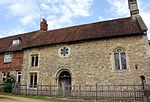
Long Crendon Courthouse
Church End, Long Crendon
Courthouse
15th century
25 October 1951
SP6978309063 51°46′33″N 0°59′24″W / 51.775896°N 0.989967°W / 51.775896; -0.989967 (Long Crendon Courthouse)
1214040 Long Crendon Courthouse More images
Warwick Farmhouse
Long Crendon
Farmhouse
18th century and 19th century
19 June 1981
SP6918908844 51°46′26″N 0°59′55″W / 51.774001°N 0.998618°W / 51.774001; -0.998618 (Warwick Farmhouse)
1213243 Upload Photo
Church of St Mary
Marsh Gibbon Church
13th century
13 July 1966
SP6476123228 51°54′14″N 1°03′36″W / 51.903838°N 1.060097°W / 51.903838; -1.060097 (Church of St Mary)
1214446 Church of St Mary More images
Manor House
Marsh Gibbon
House
17th century
25 September 1951
SP6473823170 51°54′12″N 1°03′38″W / 51.903319°N 1.060443°W / 51.903319; -1.060443 (Manor House)
1214444 Upload Photo
Church of All Saints
Marsworth Church
Late 12th century
18 October 1966
SP9199114603 51°49′21″N 0°40′00″W / 51.822488°N 0.666698°W / 51.822488; -0.666698 (Church of All Saints)
1161002 Church of All Saints More images
Church of Saint Mary
Mentmore Church
Early 13th century
18 October 1966
SP9038519776 51°52′09″N 0°41′19″W / 51.869247°N 0.688643°W / 51.869247; -0.688643 (Church of Saint Mary)
1319266 Church of Saint Mary More images
Manor House
Mentmore
House
Mid-18th century
18 October 1966
SP9068819656 51°52′05″N 0°41′03″W / 51.86812°N 0.684275°W / 51.86812; -0.684275 (Manor House)
1161133 Upload Photo
Church of St Mary
Mursley Church
14th century
19 August 1959
SP8171128554 51°56′58″N 0°48′45″W / 51.949488°N 0.812515°W / 51.949488; -0.812515 (Church of St Mary)
1288706 Church of St Mary More images
Salden House Farmhouse
Salden, Mursley
House
Late 16th century
4 June 1952
SP8245629767 51°57′37″N 0°48′05″W / 51.960282°N 0.801388°W / 51.960282; -0.801388 (Salden House Farmhouse)
1214311 Upload Photo
Manor Farmhouse
Nether Winchendon Farmhouse
16th century
25 October 1985
SP7320912246 51°48′15″N 0°56′23″W / 51.804072°N 0.939648°W / 51.804072; -0.939648 (Manor Farmhouse)
1159881 Upload Photo
Church of St Mary
Oakley Church
12th century
21 December 1967
SP6419412285 51°48′20″N 1°04′13″W / 51.805529°N 1.070367°W / 51.805529; -1.070367 (Church of St Mary)
1158749 Church of St Mary More images
Church of All Saints
Oving Church
Early 13th century
21 December 1967
SP7824621373 51°53′08″N 0°51′52″W / 51.885435°N 0.864549°W / 51.885435; -0.864549 (Church of All Saints)
1117846 Church of All Saints More images
Oving House
The Village, Oving
Country house
17th century
25 October 1951
SP7828421206 51°53′02″N 0°51′51″W / 51.883929°N 0.864035°W / 51.883929; -0.864035 (Oving House)
1117811 Oving House
Church of St Mary the Virgin
Padbury Church
13th century
13 July 1966
SP7214130921 51°58′20″N 0°57′04″W / 51.972087°N 0.951236°W / 51.972087; -0.951236 (Church of St Mary the Virgin)
1231852 Church of St Mary the Virgin More images
Church of St. Giles
Pitchcott Church, now house
12th century
21 December 1967
SP7753320419 51°52′37″N 0°52′30″W / 51.876959°N 0.875121°W / 51.876959; -0.875121 (Church of St. Giles)
1117813 Church of St. Giles More images
Pitstone Windmill
Pitstone Post mill
1627
26 September 1951
SP9451015677 51°49′54″N 0°37′48″W / 51.831721°N 0.629868°W / 51.831721; -0.629868 (Pitstone Windmill)
1310208 Pitstone Windmill More images
Church of St John the Baptist
Preston Bissett Church
12th century
13 July 1966
SP6578129903 51°57′49″N 1°02′38″W / 51.963724°N 1.044°W / 51.963724; -1.044 (Church of St John the Baptist)
1214823 Church of St John the Baptist More images
Brudenell House
Quainton House
16th century
25 October 1951
SP7492720208 51°52′32″N 0°54′47″W / 51.875418°N 0.913015°W / 51.875418; -0.913015 (Brudenell House)
1158483 Upload Photo
Cross Farmhouse
Quainton
Farmhouse
1723
25 October 1951
SP7464620171 51°52′30″N 0°55′02″W / 51.875123°N 0.917104°W / 51.875123; -0.917104 (Cross Farmhouse)
1319249 Cross Farmhouse
Denham Lodge
Denham, Quainton
House
Mid–Late 17th century
25 October 1951
SP7538320530 51°52′42″N 0°54′23″W / 51.878251°N 0.906322°W / 51.878251; -0.906322 (Denham Lodge)
1158606 Denham Lodge More images
Doddershall House
Doddershall, Quainton
House
1689
25 October 1951
SP7201920143 51°52′31″N 0°57′19″W / 51.875216°N 0.955263°W / 51.875216; -0.955263 (Doddershall House)
1117820 Doddershall House More images
Gatehouse at Denham Lodge
Denham, Quainton
Gatehouse
16th–17th century
21 December 1967
SP7537020504 51°52′41″N 0°54′23″W / 51.878019°N 0.906517°W / 51.878019; -0.906517 (Gatehouse at Denham Lodge)
1117819 Upload Photo
Market Cross
Quainton
Cross
15th century
21 December 1967
SP7465720151 51°52′30″N 0°55′01″W / 51.874942°N 0.916949°W / 51.874942; -0.916949 (Market Cross)
1117825 Market Cross More images
Numbers 40 to 54 and flanking outbuildings
Quainton
Almshouses
1687
25 October 1951
SP7494320170 51°52′30″N 0°54′46″W / 51.875074°N 0.912791°W / 51.875074; -0.912791 (Numbers 40 to 54 and flanking outbuildings)
1311462 Numbers 40 to 54 and flanking outbuildings More images
Townsend Farmhouse
Quainton
House
c .1730s25 October 1951
SP7420920194 51°52′31″N 0°55′24″W / 51.875388°N 0.923446°W / 51.875388; -0.923446 (Townsend Farmhouse)
1319273 Upload Photo
Radclive Manor
Radclive , Radclive-cum-ChackmoreManor house
16th century
25 September 1951
SP6753833871 51°59′57″N 1°01′04″W / 51.999183°N 1.017652°W / 51.999183; -1.017652 (Radclive Manor)
1211601 Radclive Manor
Parish Church of St Mary Magdalene
Shabbington Church
c .110021 December 1967
SP6666206745 51°45′20″N 1°02′08″W / 51.755437°N 1.035639°W / 51.755437; -1.035639 (Parish Church of St Mary Magdalene)
1332552 Parish Church of St Mary Magdalene More images
Church of St Edward
Shalstone Church
1828
13 July 1966
SP6414036435 52°01′21″N 1°04′00″W / 52.022635°N 1.06666°W / 52.022635; -1.06666 (Church of St Edward)
1289865 Church of St Edward More images
Church of the Holy Cross
Slapton Church
Late 13th–early 14th century
18 October 1966
SP9371520690 51°52′37″N 0°38′24″W / 51.876914°N 0.640044°W / 51.876914; -0.640044 (Church of the Holy Cross)
1117831 Church of the Holy Cross More images
Church of All Saints
Soulbury Church
1770
18 October 1966
SP8821227028 51°56′05″N 0°43′06″W / 51.93478°N 0.718342°W / 51.93478; -0.718342 (Church of All Saints)
1320152 Church of All Saints More images
Liscombe House and wall with pavilion to south of west wing
Liscombe Park, Soulbury
Country house
Mid-17th century
26 September 1951
SP8859525734 51°55′23″N 0°42′47″W / 51.923088°N 0.713105°W / 51.923088; -0.713105 (Liscombe House and wall with pavilion to south of west wing)
1219372 Upload Photo
Lovett House and wall attached to rear
Soulbury
House
1724
26 September 1951
SP8828427108 51°56′08″N 0°43′02″W / 51.935488°N 0.717274°W / 51.935488; -0.717274 (Lovett House and wall attached to rear)
1219292 Lovett House and wall attached to rear More images
Church of St Michael
Steeple Claydon Church
14th century
13 July 1966
SP7052126743 51°56′05″N 0°58′32″W / 51.934737°N 0.97567°W / 51.934737; -0.97567 (Church of St Michael)
1214937 Church of St Michael More images
Church of St Luke
Stoke Hammond Church
14th century
18 October 1966
SP8794029772 51°57′34″N 0°43′18″W / 51.959487°N 0.721596°W / 51.959487; -0.721596 (Church of St Luke)
1115981 Church of St Luke More images
Church of St John the Baptist
Stone , Stone with Bishopstone and HartwellChurch
Norman
21 December 1967
SP7841012247 51°48′12″N 0°51′51″W / 51.803377°N 0.864233°W / 51.803377; -0.864233 (Church of St John the Baptist)
1118457 Church of St John the Baptist More images
Church of St Mary
Hartwell , Stone with Bishopstone and HartwellFormer church
1753–55
21 December 1967
SP7948612464 51°48′19″N 0°50′55″W / 51.805176°N 0.848582°W / 51.805176; -0.848582 (Church of St Mary)
1160658 Church of St Mary More images
Pavilion (the Cot) south-east of Hartwell House
Hartwell, Stone with Bishopstone and Hartwell
House
c .173025 October 1951
SP7976212316 51°48′14″N 0°50′41″W / 51.803806°N 0.844614°W / 51.803806; -0.844614 (Pavilion (the Cot) south-east of Hartwell House)
1160723 Upload Photo
Stable block and coachhouse south-west of Hartwell House
Hartwell, Stone with Bishopstone and Hartwell
House
18th century
29 October 1951
SP7951912390 51°48′16″N 0°50′53″W / 51.804506°N 0.84812°W / 51.804506; -0.84812 (Stable block and coachhouse south-west of Hartwell House)
1332845 Upload Photo
Statue of Frederick, Prince of Wales, south-west of Hartwell House
Hartwell, Stone with Bishopstone and Hartwell
Statue
1757
29 October 1951
SP7957812342 51°48′15″N 0°50′50″W / 51.804066°N 0.847276°W / 51.804066; -0.847276 (Statue of Frederick, Prince of Wales, south-west of Hartwell House)
1118472 Upload Photo
New Inn Farmhouse with outbuildings behind
Stowe Farmhouse
1717–19
21 April 1983
SP6817636435 52°01′20″N 1°00′28″W / 52.022154°N 1.00785°W / 52.022154; -1.00785 (New Inn Farmhouse with outbuildings behind)
1211787 New Inn Farmhouse with outbuildings behind More images
Church of St Mary
Stowe Gardens , Stowe Church
14th century
13 July 1966
SP6761337352 52°01′50″N 1°00′57″W / 52.030466°N 1.015873°W / 52.030466; -1.015873 (Church of St Mary)
1211870 Church of St Mary More images
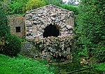
The Grotto
Stowe Gardens , Stowe Grotto
c .174021 April 1983
SP6764737501 52°01′54″N 1°00′55″W / 52.031801°N 1.015348°W / 52.031801; -1.015348 (The Grotto)
1211941 The Grotto More images
The Pebble Alcove
Stowe Gardens , Stowe Pavilion
c .173721 April 1983
SP6787037016 52°01′39″N 1°00′44″W / 52.027414°N 1.012194°W / 52.027414; -1.012194 (The Pebble Alcove)
1211948 The Pebble Alcove More images
Church of St Swithun
Swanbourne Church
13th century
19 August 1959
SP8010527287 51°56′18″N 0°50′10″W / 51.938332°N 0.836172°W / 51.938332; -0.836172 (Church of St Swithun)
1214161 Church of St Swithun More images
Church of St Mary
Thornborough Church
11th–12th century
13 July 1966
SP7431633658 51°59′47″N 0°55′08″W / 51.996404°N 0.918987°W / 51.996404; -0.918987 (Church of St Mary)
1232681 Church of St Mary More images
Church of St Mary Magdalen
Tingewick Church
Norman arcade
13 July 1966
SP6579633043 51°59′31″N 1°02′35″W / 51.991949°N 1.04318°W / 51.991949; -1.04318 (Church of St Mary Magdalen)
1212274 Church of St Mary Magdalen More images
Church of St Mary
Turweston Church
Norman
13 July 1966
SP6003637730 52°02′05″N 1°07′34″W / 52.034735°N 1.126236°W / 52.034735; -1.126236 (Church of St Mary)
1289451 Church of St Mary More images
Turweston House
Turweston
Country house
Early 18th century
31 October 1973
SP6000337758 52°02′06″N 1°07′36″W / 52.03499°N 1.126712°W / 52.03499; -1.126712 (Turweston House)
1212658 Upload Photo
Church of St Michael
Waddesdon Church
Late 12th century
21 December 1967
SP7402316977 51°50′47″N 0°55′37″W / 51.846494°N 0.926835°W / 51.846494; -0.926835 (Church of St Michael)
1117800 Church of St Michael More images
Manor Farmhouse
Weedon Farmhouse
Early 17th century
25 October 1951
SP8140018330 51°51′27″N 0°49′10″W / 51.857631°N 0.819451°W / 51.857631; -0.819451 (Manor Farmhouse)
1124301 Upload Photo
Bank Farmhouse
Wendover Farmhouse
15th century
25 October 1951
SP8705507918 51°45′47″N 0°44′24″W / 51.763187°N 0.739972°W / 51.763187; -0.739972 (Bank Farmhouse)
1204284 Bank Farmhouse More images
Lychgate and churchyard wall to St Mary's Church
Wendover
Lych gate
1871
11 October 1985
SP8710407359 51°45′29″N 0°44′22″W / 51.758155°N 0.739402°W / 51.758155; -0.739402 (Lychgate and churchyard wall to St Mary's Church)
1232487 Lychgate and churchyard wall to St Mary's Church
Parish Church of St Mary
Wendover
Church
14th century
21 December 1967
SP8713307331 51°45′28″N 0°44′20″W / 51.757898°N 0.738989°W / 51.757898; -0.738989 (Parish Church of St Mary)
1118398 Parish Church of St Mary More images
The Hale
Wendover
House
Before c .1435
25 October 1951
SP8926807344 51°45′28″N 0°42′29″W / 51.75768°N 0.708061°W / 51.75768; -0.708061 (The Hale)
1118403 Upload Photo
The Red House
Wendover
House
Early 18th century
25 October 1951
SP8694307981 51°45′50″N 0°44′30″W / 51.763771°N 0.741578°W / 51.763771; -0.741578 (The Red House)
1118430 The Red House More images
Church of St Augustine
Westbury Church
13th century
13 July 1966
SP6224135612 52°00′56″N 1°05′40″W / 52.015452°N 1.094481°W / 52.015452; -1.094481 (Church of St Augustine)
1212959 Church of St Augustine More images
A–B Test-stands and support structures, former Royal Ordnance Establishment, Westcott
Westcott Workshop
1947
23 May 2013
SP7136316472 51°50′32″N 0°57′56″W / 51.8423°N 0.965547°W / 51.8423; -0.965547 (A–B Test-stands and support structures, former Royal Ordnance Establishment, Westcott)
1403959 Upload Photo
C–D Test-stands and support structures, former Royal Ordnance Establishment, Westcott
Westcott
Workshop
1947
23 May 2013
SP7110016607 51°50′37″N 0°58′10″W / 51.843547°N 0.969336°W / 51.843547; -0.969336 (C–D Test-stands and support structures, former Royal Ordnance Establishment, Westcott)
1403962 Upload Photo
Church of St Mary
Westcott
Church
1867
26 February 1985
SP7167417141 51°50′54″N 0°57′39″W / 51.848274°N 0.960895°W / 51.848274; -0.960895 (Church of St Mary)
1332800 Church of St Mary More images
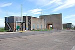
K2 Test Stand, Former Royal Ordnance Establishment, Westcott
Westcott
Control room
1957–60
23 May 2013
SP7047016944 51°50′48″N 0°58′42″W / 51.846656°N 0.978411°W / 51.846656; -0.978411 (K2 Test Stand, Former Royal Ordnance Establishment, Westcott)
1403971 K2 Test Stand, Former Royal Ordnance Establishment, Westcott
Manor Farmhouse
Weston Turville Farmhouse
Late 15th century
25 October 1951
SP8533210700 51°47′18″N 0°45′51″W / 51.788459°N 0.764249°W / 51.788459; -0.764249 (Manor Farmhouse)
1281120 Upload Photo
Manor House
Weston Turville
House
Early 18th century
25 October 1951
SP8588410405 51°47′09″N 0°45′23″W / 51.785723°N 0.756321°W / 51.785723; -0.756321 (Manor House)
1332909 Upload Photo
Church of St John
Whitchurch Church
Late 13th–mid-14th century
21 December 1967
SP8027820871 51°52′50″N 0°50′07″W / 51.880634°N 0.835149°W / 51.880634; -0.835149 (Church of St John)
1124307 Church of St John More images
Priory Hotel
Whitchurch
Mid-16th century
25 October 1951
SP8019220822 51°52′49″N 0°50′11″W / 51.880206°N 0.83641°W / 51.880206; -0.83641 (Priory Hotel)
1159973 Priory Hotel More images
The Old House and attached garden walls
Whitchurch
House
17th century
25 October 1951
SP8017020888 51°52′51″N 0°50′12″W / 51.880803°N 0.836714°W / 51.880803; -0.836714 (The Old House and attached garden walls)
1332786 The Old House and attached garden walls
Ascott House
Ascott , WingCountry house
1874
26 September 1951
SP8914522680 51°53′44″N 0°42′21″W / 51.895549°N 0.705899°W / 51.895549; -0.705899 (Ascott House)
1291467 Ascott House More images
Church of St Peter and St Paul
Wingrave , Wingrave with RowshamChurch
Late 12th century
18 October 1966
SP8691419059 51°51′48″N 0°44′21″W / 51.863353°N 0.739223°W / 51.863353; -0.739223 (Church of St Peter and St Paul)
1115952 Church of St Peter and St Paul More images
Church of St Laurence
Winslow Church
14th century
19 August 1959
SP7693227653 51°56′31″N 0°52′56″W / 51.942069°N 0.882236°W / 51.942069; -0.882236 (Church of St Laurence)
1287430 Church of St Laurence More images
Keach's Meeting House and graveyard walls
Winslow
Baptist chapel
17th century
19 August 1959
SP7695227483 51°56′26″N 0°52′55″W / 51.940539°N 0.881983°W / 51.940539; -0.881983 (Keach's Meeting House and graveyard walls)
1227954 Keach's Meeting House and graveyard walls
Church of St Peter and St Paul
Worminghall Church
14th century
21 December 1967
SP6425208031 51°46′02″N 1°04′13″W / 51.767279°N 1.070312°W / 51.767279; -1.070312 (Church of St Peter and St Paul)
1158914 Church of St Peter and St Paul More images
The Almshouses
Worminghall
Almshouse
1675
25 October 1951
SP6411908428 51°46′15″N 1°04′20″W / 51.770863°N 1.072166°W / 51.770863; -1.072166 (The Almshouses)
1124253 The Almshouses
Church of All Saints
Wotton Underwood Church
14th century
21 December 1967
SP6883715942 51°50′16″N 1°00′08″W / 51.837852°N 1.002312°W / 51.837852; -1.002312 (Church of All Saints)
1124216 Church of All Saints More images


