Name
Location
Type
Completed Date designated
Grid ref. Entry number Image
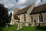
Church of St Mary
Barton Mills , Forest Heath Church
Medieval
7 May 1954
TL7168973819 52°20′08″N 0°31′07″E / 52.335586°N 0.518505°E / 52.335586; 0.518505 (Church of St Mary)
1351305 Church of St Mary More images
Paradise Farmhouse
Barton Mills Farmhouse
c. 1500
7 May 1954
TL7232473847 52°20′08″N 0°31′40″E / 52.335638°N 0.52783°E / 52.335638; 0.52783 (Paradise Farmhouse)
1037606 Upload Photo
Brandon Hall
Brandon House
Late 17th century
7 May 1954
TL7704886166 52°26′41″N 0°36′13″E / 52.44477°N 0.603594°E / 52.44477; 0.603594 (Brandon Hall)
1351338 Upload Photo
Oak House
Brandon House
c. 1730
7 May 1954
TL7838286767 52°26′59″N 0°37′25″E / 52.449734°N 0.623521°E / 52.449734; 0.623521 (Oak House)
1193522 Upload Photo
Church of St Andrew
Cavenham Church
Medieval
7 May 1954
TL7636069682 52°17′49″N 0°35′05″E / 52.296951°N 0.584822°E / 52.296951; 0.584822 (Church of St Andrew)
1192820 Church of St Andrew More images
Lower Mill
Dalham Smock Mill
c. 1790
7 May 1954
TL7198261665 52°13′35″N 0°31′00″E / 52.226332°N 0.516607°E / 52.226332; 0.516607 (Lower Mill)
1037666 Lower Mill More images
Church of St Andrew and St Patrick
Elveden Church
Medieval
7 May 1954
TL8228379942 52°23′14″N 0°40′38″E / 52.387158°N 0.677141°E / 52.387158; 0.677141 (Church of St Andrew and St Patrick)
1192876 Church of St Andrew and St Patrick More images
Elveden Hall
Elveden Park, Elveden
Country House
c. 1760
27 January 1972
TL8246279720 52°23′06″N 0°40′47″E / 52.385104°N 0.679648°E / 52.385104; 0.679648 (Elveden Hall)
1037611 Elveden Hall More images
Water Tower, 200 Metres South West of Elveden Hall
Elveden Park, Elveden
Water Tower
1895
16 October 1984
TL8226279612 52°23′03″N 0°40′36″E / 52.384201°N 0.676654°E / 52.384201; 0.676654 (Water Tower, 200 Metres South West of Elveden Hall)
1192866 Upload Photo
Church of St Laurence
Eriswell Church
Medieval
7 May 1954
TL7236178019 52°22′23″N 0°31′50″E / 52.373097°N 0.530513°E / 52.373097; 0.530513 (Church of St Laurence)
1037596 Church of St Laurence More images
Church of St Nicholas
Landwade , Exning Church
c. 1445
19 August 1959
TL6232568098 52°17′13″N 0°22′42″E / 52.287045°N 0.378443°E / 52.287045; 0.378443 (Church of St Nicholas)
1162203 Church of St Nicholas More images
Glanelly Rest (Exning House) including two attached Gate Ways and Section of Garden Wall to North
Exning Country House
1734
25 January 1963
TL6224465982 52°16′05″N 0°22′34″E / 52.268062°N 0.376239°E / 52.268062; 0.376239 (Glanelly Rest (Exning House) including two attached Gate Ways and Section of Garden Wall to North)
1374829 Upload Photo
Church of St Andrew
Freckenham Church
Medieval
7 May 1954
TL6659771758 52°19′07″N 0°26′34″E / 52.318642°N 0.442823°E / 52.318642; 0.442823 (Church of St Andrew)
1037614 Church of St Andrew More images
Manor House
Freckenham House
Late 17th century
16 October 1984
TL6674771807 52°19′09″N 0°26′42″E / 52.319037°N 0.445046°E / 52.319037; 0.445046 (Manor House)
1037615 Upload Photo
Church of St Ethelbert
Herringswell Church
Medieval
7 May 1954
TL7180669953 52°18′03″N 0°31′06″E / 52.300826°N 0.518248°E / 52.300826; 0.518248 (Church of St Ethelbert)
1351310 Church of St Ethelbert More images
Church of St James
Icklingham Church
Medieval
7 May 1954
TL7704873049 52°19′37″N 0°35′48″E / 52.326968°N 0.596669°E / 52.326968; 0.596669 (Church of St James)
1037582 Church of St James More images
Church of St Mary
Kentford Church
Earlier
7 May 1954
TL7065466795 52°16′22″N 0°29′59″E / 52.272821°N 0.499773°E / 52.272821; 0.499773 (Church of St Mary)
1037677 Church of St Mary More images
Pack Horse Bridge over the River Kennet
Moulton Packhorse Bridge
Early 15th century
7 May 1954
TL6975964531 52°15′10″N 0°29′08″E / 52.252763°N 0.485531°E / 52.252763; 0.485531 (Pack Horse Bridge over the River Kennet)
1037678 Pack Horse Bridge over the River Kennet More images
Church of St Agnes
Newmarket Church
1886
26 June 1984
TL6501764006 52°14′58″N 0°24′57″E / 52.249489°N 0.415873°E / 52.249489; 0.415873 (Church of St Agnes)
1037643 Church of St Agnes More images
Church of St Mary
Newmarket Church
Medieval
28 November 1950
TL6412563419 52°14′40″N 0°24′09″E / 52.244483°N 0.402534°E / 52.244483; 0.402534 (Church of St Mary)
1037636 Church of St Mary More images
Cleveland House
Newmarket House
c. 1730
10 March 1970
TL6483763476 52°14′41″N 0°24′47″E / 52.244782°N 0.41298°E / 52.244782; 0.41298 (Cleveland House)
1351318 Upload Photo
Palace Mansion and Entrance Steps
Newmarket House
Early to Mid 19th century
26 June 1984
TL6443363358 52°14′38″N 0°24′25″E / 52.243843°N 0.407011°E / 52.243843; 0.407011 (Palace Mansion and Entrance Steps)
1285676 Upload Photo
Church of St Denis
Wangford Church
Medieval
7 May 1954
TL7508083513 52°25′18″N 0°34′24″E / 52.421577°N 0.573281°E / 52.421577; 0.573281 (Church of St Denis)
1037542 Church of St Denis More images
Elveden War Memorial
Elveden War memorial
1921
7 May 1954
TL7880177624 52°22′03″N 0°37′29″E / 52.367488°N 0.62479848°E / 52.367488; 0.62479848 (Elveden War Memorial)
1037610 Elveden War Memorial More images


