Name
Location
Type
Completed Date designated
Grid ref. Entry number Image
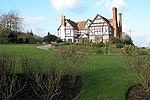
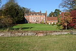
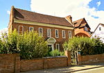
Abberley Hall (that Part in Abberley)
Abberley Park, Abberley , Malvern Hills
House
Early 18th century
18 June 1976
SO7449666437 52°17′44″N 2°22′31″W / 52.295463°N 2.375383°W / 52.295463; -2.375383 (Abberley Hall (that Part in Abberley))
1155526 Abberley Hall (that Part in Abberley)More images
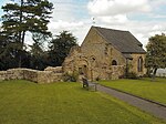
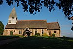
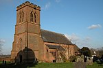
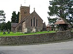
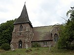
Church of St Michael
Abberley , Malvern HillsParish Church
12th century
29 July 1959
SO7535067869 52°18′30″N 2°21′47″W / 52.308376°N 2.362967°W / 52.308376; -2.362967 (Church of St Michael)
1082704 Church of St Michael More images
Clock Tower, to North of Abberley Hall
Abberley Park, Abberley, Malvern Hills
Clock Tower
1883-84
18 June 1976
SO7447166652 52°17′51″N 2°22′33″W / 52.297395°N 2.375766°W / 52.297395; -2.375766 (Clock Tower, to North of Abberley Hall)
1082707 Clock Tower, to North of Abberley Hall More images
Church of St Mary Magdalene
Alfrick , Malvern HillsParish Church
Late 12th century
29 July 1959
SO7484552974 52°10′28″N 2°22′09″W / 52.174445°N 2.369259°W / 52.174445; -2.369259 (Church of St Mary Magdalene)
1082221 Church of St Mary Magdalene More images
Pool House
Astley , Astley and Dunley , Malvern HillsHouse
17th century
12 November 1951
SO7959168393 52°18′48″N 2°18′03″W / 52.313262°N 2.300796°W / 52.313262; -2.300796 (Pool House)
1082684 Pool House More images
Yarhampton House
Yarhampton , Astley and Dunley, Malvern HillsFarmhouse
1610
12 November 1951
SO7761767392 52°18′15″N 2°19′47″W / 52.304186°N 2.329685°W / 52.304186; -2.329685 (Yarhampton House)
1082688 Yarhampton House More images
Church of St Bartholomew
Bayton , Malvern HillsParish Church
12th century
18 April 1966
SO6912373223 52°21′22″N 2°27′17″W / 52.356192°N 2.45479°W / 52.356192; -2.45479 (Church of St Bartholomew)
1081471 Church of St Bartholomew More images
Shakenhurst
Bayton, Malvern Hills
Country House
17th century
18 April 1966
SO6728272970 52°21′14″N 2°28′54″W / 52.353811°N 2.481795°W / 52.353811; -2.481795 (Shakenhurst)
1081469 Shakenhurst More images
Church of St Faith
Berrow , Malvern HillsChurch
12th century
23 March 1968
SO7938134278 52°00′24″N 2°18′06″W / 52.006549°N 2.301793°W / 52.006549; -2.301793 (Church of St Faith)
1098847 Church of St Faith More images
Church of St Peter and St Paul
Birtsmorton , Malvern HillsChurch
14th century
25 March 1968
SO8011535504 52°01′03″N 2°17′28″W / 52.017599°N 2.291172°W / 52.017599; -2.291172 (Church of St Peter and St Paul)
1302867 Church of St Peter and St Paul More images
Church of St Michael
Bockleton , Malvern HillsParish Church
12th century
18 April 1966
SO5930261428 52°14′58″N 2°35′51″W / 52.249515°N 2.597554°W / 52.249515; -2.597554 (Church of St Michael)
1082473 Church of St Michael More images
Church of St John the Baptist
Bransford , Malvern HillsChurch
13th century
29 July 1959
SO7970351559 52°09′43″N 2°17′53″W / 52.161925°N 2.298137°W / 52.161925; -2.298137 (Church of St John the Baptist)
1098793 Church of St John the Baptist More images
Butts Farmhouse
Butts Bank, Broadwas , Malvern Hills
Farmhouse
15th century
12 November 1951
SO7624755235 52°11′41″N 2°20′56″W / 52.194835°N 2.348917°W / 52.194835; -2.348917 (Butts Farmhouse)
1349343 Upload Photo
Church of St Mary Magdalene
Broadwas, Malvern Hills
Parish Church
Late 12th century
29 July 1959
SO7549655126 52°11′38″N 2°21′36″W / 52.193822°N 2.359896°W / 52.193822; -2.359896 (Church of St Mary Magdalene)
1349345 Church of St Mary Magdalene More images
Stone Farmhouse and Attached Hop Kiln
Broadwas, Malvern Hills
Farmhouse
15th century
12 November 1951
SO7557155331 52°11′44″N 2°21′32″W / 52.195668°N 2.358814°W / 52.195668; -2.358814 (Stone Farmhouse and Attached Hop Kiln)
1082977 Upload Photo
Mythe Bridge (that Part in Civil Parish of Bushley)
Bushley , Malvern HillsRoad Bridge
1825
11 August 1952
SO8885833736 52°00′07″N 2°09′49″W / 52.001949°N 2.163713°W / 52.001949; -2.163713 (Mythe Bridge (that Part in Civil Parish of Bushley))
1282810 Mythe Bridge (that Part in Civil Parish of Bushley)More images
Paynes Place
Bushley , Malvern HillsHouse
16th century
11 August 1952
SO8734334023 52°00′16″N 2°11′09″W / 52.004497°N 2.185792°W / 52.004497; -2.185792 (Paynes Place)
1082219 Paynes Place More images
Pull Court, Screen, Archway and Gates
Bushley, Malvern Hills
Country House
1834-39
25 March 1968
SO8621736086 52°01′23″N 2°12′08″W / 52.023018°N 2.202279°W / 52.023018; -2.202279 (Pull Court, Screen, Archway and Gates)
1082217 Pull Court, Screen, Archway and Gates More images
Bannut Tree House
Castlemorton , Malvern HillsHouse
1890
23 February 1987
SO7854237643 52°02′12″N 2°18′51″W / 52.03677°N 2.314228°W / 52.03677; -2.314228 (Bannut Tree House)
1156932 Bannut Tree House More images
Church of St Kenelm
Clifton-upon-Teme , Malvern HillsParish Church
13th century
29 July 1959
SO7149361611 52°15′07″N 2°25′08″W / 52.251929°N 2.419005°W / 52.251929; -2.419005 (Church of St Kenelm)
1083009 Church of St Kenelm More images
Woodmanton Farmhouse, Kitchen, Outbuildings and Tower Base
Clifton upon Teme, Malvern Hills
Farmhouse
About 1827
12 November 1951
SO7189660476 52°14′30″N 2°24′47″W / 52.241746°N 2.413007°W / 52.241746; -2.413007 (Woodmanton Farmhouse, Kitchen, Outbuildings and Tower Base)
1302591 Upload Photo
Church of St Leonard
Cotheridge , Malvern HillsParish Church
Early 12th century
29 July 1959
SO7867054739 52°11′26″N 2°18′48″W / 52.190475°N 2.313439°W / 52.190475; -2.313439 (Church of St Leonard)
1179067 Church of St Leonard More images
Cotheridge Court
Cotheridge, Malvern Hills
Country House
Late C16
12 November 1951
SO7846854630 52°11′22″N 2°18′59″W / 52.189487°N 2.316387°W / 52.189487; -2.316387 (Cotheridge Court)
1082941 Upload Photo
Church of St Nicholas
Earls Croome , Malvern HillsChurch
Norman
25 March 1968
SO8703542025 52°04′35″N 2°11′26″W / 52.076432°N 2.190585°W / 52.076432; -2.190585 (Church of St Nicholas)
1302545 Church of St Nicholas More images
Dunstall Castle
Dunstall Common, Earls Croome, Malvern Hills
Castle
1750-60
25 March 1968
SO8856242898 52°05′04″N 2°10′06″W / 52.084315°N 2.168334°W / 52.084315; -2.168334 (Dunstall Castle)
1082583 Dunstall Castle More images
Lower House Farmhouse
Eastham , Malvern HillsFarmhouse
c. 1750
6 October 1952
SO6762668098 52°18′36″N 2°28′35″W / 52.310032°N 2.476274°W / 52.310032; -2.476274 (Lower House Farmhouse)
1081442 Lower House Farmhouse More images
Puddleford Farmhouse and adjoining Cider House and Hop Kilns
Eastham, Malvern Hills
Farmhouse
c. 1600
6 October 1952
SO6843767992 52°18′33″N 2°27′52″W / 52.309127°N 2.464369°W / 52.309127; -2.464369 (Puddleford Farmhouse and adjoining Cider House and Hop Kilns)
1350031 Upload Photo
Robin's End
Eastham, Malvern Hills
House
c. 1735
18 April 1966
SO6604368165 52°18′38″N 2°29′58″W / 52.310539°N 2.499499°W / 52.310539; -2.499499 (Robin's End)
1081444 Robin's End
Church of St John Baptist
Eldersfield , Malvern HillsChurch
12th century
25 March 1968
SO7998831172 51°58′43″N 2°17′34″W / 51.978647°N 2.292768°W / 51.978647; -2.292768 (Church of St John Baptist)
1349234 Church of St John Baptist More images
Hardwick Farmhouse
Eldersfield, Malvern Hills
Farmhouse
Late 14th century
28 March 1988
SO8171732730 51°59′34″N 2°16′04″W / 51.992714°N 2.267679°W / 51.992714; -2.267679 (Hardwick Farmhouse)
1078234 Upload Photo
The Red House
Eldersfield, Malvern Hills
House
Mid 17th century
5 December 1974
SO7933230056 51°58′07″N 2°18′08″W / 51.968589°N 2.302251°W / 51.968589; -2.302251 (The Red House)
1098841 Upload Photo
Curved Linking Wing, Pavilion and Orangery and including Five-arched Arcade to rear of Link - South-west of Witley Court
Witley Park, Great Witley , Malvern Hills
Orangery
c. 1860
27 November 1984
SO7692364918 52°16′55″N 2°20′23″W / 52.281915°N 2.339692°W / 52.281915; -2.339692 (Curved Linking Wing, Pavilion and Orangery and including Five-arched Arcade to rear of Link - South-west of Witley Court)
1349485 Curved Linking Wing, Pavilion and Orangery and including Five-arched Arcade to rear of Link - South-west of Witley Court
Home Farm House
Woodbury Hill , Great Witley, Malvern HillsFarmhouse
c. 1500
27 November 1984
SO7519665234 52°17′05″N 2°21′54″W / 52.284681°N 2.36503°W / 52.284681; -2.36503 (Home Farm House)
1302892 Upload Photo
Triton Fountain c.80m east of East Front of Witley Court
Witley Park, Great Witley, Malvern Hills
Statue
c. 1860
12 November 1951
SO7709664905 52°16′55″N 2°20′14″W / 52.281806°N 2.337156°W / 52.281806; -2.337156 (Triton Fountain c.80m east of East Front of Witley Court)
1082660 Triton Fountain c.80m east of East Front of Witley Court More images
Church of St Bartholomew
Grimley , Malvern HillsParish Church
12th century
29 July 1959
SO8363060682 52°14′39″N 2°14′28″W / 52.244075°N 2.241173°W / 52.244075; -2.241173 (Church of St Bartholomew)
1349352 Church of St Bartholomew More images
Old Hill Farmhouse
Grimley, Malvern Hills
Farmhouse
Late 16th century
15 October 1984
SO8156461545 52°15′06″N 2°16′17″W / 52.251768°N 2.271478°W / 52.251768; -2.271478 (Old Hill Farmhouse)
1082945 Upload Photo
Thorngrove
Grimley, Malvern Hills
Country House
Late 18th century
29 July 1959
SO8220960095 52°14′20″N 2°15′43″W / 52.238753°N 2.261953°W / 52.238753; -2.261953 (Thorngrove)
1179144 Thorngrove More images
Church of St Philip and St James
Hallow , Malvern HillsParish Church
1867-9
15 October 1984
SO8285157927 52°13′09″N 2°15′09″W / 52.219283°N 2.252441°W / 52.219283; -2.252441 (Church of St Philip and St James)
1349353 Church of St Philip and St James More images
Church of All Saints
Hanley William , Hanley , Malvern HillsParish Church
12th century
18 April 1966
SO6730965976 52°17′27″N 2°28′51″W / 52.290937°N 2.480716°W / 52.290937; -2.480716 (Church of All Saints)
1296918 Church of All Saints More images
Church of St Mary
Hanley Castle , Malvern HillsChurch
Early 14th century
25 March 1968
SO8388341944 52°04′32″N 2°14′12″W / 52.075621°N 2.236572°W / 52.075621; -2.236572 (Church of St Mary)
1349232 Church of St Mary More images
Severn End
Hanley Castle , Malvern HillsCountry House
16th century
11 August 1952
SO8455742643 52°04′55″N 2°13′36″W / 52.081925°N 2.22677°W / 52.081925; -2.22677 (Severn End)
1098805 Severn End More images
Our Lady and St Alphonsus Catholic Church
Hanley Swan , Malvern HillsChurch
1846
25 March 1968
SO812436 52°05′27″N 2°16′31″W / 52.0908°N 2.2753°W / 52.0908; -2.2753 (Our Lady and St Alphonsus Catholic Church)
1098781 Our Lady and St Alphonsus Catholic Church More images
Baughton Court
Baughton , Hill Croome, Malvern HillsTimber Framed House
15th century to 17th century
11 August 1952
SO8780341936 52°04′32″N 2°10′46″W / 52.07565°N 2.179376°W / 52.07565; -2.179376 (Baughton Court)
1157153 Baughton Court More images
Church of St Mary
Hill Croome , Hill Croome, Malvern HillsChurch
13th century
25 March 1968
SO8879240422 52°03′43″N 2°09′54″W / 52.062059°N 2.164896°W / 52.062059; -2.164896 (Church of St Mary)
1082590 Church of St Mary More images
Glebe Farmhouse
Hill Croome , Malvern HillsFarmhouse
14th century to 17th century
11 August 1952
SO8872340381 52°03′42″N 2°09′57″W / 52.061689°N 2.165901°W / 52.061689; -2.165901 (Glebe Farmhouse)
1099073 Upload Photo
Hillhampton House
Hillhampton , Malvern HillsHouse
17th century
12 November 1951
SO7747665422 52°17′11″N 2°19′54″W / 52.286469°N 2.33162°W / 52.286469; -2.33162 (Hillhampton House)
1082666 Upload Photo
Great House and attached Outbuilding adjoining to Rear
Bickley, Knighton on Teme , Malvern Hills
Farmhouse
c. 1600
6 October 1952
SO6418971278 52°20′18″N 2°31′37″W / 52.338406°N 2.527024°W / 52.338406; -2.527024 (Great House and attached Outbuilding adjoining to Rear)
1350059 Upload Photo
Manor House
Knightwick , Malvern HillsFarmhouse
Early 18th century
12 November 1951
SO7216855061 52°11′35″N 2°24′31″W / 52.193079°N 2.408576°W / 52.193079; -2.408576 (Manor House)
1156867 Manor House More images
Church of St Mary
Kyre Park, Kyre , Malvern Hills
Parish Church
12th century
18 April 1966
SO6264663515 52°16′07″N 2°32′56″W / 52.268515°N 2.548806°W / 52.268515; -2.548806 (Church of St Mary)
1179365 Church of St Mary More images
Dovecote about 120m north-east of Kyre Park
Kyre, Malvern Hills
Dovecote
c1600 or earlier
18 April 1966
SO6273763572 52°16′09″N 2°32′51″W / 52.269033°N 2.547479°W / 52.269033; -2.547479 (Dovecote about 120m north-east of Kyre Park)
1179454 Dovecote about 120m north-east of Kyre Park More images
Little Malvern Court
Little Malvern , Malvern HillsHouse
Mid 16th century
11 August 1952
SO7699140368 52°03′40″N 2°20′13″W / 52.061207°N 2.337022°W / 52.061207; -2.337022 (Little Malvern Court)
1178481 Little Malvern Court More images
Church of Saint Mary
Longdon Village, Longdon , Malvern Hills
Church
c. 1300
25 March 1968
SO8382536256 52°01′28″N 2°14′14″W / 52.024481°N 2.237147°W / 52.024481; -2.237147 (Church of Saint Mary)
1238836 Church of Saint Mary More images
Longdon Hall
Longdon , Malvern HillsJettied House
16th century
11 August 1952
SO8411134976 52°00′47″N 2°13′59″W / 52.012981°N 2.232919°W / 52.012981; -2.232919 (Longdon Hall)
1238531 Upload Photo
The Moat House
Longdon Village, Longdon, Malvern Hills
Moat
16th century
25 March 1968
SO8391236121 52°01′24″N 2°14′09″W / 52.02327°N 2.235872°W / 52.02327; -2.235872 (The Moat House)
1238754 Upload Photo
Old Church of St Bartholomew
Lower Sapey , Malvern HillsChurch
Early 12th century
29 July 1959
SO6993060207 52°14′21″N 2°26′30″W / 52.239224°N 2.441774°W / 52.239224; -2.441774 (Old Church of St Bartholomew)
1098648 Old Church of St Bartholomew More images
Lulsley Court
Lulsley , Malvern HillsFarmhouse
16th century
12 November 1951
SO7444155982 52°12′05″N 2°22′31″W / 52.201469°N 2.375395°W / 52.201469; -2.375395 (Lulsley Court)
1156981 Lulsley Court More images
Abbey Gateway
Malvern , Malvern HillsAbbey
15th century
30 November 1949
SO7753145849 52°06′38″N 2°19′46″W / 52.110506°N 2.329509°W / 52.110506; -2.329509 (Abbey Gateway)
1349407 Abbey Gateway More images
Chapel and Cloister at the Convent of the Holy Name
Malvern, Malvern Hills
Chapel
1891-1893
4 June 1973
SO7913448052 52°07′49″N 2°18′22″W / 52.130375°N 2.306238°W / 52.130375; -2.306238 (Chapel and Cloister at the Convent of the Holy Name)
1082736 Chapel and Cloister at the Convent of the Holy Name
Main Building of Malvern College
Malvern, Malvern Hills
School
1862
1 January 1970
SO7775745143 52°06′15″N 2°19′34″W / 52.104168°N 2.326163°W / 52.104168; -2.326163 (Main Building of Malvern College)
1082796 Main Building of Malvern College More images
Laughern House School
Martley , Malvern HillsCountry House
Late 18th century
12 November 1951
SO7661459593 52°14′03″N 2°20′38″W / 52.23403°N 2.343851°W / 52.23403; -2.343851 (Laughern House School)
1178570 Laughern House School More images
Warden's Lodge, Boardroom, Chapel, Library and attached Buildings to East of Courtyard at Beauchamp Almshouses
Newland , Malvern HillsHouse
1863
9 February 1988
SO7960648460 52°08′03″N 2°17′58″W / 52.13406°N 2.299368°W / 52.13406; -2.299368 (Warden's Lodge, Boardroom, Chapel, Library and attached Buildings to East of Courtyard at Beauchamp Almshouses)
1349271 Upload Photo
Church of Saint Nicholas
Queenhill , Queenhill, Malvern HillsChurch
11th century
25 March 1968
SO8607336647 52°01′41″N 2°12′16″W / 52.028058°N 2.204401°W / 52.028058; -2.204401 (Church of Saint Nicholas)
1239009 Church of Saint Nicholas More images
Church of St Michael
Rochford , Malvern HillsParish Church
12th century
18 April 1966
SO6291868506 52°18′48″N 2°32′43″W / 52.313401°N 2.545371°W / 52.313401; -2.545371 (Church of St Michael)
1082446 Church of St Michael More images
Church of St Denys
Severn Stoke , Malvern HillsAnglican Church
1872
25 March 1968
SO8560043991 52°05′39″N 2°12′42″W / 52.094072°N 2.211607°W / 52.094072; -2.211607 (Church of St Denys)
1178488 Church of St Denys More images
The Owl House (Owl's Nest) at South End of Lake
Croome Park, Severn Stoke, Malvern Hills
Garden Temple
c. 1766
25 March 1968
SO8895043646 52°05′28″N 2°09′46″W / 52.091048°N 2.162697°W / 52.091048; -2.162697 (The Owl House (Owl's Nest) at South End of Lake)
1178399 The Owl House (Owl's Nest) at South End of Lake More images
Church of All Saints
Shelsey Beauchamp, Shelsley Beauchamp , Malvern Hills
Parish Church
14th century
27 November 1984
SO7310962856 52°15′48″N 2°23′44″W / 52.263204°N 2.395433°W / 52.263204; -2.395433 (Church of All Saints)
1349514 Church of All Saints More images
Remains of Churchyard Cross
Shelsey Beauchamp, Shelsley Beauchamp, Malvern Hills
Cross
15th century
29 July 1959
SO7312062844 52°15′47″N 2°23′43″W / 52.263096°N 2.395271°W / 52.263096; -2.395271 (Remains of Churchyard Cross)
1082633 Upload Photo
Base of Churchyard Cross about 5m south of Church of St Mary
Shrawley , Shrawley, Malvern HillsCross
14th century
29 July 1959
SO8060964782 52°16′51″N 2°17′08″W / 52.280836°N 2.285655°W / 52.280836; -2.285655 (Base of Churchyard Cross about 5m south of Church of St Mary)
1302738 Upload Photo
Church of St Mary
Stanford on Teme , Stanford with Orleton , Malvern HillsParish Church
1768-9
18 April 1966
SO7024065728 52°17′20″N 2°26′16″W / 52.288875°N 2.437723°W / 52.288875; -2.437723 (Church of St Mary)
1173236 Church of St Mary More images
Church of St Andrew
Stockton on Teme , Stockton on Teme, Malvern HillsParish Church
Mid 12th century
18 April 1966
SO7161467339 52°18′12″N 2°25′04″W / 52.30343°N 2.417717°W / 52.30343; -2.417717 (Church of St Andrew)
1082110 Church of St Andrew More images
Stables and adjoining Shelter Shed about 20m north-east of the Hyde
Stoke Bliss , Malvern HillsStables
19th century
6 October 1952
SO6286961941 52°15′16″N 2°32′43″W / 52.25438°N 2.545364°W / 52.25438; -2.545364 (Stables and adjoining Shelter Shed about 20m north-east of the Hyde)
1082454 Upload Photo
Stoke Bliss Church
Stoke Bliss, Stoke Bliss, Malvern Hills
Parish Church
12th century
18 April 1966
SO6514262850 52°15′46″N 2°30′44″W / 52.262701°N 2.512162°W / 52.262701; -2.512162 (Stoke Bliss Church)
1179715 Stoke Bliss Church More images
The Hyde and adjoining Hop Kiln
Stoke Bliss, Malvern Hills
Farmhouse
14th century
6 October 1952
SO6285461928 52°15′15″N 2°32′44″W / 52.254262°N 2.545583°W / 52.254262; -2.545583 (The Hyde and adjoining Hop Kiln)
1082453 Upload Photo
Lower Tundridge Farmhouse
Suckley , Malvern HillsFarmhouse
c. 1650
29 July 1959
SO7357151144 52°09′29″N 2°23′16″W / 52.157933°N 2.387746°W / 52.157933; -2.387746 (Lower Tundridge Farmhouse)
1082207 Upload Photo
Church of St Mary
Tenbury Wells , Malvern HillsChurch
Anglo-Saxon
18 April 1966
SO5944268368 52°18′43″N 2°35′47″W / 52.311914°N 2.59634°W / 52.311914; -2.59634 (Church of St Mary)
1082426 Church of St Mary More images
Church of St Michael and All Angels
St Michaels, Tenbury , Malvern Hills
Anglican Church
1856-1858
24 October 1988
SO5826865753 52°17′18″N 2°36′48″W / 52.288318°N 2.613235°W / 52.288318; -2.613235 (Church of St Michael and All Angels)
1349604 Church of St Michael and All Angels More images
Cornwall House
Tenbury, Malvern Hills
House
Late 17th century
6 October 1952
SO5945768041 52°18′32″N 2°35′46″W / 52.308976°N 2.596081°W / 52.308976; -2.596081 (Cornwall House)
1179894 Cornwall House More images
Nos 5 and 6, Market Square and adjoining Railings to Front
Tenbury, Malvern Hills
House
Early 18th century
6 October 1952
SO5947868221 52°18′38″N 2°35′45″W / 52.310596°N 2.595795°W / 52.310596; -2.595795 (Nos 5 and 6, Market Square and adjoining Railings to Front)
1180022 Upload Photo
Pump Room, Brine Baths and Reading Room
Tenbury, Malvern Hills
Spring
c. 1862
7 March 1972
SO5968768288 52°18′40″N 2°35′34″W / 52.311213°N 2.592737°W / 52.311213; -2.592737 (Pump Room, Brine Baths and Reading Room)
1082404 Pump Room, Brine Baths and Reading Room More images
St Michael's College and adjoining Cloister
St Michaels, Tenbury, Malvern Hills
Theological College
1856-8
24 October 1988
SO5829265714 52°17′17″N 2°36′46″W / 52.287969°N 2.612878°W / 52.287969; -2.612878 (St Michael's College and adjoining Cloister)
1349605 St Michael's College and adjoining Cloister More images
Parish Church of Saint Peter and Saint Paul
Upton-upon-Severn , Malvern HillsParish Church
1831
25 March 1968
SO8515140277 52°03′38″N 2°13′05″W / 52.060669°N 2.217998°W / 52.060669; -2.217998 (Parish Church of Saint Peter and Saint Paul)
1227107 Parish Church of Saint Peter and Saint Paul More images
Tower of Former Parish Church
Upton-upon-Severn, Malvern Hills
Bell Tower
14th century
25 March 1968
SO8515340695 52°03′52″N 2°13′05″W / 52.064427°N 2.217987°W / 52.064427; -2.217987 (Tower of Former Parish Church)
1226692 Tower of Former Parish Church More images
2–6 Church Street
Upton-upon-Severn , Malvern HillsHouse
Late 16th century
25 March 1968
SO8512440684 52°03′52″N 2°13′06″W / 52.064328°N 2.218409°W / 52.064328; -2.218409 (2–6 Church Street)
1082244 Upload Photo
Church of St Lawrence
Wichenford , Malvern HillsParish Church
12th century
29 July 1959
SO7871960147 52°14′21″N 2°18′47″W / 52.239096°N 2.313064°W / 52.239096; -2.313064 (Church of St Lawrence)
1082931 Church of St Lawrence More images
Dovecote at Wichenford Court
Wichenford, Malvern Hills
Dovecote
17th century
15 October 1984
SO7871859872 52°14′12″N 2°18′47″W / 52.236624°N 2.313061°W / 52.236624; -2.313061 (Dovecote at Wichenford Court)
1301822 Dovecote at Wichenford Court More images
Wichenford Court
Wichenford, Malvern Hills
House
15th century
12 November 1951
SO7879059835 52°14′11″N 2°18′43″W / 52.236294°N 2.312005°W / 52.236294; -2.312005 (Wichenford Court)
1082896 Upload Photo
Council House
Malvern House
1880
11 May 1979
SO7785245896 52°06′39″N 2°19′29″W / 52.110941°N 2.3248251°W / 52.110941; -2.3248251 (Council House)
1156369 Council House More images


