Name
Location
Type
Completed Date designated
Grid ref. Entry number Image
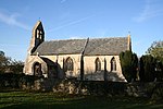
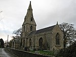
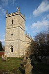
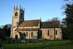
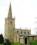
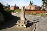
Church of St Oswald
Howell , Asgarby and Howell , North Kesteven Cross
10th century
1 February 1967
TF1350746256 53°00′06″N 0°18′36″W / 53.001604°N 0.310021°W / 53.001604; -0.310021 (Church of St Oswald)
1061833 Church of St Oswald More images
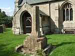
Churchyard Cross in the Churchyard of St Oswald's Church
Howell, Asgarby and Howell, North Kesteven
Cross
15th century
12 October 1988
TF1350646243 53°00′05″N 0°18′36″W / 53.001487°N 0.31004°W / 53.001487; -0.31004 (Churchyard Cross in the Churchyard of St Oswald's Church)
1168431 Churchyard Cross in the Churchyard of St Oswald's Church More images
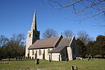
Church of St Hybald
Ashby de la Launde and Bloxholm , North KestevenParish Church
12th century
1 February 1967
TF0551054754 53°04′47″N 0°25′35″W / 53.079597°N 0.426359°W / 53.079597; -0.426359 (Church of St Hybald)
1307159 Church of St Hybald More images
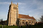
Parish Church of St Mary and All Saints
Aswarby and Swarby , North KestevenChurch
13th century
1 February 1967
TF0470740568 52°57′08″N 0°26′35″W / 52.952283°N 0.442938°W / 52.952283; -0.442938 (Parish Church of St Mary and All Saints)
1147542 Parish Church of St Mary and All Saints More images
Church of St Peter
Aubourn and Haddington , North KestevenParish Church
13th century
23 August 1967
SK9276762787 53°09′15″N 0°36′51″W / 53.154147°N 0.614207°W / 53.154147; -0.614207 (Church of St Peter)
1360541 Church of St Peter More images
Parish Church of St Thomas a Becket
Aunsby , Aunsby and Dembleby , North KestevenChurch
12th century
1 February 1967
TF0447038838 52°56′12″N 0°26′49″W / 52.936783°N 0.447021°W / 52.936783; -0.447021 (Parish Church of St Thomas a Becket)
1061790 Parish Church of St Thomas a Becket More images
Church of St Michael and All Angels
Bassingham , North KestevenParish Church
11th century
23 August 1967
SK9080659732 53°07′37″N 0°38′40″W / 53.127031°N 0.644388°W / 53.127031; -0.644388 (Church of St Michael and All Angels)
1061923 Church of St Michael and All Angels More images
Church of St Oswald
Blankney , North KestevenParish Church
12th century
1 February 1967
TF0682660003 53°07′35″N 0°24′18″W / 53.126501°N 0.404978°W / 53.126501; -0.404978 (Church of St Oswald)
1064285 Church of St Oswald More images
Church of All Saints
Branston and Mere , North KestevenSchoolroom
1836
23 August 1967
TF0213067313 53°11′35″N 0°28′22″W / 53.193106°N 0.4728°W / 53.193106; -0.4728 (Church of All Saints)
1360529 Church of All Saints More images
Lister Place, Gates and Gatepiers
Brant Broughton and Stragglethorpe , North KestevenHouse
c. 1700
17 June 1986
SK9157854087 53°04′34″N 0°38′04″W / 53.076171°N 0.634462°W / 53.076171; -0.634462 (Lister Place, Gates and Gatepiers)
1061928 Upload Photo
Quaker Meeting House and Attached Stable
Brant Broughton , Brant Broughton and Stragglethorpe Meeting Hall
1701
17 June 1986
SK9165454220 53°04′38″N 0°38′00″W / 53.077353°N 0.63329°W / 53.077353; -0.63329 (Quaker Meeting House and Attached Stable)
1061898 Quaker Meeting House and Attached Stable More images
The Priory, Gates and Gatepiers
Brant Broughton and Stragglethorpe, North Kesteven
House
1658
23 August 1967
SK9153554027 53°04′32″N 0°38′06″W / 53.075639°N 0.63512°W / 53.075639; -0.63512 (The Priory, Gates and Gatepiers)
1360527 Upload Photo
Coleby Hall
Coleby , North KestevenHouse
17th century
19 November 1951
SK9732260768 53°08′07″N 0°32′48″W / 53.135193°N 0.546727°W / 53.135193; -0.546727 (Coleby Hall)
1061979 Upload Photo
College Hall, Royal Air Force College Cranwell
Cranwell and Byard's Leap , North KestevenMilitary College
1929-33
7 December 1987
SK9997349919 53°02′14″N 0°30′38″W / 53.037214°N 0.510486°W / 53.037214; -0.510486 (College Hall, Royal Air Force College Cranwell)
1254079 College Hall, Royal Air Force College Cranwell More images
Culverthorpe Temple
Culverthorpe Park, Culverthorpe and Kelby , North Kesteven
Temple
c. 1740
11 January 1990
TF0231540456 52°57′06″N 0°28′43″W / 52.951737°N 0.478563°W / 52.951737; -0.478563 (Culverthorpe Temple)
1308442 Culverthorpe Temple
The Garages to Culverthorpe Hall
Culverthorpe and Kelby, North Kesteven
Service Wing
Late 17th century
23 November 1951
TF0206240354 52°57′03″N 0°28′56″W / 52.950869°N 0.482359°W / 52.950869; -0.482359 (The Garages to Culverthorpe Hall)
1360582 The Garages to Culverthorpe Hall
The Stables to Culverthorpe Hall
Culverthorpe Park, Culverthorpe and Kelby, North Kesteven
Stable
Late 17th century
23 November 1951
TF0197440347 52°57′03″N 0°29′01″W / 52.950822°N 0.483671°W / 52.950822; -0.483671 (The Stables to Culverthorpe Hall)
1147621 Upload Photo
Gatehouse to Doddington Hall
Doddington and Whisby , North KestevenGatehouse
16th century
22 December 1983
SK9005470080 53°13′13″N 0°39′10″W / 53.22015°N 0.652713°W / 53.22015; -0.652713 (Gatehouse to Doddington Hall)
1360505 Gatehouse to Doddington Hall More images
Walls and Gates to Doddington Hall
Doddington and Whisby, North Kesteven
Gate Pier
16th century
22 December 1983
SK8994370086 53°13′13″N 0°39′16″W / 53.220223°N 0.654373°W / 53.220223; -0.654373 (Walls and Gates to Doddington Hall)
1061959 Upload Photo
Folly Facade to The Jungle
Eagle and Swinethorpe , North KestevenFarmhouse
c. 1820
7 September 1977
SK8835268597 53°12′26″N 0°40′43″W / 53.207109°N 0.678607°W / 53.207109; -0.678607 (Folly Facade to The Jungle)
1061998 Folly Facade to The Jungle More images
Church of St Mary
Evedon , Ewerby and Evedon , North KestevenParish Church
13th century
1 February 1967
TF0928347594 53°00′52″N 0°22′21″W / 53.014504°N 0.372484°W / 53.014504; -0.372484 (Church of St Mary)
1168557 Church of St Mary More images
All Saints Parish Church
Harmston , North KestevenParish Church
11th century
23 August 1967
SK9727162275 53°08′55″N 0°32′49″W / 53.148744°N 0.547033°W / 53.148744; -0.547033 (All Saints Parish Church)
1164892 All Saints Parish Church More images
Harmston Hall
Harmston, North Kesteven
Country House
1710
23 August 1967
SK9699462141 53°08′51″N 0°33′04″W / 53.14759°N 0.551213°W / 53.14759; -0.551213 (Harmston Hall)
1317567 Upload Photo
Manor Farmhouse
Helpringham , North KestevenHouse
Late 17th century
12 October 1988
TF1400740730 52°57′07″N 0°18′16″W / 52.951845°N 0.304518°W / 52.951845; -0.304518 (Manor Farmhouse)
1061814 Upload Photo
Church of St Denys
Kirkby la Thorpe , North KestevenParish Church
12th century
1 February 1967
TF0990746092 53°00′03″N 0°21′49″W / 53.00088°N 0.363698°W / 53.00088; -0.363698 (Church of St Denys)
1360592 Church of St Denys More images
The Grange
Kirkby la Thorpe, North Kesteven
House
c. 1620
1 February 1967
TF0979146190 53°00′06″N 0°21′55″W / 53.001784°N 0.365392°W / 53.001784; -0.365392 (The Grange)
1168986 Upload Photo
Leadenham House
Leadenham, North Kesteven
Country House
1790-9
23 August 1967
SK9493651823 53°03′19″N 0°35′06″W / 53.05524°N 0.58502°W / 53.05524; -0.58502 (Leadenham House)
1061877 Leadenham House More images
The Old Hall
Leadenham , North KestevenCountry House
c. 1600
23 August 1967
SK9518452501 53°03′41″N 0°34′52″W / 53.061289°N 0.581121°W / 53.061289; -0.581121 (The Old Hall)
1061869 Upload Photo
The Manor
Leasingham , North KestevenCountry House
c. 1750
1 February 1967
TF0572648348 53°01′19″N 0°25′31″W / 53.021992°N 0.425236°W / 53.021992; -0.425236 (The Manor)
1261371 Upload Photo
Church of St Wilfred
Metheringham , North KestevenParish Church
12th century
2 May 1985
TF0701761288 53°08′17″N 0°24′06″W / 53.138009°N 0.401696°W / 53.138009; -0.401696 (Church of St Wilfred)
1165640 Church of St Wilfred More images
Church of All Saints
Nocton , North KestevenParish Church
1862
23 August 1967
TF0606764125 53°09′49″N 0°24′54″W / 53.163691°N 0.414953°W / 53.163691; -0.414953 (Church of All Saints)
1061911 Church of All Saints More images
Field House and Wall to Nocton Hall
Nocton, North Kesteven
House
Late 18th century
4 December 1979
TF0594664261 53°09′54″N 0°25′00″W / 53.164937°N 0.416717°W / 53.164937; -0.416717 (Field House and Wall to Nocton Hall)
1061910 Upload Photo
Rowston Manor
Rowston , North KestevenHouse
1741
1 February 1967
TF0835656408 53°05′38″N 0°23′00″W / 53.09389°N 0.383335°W / 53.09389; -0.383335 (Rowston Manor)
1280659 Upload Photo
Church of the Holy Cross
Scopwick , North KestevenParish Church
12th century
1 February 1967
TF0698558056 53°06′32″N 0°24′12″W / 53.108975°N 0.403251°W / 53.108975; -0.403251 (Church of the Holy Cross)
1064299 Church of the Holy Cross More images
Cross Base
Silk Willoughby , North KestevenCross
14th century
1 February 1967
TF0565042969 52°58′25″N 0°25′41″W / 52.973673°N 0.428125°W / 52.973673; -0.428125 (Cross Base)
1360612 Cross Base More images
Carre's Hospital. Pump and Sun-dial in the Forecourt and Wall Along Carre Street
Sleaford , North KestevenHouse
1841-1846
16 July 1949
TF0691745851 52°59′58″N 0°24′30″W / 52.999319°N 0.408313°W / 52.999319; -0.408313 (Carre's Hospital. Pump and Sun-dial in the Forecourt and Wall Along Carre Street)
1062145 Carre's Hospital. Pump and Sun-dial in the Forecourt and Wall Along Carre Street More images
Church of St Botolph
Quarrington , Sleaford, North KestevenChurch
Late 12th century
16 July 1949
TF0541144468 52°59′14″N 0°25′52″W / 52.98719°N 0.431195°W / 52.98719; -0.431195 (Church of St Botolph)
1360452 Church of St Botolph More images
Manor House , Rhodes House, Wall and Gate Piers to Cobbled Yard and Garden Wall to No 33
Sleaford, North Kesteven
House
16th century
16 July 1949
TF0676846001 53°00′03″N 0°24′38″W / 53.000696°N 0.410483°W / 53.000696; -0.410483 (Manor House, Rhodes House, Wall and Gate Piers to Cobbled Yard and Garden Wall to No 33)
1168499 Manor House , Rhodes House, Wall and Gate Piers to Cobbled Yard and Garden Wall to No 33More images
Town Hall (Sessions House)
Sleaford, North Kesteven
Town Hall
1831
16 July 1949
TF0679545870 52°59′58″N 0°24′36″W / 52.999514°N 0.410124°W / 52.999514; -0.410124 (Town Hall (Sessions House))
1307024 Town Hall (Sessions House) More images
Vicarage
Sleaford, North Kesteven
Vicarage
15th century
16 July 1949
TF0686845924 53°00′00″N 0°24′32″W / 52.999985°N 0.409019°W / 52.999985; -0.409019 (Vicarage)
1168389 Vicarage More images
Church of St Michael
South Hykeham , North KestevenParish Church
13th century
22 December 1983
SK9368564539 53°10′11″N 0°36′00″W / 53.169731°N 0.599972°W / 53.169731; -0.599972 (Church of St Michael)
1061957 Church of St Michael More images
Church of St Mary and All Saints
South Kyme , North KestevenParish Church
1890
1 February 1967
TF1685449788 53°01′57″N 0°15′32″W / 53.03262°N 0.258893°W / 53.03262; -0.258893 (Church of St Mary and All Saints)
1061749 Church of St Mary and All Saints More images
Church of All Saints
Swinderby , North KestevenChurch
12th century
23 August 1967
SK8690263179 53°09′31″N 0°42′06″W / 53.158658°N 0.701782°W / 53.158658; -0.701782 (Church of All Saints)
1165316 Church of All Saints More images
Church of St Germain
Thurlby , North KestevenParish Church
11th century
23 August 1967
SK9089561713 53°08′41″N 0°38′33″W / 53.144818°N 0.642497°W / 53.144818; -0.642497 (Church of St Germain)
1061972 Church of St Germain More images
Church of St Andrew
Timberland , North KestevenChurch
C20
1 February 1967
TF1217058242 53°06′34″N 0°19′33″W / 53.109582°N 0.325765°W / 53.109582; -0.325765 (Church of St Andrew)
1205586 Church of St Andrew More images
Church of St John the Evangelist
Washingborough , North KestevenParish Church
13th century
23 August 1967
TF0185270632 53°13′23″N 0°28′33″W / 53.222983°N 0.475902°W / 53.222983; -0.475902 (Church of St John the Evangelist)
1205149 Church of St John the Evangelist More images
Welbourn Manor
Welbourn , North KestevenCountry House
Early 14th century
19 November 1951
SK9663753982 53°04′28″N 0°33′32″W / 53.074337°N 0.559003°W / 53.074337; -0.559003 (Welbourn Manor)
1360567 Welbourn Manor More images
Wellingore Hall and attached R.C. Church of St Augustine
Wellingore , North KestevenApartment
c. 1760
23 August 1967
SK9831256533 53°05′49″N 0°32′00″W / 53.096956°N 0.53323°W / 53.096956; -0.53323 (Wellingore Hall and attached R.C. Church of St Augustine)
1147748 Wellingore Hall and attached R.C. Church of St Augustine More images
