Name
Location
Type
Completed Date designated
Grid ref. Entry number Image
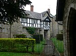
Remains of Abbey Guest House
Shrewsbury , ShropshireAbbey
Late 13th century
30 May 1969
SJ4976812409 52°42′25″N 2°44′42″W / 52.707004°N 2.744896°W / 52.707004; -2.744896 (Remains of Abbey Guest House)
1246394 Remains of Abbey Guest House More images
Abbey House
Shrewsbury, Shropshire
House
c. 1720
30 May 1969
SJ4998712506 52°42′28″N 2°44′30″W / 52.707896°N 2.74167°W / 52.707896; -2.74167 (Abbey House)
1271372 Abbey House More images
Abcott Manor
Abcott , Clungunford , ShropshireHouse
C20
1 December 1951
SO3920478756 52°24′12″N 2°53′42″W / 52.40342°N 2.895051°W / 52.40342; -2.895051 (Abcott Manor)
1176056 Abcott Manor
Acton Burnell Hall (Concord College)
Acton Burnell , ShropshireHouse
1731
29 January 1952
SJ5342202017 52°36′50″N 2°41′22″W / 52.613918°N 2.689348°W / 52.613918; -2.689348 (Acton Burnell Hall (Concord College))
1055567 Acton Burnell Hall (Concord College)More images
Acton Reynald Hall
Acton Reynald , Moreton Corbet and Lee Brockhurst , ShropshireCountry House
early-mid 17th century
28 October 1960
SJ5347023238 52°48′17″N 2°41′30″W / 52.804676°N 2.69165°W / 52.804676; -2.69165 (Acton Reynald Hall)
1055371 Acton Reynald Hall More images
Acton Scott Hall including Service Court and Railings
Acton Scott , ShropshireHouse
Medieval
12 November 1954
SO4557689522 52°30′03″N 2°48′11″W / 52.500869°N 2.80316°W / 52.500869; -2.80316 (Acton Scott Hall including Service Court and Railings)
1383205 Acton Scott Hall including Service Court and Railings More images
Albright Hussey
Pimhill , ShropshireHotel
Mid-late 16th century
29 January 1952
SJ5020117591 52°45′13″N 2°44′21″W / 52.753624°N 2.739276°W / 52.753624; -2.739276 (Albright Hussey)
1295586 Albright Hussey More images
Albrighton Hall
Albrighton , Pimhill , ShropshireCountry House
c. 1675
11 July 1985
SJ4962718166 52°45′31″N 2°44′52″W / 52.758739°N 2.747868°W / 52.758739; -2.747868 (Albrighton Hall)
1295552 Albrighton Hall More images
Aldenham Park
Morville , ShropshireHouse
Earlier Queen Anne
29 November 1951
SO6707695366 52°33′18″N 2°29′13″W / 52.555131°N 2.487037°W / 52.555131; -2.487037 (Aldenham Park)
1188890 Aldenham Park More images
Alderton Hall
Great Ness , ShropshireFarmhouse
1591
27 May 1953
SJ3855117345 52°45′01″N 2°54′43″W / 52.750212°N 2.911818°W / 52.750212; -2.911818 (Alderton Hall)
1055140 Upload Photo
Alkington Hall
Alkington , Whitchurch Rural, ShropshireFarmhouse
1592
28 October 1960
SJ5305839267 52°56′55″N 2°42′00″W / 52.94872°N 2.700078°W / 52.94872; -2.700078 (Alkington Hall)
1055994 Alkington Hall More images
Apley Hall
Stockton , ShropshireCountry House
18th century
29 September 1951
SO7117798224 52°34′52″N 2°25′36″W / 52.581057°N 2.426802°W / 52.581057; -2.426802 (Apley Hall)
1294171 Apley Hall More images
Apprentice House of former Ditherington Flax Mill
Ditherington , Shrewsbury, ShropshireApprentice House
c. 1812
10 September 1987
SJ4989013893 52°43′13″N 2°44′36″W / 52.720355°N 2.743317°W / 52.720355; -2.743317 (Apprentice House of former Ditherington Flax Mill)
1254855 Apprentice House of former Ditherington Flax Mill More images
Archway approx. one Metre to North East of Brand Hall
Norton in Hales , ShropshireArchway
c. 1700
5 June 1987
SJ6921838370 52°56′31″N 2°27′34″W / 52.941831°N 2.459496°W / 52.941831; -2.459496 (Archway approx. one Metre to North East of Brand Hall)
1056064 Archway approx. one Metre to North East of Brand Hall
Archway approx. one Metre to South East of Brand Hall
Norton in Hales, Shropshire
Archway
c. 1700
5 June 1987
SJ6921038346 52°56′30″N 2°27′35″W / 52.941615°N 2.459613°W / 52.941615; -2.459613 (Archway approx. one Metre to South East of Brand Hall)
1177483 Archway approx. one Metre to South East of Brand Hall
Ash Hall
Ash Magna , Whitchurch Rural , ShropshireFarmhouse
c1710-20
28 October 1960
SJ5706339854 52°57′16″N 2°38′26″W / 52.954333°N 2.640554°W / 52.954333; -2.640554 (Ash Hall)
1366504 Upload Photo
Ashfield Hall
Much Wenlock , ShropshireHouse
15th century
24 October 1950
SO6220399839 52°35′42″N 2°33′34″W / 52.595023°N 2.559418°W / 52.595023; -2.559418 (Ashfield Hall)
1294389 Ashfield Hall More images
Ashford Hall
Ashford Bowdler , ShropshireCountry House
c. 1760
12 November 1954
SO5133971148 52°20′10″N 2°42′56″W / 52.336245°N 2.715592°W / 52.336245; -2.715592 (Ashford Hall)
1383604 Upload Photo
Astley House with adjoining Screen Wall and Coach House
Astley , ShropshireHouse
Late 18th century
29 January 1952
SJ5280718640 52°45′48″N 2°42′03″W / 52.763288°N 2.700819°W / 52.763288; -2.700819 (Astley House with adjoining Screen Wall and Coach House)
1366892 Upload Photo
Aston Hall
Shifnal , ShropshireHouse
c. 1720
26 May 1955
SJ7560308046 52°40′10″N 2°21′44″W / 52.66957°N 2.362213°W / 52.66957; -2.362213 (Aston Hall)
1308059 Aston Hall More images
Aston Hall and Wall and Gatepiers to South East and Gatepiers to North East
Aston Munslow , ShropshireManor House
16th century
12 November 1954
SO5089286615 52°28′31″N 2°43′28″W / 52.475244°N 2.724426°W / 52.475244; -2.724426 (Aston Hall and Wall and Gatepiers to South East and Gatepiers to North East)
1383344 Upload Photo
Atcham Bridge
Atcham , ShropshireRoad Bridge
1769-1771
17 February 1985
SJ5405209307 52°40′46″N 2°40′52″W / 52.679502°N 2.681062°W / 52.679502; -2.681062 (Atcham Bridge)
1176588 Atcham Bridge More images
Attached Railings to 1-8, Claremount Bank
Shrewsbury, Shropshire
Terrace
c. 1830
10 January 1953
SJ4882412596 52°42′31″N 2°45′32″W / 52.708596°N 2.758896°W / 52.708596; -2.758896 (Attached Railings to 1-8, Claremount Bank)
1271084 Upload Photo
Attached Railings to 6, Quarry Place
Shrewsbury, Shropshire
House
Late 18th century
10 January 1953
SJ4882712330 52°42′22″N 2°45′32″W / 52.706206°N 2.75881°W / 52.706206; -2.75881 (Attached Railings to 6, Quarry Place)
1254740 Attached Railings to 6, Quarry Place More images
Banqueting House approx. 80 Metres to South East of Eyton Farmhouse
Eyton on Severn , Wroxeter and Uppington , ShropshireBanqueting House
c. 1607
13 June 1958
SJ5729006117 52°39′04″N 2°37′58″W / 52.651092°N 2.632757°W / 52.651092; -2.632757 (Banqueting House approx. 80 Metres to South East of Eyton Farmhouse)
1267039 Upload Photo
Barn adjoining Lower Spoad Farmhouse to North East
Newcastle on Clun , ShropshireBarn
14th century or 15th century
21 March 1968
SO2569982065 52°25′53″N 3°05′39″W / 52.431493°N 3.094258°W / 52.431493; -3.094258 (Barn adjoining Lower Spoad Farmhouse to North East)
1174924 Upload Photo
Barns to west of Hall Farm House
Aston Eyre , ShropshireHouse
15th century
9 March 1970
SO6528194145 52°32′39″N 2°30′48″W / 52.544043°N 2.513383°W / 52.544043; -2.513383 (Barns to west of Hall Farm House)
1053205 Barns to west of Hall Farm House
Batch Farm House
Sidbury , ShropshireFarmhouse
16th century
9 March 1970
SO6805485221 52°27′50″N 2°28′18″W / 52.46399°N 2.471635°W / 52.46399; -2.471635 (Batch Farm House)
1294199 Upload Photo
Baxter's House
Eaton Constantine , Leighton and Eaton Constantine , ShropshireFarmhouse
Late 15th century
24 February 1986
SJ5991306248 52°39′09″N 2°35′38″W / 52.65247°N 2.594003°W / 52.65247; -2.594003 (Baxter's House)
1055263 Upload Photo
Beech House British Waterways Board Canal Maintenance Depot, Beech House (nos. 2-6), Shropshire Union Canal (South East Side), Llangollen branch.
Birch, Ellesmere Rural , Shropshire
Flats
1806
25 April 1988
SJ4009034256 52°54′09″N 2°53′32″W / 52.902386°N 2.892129°W / 52.902386; -2.892129 (Beech House British Waterways Board Canal Maintenance Depot, Beech House (nos. 2-6), Shropshire Union Canal (South East Side), Llangollen branch.)
1176445 Beech House British Waterways Board Canal Maintenance Depot, Beech House (nos. 2-6), Shropshire Union Canal (South East Side), Llangollen branch.
Belmont House
Shrewsbury, Shropshire
House
Late 17th century
10 January 1953
SJ4918712277 52°42′21″N 2°45′13″W / 52.705763°N 2.753474°W / 52.705763; -2.753474 (Belmont House)
1271319 Upload Photo
Belswardyne Hall
Cressage , ShropshireFarmhouse
Late 18th century
24 February 1986
SJ6026903285 52°37′33″N 2°35′18″W / 52.625861°N 2.588383°W / 52.625861; -2.588383 (Belswardyne Hall)
1055283 Upload Photo
Benthall Farmhouse
Alberbury with Cardeston , ShropshireFarmhouse
1660
18 March 1986
SJ3946213965 52°43′12″N 2°53′52″W / 52.719934°N 2.897699°W / 52.719934; -2.897699 (Benthall Farmhouse)
1366881 Upload Photo
Berwick Chapel
Pimhill , ShropshireChapel
1670
13 June 1958
SJ4732314823 52°43′42″N 2°46′53″W / 52.72847°N 2.781468°W / 52.72847; -2.781468 (Berwick Chapel)
1366946 Upload Photo
Berwick House
Pimhill, Shropshire
Country House
Early 18th century
29 January 1952
SJ4705114794 52°43′41″N 2°47′08″W / 52.728183°N 2.78549°W / 52.728183; -2.78549 (Berwick House)
1055164 Upload Photo
Bicton Grove Farmhouse
Bicton , ShropshireFarmhouse
c. 1700
27 November 1987
SJ4512315020 52°43′48″N 2°48′51″W / 52.730022°N 2.814074°W / 52.730022; -2.814074 (Bicton Grove Farmhouse)
1366919 Upload Photo
Binnal
Astley Abbotts , ShropshireHouse
16th century
9 March 1970
SO7017796862 52°34′08″N 2°26′29″W / 52.568759°N 2.441436°W / 52.568759; -2.441436 (Binnal)
1307770 Upload Photo
Binweston Farmhouse
Binweston, Worthen with Shelve , Shropshire
House
Early 17th century
21 March 1968
SJ3011504101 52°37′49″N 3°02′02″W / 52.630146°N 3.033961°W / 52.630146; -3.033961 (Binweston Farmhouse)
1055037 Upload Photo
Birch Farm House
Kinlet , ShropshireFarmhouse
Early 18th century
9 March 1970
SO7336880862 52°25′30″N 2°23′35″W / 52.425089°N 2.393072°W / 52.425089; -2.393072 (Birch Farm House)
1294576 Upload Photo
Bishton Manor
Boningale , ShropshireJettied House
15th century
26 September 1984
SJ8041301751 52°36′47″N 2°17′27″W / 52.613176°N 2.290709°W / 52.613176; -2.290709 (Bishton Manor)
1274091 Upload Photo
Bitterley Court
Bitterley , ShropshireManor House
Mid 17th century core
12 November 1954
SO5709377248 52°23′30″N 2°37′55″W / 52.391563°N 2.631932°W / 52.391563; -2.631932 (Bitterley Court)
1383649 Bitterley Court More images
Blacksmith's and Joiner's Shop, British Waterways Board Canal Maintenance Depot
Birch, Ellesmere Rural, Shropshire
Workshops
c. 1806
25 April 1988
SJ4004134182 52°54′06″N 2°53′34″W / 52.901716°N 2.892844°W / 52.901716; -2.892844 (Blacksmith's and Joiner's Shop, British Waterways Board Canal Maintenance Depot)
1176422 Upload Photo
Blunden Hall and Old Hall Cottage
Bishop's Castle , ShropshireHouse
17th century
28 July 1950
SO3253488383 52°29′21″N 2°59′42″W / 52.489171°N 2.995025°W / 52.489171; -2.995025 (Blunden Hall and Old Hall Cottage)
1054574 Upload Photo
Boreatton Hall
Baschurch, Shropshire
House
Earlier house on site
27 May 1953
SJ4133322905 52°48′02″N 2°52′18″W / 52.800497°N 2.871605°W / 52.800497; -2.871605 (Boreatton Hall)
1055962 Upload Photo
Boscobel House
Boscobel , ShropshireFarmhouse
16th century
29 September 1951
SJ8375208243 52°40′18″N 2°14′30″W / 52.671648°N 2.241719°W / 52.671648; -2.241719 (Boscobel House)
1273964 Boscobel House More images
Bowdler's House
Woolstaston , ShropshireFarmhouse
Late 14th century
6 January 1986
SO4524498384 52°34′50″N 2°48′34″W / 52.580496°N 2.809515°W / 52.580496; -2.809515 (Bowdler's House)
1055605 Bowdler's House More images
Boycott Hall Farmhouse
Pontesbury , ShropshireFarmhouse
Late 15th century
10 March 1986
SJ3890007509 52°39′43″N 2°54′17″W / 52.66184°N 2.904817°W / 52.66184; -2.904817 (Boycott Hall Farmhouse)
1055688 Upload Photo
Brand Hall
Norton in Hales , ShropshireCountry House
17th century
10 February 1959
SJ6920638360 52°56′30″N 2°27′35″W / 52.94174°N 2.459674°W / 52.94174; -2.459674 (Brand Hall)
1366457 Brand Hall More images
Bridge Number 438 (Belvidere Bridge )
Shrewsbury, Shropshire
Railway Bridge
1848
3 April 1985
SJ5194812526 52°42′30″N 2°42′46″W / 52.708254°N 2.712651°W / 52.708254; -2.712651 (Bridge Number 438 (Belvidere Bridge))
1177239 Bridge Number 438 (Belvidere Bridge ) More images
British Waterways Board Canal Maintenance Depot, Shropshire Union Canal (South East Side) (Llangollen Branch)
Birch, Ellesmere Rural, Shropshire
Workshops
c. 1806
25 April 1988
SJ4005734227 52°54′08″N 2°53′33″W / 52.902122°N 2.892615°W / 52.902122; -2.892615 (British Waterways Board Canal Maintenance Depot, Shropshire Union Canal (South East Side) (Llangollen Branch))
1366122 Upload Photo
British Waterways Board Canal Maintenance Depot, Shropshire Union Canal (south East Side) (Llangollen Branch) Timber Store (pine loft)
Birch, Ellesmere Rural, Shropshire
Steam Engine
c. 1806
25 April 1988
SJ4006634180 52°54′06″N 2°53′33″W / 52.901701°N 2.892472°W / 52.901701; -2.892472 (British Waterways Board Canal Maintenance Depot, Shropshire Union Canal (south East Side) (Llangollen Branch) Timber Store (pine loft))
1055924 Upload Photo
Brogyntyn Hall
Brogyntyn Park, Selattyn and Gobowen , Shropshire
Country House
Early 18th century
19 January 1952
SJ2792431138 52°52′22″N 3°04′20″W / 52.872866°N 3.072278°W / 52.872866; -3.072278 (Brogyntyn Hall)
1367373 Brogyntyn Hall More images
Brook House
Ashford Carbonell , ShropshireTimber Framed House
1677
12 November 1954
SO5249370645 52°19′55″N 2°41′55″W / 52.331825°N 2.698585°W / 52.331825; -2.698585 (Brook House)
1383624 Upload Photo
Brook House
Middleton , Bitterley , ShropshireFarmhouse
1974
15 March 1974
SO5413477600 52°23′40″N 2°40′32″W / 52.394487°N 2.675459°W / 52.394487; -2.675459 (Brook House)
1383677 Upload Photo
Brookgate Farmhouse
Plealey , Pontesbury , ShropshireKitchen
14th century or 15th century
2 July 1971
SJ4250906913 52°39′25″N 2°51′05″W / 52.656879°N 2.851359°W / 52.656879; -2.851359 (Brookgate Farmhouse)
1366680 Upload Photo
Buntingsdale Hall
Sutton upon Tern , ShropshireCountry House
1721
14 February 1979
SJ6547532538 52°53′21″N 2°30′52″W / 52.889179°N 2.514569°W / 52.889179; -2.514569 (Buntingsdale Hall)
1293695 Buntingsdale Hall More images
Burford House and Garden Wall attached to the South East
Burford , ShropshireHouse
Early-mid 18th century
12 November 1954
SO5821567973 52°18′30″N 2°36′51″W / 52.308271°N 2.614288°W / 52.308271; -2.614288 (Burford House and Garden Wall attached to the South East)
1383418 Burford House and Garden Wall attached to the South EastMore images
Cantlop Bridge
Cantlop , Berrington , ShropshireBridge
1818
8 May 1972
SJ5173806244 52°39′06″N 2°42′53″W / 52.651767°N 2.714836°W / 52.651767; -2.714836 (Cantlop Bridge)
1366715 Cantlop Bridge More images
Castle Farmhouse including attached Outbuildings
Cheney Longville , Wistanstow , ShropshireFarmhouse
14th century
12 November 1954
SO4172884776 52°27′28″N 2°51′32″W / 52.45781°N 2.859007°W / 52.45781; -2.859007 (Castle Farmhouse including attached Outbuildings)
1269816 Upload Photo
Castle Gates House
Shrewsbury, Shropshire
House
Later
10 January 1953
SJ4941412763 52°42′37″N 2°45′01″W / 52.710153°N 2.75019°W / 52.710153; -2.75019 (Castle Gates House)
1246555 Castle Gates House More images
Castle Lodge and attached Railings
Ludlow, Shropshire
House
Late C16/Early 17th century
15 April 1954
SO5099074584 52°22′02″N 2°43′16″W / 52.367102°N 2.721216°W / 52.367102; -2.721216 (Castle Lodge and attached Railings)
1282027 Castle Lodge and attached Railings More images
Catherton Cottage
Hopton Wafers , ShropshireHouse
Late 14th century or early 15th century
29 February 2000
SO6532678386 52°24′09″N 2°30′40″W / 52.402378°N 2.511074°W / 52.402378; -2.511074 (Catherton Cottage)
1383536 Upload Photo
Chapel House
Dinham, Ludlow, Shropshire
House
1993
15 April 1954
SO5088574447 52°21′57″N 2°43′22″W / 52.365861°N 2.722738°W / 52.365861; -2.722738 (Chapel House)
1210446 Chapel House More images
Charlton Hill House
Charlton Hill, Wroxeter and Uppington , Shropshire
House
c. 1660
17 February 1985
SJ5879007368 52°39′45″N 2°36′39″W / 52.662454°N 2.610742°W / 52.662454; -2.610742 (Charlton Hill House)
1267155 Upload Photo
Charlton House & Garden House & Ludford House & St Giles House
Ludford , ShropshireHouse
16th century
15 November 1954
SO5126674084 52°21′45″N 2°43′02″W / 52.362632°N 2.71709°W / 52.362632; -2.71709 (Charlton House & Garden House & Ludford House & St Giles House)
1291720 Charlton House & Garden House & Ludford House & St Giles House More images
Chatwall Hall
Chatwall , Cardington , ShropshireFarmhouse
Mid 17th century
29 January 1952
SO5141997544 52°34′25″N 2°43′06″W / 52.573534°N 2.71827°W / 52.573534; -2.71827 (Chatwall Hall)
1055617 Chatwall Hall More images
Chirk Aqueduct (that part in Weston Rhyn CP)
Shropshire Union Canal , Weston Rhyn , ShropshireAqueduct
1796-1801
2 September 1987
SJ2872437213 52°55′39″N 3°03′42″W / 52.927574°N 3.061729°W / 52.927574; -3.061729 (Chirk Aqueduct (that part in Weston Rhyn CP))
1295150 Chirk Aqueduct (that part in Weston Rhyn CP)More images
Chirk Viaduct
Weston Rhyn, Shropshire
Railway Viaduct
1846-8
2 September 1987
SJ2869437205 52°55′39″N 3°03′44″W / 52.927498°N 3.062174°W / 52.927498; -3.062174 (Chirk Viaduct)
1295219 Chirk Viaduct More images
Church Farmhouse
Edgton , ShropshireFarmhouse
Late 16th century
21 March 1968
SO3871085742 52°27′58″N 2°54′13″W / 52.466162°N 2.903595°W / 52.466162; -2.903595 (Church Farmhouse)
1307992 Upload Photo
Church of All Saints
Baschurch , ShropshireParish Church
Late 12th century
27 May 1953
SJ4223721879 52°47′29″N 2°51′29″W / 52.791373°N 2.858017°W / 52.791373; -2.858017 (Church of All Saints)
1176049 Church of All Saints More images
Church of All Saints
Broseley , ShropshireChurch
1845
24 October 1950
SJ6789001534 52°36′38″N 2°28′32″W / 52.610627°N 2.475632°W / 52.610627; -2.475632 (Church of All Saints)
1053895 Church of All Saints More images
Church of All Saints
Clive , ShropshireParish Church
c. 1190
28 October 1960
SJ5147924028 52°48′42″N 2°43′17″W / 52.811602°N 2.721299°W / 52.811602; -2.721299 (Church of All Saints)
1055420 Church of All Saints More images
Church of All Saints
Culmington , ShropshireParish Church
Anglo Saxon
12 November 1954
SO4936181962 52°26′00″N 2°44′47″W / 52.433276°N 2.746257°W / 52.433276; -2.746257 (Church of All Saints)
1269907 Church of All Saints More images
Church of All Saints
Neen Sollars , ShropshireChurch
Late 13th century
12 November 1954
SO6600072274 52°20′51″N 2°30′02″W / 52.347475°N 2.500546°W / 52.347475; -2.500546 (Church of All Saints)
1383573 Church of All Saints More images
Church of All Saints
Norbury , ShropshireParish Church
Late 13th century
21 March 1968
SO3640492835 52°31′47″N 2°56′20″W / 52.529655°N 2.938891°W / 52.529655; -2.938891 (Church of All Saints)
1367199 Church of All Saints More images
Church of Holy Trinity
Bourton , Much Wenlock , ShropshireChurch
Early 18th century
24 October 1950
SO5971296359 52°33′49″N 2°35′45″W / 52.56356°N 2.595766°W / 52.56356; -2.595766 (Church of Holy Trinity)
1189037 Church of Holy Trinity More images
Church of Holy Trinity
Sidbury , ShropshireChurch
1734
9 March 1970
SO6838385773 52°28′08″N 2°28′01″W / 52.468971°N 2.466845°W / 52.468971; -2.466845 (Church of Holy Trinity)
1053776 Church of Holy Trinity More images
Church of Holy Trinity
Wheathill , ShropshireChurch
12th century
12 November 1954
SO6219582152 52°26′10″N 2°33′27″W / 52.436025°N 2.557519°W / 52.436025; -2.557519 (Church of Holy Trinity)
1383755 Church of Holy Trinity More images
Church of Saint Chad
Montford , ShropshireParish Church
1735-1738
13 June 1958
SJ4188814776 52°43′39″N 2°51′43″W / 52.72749°N 2.86193°W / 52.72749; -2.86193 (Church of Saint Chad)
1055118 Church of Saint Chad More images
Church of Saint Chad and attached Archway
Norton in Hales , ShropshireTower
Late 14th century
5 June 1987
SJ7035538676 52°56′41″N 2°26′33″W / 52.944646°N 2.442606°W / 52.944646; -2.442606 (Church of Saint Chad and attached Archway)
1366459 Church of Saint Chad and attached Archway More images
Church of Saint John the Baptist
Ightfield , ShropshireParish Church
Late 15th century
1 March 1988
SJ5924438672 52°56′38″N 2°36′29″W / 52.943879°N 2.607944°W / 52.943879; -2.607944 (Church of Saint John the Baptist)
1366502 Church of Saint John the Baptist More images
Church of Saint Margaret
Moreton Say , ShropshireTower
1769
10 February 1959
SJ6300334460 52°54′23″N 2°33′05″W / 52.906291°N 2.551527°W / 52.906291; -2.551527 (Church of Saint Margaret)
1056059 Church of Saint Margaret More images
Church of Saint Martin
Little Ness , ShropshireChapel of Ease
Late 12th century
27 May 1953
SJ4075319893 52°46′24″N 2°52′47″W / 52.77336°N 2.879661°W / 52.77336; -2.879661 (Church of Saint Martin)
1055114 Church of Saint Martin More images
Church of Saint Martin
Preston Gubbals , Pimhill, ShropshireChapel of Ease
12th century
13 June 1958
SJ4918819613 52°46′18″N 2°45′17″W / 52.771705°N 2.754598°W / 52.771705; -2.754598 (Church of Saint Martin)
1175242 Church of Saint Martin More images
Church of Saint Mary
Market Drayton , ShropshireTower
14th century
7 May 1952
SJ6759234071 52°54′11″N 2°29′00″W / 52.903091°N 2.48326°W / 52.903091; -2.48326 (Church of Saint Mary)
1366835 Church of Saint Mary More images
Church of Saint Mary
Shrawardine , Montford, ShropshireChurch
1213
27 November 1987
SJ3994815278 52°43′54″N 2°53′27″W / 52.73179°N 2.890745°W / 52.73179; -2.890745 (Church of Saint Mary)
1366943 Church of Saint Mary More images
Church of Saint Peter and Saint Paul
Fitz , Pimhill , ShropshireParish Church
c. 1722
13 June 1958
SJ4487717840 52°45′19″N 2°49′05″W / 52.755344°N 2.818191°W / 52.755344; -2.818191 (Church of Saint Peter and Saint Paul)
1366947 Church of Saint Peter and Saint Paul More images
Church of St Alkmund
Shrewsbury, Shropshire
Parish Church
15th century
10 January 1953
SJ4927112487 52°42′28″N 2°45′08″W / 52.707659°N 2.752263°W / 52.707659; -2.752263 (Church of St Alkmund)
1254774 Church of St Alkmund More images
Church of St Andrew
Ashford Bowdler , ShropshireChurch
12th century
12 November 1954
SO5194170553 52°19′51″N 2°42′24″W / 52.33095°N 2.706672°W / 52.33095; -2.706672 (Church of St Andrew)
1383609 Church of St Andrew More images
Church of St Andrew
Quatt , Quatt Malvern , ShropshireChurch
12th century origins
9 March 1970
SO7562488206 52°29′28″N 2°21′38″W / 52.491216°N 2.360436°W / 52.491216; -2.360436 (Church of St Andrew)
1367569 Church of St Andrew More images
Church of St Calixtus
Astley Abbotts , ShropshireChurch
1633
9 March 1970
SO7085896237 52°33′47″N 2°25′53″W / 52.563177°N 2.431334°W / 52.563177; -2.431334 (Church of St Calixtus)
1367834 Church of St Calixtus More images
Church of St Catherine
Tugford , Abdon , ShropshireChurch
12th century
12 November 1954
SO5571087060 52°28′47″N 2°39′13″W / 52.479657°N 2.653558°W / 52.479657; -2.653558 (Church of St Catherine)
1383393 Church of St Catherine More images
Church of St Chad
Boningale , ShropshireChurch
1861
26 September 1984
SJ8116702601 52°37′15″N 2°16′47″W / 52.620844°N 2.279622°W / 52.620844; -2.279622 (Church of St Chad)
1053675 Church of St Chad More images
Church of St Chad
Prees , ShropshireParish Church
Late 14th century
28 October 1960
SJ5569833456 52°53′48″N 2°39′36″W / 52.896712°N 2.659995°W / 52.896712; -2.659995 (Church of St Chad)
1213100 Church of St Chad More images
Church of St Chad
Stockton , ShropshireChurch
Before 1651
1 February 1974
SO7292099658 52°35′39″N 2°24′04″W / 52.594038°N 2.401197°W / 52.594038; -2.401197 (Church of St Chad)
1053743 Church of St Chad More images
Church of St Cuthbert
Clungunford , ShropshireChurch
1776
21 March 1968
SO3948778733 52°24′12″N 2°53′27″W / 52.403245°N 2.890887°W / 52.403245; -2.890887 (Church of St Cuthbert)
1367013 Church of St Cuthbert More images
Church of St Cuthbert
Donington , ShropshireParish Church
Early 14th century
26 September 1984
SJ8088304654 52°38′21″N 2°17′02″W / 52.63929°N 2.283937°W / 52.63929; -2.283937 (Church of St Cuthbert)
1273838 Church of St Cuthbert More images
Church of St Edith
Church Pulverbatch , ShropshireParish Church
Medieval
13 June 1958
SJ4299202921 52°37′16″N 2°50′37″W / 52.621047°N 2.843529°W / 52.621047; -2.843529 (Church of St Edith)
1055078 Church of St Edith More images
Church of St George
Clun , ShropshireParish Church
12th century
21 March 1968
SO3004180554 52°25′07″N 3°01′48″W / 52.418485°N 3.03009°W / 52.418485; -3.03009 (Church of St George)
1367257 Church of St George More images
Church of St George
Milson , ShropshireChurch
12th century
12 November 1954
SO6395672819 52°21′08″N 2°31′50″W / 52.352244°N 2.53061°W / 52.352244; -2.53061 (Church of St George)
1383558 Church of St George More images
Church of St George
Pontesbury , ShropshireParish Church
Saxon
13 June 1958
SJ3997306086 52°38′57″N 2°53′19″W / 52.64917°N 2.888695°W / 52.64917; -2.888695 (Church of St George)
1055633 Church of St George More images
Church of St Giles
Chetton , ShropshireChurch
1788
9 March 1970
SO6639790368 52°30′37″N 2°29′48″W / 52.51016°N 2.496544°W / 52.51016; -2.496544 (Church of St Giles)
1188141 Church of St Giles More images
Church of St Giles
Ludford , ShropshireParish Church
11th century
15 November 1954
SO5128374114 52°21′46″N 2°43′01″W / 52.362903°N 2.716845°W / 52.362903; -2.716845 (Church of St Giles)
1291747 Church of St Giles More images
Church of St Giles
Shrewsbury, Shropshire
Church
Later
10 January 1953
SJ5073011841 52°42′07″N 2°43′50″W / 52.701987°N 2.730574°W / 52.701987; -2.730574 (Church of St Giles)
1254938 Church of St Giles More images
Church of St James
Greete , ShropshireChurch
12th century
12 November 1954
SO5772070876 52°20′04″N 2°37′19″W / 52.33433°N 2.621914°W / 52.33433; -2.621914 (Church of St James)
1383510 Church of St James More images
Church of St James
Shipton , ShropshireBell Tower
Later Medieval
9 March 1970
SO5618491855 52°31′22″N 2°38′50″W / 52.522799°N 2.647212°W / 52.522799; -2.647212 (Church of St James)
1367573 Church of St James More images
Church of St John
Willey , Barrow , ShropshireChurch
12th century
24 October 1950
SO6720999197 52°35′22″N 2°29′08″W / 52.589578°N 2.485456°W / 52.589578; -2.485456 (Church of St John)
1053169 Church of St John More images
Church of St John the Baptist
Bishop's Castle , ShropshireTower
Medieval
28 July 1950
SO3230088418 52°29′22″N 2°59′55″W / 52.489457°N 2.998477°W / 52.489457; -2.998477 (Church of St John the Baptist)
1367186 Church of St John the Baptist More images
Church of St John the Baptist
Church Preen , ShropshireChurch
1220-50
13 June 1958
SO5433198148 52°34′45″N 2°40′31″W / 52.579216°N 2.675388°W / 52.579216; -2.675388 (Church of St John the Baptist)
1366863 Church of St John the Baptist More images
Church of St John the Baptist
Stapleton , Condover , ShropshireParish Church
c. 1790
13 June 1958
SJ4707604502 52°38′08″N 2°47′00″W / 52.635672°N 2.783462°W / 52.635672; -2.783462 (Church of St John the Baptist)
1176071 Church of St John the Baptist More images
Church of St John the Baptist
Ditton Priors , ShropshireChurch
13th century
9 March 1970
SO6082789168 52°29′56″N 2°34′42″W / 52.498999°N 2.578468°W / 52.498999; -2.578468 (Church of St John the Baptist)
1053854 Church of St John the Baptist More images
Church of St John the Baptist
Kenley , ShropshireParish Church
17th century
13 June 1958
SJ5627900795 52°36′11″N 2°38′49″W / 52.603171°N 2.646994°W / 52.603171; -2.646994 (Church of St John the Baptist)
1055258 Church of St John the Baptist More images
Church of St John the Baptist
Churchtown, Mainstone , Shropshire
Church
15th century
21 March 1968
SO2646387347 52°28′45″N 3°05′03″W / 52.479074°N 3.084189°W / 52.479074; -3.084189 (Church of St John the Baptist)
1176459 Church of St John the Baptist More images
Church of St John the Baptist
Myndtown , ShropshireParish Church
12th century
21 March 1968
SO3903489542 52°30′01″N 2°53′58″W / 52.500356°N 2.899523°W / 52.500356; -2.899523 (Church of St John the Baptist)
1054598 Church of St John the Baptist More images
Church of St John the Baptist
Nash Church
Early 14th century
12 November 1954
SO6041871710 52°20′31″N 2°34′57″W / 52.342029°N 2.582419°W / 52.342029; -2.582419 (Church of St John the Baptist)
1383565 Church of St John the Baptist More images
Church of St John the Evangelist
Colemere , Welshampton and Lyneal , ShropshireParish Church
1870
20 August 1971
SJ4377932908 52°53′26″N 2°50′13″W / 52.890669°N 2.837058°W / 52.890669; -2.837058 (Church of St John the Evangelist)
1055926 Church of St John the Evangelist More images
Church of St Julian
Shrewsbury, Shropshire
Tower
12th century
10 January 1953
SJ4928012438 52°42′26″N 2°45′08″W / 52.707219°N 2.752123°W / 52.707219; -2.752123 (Church of St Julian)
1247563 Church of St Julian More images
Church of St Lucia
Upton Magna , ShropshireParish Church
Early 12th century
13 June 1958
SJ5533912473 52°42′29″N 2°39′45″W / 52.708069°N 2.662458°W / 52.708069; -2.662458 (Church of St Lucia)
1267600 Church of St Lucia More images
Church of St Margaret
Abdon , ShropshireChurch
14th century
12 November 1954
SO5753786605 52°28′33″N 2°37′36″W / 52.475712°N 2.6266°W / 52.475712; -2.6266 (Church of St Margaret)
1383593 Church of St Margaret More images
Church of St Margaret
Acton Scott , ShropshireChurch
12th century
12 November 1954
SO4536889434 52°30′00″N 2°48′22″W / 52.500058°N 2.806209°W / 52.500058; -2.806209 (Church of St Margaret)
1383212 Church of St Margaret More images
Church of St Margaret
Clee St. Margaret , ShropshireChurch
11th century
11 December 1954
SO5645084358 52°27′20″N 2°38′32″W / 52.455427°N 2.642309°W / 52.455427; -2.642309 (Church of St Margaret)
1380326 Church of St Margaret More images
Church of St Mary
Alveley , ShropshireChurch
13th century
9 March 1970
SO7595884544 52°27′30″N 2°21′19″W / 52.458311°N 2.355251°W / 52.458311; -2.355251 (Church of St Mary)
1053191 Church of St Mary More images
Church of St Mary
Ashford Carbonel , ShropshireChurch
12th century
12 November 1954
SO5251271004 52°20′06″N 2°41′54″W / 52.335054°N 2.698357°W / 52.335054; -2.698357 (Church of St Mary)
1383628 Church of St Mary More images
Church of St Mary
Astley , ShropshireChurch
15th century or 16th century
13 June 1958
SJ5297518819 52°45′54″N 2°41′54″W / 52.764912°N 2.698355°W / 52.764912; -2.698355 (Church of St Mary)
1055176 Church of St Mary More images
Church of St Mary
Bedstone , ShropshireParish Church
12th century
21 March 1968
SO3688875745 52°22′34″N 2°55′43″W / 52.376092°N 2.92852°W / 52.376092; -2.92852 (Church of St Mary)
1055017 Church of St Mary More images
Church of St Mary
Bettws-y-Crwyn , ShropshireParish Church
Late 13th century or Early 14th century
21 March 1968
SO2058481364 52°25′28″N 3°10′10″W / 52.424473°N 3.169307°W / 52.424473; -3.169307 (Church of St Mary)
1367242 Church of St Mary More images
Church of St Mary
Billingsley , ShropshireChurch
12th century
9 March 1970
SO7041685387 52°27′56″N 2°26′13″W / 52.465616°N 2.436885°W / 52.465616; -2.436885 (Church of St Mary)
1053172 Church of St Mary More images
Church of St Mary
Bitterley , ShropshireChurch
12th century
12 November 1954
SO5708177314 52°23′32″N 2°37′56″W / 52.392155°N 2.632117°W / 52.392155; -2.632117 (Church of St Mary)
1383652 Church of St Mary More images
Church of St Mary
Caynham , ShropshireChurch
12th century
12 November 1954
SO5537473278 52°21′21″N 2°39′24″W / 52.355737°N 2.656661°W / 52.355737; -2.656661 (Church of St Mary)
1383694 Church of St Mary More images
Church of St Mary
Highley , ShropshireChurch
Early 12th century
9 March 1970
SO7411383270 52°26′48″N 2°22′56″W / 52.446773°N 2.382304°W / 52.446773; -2.382304 (Church of St Mary)
1188722 Church of St Mary More images
Church of St Mary
Hordley , ShropshireParish Church
Mid to late 12th century
27 May 1953
SJ3812330825 52°52′17″N 2°55′15″W / 52.871325°N 2.920715°W / 52.871325; -2.920715 (Church of St Mary)
1055883 Church of St Mary More images
Church of St Mary
Kinnerley , ShropshireChurch
Late 19th century
8 October 1959
SJ3382520943 52°46′55″N 2°58′57″W / 52.781992°N 2.982552°W / 52.781992; -2.982552 (Church of St Mary)
1054675 Church of St Mary More images
Church of St Mary
Knockin , ShropshireChapel of Ease
1182-1195
8 October 1959
SJ3340522339 52°47′40″N 2°59′21″W / 52.794488°N 2.989062°W / 52.794488; -2.989062 (Church of St Mary)
1054683 Church of St Mary More images
Church of St Mary
Leebotwood , ShropshireParish Church
13th century
13 June 1958
SO4706198673 52°35′00″N 2°46′58″W / 52.583275°N 2.782749°W / 52.583275; -2.782749 (Church of St Mary)
1177258 Church of St Mary More images
Church of St Mary
Leighton , Leighton and Eaton Constantine , ShropshireParish Church
Medieval
13 June 1958
SJ6128105144 52°38′34″N 2°34′25″W / 52.642646°N 2.573652°W / 52.642646; -2.573652 (Church of St Mary)
1055265 Church of St Mary More images
Church of St Mary
Neen Savage , ShropshireChurch
12th century
9 March 1970
SO6743777333 52°23′35″N 2°28′48″W / 52.393042°N 2.479945°W / 52.393042; -2.479945 (Church of St Mary)
1053802 Church of St Mary More images
Church of St Mary
Sheriffhales , ShropshireParish Church
12th century
26 May 1955
SJ7580212032 52°42′19″N 2°21′34″W / 52.70541°N 2.359565°W / 52.70541; -2.359565 (Church of St Mary)
1053645 Church of St Mary More images
Church of St Mary
Sutton Maddock , ShropshireChurch
1887-1888
1 February 1974
SJ7188901390 52°36′34″N 2°25′00″W / 52.609555°N 2.416564°W / 52.609555; -2.416564 (Church of St Mary)
1367564 Church of St Mary More images
Church of St Mary
Westbury , ShropshireParish Church
13th century
13 June 1958
SJ3554509428 52°40′43″N 2°57′17″W / 52.6787°N 2.95479°W / 52.6787; -2.95479 (Church of St Mary)
1366907 Church of St Mary More images
Church of St Mary and St Andrew
Condover , ShropshireParish Church
12th century
13 June 1958
SJ4946905782 52°38′51″N 2°44′54″W / 52.647407°N 2.748302°W / 52.647407; -2.748302 (Church of St Mary and St Andrew)
1366672 Church of St Mary and St Andrew More images
Church of St Mary Magdalene
Albrighton , ShropshireBoiler House
C20
26 September 1984
SJ8093904427 52°38′14″N 2°16′59″W / 52.637251°N 2.283096°W / 52.637251; -2.283096 (Church of St Mary Magdalene)
1053700 Church of St Mary Magdalene More images
Church of St Mary Magdalene
Bridgnorth, Shropshire
Church
1792
18 July 1949
SO7169692820 52°31′57″N 2°25′07″W / 52.532504°N 2.418679°W / 52.532504; -2.418679 (Church of St Mary Magdalene)
1177357 Church of St Mary Magdalene More images
Church of St Mary Magdalene
Quatford , Bridgnorth , ShropshireChurch
1714
9 March 1970
SO7387590705 52°30′49″N 2°23′11″W / 52.5136°N 2.386391°W / 52.5136; -2.386391 (Church of St Mary Magdalene)
1374848 Church of St Mary Magdalene More images
Church of St Mary Magdalene
Hadnall , ShropshireChurch
c. 1840
29 October 1986
SJ5220520054 52°46′33″N 2°42′36″W / 52.775945°N 2.709947°W / 52.775945; -2.709947 (Church of St Mary Magdalene)
1177680 Church of St Mary Magdalene More images
Church of St Mary Magdalene
Battlefield, Shrewsbury, Shropshire
Church
Early 15th century
19 September 1972
SJ5125217255 52°45′03″N 2°43′25″W / 52.7507°N 2.723655°W / 52.7507; -2.723655 (Church of St Mary Magdalene)
1246192 Church of St Mary Magdalene More images
Church of St Mary the Virgin
Whitton , ShropshireChurch
12th century
12 November 1954
SO5758772860 52°21′08″N 2°37′27″W / 52.352155°N 2.624117°W / 52.352155; -2.624117 (Church of St Mary the Virgin)
1383589 Church of St Mary the Virgin More images
Church of St Michael
Aston Botterell , ShropshireChurch
12th century
9 March 1970
SO6325484114 52°27′13″N 2°32′32″W / 52.453735°N 2.542159°W / 52.453735; -2.542159 (Church of St Michael)
1053203 Church of St Michael More images
Church of St Michael
Child's Ercall , ShropshireParish Church
13th century
25 February 1987
SJ6655925087 52°49′20″N 2°29′52″W / 52.82227°N 2.497692°W / 52.82227; -2.497692 (Church of St Michael)
1176104 Church of St Michael More images
Church of St Michael
Hopton Wafers , ShropshireChurch
1827
12 November 1954
SO6373476544 52°23′09″N 2°32′03″W / 52.385716°N 2.534273°W / 52.385716; -2.534273 (Church of St Michael)
1383537 Church of St Michael More images
Church of St Michael
Onibury , ShropshireChurch
Norman
12 November 1954
SO4557879158 52°24′28″N 2°48′05″W / 52.407706°N 2.801437°W / 52.407706; -2.801437 (Church of St Michael)
1269840 Church of St Michael More images
Church of St Michael
Stowe , ShropshireParish Church
Mid 13th century
21 March 1968
SO3100673697 52°21′25″N 3°00′52″W / 52.356973°N 3.014488°W / 52.356973; -3.014488 (Church of St Michael)
1176468 Church of St Michael More images
Church of St Michael
Wentnor , ShropshireParish Church
Medieval
21 March 1968
SO3836492657 52°31′42″N 2°54′36″W / 52.52828°N 2.90997°W / 52.52828; -2.90997 (Church of St Michael)
1054608 Church of St Michael More images
Church of St Michael
West Felton , ShropshireParish Church
Early 12th century
8 October 1959
SJ3411425225 52°49′14″N 2°58′45″W / 52.820515°N 2.979132°W / 52.820515; -2.979132 (Church of St Michael)
1367365 Church of St Michael More images
Church of St Michael
Silvington , Wheathill , ShropshireChurch
12th century
12 November 1954
SO6210779852 52°24′55″N 2°33′31″W / 52.415343°N 2.558552°W / 52.415343; -2.558552 (Church of St Michael)
1383760 Church of St Michael More images
Church of St Michael and All Angels
Alberbury , Alberbury with Cardeston , ShropshireCollegiate Church
Late 12th century
13 June 1958
SJ3586214443 52°43′26″N 2°57′04″W / 52.723814°N 2.951082°W / 52.723814; -2.951082 (Church of St Michael and All Angels)
1055242 Church of St Michael and All Angels More images
Church of St Michael and All Angels
Stanton Long , ShropshireParish Church
13th century
9 March 1970
SO5716190716 52°30′45″N 2°37′58″W / 52.512638°N 2.632666°W / 52.512638; -2.632666 (Church of St Michael and All Angels)
1367577 Church of St Michael and All Angels More images
Church of St Michael and All Angels
Woolstaston , ShropshireParish Church
Late 12th century or early 13th century
7 April 1986
SO4522398473 52°34′53″N 2°48′35″W / 52.581294°N 2.809839°W / 52.581294; -2.809839 (Church of St Michael and All Angels)
1366699 Church of St Michael and All Angels More images
Church of St Milburga
Beckbury , ShropshireParish Church
13th century
26 September 1984
SJ7651101558 52°36′41″N 2°20′54″W / 52.611286°N 2.348322°W / 52.611286; -2.348322 (Church of St Milburga)
1367602 Church of St Milburga More images
Church of St Milburga
Stoke St. Milborough , ShropshireChurch
13th century
12 November 1954
SO5663482290 52°26′13″N 2°38′22″W / 52.436852°N 2.639332°W / 52.436852; -2.639332 (Church of St Milburga)
1383737 Church of St Milburga More images
Church of St Oswald
Oswestry , ShropshireParish Church
Medieval
10 September 1951
SJ2886929368 52°51′26″N 3°03′28″W / 52.857084°N 3.057854°W / 52.857084; -3.057854 (Church of St Oswald)
1054332 Church of St Oswald More images
Church of St Peter
Coreley , ShropshireChurch
13th century
12 November 1954
SO6131973994 52°21′45″N 2°34′10″W / 52.362626°N 2.569459°W / 52.362626; -2.569459 (Church of St Peter)
1383711 Church of St Peter More images
Church of St Peter
Diddlebury , ShropshireParish Church
Saxon
12 November 1954
SO5084385372 52°27′51″N 2°43′30″W / 52.464065°N 2.724964°W / 52.464065; -2.724964 (Church of St Peter)
1269882 Church of St Peter More images
Church of St Peter
Monkhopton , ShropshireChurch
12th century
9 March 1970
SO6256293424 52°32′15″N 2°33′12″W / 52.537381°N 2.553392°W / 52.537381; -2.553392 (Church of St Peter)
1367522 Church of St Peter More images
Church of St Peter
More , ShropshireParish Church
Early 13th century
2 March 1968
SO3429691524 52°31′03″N 2°58′11″W / 52.51762°N 2.9697°W / 52.51762; -2.9697 (Church of St Peter)
1054594 Church of St Peter More images
Church of St Peter
Moreton Corbet and Lee Brockhurst , ShropshireParish Church
Mid 12th century
16 September 1987
SJ5461327173 52°50′25″N 2°40′31″W / 52.840145°N 2.675245°W / 52.840145; -2.675245 (Church of St Peter)
1366483 Church of St Peter More images
Church of St Peter
Rushbury , ShropshireChurch
Saxon
12 November 1954
SO5136991848 52°31′20″N 2°43′05″W / 52.522327°N 2.718171°W / 52.522327; -2.718171 (Church of St Peter)
1383373 Church of St Peter More images
Church of St Peter
Worfield , ShropshireChurch
14th century
9 March 1970
SO7580695804 52°33′34″N 2°21′30″W / 52.559528°N 2.358311°W / 52.559528; -2.358311 (Church of St Peter)
1293886 Church of St Peter More images
Church of St Peter and St Paul
Cleobury North , ShropshireChurch
Late 12th century
9 March 1970
SO6232087002 52°28′47″N 2°33′22″W / 52.479633°N 2.55623°W / 52.479633; -2.55623 (Church of St Peter and St Paul)
1053891 Church of St Peter and St Paul More images
Church of St Peter and St Paul
Sheinton , ShropshireParish Church
Medieval
13 June 1958
SJ6105803982 52°37′56″N 2°34′37″W / 52.632184°N 2.57681°W / 52.632184; -2.57681 (Church of St Peter and St Paul)
1175850 Church of St Peter and St Paul More images
Church of St Peter and St Paul
Wem Urban , ShropshireChurch
Circa 14th century
28 August 1951
SJ5123528864 52°51′18″N 2°43′32″W / 52.855049°N 2.725643°W / 52.855049; -2.725643 (Church of St Peter and St Paul)
1366758 Church of St Peter and St Paul More images
Church of St Swithun
Cheswardine , ShropshireParish Church
13th century
10 February 1959
SJ7192929907 52°51′57″N 2°25′06″W / 52.865906°N 2.418423°W / 52.865906; -2.418423 (Church of St Swithun)
1055352 Church of St Swithun More images
Church of St. Leonard
Bridgnorth , ShropshireChurch
1448
18 July 1949
SO7169393342 52°32′14″N 2°25′08″W / 52.537197°N 2.418768°W / 52.537197; -2.418768 (Church of St. Leonard)
1178124 Church of St. Leonard More images
Church of the Holy Trinity
Lydham , ShropshireParish Church
13th century
21 March 1968
SO3356391065 52°30′48″N 2°58′49″W / 52.513405°N 2.980409°W / 52.513405; -2.980409 (Church of the Holy Trinity)
1054512 Church of the Holy Trinity More images
Church of the Holy Trinity
Minsterley , ShropshireParish Church
1689
13 June 1958
SJ3739405062 52°38′23″N 2°55′36″W / 52.639673°N 2.926615°W / 52.639673; -2.926615 (Church of the Holy Trinity)
1055228 Church of the Holy Trinity More images
Church of the Holy Trinity
Wistanstow , ShropshireParish Church
12th century
12 November 1954
SO4322485591 52°27′55″N 2°50′14″W / 52.465293°N 2.837133°W / 52.465293; -2.837133 (Church of the Holy Trinity)
1269808 Church of the Holy Trinity More images
Church of the Holy Trinity
Uppington , Wroxeter and Uppington , ShropshireParish Church
Late 11th century or 12th century
13 June 1958
SJ5973709368 52°40′50″N 2°35′49″W / 52.680504°N 2.596987°W / 52.680504; -2.596987 (Church of the Holy Trinity)
1273575 Church of the Holy Trinity More images
Churchyard Cross about 10m south of the Tower of the Church of St Cuthbert
Donington , ShropshireCross/Sundial
1984
26 September 1984
SJ8087404639 52°38′21″N 2°17′03″W / 52.639155°N 2.284069°W / 52.639155; -2.284069 (Churchyard Cross about 10m south of the Tower of the Church of St Cuthbert)
1239196 Churchyard Cross about 10m south of the Tower of the Church of St Cuthbert More images
Churchyard Cross about 5m south-east of the Chancel of the Church of St Giles
Badger , ShropshireCross
14th century or 15th century
26 September 1984
SO7682899616 52°35′38″N 2°20′37″W / 52.593842°N 2.343504°W / 52.593842; -2.343504 (Churchyard Cross about 5m south-east of the Chancel of the Church of St Giles)
1221769 Churchyard Cross about 5m south-east of the Chancel of the Church of St Giles More images
Churchyard Cross about 5m south of the South Porch of the Church of St Mary Magdalene
Albrighton , ShropshireCross/Sundial
Late 19th century
26 September 1984
SJ8093104408 52°38′13″N 2°17′00″W / 52.63708°N 2.283213°W / 52.63708; -2.283213 (Churchyard Cross about 5m south of the South Porch of the Church of St Mary Magdalene)
1275163 Churchyard Cross about 5m south of the South Porch of the Church of St Mary Magdalene
Churchyard Cross about 5m to south of South Chapel of Church of St Michael and All Angels
Alberbury with Cardeston , ShropshireCross/Sundial
1958
13 June 1958
SJ3585714427 52°43′25″N 2°57′04″W / 52.72367°N 2.951153°W / 52.72367; -2.951153 (Churchyard Cross about 5m to south of South Chapel of Church of St Michael and All Angels)
1175214 Upload Photo
Churchyard Cross Base and Sundial about 5m to south of South Chapel of Church of St Bartholomew
Tong , ShropshireCross/Sundial
1776
29 August 1984
SJ7956807365 52°39′49″N 2°18′13″W / 52.663612°N 2.303538°W / 52.663612; -2.303538 (Churchyard Cross Base and Sundial about 5m to south of South Chapel of Church of St Bartholomew)
1176556 Churchyard Cross Base and Sundial about 5m to south of South Chapel of Church of St Bartholomew More images
Churchyard Cross in Churchyard of St Mary
Caynham , ShropshireCross
Medieval
12 November 1954
SO5538673265 52°21′20″N 2°39′23″W / 52.355621°N 2.656483°W / 52.355621; -2.656483 (Churchyard Cross in Churchyard of St Mary)
1383696 Churchyard Cross in Churchyard of St Mary More images
Churchyard Farmhouse
Neenton , ShropshireHouse
16th century
1 February 1974
SO6371287696 52°29′09″N 2°32′09″W / 52.485967°N 2.5358112°W / 52.485967; -2.5358112 (Churchyard Farmhouse)
1053803 Churchyard Farmhouse
Cleeton Court
Bitterley , ShropshireFarmhouse
15th century
15 March 1974
SO6061279474 52°24′43″N 2°34′50″W / 52.411839°N 2.580487°W / 52.411839; -2.580487 (Cleeton Court)
1383664 Upload Photo
Clive House and adjacent Dwelling
Shrewsbury, Shropshire
House
1752
10 January 1953
SJ4912012343 52°42′23″N 2°45′16″W / 52.70635°N 2.754476°W / 52.70635; -2.754476 (Clive House and adjacent Dwelling)
1271068 Upload Photo
Cloverley Hall and Stable Yards
Calverhall , Ightfield , ShropshireCountry House
1764-70
20 August 1971
SJ6152837081 52°55′47″N 2°34′26″W / 52.929747°N 2.573768°W / 52.929747; -2.573768 (Cloverley Hall and Stable Yards)
1366479 Cloverley Hall and Stable Yards More images
Clun Bridge
Clun , ShropshireBridge
16th century
1 December 1951
SO3003180769 52°25′14″N 3°01′49″W / 52.420417°N 3.030282°W / 52.420417; -3.030282 (Clun Bridge)
1054499 Clun Bridge More images
Clun Museum
Clun, Shropshire
Market House
1780
1 December 1951
SO3007680876 52°25′17″N 3°01′47″W / 52.421384°N 3.029643°W / 52.421384; -3.029643 (Clun Museum)
1054426 Clun Museum More images
Coalport Bridge
Coalport , Broseley , ShropshireRoad Bridge
1818
26 March 1968
SJ7017902082 52°36′56″N 2°26′31″W / 52.615684°N 2.441879°W / 52.615684; -2.441879 (Coalport Bridge)
1206658 Coalport Bridge More images
Colehurst Manor
Sutton, Sutton upon Tern , Shropshire
Farmhouse
c. 1600
25 February 1987
SJ6611331340 52°52′42″N 2°30′18″W / 52.878451°N 2.504962°W / 52.878451; -2.504962 (Colehurst Manor)
1190654 Upload Photo
Corfton House
Corfton , Diddlebury , ShropshireHouse
18th century
12 November 1954
SO4981184777 52°27′31″N 2°44′24″W / 52.458623°N 2.740063°W / 52.458623; -2.740063 (Corfton House)
1269899 Upload Photo
Cotton's House
Market Drayton , ShropshireHouse
c. 1600
2 October 1975
SJ6739733992 52°54′09″N 2°29′10″W / 52.902369°N 2.486151°W / 52.902369; -2.486151 (Cotton's House)
1176974 Cotton's House
Council House Cottage
Shrewsbury, Shropshire
House
C15-C17
10 January 1953
SJ4944112698 52°42′34″N 2°44′59″W / 52.709571°N 2.74978°W / 52.709571; -2.74978 (Council House Cottage)
1247156 Upload Photo
Cound Arbour Bridge
Cound , ShropshireBridge
18th century
8 May 1972
SJ5552805245 52°38′35″N 2°39′31″W / 52.643112°N 2.658682°W / 52.643112; -2.658682 (Cound Arbour Bridge)
1177597 Cound Arbour Bridge More images
Court of Hill
Nash Manor House
Medieval
12 November 1954
SO6014972975 52°21′12″N 2°35′11″W / 52.353382°N 2.586518°W / 52.353382; -2.586518 (Court of Hill)
1383566 Upload Photo
Crowleasowes
Middleton, Bitterley , Shropshire
Farmhouse
Earlier core
12 November 1954
SO5469778357 52°24′05″N 2°40′02″W / 52.401339°N 2.667288°W / 52.401339; -2.667288 (Crowleasowes)
1383684 Upload Photo
Cruck Barn about 20m north-east of Binweston Farmhouse
Binweston, Worthen with Shelve , Shropshire
Cow House
C20
14 November 1986
SJ3017504108 52°37′49″N 3°01′59″W / 52.630216°N 3.033076°W / 52.630216; -3.033076 (Cruck Barn about 20m north-east of Binweston Farmhouse)
1055038 Upload Photo
Cruckmeole Old Hall
Cruckmeole , Pontesbury , ShropshireHouse
Late 16th century
29 January 1952
SJ4301909563 52°40′51″N 2°50′39″W / 52.680753°N 2.84428°W / 52.680753; -2.84428 (Cruckmeole Old Hall)
1055662 Upload Photo
Detton Hall
Neen Savage , ShropshireFarmhouse
c. 1600
9 March 1970
SO6672279574 52°24′47″N 2°29′26″W / 52.413145°N 2.490675°W / 52.413145; -2.490675 (Detton Hall)
1053799 Upload Photo
Dinham House
Ludlow, Shropshire
House
Early 18th century
15 April 1954
SO5085274494 52°21′59″N 2°43′24″W / 52.36628°N 2.72323°W / 52.36628; -2.72323 (Dinham House)
1210491 Dinham House More images
Dinham Lodge
Ludlow, Shropshire
House
Late 18th century
15 April 1954
SO5085274459 52°21′57″N 2°43′24″W / 52.365966°N 2.723224°W / 52.365966; -2.723224 (Dinham Lodge)
1202915 Dinham Lodge More images
Dinthill Hall
Bicton , ShropshireCountry House
Mid-late 18th century
29 January 1952
SJ4283012715 52°42′33″N 2°50′51″W / 52.709065°N 2.847624°W / 52.709065; -2.847624 (Dinthill Hall)
1295699 Dinthill Hall More images
Disused Windmill
Hawkstone Park, Weston-under-Redcastle , Shropshire
Windmill
Late 18th century
16 September 1987
SJ5665229724 52°51′48″N 2°38′43″W / 52.863244°N 2.645317°W / 52.863244; -2.645317 (Disused Windmill)
1264219 Disused Windmill More images
Dovecote about 15m east of Chirbury Hall
Chirbury , Chirbury with Brompton , ShropshireDovecote
17th century
14 November 1986
SO2618898593 52°34′48″N 3°05′27″W / 52.580118°N 3.090739°W / 52.580118; -3.090739 (Dovecote about 15m east of Chirbury Hall)
1366950 Upload Photo
Dovecote about 60m west of Lea Hall
Pimhill, Shropshire
Dovecote
c. 1584
29 January 1952
SJ4922421040 52°47′04″N 2°45′15″W / 52.784535°N 2.754286°W / 52.784535; -2.754286 (Dovecote about 60m west of Lea Hall)
1366924 Upload Photo
Dovecote about 95m north-west of Garden Cottage
Hodnet Park, Hodnet , Shropshire
Dovecote
1656
10 February 1986
SJ6092828184 52°50′59″N 2°34′54″W / 52.849729°N 2.581621°W / 52.849729; -2.581621 (Dovecote about 95m north-west of Garden Cottage)
1055342 Dovecote about 95m north-west of Garden Cottage More images
Dovecote to north of Shipton Hall
Shipton, Shropshire
Dovecote
Saxon
9 March 1970
SO5621291993 52°31′27″N 2°38′49″W / 52.524042°N 2.646817°W / 52.524042; -2.646817 (Dovecote to north of Shipton Hall)
1053773 Dovecote to north of Shipton Hall More images
Dower House
Quatt, Quatt Malvern , Shropshire
House
Queen Anne
9 March 1970
SO7559588250 52°29′30″N 2°21′39″W / 52.491611°N 2.360866°W / 52.491611; -2.360866 (Dower House)
1053767 Dower House More images
Downton Farmhouse
Downton, Upton Magna , Shropshire
Farmhouse
Late 16th century
17 February 1985
SJ5430412878 52°42′42″N 2°40′40″W / 52.711623°N 2.677832°W / 52.711623; -2.677832 (Downton Farmhouse)
1267697 Upload Photo
Downton Hall and attached Balustrade
Stanton Lacy , ShropshireHouse
Mid 18th century
12 November 1954
SO5280779274 52°24′34″N 2°41′43″W / 52.409422°N 2.695195°W / 52.409422; -2.695195 (Downton Hall and attached Balustrade)
1269833 Downton Hall and attached Balustrade More images
Drapers Hall and attached raised Pavement and Railings
Shrewsbury, Shropshire
House
Early C20
10 January 1953
SJ4932512547 52°42′30″N 2°45′05″W / 52.708203°N 2.751473°W / 52.708203; -2.751473 (Drapers Hall and attached raised Pavement and Railings)
1058993 Drapers Hall and attached raised Pavement and RailingsMore images
Dudmaston Hall
Quatt Malvern , ShropshireCountry House
Queen Anne
9 March 1970
SO7461888800 52°29′47″N 2°22′31″W / 52.49651°N 2.375297°W / 52.49651; -2.375297 (Dudmaston Hall)
1053806 Dudmaston Hall More images
Dunval
Astley Abbotts , ShropshireFarmhouse
Elizabethan
9 March 1970
SO7007796042 52°33′41″N 2°26′34″W / 52.561382°N 2.442837°W / 52.561382; -2.442837 (Dunval)
1053199 Upload Photo
Eardington House and Outbuildings adjoining
Eardington , ShropshireHouse
18th century
9 March 1970
SO7219090594 52°30′45″N 2°24′40″W / 52.512519°N 2.41121°W / 52.512519; -2.41121 (Eardington House and Outbuildings adjoining)
1188629 Eardington House and Outbuildings adjoining
East Farmhouse
Crickheath, Oswestry Rural , Shropshire
Farmhouse
Early 17th century
15 May 1986
SJ2919422947 52°47′58″N 3°03′06″W / 52.799415°N 3.051633°W / 52.799415; -3.051633 (East Farmhouse)
1177212 Upload Photo
Elsich Manor
Corfton, Diddlebury , Shropshire
Manor House
16th century and later
12 November 1954
SO4916884029 52°27′07″N 2°44′58″W / 52.451839°N 2.749411°W / 52.451839; -2.749411 (Elsich Manor)
1269900 Upload Photo
English Bridge at SJ 496 123
Shrewsbury, Shropshire
Bridge
1769
10 January 1953
SJ4958312362 52°42′24″N 2°44′51″W / 52.706564°N 2.747627°W / 52.706564; -2.747627 (English Bridge at SJ 496 123)
1271479 English Bridge at SJ 496 123More images
Entrance Screen and East and West Front Lodges to Attingham Park
Atcham , ShropshireGate
1805-1807
29 January 1952
SJ5418009353 52°40′48″N 2°40′45″W / 52.679926°N 2.679175°W / 52.679926; -2.679175 (Entrance Screen and East and West Front Lodges to Attingham Park)
1176543 Entrance Screen and East and West Front Lodges to Attingham Park More images
Estate Bridge about 120m to south-east of Attingham Park
Attingham Park, Atcham , Shropshire
Bridge
1780
17 February 1985
SJ5515209897 52°41′06″N 2°39′54″W / 52.684898°N 2.664873°W / 52.684898; -2.664873 (Estate Bridge about 120m to south-east of Attingham Park)
1055096 Estate Bridge about 120m to south-east of Attingham Park More images
Eudon George
Eudon George, Chetton, Shropshire
Farmhouse
17th century
9 March 1970
SO6877888933 52°29′51″N 2°27′41″W / 52.497401°N 2.461328°W / 52.497401; -2.461328 (Eudon George)
1053910 Upload Photo
Ewdness Manor House
Worfield, Shropshire
Farmhouse
Tudor
29 November 1951
SO7313098193 52°34′51″N 2°23′53″W / 52.580878°N 2.397977°W / 52.580878; -2.397977 (Ewdness Manor House)
1053718 Ewdness Manor House More images
Fitz Manor
Fitz, Pimhill, Shropshire
House
16th century
27 November 1987
SJ4492617854 52°45′20″N 2°49′03″W / 52.755475°N 2.817468°W / 52.755475; -2.817468 (Fitz Manor)
1055131 Upload Photo
Fives Court to North West of Bowling Green House
Ludford , ShropshireFives Court
17th century
12 November 1954
SO5049074279 52°21′52″N 2°43′43″W / 52.364315°N 2.728514°W / 52.364315; -2.728514 (Fives Court to North West of Bowling Green House)
1202842 Upload Photo
Ford House
Ford , SnropshireHouse
c. 1730
29 January 1952
SJ4127213886 52°43′10″N 2°52′15″W / 52.719423°N 2.870891°W / 52.719423; -2.870891 (Ford House)
1308164 Upload Photo
Foresters House
Upper Millichope , Munslow , ShropshireHouse
c. 1280
12 November 1954
SO5209889304 52°29′58″N 2°42′25″W / 52.499523°N 2.70706°W / 52.499523; -2.70706 (Foresters House)
1383368 Upload Photo
Former Church of St Bartholomew
Benthall , Barrow , ShropshireChurch
1667-68
24 October 1950
SJ6578302563 52°37′11″N 2°30′25″W / 52.619748°N 2.506853°W / 52.619748; -2.506853 (Former Church of St Bartholomew)
1053209 Former Church of St Bartholomew More images
Former Church of St John
Sutton , Shrewsbury, ShropshireChapel
13th century
30 May 1969
SJ5026010472 52°41′23″N 2°44′14″W / 52.689638°N 2.737321°W / 52.689638; -2.737321 (Former Church of St John)
1270749 Upload Photo
Former Hunting Lodge about 600m to north-west of Park Lodge
Loton Deer Park , Alberbury with Cardeston , ShropshireHunting Lodge
c. 1675
18 March 1986
SJ3575213303 52°42′49″N 2°57′09″W / 52.713555°N 2.952487°W / 52.713555; -2.952487 (Former Hunting Lodge about 600m to north-west of Park Lodge)
1175673 Upload Photo
Former Office Range, Corner Pavilions, Gatehouse and Enclosing Walls to Outer Service Courtyard adjoining Attingham Park to North-west
Attingham Park , Atcham , ShropshireKennels
1783-1785
29 January 1952
SJ5493909955 52°41′07″N 2°40′05″W / 52.685401°N 2.668032°W / 52.685401; -2.668032 (Former Office Range, Corner Pavilions, Gatehouse and Enclosing Walls to Outer Service Courtyard adjoining Attingham Park to North-west)
1366931 Upload Photo
Frodesley Lodge
Frodesley , ShropshireHouse
17th century
29 January 1952
SO5182799842 52°35′39″N 2°43′17″W / 52.59429°N 2.721414°W / 52.59429; -2.721414 (Frodesley Lodge)
1055529 Frodesley Lodge More images
Gamehouse or Ash House about 25m north-east of Shelvock Farmhouse
Ruyton-XI-Towns , ShropshireGame Larder
Mid-Late 17th century
21 August 1986
SJ3710124059 52°48′37″N 2°56′05″W / 52.810392°N 2.934589°W / 52.810392; -2.934589 (Gamehouse or Ash House about 25m north-east of Shelvock Farmhouse)
1177462 Upload Photo
Garden House 120m north-west of Burford House
Burford , ShropshireGarden House
1728
12 November 1954
SO5813868058 52°18′33″N 2°36′56″W / 52.309029°N 2.615428°W / 52.309029; -2.615428 (Garden House 120m north-west of Burford House)
1383419 Garden House 120m north-west of Burford House More images
Gaskell Arms Hotel
Much Wenlock , ShropshireHall House
Regency
24 October 1950
SO6210599767 52°35′40″N 2°33′39″W / 52.594369°N 2.560857°W / 52.594369; -2.560857 (Gaskell Arms Hotel)
1053821 Gaskell Arms Hotel More images
Gatehouse about 10m north-east of Langley Hall Farmhouse
Langley , Ruckley and Langley , ShropshireGatehouse
15th century
13 June 1958
SJ5399900202 52°35′52″N 2°40′50″W / 52.597652°N 2.680574°W / 52.597652; -2.680574 (Gatehouse about 10m north-east of Langley Hall Farmhouse)
1039985 Gatehouse about 10m north-east of Langley Hall Farmhouse More images
Gazebo about 65m to east of Harnage Granage
Cound , ShropshireGazebo
Late 16th century
14 May 1986
SJ5701902199 52°36′57″N 2°38′11″W / 52.615851°N 2.636251°W / 52.615851; -2.636251 (Gazebo about 65m to east of Harnage Granage)
1177293 Upload Photo
Gazebo in Garden of No 5, Brand Lane (House not included)
Ludlow, Shropshire
Gazebo
18th century
15 April 1954
SO5124974462 52°21′58″N 2°43′03″W / 52.366028°N 2.717395°W / 52.366028; -2.717395 (Gazebo in Garden of No 5, Brand Lane (House not included))
1219113 Upload Photo
Golding
Golding, Cound , Shropshire
Farmhouse
Mid to late 18th century
29 January 1952
SJ5437103444 52°37′37″N 2°40′32″W / 52.626826°N 2.67553°W / 52.626826; -2.67553 (Golding)
1177600 Upload Photo
Governor's House
Bridgnorth , ShropshireHouse
c. 1630
18 July 1949
SO7170892914 52°32′00″N 2°25′07″W / 52.53335°N 2.418511°W / 52.53335; -2.418511 (Governor's House)
1053993 Governor's House More images
Grammar School House
Bridgnorth , ShropshireHouse
1625
18 July 1949
SO7171493286 52°32′12″N 2°25′06″W / 52.536694°N 2.418454°W / 52.536694; -2.418454 (Grammar School House)
1053955 Grammar School House More images
Grange Farm House
Eardington , ShropshireFarmhouse
18th century
9 March 1970
SO7234790347 52°30′37″N 2°24′32″W / 52.510306°N 2.408876°W / 52.510306; -2.408876 (Grange Farm House)
1294663 Upload Photo
Great Oxenbold
Monkhampton, Monkhopton , Shropshire
Farmhouse
Medieval
9 March 1970
SO5934091962 52°31′26″N 2°36′03″W / 52.524006°N 2.600713°W / 52.524006; -2.600713 (Great Oxenbold)
1053835 Upload Photo
Greete Court
Greete , ShropshireFarmhouse
16th century
15 March 1974
SO5775670847 52°20′03″N 2°37′17″W / 52.334072°N 2.621382°W / 52.334072; -2.621382 (Greete Court)
1383517 Greete Court More images
Guildhall
Much Wenlock , ShropshireGate
19th century
24 October 1950
SO6235599955 52°35′46″N 2°33′26″W / 52.596076°N 2.557188°W / 52.596076; -2.557188 (Guildhall)
1053794 Guildhall More images
Church of the Holy Trinity
Calverhall Church
19th century
20 August 1971
SJ6032037237 52°55′52″N 2°35′30″W / 52.931061°N 2.5917565°W / 52.931061; -2.5917565 (Church of the Holy Trinity)
1056028 Church of the Holy Trinity More images
