Name
Location
Type
Completed Date designated
Grid ref. Entry number Image
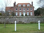
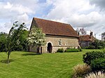
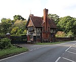
Pennymarsh
Little Ann , Abbotts Ann, Test Valley House
late 16th century or early 17th century
20 December 1960
SU3319543673 51°11′29″N 1°31′35″W / 51.191321°N 1.526369°W / 51.191321; -1.526369 (Pennymarsh)
1279211 Pennymarsh
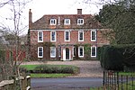
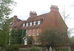
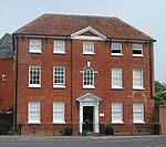
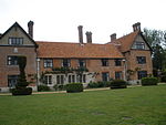
The Rectory
Abbotts Ann , Test ValleyHouse
Queen Anne
20 December 1960
SU3320343609 51°11′27″N 1°31′35″W / 51.190745°N 1.526261°W / 51.190745; -1.526261 (The Rectory)
1228705 The Rectory More images
Ampfield House
Ampfield , Test ValleyCountry House
Mid 18th century
29 May 1957
SU3988723245 51°00′26″N 1°25′58″W / 51.007214°N 1.432864°W / 51.007214; -1.432864 (Ampfield House)
1093686 Ampfield House More images
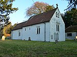
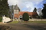
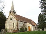
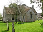
Church of St Mary
Amport , Test ValleyParish Church
c. 1320
21 December 1960
SU2994544202 51°11′47″N 1°34′22″W / 51.196257°N 1.572831°W / 51.196257; -1.572831 (Church of St Mary)
1093280 Church of St Mary More images
The Firs
Amport, Test Valley
Apartment
Late 17th century
20 December 1960
SU3016944209 51°11′47″N 1°34′11″W / 51.196308°N 1.569624°W / 51.196308; -1.569624 (The Firs)
1155840 Upload Photo
89, 91 & 93 High Street, Andover
Andover , Test ValleyTimber Framed Building
Built 1445-1455
24 February 1950
SU3648945677 51°12′33″N 1°28′45″W / 51.20914°N 1.479032°W / 51.20914; -1.479032 (89, 91 & 93 High Street, Andover)
1264607 Upload Photo
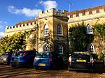
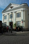
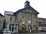
Guildhall
Andover, Test Valley
Guildhall
1950
24 February 1950
SU3647145528 51°12′28″N 1°28′45″W / 51.207802°N 1.479305°W / 51.207802; -1.479305 (Guildhall)
1236337 Guildhall More images
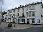
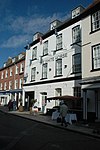
Danebury Hotel (Star and Garter Hotel)
Andover, Test Valley
Coaching Inn
Early 19th century
24 February 1950
SU3650745386 51°12′23″N 1°28′44″W / 51.206523°N 1.478804°W / 51.206523; -1.478804 (Danebury Hotel (Star and Garter Hotel))
1093497 Danebury Hotel (Star and Garter Hotel) More images
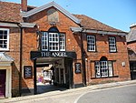
The Angel Inn
Andover, Test Valley
Courtyard Inn
Built 1445-55
24 February 1950
SU3648245695 51°12′33″N 1°28′45″W / 51.209303°N 1.47913°W / 51.209303; -1.47913 (The Angel Inn)
1093460 The Angel Inn More images
Hill House
Appleshaw , Test ValleyHouse
Queen Anne
20 December 1960
SU3036548633 51°14′10″N 1°33′59″W / 51.236077°N 1.566446°W / 51.236077; -1.566446 (Hill House)
1339464 Upload Photo
Mead House
Appleshaw, Test Valley
House
Queen Anne
20 December 1960
SU3067248320 51°14′00″N 1°33′43″W / 51.233246°N 1.562076°W / 51.233246; -1.562076 (Mead House)
1339042 Upload Photo
Redenham House
Redenham , Appleshaw, Test ValleyCountry House
Early 19th century
20 October 1960
SU2943249348 51°14′33″N 1°34′47″W / 51.242554°N 1.579751°W / 51.242554; -1.579751 (Redenham House)
1093912 Redenham House More images
The Old Vicarage
Appleshaw, Test Valley
House
Mid 18th century
20 December 1960
SU3041148843 51°14′17″N 1°33′57″W / 51.237963°N 1.56577°W / 51.237963; -1.56577 (The Old Vicarage)
1229290 Upload Photo
Church of St Mary
Ashley , Test ValleyParish Church
Early 12th century
29 May 1957
SU3849230903 51°04′34″N 1°27′07″W / 51.076167°N 1.451934°W / 51.076167; -1.451934 (Church of St Mary)
1339063 Church of St Mary More images
Awbridge Danes House
Awbridge Danes Estate, Awbridge , Test Valley
Country House
1822-25
4 March 1986
SU3187323051 51°00′21″N 1°32′50″W / 51.005967°N 1.5471°W / 51.005967; -1.5471 (Awbridge Danes House)
1093655 Upload Photo
Church Farmhouse and Garden Wall
Barton Stacey , Test ValleyHouse
15th century
7 January 1952
SU4336441380 51°10′12″N 1°22′52″W / 51.170025°N 1.381138°W / 51.170025; -1.381138 (Church Farmhouse and Garden Wall)
1093439 Upload Photo
Church of All Saints
Barton Stacey, Test Valley
Parish Church
Norman
20 December 1960
SU4348841145 51°10′04″N 1°22′46″W / 51.167902°N 1.379393°W / 51.167902; -1.379393 (Church of All Saints)
1302289 Church of All Saints More images
Pittleworth Manor House
Bossington , Test ValleyHouse
16th century
29 May 1957
SU3276929679 51°03′56″N 1°32′01″W / 51.065515°N 1.533733°W / 51.065515; -1.533733 (Pittleworth Manor House)
1157769 Upload Photo
Braishfield Manor House
Braishfield , Test ValleyCountry House
Mid 18th century
29 May 1957
SU3755026272 51°02′05″N 1°27′57″W / 51.034589°N 1.465859°W / 51.034589; -1.465859 (Braishfield Manor House)
1157292 Braishfield Manor House More images
Broughton Manor House
Broughton , Test ValleyHouse
c. 1800
29 May 1957
SU3117532879 51°05′40″N 1°33′22″W / 51.094378°N 1.556205°W / 51.094378; -1.556205 (Broughton Manor House)
1166844 Upload Photo
Church of St Mary the Virgin
Broughton, Test Valley
Parish Church
12th century
29 May 1957
SU3089432914 51°05′41″N 1°33′37″W / 51.094708°N 1.560215°W / 51.094708; -1.560215 (Church of St Mary the Virgin)
1093875 Church of St Mary the Virgin More images
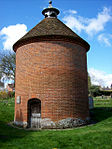
Dovecote in Churchyard 50m north of Chancel of St Mary's Church
Broughton, Test Valley
Dovecote
17th century
29 May 1957
SU3090432966 51°05′43″N 1°33′36″W / 51.095175°N 1.560067°W / 51.095175; -1.560067 (Dovecote in Churchyard 50m north of Chancel of St Mary's Church)
1166461 Dovecote in Churchyard 50m north of Chancel of St Mary's Church More images
Grandfathers
Broughton, Test Valley
House
c. 1700
29 May 1957
SU3129432641 51°05′32″N 1°33′16″W / 51.092231°N 1.554526°W / 51.092231; -1.554526 (Grandfathers)
1166852 Upload Photo
The Lindens
Broughton, Test Valley
House
Mid 18th century
29 May 1957
SU3063133168 51°05′49″N 1°33′50″W / 51.097006°N 1.563949°W / 51.097006; -1.563949 (The Lindens)
1339070 Upload Photo
The Old Rectory
Broughton, Test Valley
House
15th century
29 May 1957
SU3089033050 51°05′45″N 1°33′37″W / 51.095931°N 1.56026°W / 51.095931; -1.56026 (The Old Rectory)
1093854 Upload Photo
Church of St Michael
Lower Bullington , Bullington , Test ValleyParish Church
Norman
20 December 1960
SU4548541228 51°10′07″N 1°21′03″W / 51.168494°N 1.350822°W / 51.168494; -1.350822 (Church of St Michael)
1093440 Church of St Michael More images
Northwood House
Chilbolton , Test ValleyHouse
c. 1700
7 January 1952
SU3956540249 51°09′36″N 1°26′08″W / 51.16013°N 1.435597°W / 51.16013; -1.435597 (Northwood House)
1178985 Upload Photo
Church of St Winfrith
East Dean , Test ValleyParish Church
C12/13
29 May 1957
SU2734126746 51°02′22″N 1°36′41″W / 51.039425°N 1.611414°W / 51.039425; -1.611414 (Church of St Winfrith)
1093769 Church of St Winfrith More images
East Dean Manor House
East Dean, Test Valley
House
Early 18th century
29 May 1957
SU2724626779 51°02′23″N 1°36′46″W / 51.039726°N 1.612767°W / 51.039726; -1.612767 (East Dean Manor House)
1157343 Upload Photo
Park Farmhouse
East Dean, Test Valley
Farmhouse
17th century
29 May 1957
SU2686327107 51°02′34″N 1°37′06″W / 51.042694°N 1.618205°W / 51.042694; -1.618205 (Park Farmhouse)
1301571 Upload Photo
Barn 30m east of Manor Farmhouse
Manor Farm, East Tytherley , Test Valley
Aisled Barn
c. 1600
11 April 1986
SU2923829504 51°03′51″N 1°35′03″W / 51.064132°N 1.584136°W / 51.064132; -1.584136 (Barn 30m east of Manor Farmhouse)
1093739 Upload Photo
Church of St Peter
East Tytherley, Test Valley
Parish Church
Mid 13th century
11 April 1986
SU2923429000 51°03′35″N 1°35′03″W / 51.0596°N 1.584234°W / 51.0596; -1.584234 (Church of St Peter)
1301531 Church of St Peter More images
Rolle House
East Tytherley, Test Valley
House
C20
29 May 1957
SU2943128792 51°03′28″N 1°34′53″W / 51.05772°N 1.58144°W / 51.05772; -1.58144 (Rolle House)
1301542 Upload Photo
Netherton House
Netherton , Faccombe, Test ValleyHouse
1964
7 January 1952
SU3763257770 51°19′04″N 1°27′41″W / 51.3178°N 1.461402°W / 51.3178; -1.461402 (Netherton House)
1093358 Upload Photo
Church of All Saints
Houghton , Test ValleyParish Church
Early 12th century
29 May 1957
SU3414032657 51°05′32″N 1°30′50″W / 51.092213°N 1.513888°W / 51.092213; -1.513888 (Church of All Saints)
1339061 Church of All Saints More images
Houghton Lodge
Houghton Lodge, Houghton, Test Valley
Fishing Lodge
c. 1800
7 February 1986
SU3440133121 51°05′47″N 1°30′36″W / 51.09637°N 1.510117°W / 51.09637; -1.510117 (Houghton Lodge)
1093833 Houghton Lodge More images
Old Rectory
Houghton, Test Valley
House
Mid 18th century
29 May 1957
SU3418132650 51°05′32″N 1°30′48″W / 51.092148°N 1.513303°W / 51.092148; -1.513303 (Old Rectory)
1093859 Old Rectory More images
Garvery
Hurstbourne Tarrant , Test ValleyHouse
Early 19th century
20 December 1960
SU3827953167 51°16′35″N 1°27′09″W / 51.276369°N 1.45261°W / 51.276369; -1.45261 (Garvery)
1093339 Upload Photo
Ibthorpe Farm House
Ibthorpe , Hurstbourne Tarrant, Test ValleyHouse
Early 18th century
20 December 1960
SU3780953688 51°16′52″N 1°27′33″W / 51.281085°N 1.459293°W / 51.281085; -1.459293 (Ibthorpe Farm House)
1339371 Upload Photo
Ibthorpe House
Hurstbourne Tarrant, Test Valley
House
Mid 18th century
20 December 1960
SU3766753798 51°16′56″N 1°27′41″W / 51.282084°N 1.461317°W / 51.282084; -1.461317 (Ibthorpe House)
1093341 Ibthorpe House More images
Ibthorpe Manor Farmhouse
Hurstbourne Tarrant, Test Valley
House
Early 18th century
20 December 1960
SU3789953800 51°16′56″N 1°27′29″W / 51.282086°N 1.457991°W / 51.282086; -1.457991 (Ibthorpe Manor Farmhouse)
1155768 Upload Photo
Rookery Farmhouse
Hurstbourne Tarrant, Test Valley
House
1776
20 December 1960
SU3816453083 51°16′32″N 1°27′15″W / 51.275622°N 1.454268°W / 51.275622; -1.454268 (Rookery Farmhouse)
1093338 Upload Photo
Kimpton Manor Farmhouse
Kimpton , Test ValleyHouse
Early 19th century
20 December 1960
SU2814546666 51°13′07″N 1°35′54″W / 51.218504°N 1.598398°W / 51.218504; -1.598398 (Kimpton Manor Farmhouse)
1339407 Upload Photo
Church of St John the Baptist
Upper Eldon, King's Somborne , Test Valley
Church
Late 12th century
29 May 1957
SU3643727792 51°02′54″N 1°28′54″W / 51.048328°N 1.481579°W / 51.048328; -1.481579 (Church of St John the Baptist)
1093786 Church of St John the Baptist More images
Church of St Peter and St Paul
King's Somborne, Test Valley
Parish Church
12th century
29 May 1957
SU3602230979 51°04′37″N 1°29′14″W / 51.07701°N 1.487183°W / 51.07701; -1.487183 (Church of St Peter and St Paul)
1339113 Church of St Peter and St Paul More images
Rookley House
Up Somborne , Kings Somborne, Test ValleyHouse
Early 18th century
5 December 1955
SU3954732753 51°05′34″N 1°26′12″W / 51.09273°N 1.436674°W / 51.09273; -1.436674 (Rookley House)
1303305 Rookley House More images
Sunken Garden on South of West Wing of Marsh Court
Marsh Court , King's Somborne, Test ValleyGarden
1901–1905
7 February 1986
SU3563033594 51°06′02″N 1°29′33″W / 51.100548°N 1.492521°W / 51.100548; -1.492521 (Sunken Garden on South of West Wing of Marsh Court)
1093807 Upload Photo
The Old Vicarage
King's Somborne, Test Valley
House
Early 18th century
29 May 1957
SU3615931077 51°04′40″N 1°29′07″W / 51.077883°N 1.485217°W / 51.077883; -1.485217 (The Old Vicarage)
1296888 Upload Photo
Church of St Nicholas
Leckford , Test ValleyParish Church
13th century
29 May 1957
SU3739037639 51°08′13″N 1°28′01″W / 51.136808°N 1.466968°W / 51.136808; -1.466968 (Church of St Nicholas)
1093181 Church of St Nicholas More images
Church of All Saints
Little Somborne , Test ValleyChurch
Saxon
29 May 1957
SU3821632655 51°05′31″N 1°27′20″W / 51.091939°N 1.455689°W / 51.091939; -1.455689 (Church of All Saints)
1167714 Church of All Saints More images
School Farmhouse
Lockerley , Test ValleyFarmhouse
16th century
29 May 1957
SU3050426123 51°02′01″N 1°33′59″W / 51.033665°N 1.566354°W / 51.033665; -1.566354 (School Farmhouse)
1296775 Upload Photo
Longparish House
Longparish , Test ValleyCountry House
Late 17th century
7 January 1952
SU4364244831 51°12′04″N 1°22′36″W / 51.201033°N 1.376744°W / 51.201033; -1.376744 (Longparish House)
1093433 Upload Photo
Church of St Peter
Melchet Park and Plaitford , Test ValleyParish Church
13th century
17 November 1986
SU2778220316 50°58′54″N 1°36′20″W / 50.981586°N 1.605615°W / 50.981586; -1.605615 (Church of St Peter)
1157584 Church of St Peter More images
Melchet Court (St Edwards School)
Melchet Park, Melchet Park and Plaitford, Test Valley
Country House
1863
17 November 1986
SU2707222266 50°59′57″N 1°36′56″W / 50.999154°N 1.615584°W / 50.999154; -1.615584 (Melchet Court (St Edwards School))
1339192 Melchet Court (St Edwards School) More images
Church of St Andrew
Timsbury , Michelmersh and Timsbury , Test ValleyChurch
13th century
29 May 1957
SU3457524556 51°01′10″N 1°30′30″W / 51.019345°N 1.508448°W / 51.019345; -1.508448 (Church of St Andrew)
1093717 Church of St Andrew More images
Church of St Mary
Michelmersh and Timsbury, Test ValleyParish Church
12th century
29 May 1957
SU3460826622 51°02′17″N 1°30′28″W / 51.03792°N 1.507781°W / 51.03792; -1.507781 (Church of St Mary)
1296690 Church of St Mary More images
Manor Farm House
Michelmersh and Timsbury, Test Valley
Farmhouse
c. 1700
22 March 1979
SU3521526390 51°02′09″N 1°29′57″W / 51.035797°N 1.499147°W / 51.035797; -1.499147 (Manor Farm House)
1093754 Upload Photo
Michelmersh Court
Michelmersh and Timsbury, Test Valley
House
1986
29 May 1957
SU3467526674 51°02′18″N 1°30′25″W / 51.038383°N 1.506821°W / 51.038383; -1.506821 (Michelmersh Court)
1093751 Upload Photo
Staddle Barn 15m north of Michelmersh Manor Farmhouse
Michelmersh and Timsbury, Test Valley
Staddle Stone
Mid 18th century
22 March 1979
SU3518926407 51°02′09″N 1°29′58″W / 51.035951°N 1.499516°W / 51.035951; -1.499516 (Staddle Barn 15m north of Michelmersh Manor Farmhouse)
1093714 Upload Photo
Church of St Mary
Monxton , Test ValleyParish Church
Norman
30 April 1985
SU3128744572 51°11′58″N 1°33′13″W / 51.199512°N 1.553593°W / 51.199512; -1.553593 (Church of St Mary)
1093882 Church of St Mary More images
Stable Block
Mottisfont Abbey , Mottisfont , Test ValleyGate Pier
1836
29 May 1957
SU3263027017 51°02′30″N 1°32′09″W / 51.041587°N 1.535956°W / 51.041587; -1.535956 (Stable Block)
1093729 Stable Block More images
Fifehead Manor Hotel
Middle Wallop , Nether Wallop, Test ValleyManor House
17th century
29 May 1957
SU2893337884 51°08′22″N 1°35′16″W / 51.139499°N 1.58782°W / 51.139499; -1.58782 (Fifehead Manor Hotel)
1093165 Upload Photo
Church of St John the Baptist
North Baddesley , Test ValleyParish Church
11th century
29 May 1957
SU4025820862 50°59′09″N 1°25′40″W / 50.98576°N 1.42784°W / 50.98576; -1.42784 (Church of St John the Baptist)
1093668 Church of St John the Baptist More images
Church of St Boniface
Nursling and Rownhams , Test ValleyParish Church
Saxon
29 May 1957
SU3593316473 50°56′48″N 1°29′24″W / 50.94658°N 1.489885°W / 50.94658; -1.489885 (Church of St Boniface)
1093670 Church of St Boniface More images
Church of St Peter
Over Wallop , Test ValleyChurch
12th century
29 May 1957
SU2842638241 51°08′34″N 1°35′42″W / 51.142734°N 1.595038°W / 51.142734; -1.595038 (Church of St Peter)
1093127 Church of St Peter More images
Townsend Farm House
Over Wallop, Test Valley
Farmhouse
earlier core
29 May 1957
SU2800238382 51°08′38″N 1°36′04″W / 51.144023°N 1.601088°W / 51.144023; -1.601088 (Townsend Farm House)
1093122 Upload Photo
Church of St Michael and All Angels
Weyhill , Penton Grafton , Test ValleyParish Church
Norman
20 December 1960
SU3176246642 51°13′05″N 1°32′48″W / 51.218099°N 1.546613°W / 51.218099; -1.546613 (Church of St Michael and All Angels)
1229819 Church of St Michael and All Angels More images
Clanville House
Clanville , Penton Grafton, Test ValleyHouse
Early 18th century
20 December 1960
SU3188249133 51°14′26″N 1°32′41″W / 51.24049°N 1.544674°W / 51.24049; -1.544674 (Clanville House)
1278896 Upload Photo
Ramridge House
Ramridge Park , Penton Grafton, Test ValleyCountry House
c. 1740
20 December 1960
SU3127047767 51°13′42″N 1°33′13″W / 51.228241°N 1.553559°W / 51.228241; -1.553559 (Ramridge House)
1229808 Ramridge House More images
Holy Trinity Church
Penton Mewsey , Test ValleyParish Church
14th century
20 December 1960
SU3296747422 51°13′30″N 1°31′45″W / 51.225044°N 1.529289°W / 51.225044; -1.529289 (Holy Trinity Church)
1278801 Holy Trinity Church More images
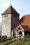
Church of St Michael
Quarley , Test ValleyBell Tower
11th century
20 December 1960
SU2728043985 51°11′40″N 1°36′40″W / 51.194439°N 1.610986°W / 51.194439; -1.610986 (Church of St Michael)
1339411 Church of St Michael More images
Broadwater House
Romsey , Test ValleyHouse
18th century
28 August 1951
SU3524221007 50°59′15″N 1°29′57″W / 50.987392°N 1.499283°W / 50.987392; -1.499283 (Broadwater House)
1277499 Broadwater House More images
Railings at Broadwater House
Romsey, Test Valley
Gate
4 December 1972
SU3523621005 50°59′15″N 1°29′58″W / 50.987374°N 1.499369°W / 50.987374; -1.499369 (Railings at Broadwater House)
1231605 Upload Photo
Bradbeers (Dolphin Hotel)
Romsey, Test Valley
Hotel
Early 19th century
28 August 1951
SU3525821152 50°59′19″N 1°29′57″W / 50.988695°N 1.499041°W / 50.988695; -1.499041 (Bradbeers (Dolphin Hotel))
1231843 Bradbeers (Dolphin Hotel) More images
Former Corn Exchange
Romsey, Test Valley
Corn Exchange
1864
28 August 1951
SU3524021171 50°59′20″N 1°29′57″W / 50.988867°N 1.499296°W / 50.988867; -1.499296 (Former Corn Exchange)
1231877 Former Corn Exchange More images
Luzborough House
Romsey, Test Valley
House
Late 17th century
22 April 1985
SU3770920734 50°59′05″N 1°27′51″W / 50.984781°N 1.464166°W / 50.984781; -1.464166 (Luzborough House)
1232586 Luzborough House More images
The White Horse Hotel
Romsey, Test Valley
House
18th century
28 August 1951
SU3524621254 50°59′23″N 1°29′57″W / 50.989613°N 1.499202°W / 50.989613; -1.499202 (The White Horse Hotel)
1232184 The White Horse Hotel More images
1 Church Court
Romsey, Test Valley
Timber Framed House
partly 16th century
28 August 1951
SU3520721279 50°59′23″N 1°29′59″W / 50.98984°N 1.499755°W / 50.98984; -1.499755 (1 Church Court)
1231711 1 Church Court More images
37 and 39 Church Street
Romsey, Test Valley
House
Late 18th century
28 August 1951
SU3518621376 50°59′27″N 1°30′00″W / 50.990714°N 1.500045°W / 50.990714; -1.500045 (37 and 39 Church Street)
1231749 Upload Photo
Ashfield Lodge
Broadlands Estate, Romsey Extra , Test ValleyTimber Framed House
1870
17 November 1986
SU3621619944 50°58′40″N 1°29′08″W / 50.977773°N 1.485513°W / 50.977773; -1.485513 (Ashfield Lodge)
1301303 Ashfield Lodge More images
Barn 40m north of Moorcourt
Romsey Extra, Test Valley
Timber Framed Barn
c. 1700
29 May 1957
SU3453217044 50°57′06″N 1°30′35″W / 50.9518°N 1.509773°W / 50.9518; -1.509773 (Barn 40m north of Moorcourt)
1166645 Upload Photo
Moorcourt
Romsey Extra , Test ValleyHouse
15th century
29 May 1957
SU3452517002 50°57′05″N 1°30′36″W / 50.951423°N 1.509876°W / 50.951423; -1.509876 (Moorcourt)
1093649 Upload Photo
Orangery
Broadlands Estate, Romsey Extra, Test ValleyOrangery
18th century
17 November 1986
SU3543420096 50°58′45″N 1°29′48″W / 50.979189°N 1.496636°W / 50.979189; -1.496636 (Orangery)
1301341 Upload Photo
Ranvilles Farmhouse
Romsey Extra, Test Valley
Farmhouse
16th century
29 May 1957
SU3370718853 50°58′05″N 1°31′17″W / 50.968115°N 1.52135°W / 50.968115; -1.52135 (Ranvilles Farmhouse)
1339186 Upload Photo
Stanbridge Earls
Stanbridge Earls, Romsey Extra, Test Valley
House
Mid 14th century
29 May 1957
SU3377323194 51°00′26″N 1°31′12″W / 51.007145°N 1.520008°W / 51.007145; -1.520008 (Stanbridge Earls)
1166424 Stanbridge Earls More images
Fairways, the Grosvenor Hotel
Stockbridge , Test ValleyHouse
Late 18th century
29 May 1957
SU3560035123 51°06′51″N 1°29′34″W / 51.114298°N 1.492799°W / 51.114298; -1.492799 (Fairways, the Grosvenor Hotel)
1093088 Fairways, the Grosvenor Hotel More images
Kings Head House, Lane Antiques, Lane House, Leyanne Salon
Stockbridge, Test Valley
House
Formerly
27 November 1984
SU3581235091 51°06′50″N 1°29′23″W / 51.113998°N 1.489774°W / 51.113998; -1.489774 (Kings Head House, Lane Antiques, Lane House, Leyanne Salon)
1093091 Upload Photo
Old Town Hall
Stockbridge, Test Valley
Town Hall
Dated 1810
29 May 1957
SU3549935104 51°06′51″N 1°29′39″W / 51.114134°N 1.494244°W / 51.114134; -1.494244 (Old Town Hall)
1093093 Old Town Hall More images
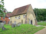
Remains of Old St Peter's Church
Stockbridge, Test Valley
Church
c. 1300
27 November 1984
SU3596134997 51°06′47″N 1°29′16″W / 51.113143°N 1.487654°W / 51.113143; -1.487654 (Remains of Old St Peter's Church)
1302362 Remains of Old St Peter's Church More images
Church of St Thomas of Canterbury
Tangley , Test ValleyParish Church
Early Medieval
27 September 1984
SU3340952447 51°16′13″N 1°31′21″W / 51.270201°N 1.522492°W / 51.270201; -1.522492 (Church of St Thomas of Canterbury)
1156218 Church of St Thomas of Canterbury More images
Church of All Saints
Upper Clatford , Test ValleyParish Church
12th century
20 December 1960
SU3571643559 51°11′25″N 1°29′25″W / 51.190145°N 1.490307°W / 51.190145; -1.490307 (Church of All Saints)
1278644 Church of All Saints More images
Vernham Manor House
Vernhams Dean , Test ValleyHouse
Medieval
20 December 1960
SU3517656608 51°18′27″N 1°29′48″W / 51.307508°N 1.496756°W / 51.307508; -1.496756 (Vernham Manor House)
1156458 Upload Photo
Church Farmhouse
West Tytherley , Test ValleyFarmhouse
c. 1300
11 April 1986
SU2757629754 51°03′59″N 1°36′28″W / 51.066462°N 1.607834°W / 51.066462; -1.607834 (Church Farmhouse)
1093704 Upload Photo
Dean House
West Tytherley, Test Valley
House
1978
24 January 1978
SU2576827278 51°02′39″N 1°38′02″W / 51.044281°N 1.633811°W / 51.044281; -1.633811 (Dean House)
1135717 Upload Photo
Norman Court House
Northaw School, West Tytherley, Test Valley
Country House
c. 1752
19 February 1986
SU2651930926 51°04′37″N 1°37′22″W / 51.07705°N 1.622833°W / 51.07705; -1.622833 (Norman Court House)
1173046 Upload Photo
Church of St Peter and Holy Cross
Wherwell , Test ValleyCross
Saxon
21 March 1984
SU3914640822 51°09′55″N 1°26′29″W / 51.165311°N 1.441526°W / 51.165311; -1.441526 (Church of St Peter and Holy Cross)
1179499 Church of St Peter and Holy Cross More images
The Priory
Wherwell, Test Valley
Country House
Early 18th century
7 January 1952
SU3918040736 51°09′52″N 1°26′28″W / 51.164535°N 1.441049°W / 51.164535; -1.441049 (The Priory)
1301832 The Priory More images
28 Church Street
Wherwell, Test Valley
House
15th century
20 December 1960
SU3912440933 51°09′59″N 1°26′31″W / 51.166311°N 1.441828°W / 51.166311; -1.441828 (28 Church Street)
1093414 28 Church Street More images

