Name
Location
Type
Completed Date designated
Grid ref. Entry number Image Ref.
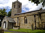
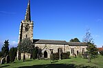
Church of Saint Helen
Ainderby Steeple Church
14th century
31 March 1970
SE3346392097 54°19′24″N 1°29′13″W / 54.323361°N 1.487022°W / 54.323361; -1.487022 (Church of Saint Helen)
1315088 Church of Saint Helen More images
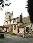
Church of St Andrew
Aldborough Church
16th century
15 March 1966
SE4059966430 54°05′32″N 1°22′51″W / 54.09218°N 1.380772°W / 54.09218; -1.380772 (Church of St Andrew)
1173835 Church of St Andrew More images
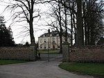
Allerton Castle
Allerton Park, Allerton Mauleverer with Hopperton
House
1721
15 March 1966
SE4141658089 54°01′02″N 1°22′10″W / 54.017154°N 1.369418°W / 54.017154; -1.369418 (Allerton Castle)
1189430 Allerton Castle More images
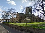
Church of St Mary
Church Wynd, Alne
Church
12th century
17 May 1960
SE4951365334 54°04′54″N 1°14′41″W / 54.081552°N 1.244676°W / 54.081552; -1.244676 (Church of St Mary)
1151297 Church of St Mary More images
Ampleforth Abbey Church
Ampleforth Church
1961
2 March 2016
SE5980778841 54°12′07″N 1°05′05″W / 54.201840°N 1.0846784°W / 54.201840; -1.0846784 (Ampleforth Abbey Church)
1315767 Ampleforth Abbey Church More images
Christ Church
Appleton-le-Moors Church
1863-5
5 June 1985
SE7348088094 54°17′00″N 0°52′22″W / 54.283209°N 0.872853°W / 54.283209; -0.872853 (Christ Church)
1173545 Christ Church More images
Church of All Saints
Appleton-le-Street with Easthorpe Church
11th century
25 January 1954
SE7343673580 54°09′10″N 0°52′37″W / 54.152799°N 0.877072°W / 54.152799; -0.877072 (Church of All Saints)
1296551 Church of All Saints More images
Aske Hall
Aske Country House
Early-mid 18th century
19 December 1951
NZ1775703385 54°25′32″N 1°43′40″W / 54.42559°N 1.727822°W / 54.42559; -1.727822 (Aske Hall)
1157422 Aske Hall More images
The Temple
Aske Park, Aske
Folly
c. 1745
4 February 1969
NZ1744903572 54°25′38″N 1°43′57″W / 54.427281°N 1.732558°W / 54.427281; -1.732558 (The Temple)
1157439 The Temple More images
Church of Saint Oswald
Askrigg Church
15th century
25 March 1969
SD9475991015 54°18′53″N 2°04′55″W / 54.314698°N 2.082064°W / 54.314698; -2.082064 (Church of Saint Oswald)
1301613 Church of Saint Oswald More images
Nappa Hall
Nappa , Askrigg Fortified Manor House
1459
16 January 1952
SD9657990795 54°18′46″N 2°03′15″W / 54.312736°N 2.054086°W / 54.312736; -2.054086 (Nappa Hall)
1157398 Nappa Hall More images
Church of St James
Baldersby St James , Baldersby Church
1856-58
26 May 1971
SE3662376957 54°11′14″N 1°26′25″W / 54.187084°N 1.440285°W / 54.187084; -1.440285 (Church of St James)
1296495 Church of St James More images
Lych Gate to Church of St James
Baldersby St James , Baldersby Lych Gate
1856-8
26 May 1971
SE3660676919 54°11′12″N 1°26′26″W / 54.186743°N 1.44055°W / 54.186743; -1.44055 (Lych Gate to Church of St James)
1315555 Lych Gate to Church of St James
Barden Church
Barden Chapel
16th century
10 September 1954
SE0511857171 54°00′38″N 1°55′24″W / 54.010532°N 1.923394°W / 54.010532; -1.923394 (Barden Church)
1131761 Upload Photo
Barden Tower
Barden Tower house
Mid-16th century
10 September 1954
SE0509357198 54°00′39″N 1°55′26″W / 54.010775°N 1.923775°W / 54.010775; -1.923775 (Barden Tower)
1317012 Barden Tower More images
Priest's House
Barden House
16th century
10 September 1954
SE0511057163 54°00′38″N 1°55′25″W / 54.01046°N 1.923517°W / 54.01046; -1.923517 (Priest's House)
1317013 Priest's House More images
Church of St Michael
Barton-le-Street Church
1160s
25 January 1954
SE7212174234
1148993 Church of St Michael More images
Beamsley Hospital (north range)
Beamsley Chapel
17th century
10 September 1954
SE0822953089 53°58′26″N 1°52′34″W / 53.973805°N 1.876032°W / 53.973805; -1.876032 (Beamsley Hospital (north range))
1131765 Beamsley Hospital (north range)More images
Bedale Hall
Bedale Country House
c. 1735
5 May 1952
SE2652288373 54°17′25″N 1°35′39″W / 54.290299°N 1.594063°W / 54.290299; -1.594063 (Bedale Hall)
1314999 Bedale Hall More images
Church of Saint Gregory
Bedale Church
13th to 15th centuries
22 August 1966
SE2655688450 54°17′28″N 1°35′37″W / 54.29099°N 1.593534°W / 54.29099; -1.593534 (Church of Saint Gregory)
1151205 Church of Saint Gregory More images
Market Cross, Bedale
Bedale Market Cross
14th century
22 August 1966
SE2659288280 54°17′22″N 1°35′35″W / 54.28946°N 1.592996°W / 54.28946; -1.592996 (Market Cross, Bedale)
1314972 Market Cross, Bedale More images
Beningbrough Hall
Beningbrough Park, Beningbrough
Country House
1716
28 February 1952
SE5162258563 54°01′14″N 1°12′49″W / 54.020497°N 1.213593°W / 54.020497; -1.213593 (Beningbrough Hall)
1150998 Beningbrough Hall More images
Church of St Helen
Bilton-in-Ainsty Church
12th century
30 March 1966
SE4760450382 53°56′50″N 1°16′34″W / 53.94736°N 1.276188°W / 53.94736; -1.276188 (Church of St Helen)
1315388 Church of St Helen More images
Syningthwaite Priory Farmhouse
Bilton in Ainsty Farmhouse
12th century
2 September 1952
SE4615448686 53°55′56″N 1°17′55″W / 53.932249°N 1.298535°W / 53.932249; -1.298535 (Syningthwaite Priory Farmhouse)
1150361 Upload Photo
Spout House
Bilsdale Midcable House/Public House
16th century
23 June 1966
SE5741193549 54°20′03″N 1°07′07″W / 54.334282°N 1.118589°W / 54.334282; -1.118589 (Spout House)
1150636 Spout House More images
Church of Saint Nicholas
North Grimston , Birdsall Church
Early 13th century
10 October 1966
SE8414067779 54°05′57″N 0°42′53″W / 54.099036°N 0.714833°W / 54.099036; -0.714833 (Church of Saint Nicholas)
1174500 Church of Saint Nicholas More images
Church of St Mary
Birkin Church
12th century
11 December 1967
SE5303426511 53°43′56″N 1°11′51″W / 53.732304°N 1.197576°W / 53.732304; -1.197576 (Church of St Mary)
1316671 Church of St Mary More images
Church of St Mary, Bolton Abbey
Bolton Abbey Church
Late 12th century
10 September 1954
SE0739854203 53°59′02″N 1°53′19″W / 53.983829°N 1.888675°W / 53.983829; -1.888675 (Church of St Mary, Bolton Abbey)
1166745 Church of St Mary, Bolton Abbey More images
Priory of St Mary
Bolton Abbey Augustinian monastery
12th century
10 September 1954
SE0741754182 53°59′01″N 1°53′18″W / 53.98364°N 1.888386°W / 53.98364; -1.888386 (Priory of St Mary)
1131775 Priory of St Mary More images
Church of All Saints
Bolton Percy Church
Early 14th century
3 February 1967
SE5317541275 53°51′54″N 1°11′34″W / 53.864975°N 1.192896°W / 53.864975; -1.192896 (Church of All Saints)
1296630 Church of All Saints More images
Church of St Wilfrid
Brayton Church
12th century
17 November 1966
SE6041930997 53°46′19″N 1°05′05″W / 53.771818°N 1.084771°W / 53.771818; -1.084771 (Church of St Wilfrid)
1132537 Church of St Wilfrid More images
Church of St Thomas
High Green, Brompton
Church
12th century
31 March 1970
SE3737596359 54°21′41″N 1°25′35″W / 54.361391°N 1.426346°W / 54.361391; -1.426346 (Church of St Thomas)
1150903 Church of St Thomas More images
Church of All Saints
Brompton Church
14th century
18 January 1967
SE9429182127 54°13′34″N 0°33′19″W / 54.22619°N 0.555173°W / 54.22619; -0.555173 (Church of All Saints)
1316111 Church of All Saints More images
Ferry Bridge
Brotherton Bridge
1797
11 December 1967
SE4835224640 53°42′57″N 1°16′08″W / 53.715943°N 1.268832°W / 53.715943; -1.268832 (Ferry Bridge)
1167483 Ferry Bridge More images
Brough Hall
Brough Park, Brough with St. Giles
Country House
15th century
19 December 1951
SE2157497826 54°22′32″N 1°40′10″W / 54.375485°N 1.669394°W / 54.375485; -1.669394 (Brough Hall)
1318301 Brough Hall More images
Broughton Hall
Broughton Country house
1597
10 September 1954
SD9428250844 53°57′13″N 2°05′19″W / 53.953658°N 2.08862°W / 53.953658; -2.08862 (Broughton Hall)
1132296 Broughton Hall More images
Church of All Saints
Broughton Church
Early 16th century
10 September 1954
SD9340650359 53°56′57″N 2°06′07″W / 53.949288°N 2.101958°W / 53.949288; -2.101958 (Church of All Saints)
1132291 Church of All Saints More images
Carrmire Gates, Wall and End Turrets
Bulmer Gates and Wall
Early 18th century
25 January 1954
SE7122868497 54°06′27″N 0°54′43″W / 54.107434°N 0.912071°W / 54.107434; -0.912071 (Carrmire Gates, Wall and End Turrets)
1174223 Carrmire Gates, Wall and End Turrets More images
Church of St Martin
Bulmer Cross
Saxon
25 January 1954
SE6993867630 54°05′59″N 0°55′55″W / 54.09982°N 0.931997°W / 54.09982; -0.931997 (Church of St Martin)
1174317 Church of St Martin More images
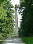
Monument to the 7th Earl of Carlisle
Bulmer Column
1869
25 January 1954
SE7146867078 54°05′41″N 0°54′31″W / 54.09465°N 0.908735°W / 54.09465; -0.908735 (Monument to the 7th Earl of Carlisle)
1149624 Monument to the 7th Earl of Carlisle More images
Church of St Lambert
Burneston Church
15th century
22 August 1966
SE3086584942 54°15′33″N 1°31′40″W / 54.259222°N 1.527699°W / 54.259222; -1.527699 (Church of St Lambert)
1315164 Church of St Lambert More images
Church of St Wilfrid
Burnsall Church
14th century
10 September 1954
SE0325761515 54°02′59″N 1°57′06″W / 54.049589°N 1.951746°W / 54.049589; -1.951746 (Church of St Wilfrid)
1131740 Church of St Wilfrid More images
Cowling Hall and wing
Cowling Lan, Burrill with Cowling
House
12th century
22 August 1966
SE2374787706 54°17′04″N 1°38′12″W / 54.284441°N 1.636745°W / 54.284441; -1.636745 (Cowling Hall and wing)
1294034 Cowling Hall and wingMore images
Church of St Botolph
Bossall , Buttercrambe with Bossall Church
Late 12th century
29 January 1953
SE7183660747 54°02′16″N 0°54′17″W / 54.037709°N 0.904608°W / 54.037709; -0.904608 (Church of St Botolph)
1315746 Church of St Botolph More images
Byland Abbey
Byland, Byland with Wass
Abbey
Late 12th century
4 January 1955
SE5495178959 54°12′12″N 1°09′33″W / 54.203443°N 1.159088°W / 54.203443; -1.159088 (Byland Abbey)
1315790 Byland Abbey More images
Camblesforth Hall
Camblesforth House
c. 1700
17 November 1966
SE6467826140 53°43′40″N 1°01′16″W / 53.727659°N 1.021176°W / 53.727659; -1.021176 (Camblesforth Hall)
1173983 Camblesforth Hall More images
Carlton Towers
Carlton Country House
Early 17th century
17 November 1966
SE6497623798 53°42′24″N 1°01′02″W / 53.706575°N 1.017151°W / 53.706575; -1.017151 (Carlton Towers)
1295955 Carlton Towers More images
Bolton Castle
Castle Bolton , Castle Bolton with East and West Bolton Castle
Late 14th century
13 February 1967
SE0335891833 54°19′19″N 1°57′00″W / 54.322067°N 1.949877°W / 54.322067; -1.949877 (Bolton Castle)
1130885 Bolton Castle More images
Church of St Anne
Catterick Church
1412
4 February 1969
SE2401297977 54°22′36″N 1°37′55″W / 54.376734°N 1.631852°W / 54.376734; -1.631852 (Church of St Anne)
1131488 Church of St Anne More images
Cawood Castle gatehouse
Cawood Castle
1426-1451
17 November 1966
SE5739437698 53°49′57″N 1°07′46″W / 53.832381°N 1.129416°W / 53.832381; -1.129416 (Cawood Castle gatehouse)
1132508 Cawood Castle gatehouseMore images
Banqueting Hall Adjoining East Side of Cawood Castle gatehouse
Cawood Castle
1426-1451
17 November 1966
SE5740837687 53°49′56″N 1°07′45″W / 53.83228°N 1.129205°W / 53.83228; -1.129205 (Banqueting Hall Adjoining East Side of Cawood Castle gatehouse)
1174558 Banqueting Hall Adjoining East Side of Cawood Castle gatehouse More images
Church of All Saints
Cawood Church
C20
17 November 1966
SE5777937790 53°49′59″N 1°07′25″W / 53.833165°N 1.12355°W / 53.833165; -1.12355 (Church of All Saints)
1316657 Church of All Saints More images
Church of Saint John the Baptist
Cayton Church
12th century
18 January 1967
TA0566083330 54°14′05″N 0°22′50″W / 54.234781°N 0.380434°W / 54.234781; -0.380434 (Church of Saint John the Baptist)
1148133 Church of Saint John the Baptist More images
Church of St Mary the Virgin
Church Fenton Church
13th century
3 February 1967
SE5143136764 53°49′29″N 1°13′13″W / 53.82461°N 1.220166°W / 53.82461; -1.220166 (Church of St Mary the Virgin)
1148436 Church of St Mary the Virgin More images
Courthouse to East of Colburn Hall
Colburn Courthouse
c. 1300
4 February 1969
SE1963099232 54°23′18″N 1°41′57″W / 54.388199°N 1.699227°W / 54.388199; -1.699227 (Courthouse to East of Colburn Hall)
1301649 Courthouse to East of Colburn Hall
Constable Burton Hall
Burton Park, Constable Burton
House
Early 17th century
13 February 1967
SE1636091193 54°18′58″N 1°45′00″W / 54.316067°N 1.750019°W / 54.316067; -1.750019 (Constable Burton Hall)
1131472 Constable Burton Hall More images
Coverham Abbey
Coverham with Agglethorpe Premonstratensian Monastery
13th century
13 December 1967
SE1060186404 54°16′23″N 1°50′19″W / 54.273178°N 1.838713°W / 54.273178; -1.838713 (Coverham Abbey)
1178910 Coverham Abbey More images
Church of St Michael
Coxwold Church
c. 1430
17 May 1960
SE5330477201 54°11′16″N 1°11′05″W / 54.187818°N 1.184645°W / 54.187818; -1.184645 (Church of St Michael)
1150758 Church of St Michael More images
Shandy Hall
Coxwold House
1450s
28 February 1952
SE5312077291 54°11′19″N 1°11′15″W / 54.188646°N 1.187449°W / 54.188646; -1.187449 (Shandy Hall)
1315184 Shandy Hall More images
Church of St Michael
Crambe Church
Late 11th century
25 January 1954
SE7333164859 54°04′28″N 0°52′51″W / 54.074449°N 0.880792°W / 54.074449; -0.880792 (Church of St Michael)
1295776 Church of St Michael More images
Crayke Castle
Crayke House
15th century
28 February 1952
SE5590970680 54°07′44″N 1°08′45″W / 54.128941°N 1.145937°W / 54.128941; -1.145937 (Crayke Castle)
1189213 Crayke Castle More images
Church of St Peter
Croft-on-Tees Church
12th century
18 March 1968
NZ2888109846 54°28′59″N 1°33′21″W / 54.483146°N 1.555746°W / 54.483146; -1.555746 (Church of St Peter)
1301945 Church of St Peter More images
Croft Bridge
Hurworth Place, Croft-on-Tees
Road Bridge
14th century
20 March 1967
NZ2896309832 54°28′59″N 1°33′16″W / 54.483015°N 1.554482°W / 54.483015; -1.554482 (Croft Bridge)
1116440 Croft Bridge More images
Croft Bridge
Croft-on-Tees Road Bridge
14th century
19 December 1951
NZ2896309831 54°28′59″N 1°33′16″W / 54.483006°N 1.554482°W / 54.483006; -1.554482 (Croft Bridge)
1131364 Croft Bridge More images
Church of St Peter
Dalby , Dalby-cum-Skewsby Church
Early 12th century
17 May 1960
SE6372271212 54°07′58″N 1°01′35″W / 54.132814°N 1.026283°W / 54.132814; -1.026283 (Church of St Peter)
1150761 Church of St Peter More images
Danby Castle
Danby Farmhouse
19th century
20 December 1990
NZ7172507238 54°27′20″N 0°53′43″W / 54.455475°N 0.895197°W / 54.455475; -0.895197 (Danby Castle)
1178588 Danby Castle More images
Danby Wiske Church
Danby Wiske Church
Late 15th century
31 March 1970
SE3381098337 54°22′46″N 1°28′52″W / 54.379415°N 1.480981°W / 54.379415; -1.480981 (Danby Wiske Church)
1150204 Danby Wiske Church More images
Denton Hall and Attached Forecourt Walls and Railings
Denton House
1778
6 February 1952
SE1476548694 53°56′03″N 1°46′36″W / 53.93416°N 1.776599°W / 53.93416; -1.776599 (Denton Hall and Attached Forecourt Walls and Railings)
1315354 Denton Hall and Attached Forecourt Walls and RailingsMore images
Church of St Peter and St Paul
Drax Church
12th century
17 November 1986
SE6758726371 53°43′46″N 0°58′37″W / 53.729367°N 0.977043°W / 53.729367; -0.977043 (Church of St Peter and St Paul)
1148397 Church of St Peter and St Paul More images
Ruins of Abbey of St Agatha
Easby Abbey
Late 12th century
4 February 1969
NZ1849100291 54°23′52″N 1°43′00″W / 54.397759°N 1.716701°W / 54.397759; -1.716701 (Ruins of Abbey of St Agatha)
1131606 Ruins of Abbey of St Agatha More images
Easby Abbey gatehouse
Easby Gatehouse
Early 14th century
4 February 1969
NZ1859700276 54°23′51″N 1°42′54″W / 54.39762°N 1.715069°W / 54.39762; -1.715069 (Easby Abbey gatehouse)
1131564 Easby Abbey gatehouse More images
Church of St Agatha
Easby Church
12th, 13th, and 14th centuries
4 February 1969
NZ1855100275 54°23′51″N 1°42′57″W / 54.397613°N 1.715778°W / 54.397613; -1.715778 (Church of St Agatha)
1131607 Church of St Agatha More images
Jervaulx Abbey
Jervaulx Park, East Witton
Abbey
Early English
15 February 1967
SE1717685753 54°16′02″N 1°44′16″W / 54.26715°N 1.737786°W / 54.26715; -1.737786 (Jervaulx Abbey)
1130961 Jervaulx Abbey More images
Mount Grace Priory
East Harlsey Priory
15th century
31 March 1970
SE4493298513 54°22′49″N 1°18′35″W / 54.38014°N 1.309737°W / 54.38014; -1.309737 (Mount Grace Priory)
1315123 Mount Grace Priory More images
Jervaulx Abbey gatehouse
Jervaulx Park, East Witton
Abbey
13th century
15 February 1967
SE1697785665 54°15′59″N 1°44′27″W / 54.266366°N 1.740847°W / 54.266366; -1.740847 (Jervaulx Abbey gatehouse)
1318555 Jervaulx Abbey gatehouseMore images
Ebberston Hall
Ebberston and Yedingham Country House
Early 19th century
10 November 1953
SE8924383423 54°14′19″N 0°37′56″W / 54.238737°N 0.632194°W / 54.238737; -0.632194 (Ebberston Hall)
1149555 Ebberston Hall More images
Church of St Oswald
Farnham Church
12th century
15 March 1966
SE3481160584 54°02′24″N 1°28′12″W / 54.040064°N 1.46993°W / 54.040064; -1.46993 (Church of St Oswald)
1150301 Church of St Oswald More images
Farnhill Hall
Main Street, Farnhill
Fortified manor house
15th century
10 September 1954
SE0032946468 53°54′52″N 1°59′47″W / 53.91436°N 1.996477°W / 53.91436; -1.996477 (Farnhill Hall)
1316997 Upload Photo
Farnley Hall
Farnley Country House
17th century
6 February 1952
SE2151947276 53°55′16″N 1°40′26″W / 53.92118°N 1.673828°W / 53.92118; -1.673828 (Farnley Hall)
1150040 Farnley Hall More images
Church of St Oswald
Filey Church
17th century
24 October 1950
TA1177881065 54°12′47″N 0°17′15″W / 54.213137°N 0.287457°W / 54.213137; -0.287457 (Church of St Oswald)
1316455 Church of St Oswald More images
Rudding Park House
Rudding Lane, Follifoot
House
1805-24
8 March 1952
SE3341853164 53°58′24″N 1°29′31″W / 53.97347°N 1.492013°W / 53.97347; -1.492013 (Rudding Park House)
1188343 Rudding Park House More images
Forcett Hall
Forcett Country House
Early 18th century
19 December 1951
NZ1721212376 54°30′23″N 1°44′09″W / 54.50641°N 1.735702°W / 54.50641; -1.735702 (Forcett Hall)
1316916 Forcett Hall More images
Church of St Stephen
Fylingdales Church
Medieval
6 October 1969
NZ9416205940 54°26′25″N 0°32′59″W / 54.440156°N 0.549641°W / 54.440156; -0.549641 (Church of St Stephen)
1148706 Church of St Stephen More images
Church of St Alkeda
Giggleswick Church
Late 14th/early 15th century
20 February 1958
SD8115164084 54°04′20″N 2°17′22″W / 54.072338°N 2.289538°W / 54.072338; -2.289538 (Church of St Alkeda)
1157303 Church of St Alkeda More images
Church of the Holy Cross
Gilling East Church
c. 1200
4 January 1955
SE6160076902 54°11′03″N 1°03′27″W / 54.184204°N 1.057593°W / 54.184204; -1.057593 (Church of the Holy Cross)
1296322 Church of the Holy Cross More images
Gilling Castle
Gilling East Country House
18th century
4 January 1955
SE6113376794 54°11′00″N 1°03′53″W / 54.183289°N 1.06477°W / 54.183289; -1.06477 (Gilling Castle)
1149581 Gilling Castle More images
Church of St Agatha
Gilling West , Gilling with Hartforth and Sedbury Church
Late 11th century
4 February 1969
NZ1820205154 54°26′29″N 1°43′15″W / 54.441472°N 1.720855°W / 54.441472; -1.720855 (Church of St Agatha)
1316927 Church of St Agatha More images
Church of All Saints
Low Green, Great Ayton
Church
12th century
23 June 1966
NZ5561610824 54°29′23″N 1°08′35″W / 54.489714°N 1.14296°W / 54.489714; -1.14296 (Church of All Saints)
1150650 Church of All Saints More images
Church of St Andrew
Grinton Church
16th century
7 December 1966
SE0461498426 54°22′53″N 1°55′50″W / 54.381309°N 1.930468°W / 54.381309; -1.930468 (Church of St Andrew)
1301991 Church of St Andrew More images
Church of St Peter
Hackness Church
11th century
18 January 1967
SE9691090554 54°18′05″N 0°30′44″W / 54.301412°N 0.512291°W / 54.301412; -0.512291 (Church of St Peter)
1296564 Church of St Peter More images
Hackness Hall and Railings Attached to Terrace on Garden Front
Hackness Country House
1791-1796
13 December 1951
SE9711790521 54°18′04″N 0°30′33″W / 54.301076°N 0.509122°W / 54.301076; -0.509122 (Hackness Hall and Railings Attached to Terrace on Garden Front)
1148859 Hackness Hall and Railings Attached to Terrace on Garden FrontMore images
Church of St Wilfrid
Duchy Road, Harrogate
Church
1909-14
4 February 1975
SE2941255554 53°59′43″N 1°33′10″W / 53.995192°N 1.552854°W / 53.995192; -1.552854 (Church of St Wilfrid)
1189773 Church of St Wilfrid More images
Brimham Lodge
Brimham Road, Hartwith cum Winsley
House
1661
3 March 1987
SE2271363298 54°03′54″N 1°39′16″W / 54.065127°N 1.654459°W / 54.065127; -1.654459 (Brimham Lodge)
1150538 Brimham Lodge More images
Helmsley Castle
Helmsley Castle
12th century
4 January 1955
SE6106183637 54°14′41″N 1°03′52″W / 54.24479°N 1.064484°W / 54.24479; -1.064484 (Helmsley Castle)
1175226 Helmsley Castle More images
Duncombe Park
Helmsley House
Early 18th century
4 January 1955
SE6041882992 54°14′21″N 1°04′28″W / 54.23907°N 1.07448°W / 54.23907; -1.07448 (Duncombe Park)
1295358 Duncombe Park More images
Duncombe Park Gates and Railings
Duncombe Park , Helmsley Gates
1845
18 March 1985
SE603830 54°14′21″N 1°04′31″W / 54.2392°N 1.0754°W / 54.2392; -1.0754 (Duncombe Park Gates and Railings)
1149246 Duncombe Park Gates and Railings More images
Northern Stable Block, Duncombe Park
Duncombe Park , Helmsley Stable
1846
4 January 1955
SE6039783046 54°14′22″N 1°04′29″W / 54.239558°N 1.074791°W / 54.239558; -1.074791 (Northern Stable Block, Duncombe Park)
1149310 Northern Stable Block, Duncombe Park More images
Duncombe Park Southern Stable Block
Duncombe Park , Helmsley Stable
1846
18 March 1985
SE603829 54°14′19″N 1°04′30″W / 54.2386°N 1.075°W / 54.2386; -1.075 (Duncombe Park Southern Stable Block)
1149288 Duncombe Park Southern Stable Block More images
Ionic Temple, Duncombe Park
Duncombe Park , Helmsley Temple
c. 1730
4 January 1955
SE6059683137 54°14′25″N 1°04′18″W / 54.240352°N 1.07172°W / 54.240352; -1.07172 (Ionic Temple, Duncombe Park)
1149311 Ionic Temple, Duncombe Park More images
Tuscan Temple, Duncombe Park
Duncombe Park , Helmsley Temple
c. 1730
4 January 1955
SE6070682624 54°14′09″N 1°04′12″W / 54.235729°N 1.070136°W / 54.235729; -1.070136 (Tuscan Temple, Duncombe Park)
1295364 Tuscan Temple, Duncombe Park More images
Church of St Mary the Virgin
Hemingbrough Church
Late 12th century
17 November 1966
SE6735130619 53°46′03″N 0°58′47″W / 53.767572°N 0.979695°W / 53.767572; -0.979695 (Church of St Mary the Virgin)
1148462 Church of St Mary the Virgin More images
Castle Howard and east court
Castle Howard , Henderskelfe House
1700-1714
25 January 1954
SE7163570088 54°07′18″N 0°54′20″W / 54.121674°N 0.90547°W / 54.121674; -0.90547 (Castle Howard and east court)
1316030 Castle Howard and east courtMore images
Atlas Fountain and Pond
Castle Howard , Henderskelfe Fountain
1850
22 June 1987
SE7164469922 54°07′13″N 0°54′19″W / 54.120181°N 0.905372°W / 54.120181; -0.905372 (Atlas Fountain and Pond)
1148973 Atlas Fountain and PondMore images
Pyramid in Pretty Wood
Castle Howard , Henderskelfe Garden Ornament
25 January 1954
SE7314269037 54°06′43″N 0°52′58″W / 54.112018°N 0.882672°W / 54.112018; -0.882672 (Pyramid in Pretty Wood)
1149012 Upload Photo
The Four Faces statue
Castle Howard , Henderskelfe Sculpture
25 January 1954
SE7308368733 54°06′33″N 0°53′01″W / 54.109295°N 0.883648°W / 54.109295; -0.883648 (The Four Faces statue)
1316051 The Four Faces statue More images
New River Bridge
Castle Howard , Henderskelfe Bridge
c. 1740
25 January 1954
SE7238069762 54°07′07″N 0°53′39″W / 54.118641°N 0.894152°W / 54.118641; -0.894152 (New River Bridge)
1149011 New River Bridge More images
Pedestal
Castle Howard , Henderskelfe Garden Ornament
c. 1720
25 January 1954
SE7164069784 54°07′08″N 0°54′20″W / 54.118942°N 0.905466°W / 54.118942; -0.905466 (Pedestal)
1172902 Pedestal More images
Pedestal and Statue of Spinario
Castle Howard , Henderskelfe Statue
c. 1720
25 January 1954
SE7172269808 54°07′09″N 0°54′15″W / 54.119146°N 0.904206°W / 54.119146; -0.904206 (Pedestal and Statue of Spinario)
1296457 Pedestal and Statue of Spinario
Pyramid Gatehouse and flanking wings
Castle Howard , Henderskelfe Gatehouse
Early 18th-century
25 January 1954
SE7106669465 54°06′58″N 0°54′52″W / 54.116155°N 0.914321°W / 54.116155; -0.914321 (Pyramid Gatehouse and flanking wings)
1148979 Pyramid Gatehouse and flanking wingsMore images
The Mausoleum and Bastion Wall with Gates and Railings
Castle Howard , Henderskelfe Gate
1729-42
25 January 1954
SE7273969630 54°07′03″N 0°53′19″W / 54.117404°N 0.888693°W / 54.117404; -0.888693 (The Mausoleum and Bastion Wall with Gates and Railings)
1149010 The Mausoleum and Bastion Wall with Gates and Railings More images
The Obelisk
Castle Howard , Henderskelfe Obelisk
1714
25 January 1954
SE7098369950 54°07′14″N 0°54′56″W / 54.120525°N 0.915476°W / 54.120525; -0.915476 (The Obelisk)
1148980 The Obelisk More images
The Pyramid and Surrounding Piers
Castle Howard , Henderskelfe Commemorative Monument
1728
25 January 1954
SE7192069191 54°06′49″N 0°54′05″W / 54.113574°N 0.901324°W / 54.113574; -0.901324 (The Pyramid and Surrounding Piers)
1148971 The Pyramid and Surrounding Piers More images
The Stables
Castle Howard , Henderskelfe Stables/Cafe
1781-4
22 June 1987
SE7121969949 54°07′14″N 0°54′43″W / 54.120483°N 0.911867°W / 54.120483; -0.911867 (The Stables)
1172772 The Stables More images
The Temple of the Four Winds Including Retaining Wall
Castle Howard , Henderskelfe Wall
1724-26
25 January 1954
SE7223669988 54°07′14″N 0°53′47″W / 54.120692°N 0.896301°W / 54.120692; -0.896301 (The Temple of the Four Winds Including Retaining Wall)
1296445 The Temple of the Four Winds Including Retaining Wall More images
Victoria Gate and Railings and Pier to North
Castle Howard , Henderskelfe Gate
Early 18th century
22 June 1987
SE7125769928 54°07′13″N 0°54′41″W / 54.120289°N 0.91129°W / 54.120289; -0.91129 (Victoria Gate and Railings and Pier to North)
1172781 Victoria Gate and Railings and Pier to North
Walls to Walled Garden with Gates including the Satyr Gate and Corner Piers
Castle Howard , Henderskelfe Gate
Early 18th century
22 June 1987
SE7128269841 54°07′10″N 0°54′39″W / 54.119504°N 0.910928°W / 54.119504; -0.910928 (Walls to Walled Garden with Gates including the Satyr Gate and Corner Piers)
1296425 Walls to Walled Garden with Gates including the Satyr Gate and Corner Piers More images
Walling to Park South of Gatehouse
Castle Howard , Henderskelfe Wall
c. 1723
25 January 1954
SE7061869475 54°06′59″N 0°55′16″W / 54.116306°N 0.921171°W / 54.116306; -0.921171 (Walling to Park South of Gatehouse)
1316058 Walling to Park South of Gatehouse
Church of St Andrew
East Heslerton Village, Heslerton Church
1877
10 October 1966
SE9261176653 54°10′38″N 0°34′57″W / 54.177314°N 0.582618°W / 54.177314; -0.582618 (Church of St Andrew)
1315728 Church of St Andrew More images
Hipswell Hall
Hipswell Farmhouse
c. 1917
4 February 1969
SE1881198426 54°22′52″N 1°42′43″W / 54.380986°N 1.711889°W / 54.380986; -1.711889 (Hipswell Hall)
1179639 Hipswell Hall More images
Church of St Mary the Virgin
Hornby Church
c. 1080
13 February 1967
SE2224393758 54°20′20″N 1°39′34″W / 54.338898°N 1.659398°W / 54.338898; -1.659398 (Church of St Mary the Virgin)
1318321 Church of St Mary the Virgin More images
Hornby Castle
Hornby Park, Hornby
Manor House
Late 14th century
13 February 1967
SE2257593704 54°20′18″N 1°39′15″W / 54.338398°N 1.654296°W / 54.338398; -1.654296 (Hornby Castle)
1131444 Hornby Castle More images
Church of St Oswald
Horton in Ribblesdale Parish church
12th century
20 February 1958
SD8101072116 54°08′40″N 2°17′32″W / 54.144519°N 2.2922°W / 54.144519; -2.2922 (Church of St Oswald)
1132264 Church of St Oswald More images
Hovingham Hall
Hovingham Country House
c1750-1774
25 January 1954
SE6662775673 54°10′21″N 0°58′51″W / 54.172533°N 0.980848°W / 54.172533; -0.980848 (Hovingham Hall)
1315690 Hovingham Hall More images
Church of Saint John
Howsham Church
1859-1860
10 October 1966
SE7374162892 54°03′24″N 0°52′30″W / 54.056715°N 0.875005°W / 54.056715; -0.875005 (Church of Saint John)
1315991 Church of Saint John More images
Howsham Hall
Howsham House
Elizabethan
20 September 1951
SE7341863134 54°03′32″N 0°52′48″W / 54.058936°N 0.87988°W / 54.058936; -0.87988 (Howsham Hall)
1315992 Howsham Hall More images
Church of St Matthew
Hutton Buscel Church
12th century
18 January 1967
SE9727384032 54°14′34″N 0°30′32″W / 54.242748°N 0.508832°W / 54.242748; -0.508832 (Church of St Matthew)
1172851 Church of St Matthew More images
Arncliffe Hall and wall attached to south east
Ingleby Cross , Ingleby Arncliffe Country House
1753-4
5 May 1952
NZ4529100204 54°23′43″N 1°18′14″W / 54.395304°N 1.303953°W / 54.395304; -1.303953 (Arncliffe Hall and wall attached to south east)
1151375 Arncliffe Hall and wall attached to south eastMore images
Church of St Andrew
Ingleby Greenhow Church
12th century
23 June 1966
NZ5809206280 54°26′55″N 1°06′20″W / 54.448606°N 1.105633°W / 54.448606; -1.105633 (Church of St Andrew)
1151383 Church of St Andrew More images
Church of St Edmund
Kellington Church
Norman
11 December 1967
SE5479224561 53°42′53″N 1°10′17″W / 53.714598°N 1.171275°W / 53.714598; -1.171275 (Church of St Edmund)
1148402 Church of St Edmund More images
Church of St Andrew
Kildwick Church
14th century
10 September 1954
SE0114445893 53°54′33″N 1°59′03″W / 53.909192°N 1.984072°W / 53.909192; -1.984072 (Church of St Andrew)
1132175 Church of St Andrew More images
Kildwick Bridge
Kildwick Bridge
1305–13
10 September 1954
SE0111545699 53°54′27″N 1°59′04″W / 53.907448°N 1.984514°W / 53.907448; -1.984514 (Kildwick Bridge)
1167718 Kildwick Bridge More images
Kiplin Hall
Kiplin Park, Kiplin
Country House
1625
29 January 1953
SE2744697487 54°22′20″N 1°34′45″W / 54.372157°N 1.579033°W / 54.372157; -1.579033 (Kiplin Hall)
1315476 Kiplin Hall More images
Church of St Peter and St Felix
Kirby Church
12th century
4 February 1969
NZ1402906598 54°27′16″N 1°47′06″W / 54.454581°N 1.78513°W / 54.454581; -1.78513 (Church of St Peter and St Felix)
1301472 Church of St Peter and St Felix More images
Church of All Saints
Kirby Hill Church
10th century
20 June 1966
SE3932268598 54°06′42″N 1°24′00″W / 54.111763°N 1.400014°W / 54.111763; -1.400014 (Church of All Saints)
1190293 Church of All Saints More images
Church of St Lawrence
Kirby Sigston Church
12th century
31 March 1970
SE4166194668 54°20′45″N 1°21′38″W / 54.345864°N 1.36063°W / 54.345864; -1.36063 (Church of St Lawrence)
1150888 Church of St Lawrence More images
Dromonby Hall and Dromonby Hall Cottage with attached outbuilding
Busby Lane, Kirkby
House
18th century
27 February 1975
NZ5316505827 54°26′42″N 1°10′54″W / 54.445073°N 1.181688°W / 54.445073; -1.181688 (Dromonby Hall and Dromonby Hall Cottage with attached outbuilding)
1151365 Upload Photo
Church of St Michael the Archangel
Kirkby Malham Parish church
Late 15th century
20 February 1958
SD8940360997 54°02′41″N 2°09′48″W / 54.044831°N 2.163325°W / 54.044831; -2.163325 (Church of St Michael the Archangel)
1132389 Church of St Michael the Archangel More images
Church of St Andrew
Kirkby Malzeard Church
12th century
6 March 1967
SE2354774527 54°09′58″N 1°38′27″W / 54.166009°N 1.640846°W / 54.166009; -1.640846 (Church of St Andrew)
1173967 Church of St Andrew More images
Church of All Saints
Kirkbymoorside Church
13th century
14 July 1955
SE6974086613 54°16′14″N 0°55′50″W / 54.270425°N 0.930633°W / 54.270425; -0.930633 (Church of All Saints)
1315938 Church of All Saints More images
Church of All Saints
Kirk Deighton Church
Early-mid 15th century
30 March 1966
SE3988250524 53°56′57″N 1°23′38″W / 53.949287°N 1.393815°W / 53.949287; -1.393815 (Church of All Saints)
1294634 Church of All Saints More images
Church of St John the Baptist
Kirk Hammerton Church
11th century
15 March 1966
SE4652455525 53°59′37″N 1°17′31″W / 53.993678°N 1.291859°W / 53.993678; -1.291859 (Church of St John the Baptist)
1149932 Church of St John the Baptist More images
Church of St Michael
Kirklington Church
Early 13th century
22 August 1966
SE3186781042 54°13′27″N 1°30′46″W / 54.224112°N 1.512731°W / 54.224112; -1.512731 (Church of St Michael)
1150766 Church of St Michael More images
Chapel of Our Lady of the Crag
Knaresborough Chapel
Early 15th century
5 February 1952
SE3513556447 54°00′10″N 1°27′56″W / 54.002862°N 1.46546°W / 54.002862; -1.46546 (Chapel of Our Lady of the Crag)
1149913 Chapel of Our Lady of the Crag More images
Church of Saint John the Baptist
Knaresborough Parish Church
Late 12th century
5 February 1952
SE3471257185 54°00′34″N 1°28′19″W / 54.009523°N 1.471829°W / 54.009523; -1.471829 (Church of Saint John the Baptist)
1293930 Church of Saint John the Baptist More images
Church of St Mary
Lastingham Church
early C9
14 July 1955
SE7280890452 54°18′16″N 0°52′57″W / 54.304493°N 0.882599°W / 54.304493; -0.882599 (Church of St Mary)
1316041 Church of St Mary More images
Lawkland Hall and garden walls
Lawkland House
Late 16th century
20 February 1958
SD7765065922 54°05′19″N 2°20′35″W / 54.088716°N 2.343174°W / 54.088716; -2.343174 (Lawkland Hall and garden walls)
1132378 Lawkland Hall and garden wallsMore images
Church of St Mary
Leake Church
12th century
31 March 1970
SE4331990630 54°18′34″N 1°20′09″W / 54.309438°N 1.335711°W / 54.309438; -1.335711 (Church of St Mary)
1315093 Church of St Mary More images
Church of St Oswald
Leathley Church
12th century
22 November 1966
SE2318847010 53°55′07″N 1°38′54″W / 53.918718°N 1.648436°W / 53.918718; -1.648436 (Church of St Oswald)
1174461 Church of St Oswald More images
Banqueting House at Studley Royal
Studley Park, Lindrick With Studley Royal And Fountains
Banqueting House
1728–32
6 March 1967
SE2781268901 54°06′55″N 1°34′34″W / 54.115234°N 1.57604°W / 54.115234; -1.57604 (Banqueting House at Studley Royal)
1150608 Banqueting House at Studley Royal More images
Canal Approximately 500 Metres Long, with the Drum Falls and Weir Inlet
Studley Park, Lindrick with Studley Royal and Fountains
Canal
c1718-1728
11 June 1986
SE2799068929 54°06′56″N 1°34′24″W / 54.115476°N 1.573315°W / 54.115476; -1.573315 (Canal Approximately 500 Metres Long, with the Drum Falls and Weir Inlet)
1173904 Canal Approximately 500 Metres Long, with the Drum Falls and Weir Inlet
Temple of Piety on East Side of Moon Pond
Studley Park, Lindrick with Studley Royal and Fountains
Garden Building
Completed 1742
6 March 1967
SE2808968786 54°06′51″N 1°34′19″W / 54.114186°N 1.571814°W / 54.114186; -1.571814 (Temple of Piety on East Side of Moon Pond)
1150613 Temple of Piety on East Side of Moon Pond More images
Tunnel approximately 20 Metres West of the Octagon, with Flanking Wall attached to South
Studley Park, Lindrick with Studley Royal and Fountains
Tunnel
c. 1730
11 June 1986
SE2805468982 54°06′57″N 1°34′20″W / 54.115949°N 1.572331°W / 54.115949; -1.572331 (Tunnel approximately 20 Metres West of the Octagon, with Flanking Wall attached to South)
1150610 Tunnel approximately 20 Metres West of the Octagon, with Flanking Wall attached to South
Church of St Mary
Studley Park, Lindrick with Studley Royal and Fountains
Church
1871-78
6 March 1967
SE2754169291 54°07′08″N 1°34′49″W / 54.118754°N 1.58015°W / 54.118754; -1.58015 (Church of St Mary)
1315267 Church of St Mary More images
Fountains Abbey with ancillary buildings
Lindrick with Studley Royal and Fountains Abbey
Romanesque
11 June 1986
SE2749468282 54°06′35″N 1°34′51″W / 54.109688°N 1.580961°W / 54.109688; -1.580961 (Fountains Abbey with ancillary buildings)
1149811 Fountains Abbey with ancillary buildingsMore images
Abbey Mill at Fountains Abbey
Lindrick with Studley Royal and Fountains Mill
Mid 12th century
11 June 1986
SE2725668193 54°06′32″N 1°35′05″W / 54.108901°N 1.584609°W / 54.108901; -1.584609 (Abbey Mill at Fountains Abbey)
1173325 Abbey Mill at Fountains Abbey More images
Fountains Hall
Lindrick with Studley Royal and Fountains Country House
1598-1611
23 April 1952
SE2713668289 54°06′35″N 1°35′11″W / 54.10977°N 1.586436°W / 54.10977; -1.586436 (Fountains Hall)
1149809 Fountains Hall More images
Church of the Holy Trinity, Little Ouseburn
Little Ouseburn Church
11th century
15 March 1966
SE4523761139 54°02′39″N 1°18′38″W / 54.044245°N 1.310655°W / 54.044245; -1.310655 (Church of the Holy Trinity, Little Ouseburn)
1150296 Church of the Holy Trinity, Little Ouseburn More images
Swinsty Hall
Little Timble House
Late C16-Early 17th century
14 July 1987
SE1936453197 53°58′28″N 1°42′23″W / 53.974481°N 1.706267°W / 53.974481; -1.706267 (Swinsty Hall)
1174496 Swinsty Hall More images
Church of All Saints
Long Marston Church
c. 1400
30 March 1966
SE5051750777 53°57′02″N 1°13′54″W / 53.950634°N 1.231745°W / 53.950634; -1.231745 (Church of All Saints)
1150327 Church of All Saints More images
Church of St Mary the Virgin
Long Preston Church
Late 14th/early 15th century
20 February 1958
SD8371558090 54°01′07″N 2°15′00″W / 54.018555°N 2.250032°W / 54.018555; -2.250032 (Church of St Mary the Virgin)
1157818 Church of St Mary the Virgin More images
Church of St Oswald
Lythe Parish Church
13th century
6 October 1969
NZ8501513154 54°30′24″N 0°41′19″W / 54.506581°N 0.688563°W / 54.506581; -0.688563 (Church of St Oswald)
1316097 Church of St Oswald More images
Old Mulgrave Castle
Lythe Bailey
12th century
6 October 1969
NZ8393911673 54°29′36″N 0°42′20″W / 54.493454°N 0.705596°W / 54.493454; -0.705596 (Old Mulgrave Castle)
1316096 Old Mulgrave Castle More images
Priory Church of St Mary
Old Malton , Malton Church
12th century
29 September 1951
SE7986172549 54°08′33″N 0°46′44″W / 54.142578°N 0.778991°W / 54.142578; -0.778991 (Priory Church of St Mary)
1201925 Priory Church of St Mary More images
Walls Bounding Churchyard of St Mary's Priory Church
Old Malton , Malton Gate
Mid 18th century
29 September 1951
SE7983972528 54°08′33″N 0°46′46″W / 54.142392°N 0.779334°W / 54.142392; -0.779334 (Walls Bounding Churchyard of St Mary's Priory Church)
1220206 Walls Bounding Churchyard of St Mary's Priory Church
Markenfield Hall
Markenfield Hall Kitchen
Early 15th century
23 April 1952
SE2945567395 54°06′06″N 1°33′04″W / 54.101608°N 1.551053°W / 54.101608; -1.551053 (Markenfield Hall)
1293954 Markenfield Hall More images
Church of St Mary and St Alkelda
Middleham Church
14th century
15 February 1967
SE1263287878 54°17′11″N 1°48′27″W / 54.28638°N 1.807464°W / 54.28638; -1.807464 (Church of St Mary and St Alkelda)
1318544 Church of St Mary and St Alkelda More images
Middleham Castle
Middleham Castle
12th century
6 January 1970
SE1267387618 54°17′03″N 1°48′25″W / 54.284042°N 1.806845°W / 54.284042; -1.806845 (Middleham Castle)
1318543 Middleham Castle More images
Church of St Andrew
Middleton Church
1782
10 November 1953
SE7821585446 54°15′31″N 0°48′03″W / 54.258715°N 0.800832°W / 54.258715; -0.800832 (Church of St Andrew)
1315705 Church of St Andrew More images
Church of St Michael and grave cover leaning on buttress beside north door
Middleton Tyas Church
14th century
4 February 1969
NZ2352005569 54°26′42″N 1°38′20″W / 54.444985°N 1.638827°W / 54.444985; -1.638827 (Church of St Michael and grave cover leaning on buttress beside north door)
1131579 Church of St Michael and grave cover leaning on buttress beside north door More images
Church of St Wilfrid
Monk Fryston Church
13th century
11 December 1967
SE5052429746 53°45′42″N 1°14′06″W / 53.761626°N 1.235092°W / 53.761626; -1.235092 (Church of St Wilfrid)
1296769 Church of St Wilfrid More images
Moulton Hall
Moulton Country House
Early-Mid 17th century
19 December 1951
NZ2345903476 54°25′34″N 1°38′24″W / 54.426178°N 1.639932°W / 54.426178; -1.639932 (Moulton Hall)
1157560 Moulton Hall More images
The Manor House
Moulton House
17th century
19 December 1951
NZ2350003739 54°25′43″N 1°38′21″W / 54.42854°N 1.63928°W / 54.42854; -1.63928 (The Manor House)
1131585 The Manor House More images
Gatepiers, Wall and Railings of Myton Hall to east
Myton-on-Swale Gate
17 May 1960
SE4412266869 54°05′45″N 1°19′37″W / 54.095836°N 1.326849°W / 54.095836; -1.326849 (Gatepiers, Wall and Railings of Myton Hall to east)
1151270 Gatepiers, Wall and Railings of Myton Hall to east
Myton Hall
Hall Lane, Myton-on-Swale
Country House
1693
28 February 1952
SE4406266891 54°05′46″N 1°19′40″W / 54.096039°N 1.327763°W / 54.096039; -1.327763 (Myton Hall)
1189504 Myton Hall More images
Church of Christ the Consoler , with Eleanor Cross to east
Skelton-on-Ure , Newby with Mulwith Church
1871-76
6 March 1967
SE3599567951 54°06′22″N 1°27′04″W / 54.106191°N 1.450979°W / 54.106191; -1.450979 (Church of Christ the Consoler, with Eleanor Cross to east)
1315406 Church of Christ the Consoler , with Eleanor Cross to eastMore images
Newby Hall
Newby with Mulwith Country House
c1695-1697
23 April 1952
SE3478667436 54°06′06″N 1°28′10″W / 54.101645°N 1.469528°W / 54.101645; -1.469528 (Newby Hall)
1150307 Newby Hall More images
Skelton Lodges to Newby Hall with Attached Gates and Screen Walls
Newby with Mulwith Gate
c. 1777
6 March 1967
SE3624167921 54°06′21″N 1°26′50″W / 54.105904°N 1.447221°W / 54.105904; -1.447221 (Skelton Lodges to Newby Hall with Attached Gates and Screen Walls)
1289365 Skelton Lodges to Newby Hall with Attached Gates and Screen Walls More images
Stables Approximately 150 Metres North of Newby Hall
Newby with Mulwith Tack Room
19th century
23 April 1952
SE3479267524 54°06′09″N 1°28′10″W / 54.102436°N 1.469426°W / 54.102436; -1.469426 (Stables Approximately 150 Metres North of Newby Hall)
1150308 Upload Photo
Newburgh Priory
Newburgh Park, Newburgh
Country House
16th century
28 February 1952
SE5427976476 54°10′52″N 1°10′11″W / 54.181201°N 1.169836°W / 54.181201; -1.169836 (Newburgh Priory)
1150725 Newburgh Priory More images
Church of St Andrew
Newton Kyme Church
12th century
12 July 1985
SE4658044879 53°53′53″N 1°17′33″W / 53.897997°N 1.292625°W / 53.897997; -1.292625 (Church of St Andrew)
1132464 Church of St Andrew More images
Church of All Saints
High Street, Northallerton
Church
Saxon
23 April 1952
SE3672594200 54°20′31″N 1°26′12″W / 54.342036°N 1.436614°W / 54.342036; -1.436614 (Church of All Saints)
1150735 Church of All Saints More images
Church of St Mary
Nun Monkton Church
Late C12-Early 13th century
15 March 1966
SE5115357927 54°00′53″N 1°13′15″W / 54.014828°N 1.220857°W / 54.014828; -1.220857 (Church of St Mary)
1190942 Church of St Mary More images
Church of All Saints and St James
Nunnington Church
Late 13th century
14 July 1955
SE6659579072 54°12′11″N 0°58′50″W / 54.203081°N 0.980587°W / 54.203081; -0.980587 (Church of All Saints and St James)
1149676 Church of All Saints and St James More images
Nunnington Hall
Nunnington House
Mid 16th century
14 July 1955
SE6703079481 54°12′24″N 0°58′26″W / 54.206699°N 0.973829°W / 54.206699; -0.973829 (Nunnington Hall)
1168075 Nunnington Hall More images
Church of All Saints
Old Byland , Old Byland and Scawton Church
Late C11- early 12th century
4 January 1955
SE5507985951 54°15′59″N 1°09′21″W / 54.266261°N 1.155845°W / 54.266261; -1.155845 (Church of All Saints)
1149191 Church of All Saints More images
Church of Saint Mary
Scawton , Old Byland and Scawton Church
12th century
4 January 1955
SE5489783590 54°14′42″N 1°09′33″W / 54.245064°N 1.159071°W / 54.245064; -1.159071 (Church of Saint Mary)
1149196 Church of Saint Mary More images
Church of St Patrick
Patrick Brompton Church
Late 12th century
13 February 1967
SE2191090701 54°18′41″N 1°39′53″W / 54.311439°N 1.664743°W / 54.311439; -1.664743 (Church of St Patrick)
1157773 Church of St Patrick More images
Parish Church of St Peter and St Paul
Pickering Church
Saxon
24 October 1950
SE7988884021 54°14′44″N 0°46′32″W / 54.245653°N 0.775535°W / 54.245653; -0.775535 (Parish Church of St Peter and St Paul)
1149369 Parish Church of St Peter and St Paul More images
Baldersby Park House
Rainton with Newby House/School
1718-21
10 July 1970
SE3878776282 54°10′51″N 1°24′26″W / 54.180859°N 1.407212°W / 54.180859; -1.407212 (Baldersby Park House)
1150028 Baldersby Park House More images
Ravensworth Castle and Park Wall
Ravensworth Castle
Late 14th century
4 February 1969
NZ1420607648 54°27′50″N 1°46′56″W / 54.464012°N 1.78235°W / 54.464012; -1.78235 (Ravensworth Castle and Park Wall)
1166522 Ravensworth Castle and Park Wall More images
Church of St Mary
Riccall Church
Mid - Late 12th century
17 November 1966
SE6195937836 53°49′59″N 1°03′36″W / 53.833098°N 1.060036°W / 53.833098; -1.060036 (Church of St Mary)
1148464 Church of St Mary More images
Grey Friars Tower
Richmond Tower
Late 15th century
1 August 1952
NZ1710501040 54°24′16″N 1°44′17″W / 54.404538°N 1.738005°W / 54.404538; -1.738005 (Grey Friars Tower)
1212029 Grey Friars Tower More images
Holy Trinity Church (now Green Howards Regimental Museum)
Richmond Church/Museum
15th century
1 August 1952
NZ1712700882 54°24′11″N 1°44′16″W / 54.403117°N 1.737675°W / 54.403117; -1.737675 (Holy Trinity Church (now Green Howards Regimental Museum))
1096970 Holy Trinity Church (now Green Howards Regimental Museum) More images
Richmond Castle
Richmond Castle
11th century
1 August 1952
NZ1713800778 54°24′08″N 1°44′15″W / 54.402182°N 1.737512°W / 54.402182; -1.737512 (Richmond Castle)
1318398 Richmond Castle More images
Georgian Theatre Royal
Richmond Theatre
1788
1 August 1952
NZ1710700990 54°24′15″N 1°44′17″W / 54.404089°N 1.737977°W / 54.404089; -1.737977 (Georgian Theatre Royal)
1334316 Georgian Theatre Royal More images
Doric Temple (Tuscan Temple)
Rievaulx Terrace , Rievaulx Temple
1758
4 January 1955
SE5773284407 54°15′08″N 1°06′55″W / 54.252095°N 1.115415°W / 54.252095; -1.115415 (Doric Temple (Tuscan Temple))
1149251 Doric Temple (Tuscan Temple) More images
Duncombe Park Gates and Railings
Duncombe Park Estate, Rievaulx
Gate
1845
18 March 1985
SE6035583006 54°14′21″N 1°04′32″W / 54.239203°N 1.075443°W / 54.239203; -1.075443 (Duncombe Park Gates and Railings)
1149246 Upload Photo
Ionic Temple
Rievaulx Terrace, Rievaulx
Temple
1758
4 January 1955
SE5793185072 54°15′29″N 1°06′44″W / 54.258048°N 1.112233°W / 54.258048; -1.112233 (Ionic Temple)
1315950 Ionic Temple More images
Rievaulx Abbey
Rievaulx Abbey
12th century
4 January 1955
SE5763284971 54°15′26″N 1°07′01″W / 54.257174°N 1.116841°W / 54.257174; -1.116841 (Rievaulx Abbey)
1175724 Rievaulx Abbey More images
Southern Stable Block
Duncombe Park Estate, Rievaulx
Wall
1846
18 March 1985
SE6038182944 54°14′19″N 1°04′30″W / 54.238643°N 1.075057°W / 54.238643; -1.075057 (Southern Stable Block)
1149288 Southern Stable Block More images
Church of Saint Andrew
Rillington Church
12th century
10 October 1966
SE8526574343 54°09′28″N 0°41′45″W / 54.15783°N 0.695784°W / 54.15783; -0.695784 (Church of Saint Andrew)
1149509 Church of Saint Andrew More images
Gatehouse approximately 80 metres south of Ripley Castle
Ripley Gatehouse
Medieval
8 March 1952
SE2826560529 54°02′24″N 1°34′12″W / 54.039968°N 1.569889°W / 54.039968; -1.569889 (Gatehouse approximately 80 metres south of Ripley Castle)
1174136 Gatehouse approximately 80 metres south of Ripley Castle More images
Ripley Castle
Ripley Park, Ripley
House
Mid 16th century
8 March 1952
SE2822660557 54°02′25″N 1°34′14″W / 54.040222°N 1.570482°W / 54.040222; -1.570482 (Ripley Castle)
1315370 Ripley Castle More images
Chapel of St Mary Magdalen
Ripon Chapel
Medieval
27 May 1949
SE3172671779 54°08′27″N 1°30′57″W / 54.140874°N 1.515867°W / 54.140874; -1.515867 (Chapel of St Mary Magdalen)
1150194 Chapel of St Mary Magdalen More images
The Obelisk
Ripon Obelisk
1702
27 May 1949
SE3121671270 54°08′11″N 1°31′25″W / 54.13633°N 1.523725°W / 54.13633; -1.523725 (The Obelisk)
1315492 The Obelisk More images
Ripon Minster (cathedral Church of St Peter and Wilfrid)
Ripon Cathedral
14th century
27 May 1949
SE3144671129 54°08′06″N 1°31′13″W / 54.135049°N 1.52022°W / 54.135049; -1.52022 (Ripon Minster (cathedral Church of St Peter and Wilfrid))
1150164 Ripon Minster (cathedral Church of St Peter and Wilfrid) More images
Church of All Saints
Rudby Church
14th century
23 June 1966
NZ4719206666 54°27′12″N 1°16′25″W / 54.453201°N 1.273651°W / 54.453201; -1.273651 (Church of All Saints)
1150240 Church of All Saints More images
Church of All Saints
Ryther cum Ossendyke Church
late Saxon/early Norman
3 February 1967
SE5550139409 53°50′53″N 1°09′28″W / 53.847962°N 1.157867°W / 53.847962; -1.157867 (Church of All Saints)
1148428 Church of All Saints More images
St Martins Priory Ruins
St Martin's Ruins
12th century
19 December 1951
NZ1775500745 54°24′07″N 1°43′41″W / 54.401865°N 1.72801°W / 54.401865; -1.72801 (St Martins Priory Ruins)
1131548 St Martins Priory Ruins More images
Church of St John of Beverley
Salton Church
Early 12th century
14 July 1955
SE7164079971 54°12′38″N 0°54′11″W / 54.21048°N 0.903048°W / 54.21048; -0.903048 (Church of St John of Beverley)
1315726 Church of St John of Beverley More images
Church of All Saints
Saxton Church
11th century
3 February 1967
SE4757536883 53°49′34″N 1°16′43″W / 53.826045°N 1.278721°W / 53.826045; -1.278721 (Church of All Saints)
1168016 Church of All Saints More images
Butter Cross
Scarborough
Market Cross
Medieval
22 December 1953
TA0471688840 54°17′04″N 0°23′35″W / 54.284475°N 0.392987°W / 54.284475; -0.392987 (Butter Cross)
1243561 Butter Cross More images
Church of St Martin
Scarborough Parish Church
1861-62
8 June 1973
TA0420287774 54°16′30″N 0°24′05″W / 54.275003°N 0.40125°W / 54.275003; -0.40125 (Church of St Martin)
1242903 Church of St Martin More images
Church of St Mary
Scarborough Church
12th century
22 December 1953
TA0468089064 54°17′11″N 0°23′36″W / 54.286495°N 0.393461°W / 54.286495; -0.393461 (Church of St Mary)
1258195 Church of St Mary More images
King Richard's House
Scarborough House
medieval origin
22 December 1953
TA0488588808 54°17′03″N 0°23′25″W / 54.284153°N 0.390403°W / 54.284153; -0.390403 (King Richard's House)
1243365 King Richard's House More images
Church of St Martin
Seamer Church
19th century
18 January 1967
TA0149983381 54°14′10″N 0°26′39″W / 54.23608°N 0.444229°W / 54.23608; -0.444229 (Church of St Martin)
1316472 Church of St Martin More images
Church of St Mary and St Germain (Selby Abbey )
Selby Abbey
1069
16 December 1952
SE6156832376 53°47′03″N 1°04′01″W / 53.784076°N 1.067066°W / 53.784076; -1.067066 (Church of St Mary and St Germain (Selby Abbey))
1132591 Church of St Mary and St Germain (Selby Abbey ) More images
The Folly
Victoria Street, Settle
House
1670s
20 February 1958
SD8207563568 54°04′04″N 2°16′31″W / 54.067734°N 2.275387°W / 54.067734; -2.275387 (The Folly)
1166834 The Folly More images
Church of All Saints
Sherburn in Elmet Church
15th century
3 February 1967
SE4880333525 53°47′45″N 1°15′38″W / 53.795753°N 1.260598°W / 53.795753; -1.260598 (Church of All Saints)
1148444 Church of All Saints More images
Church of St Helen and the Holy Cross
Sheriff Hutton Church
12th century
25 January 1954
SE6574066283 54°05′18″N 0°59′47″W / 54.088268°N 0.996474°W / 54.088268; -0.996474 (Church of St Helen and the Holy Cross)
1149591 Church of St Helen and the Holy Cross More images
Sheriff Hutton Hall
Sheriff Hutton Park, Sheriff Hutton
Country House
1619-24
25 January 1954
SE6613965580 54°04′55″N 0°59′26″W / 54.0819°N 0.990529°W / 54.0819; -0.990529 (Sheriff Hutton Hall)
1174671 Upload Photo
Barn Approximately 10 Metres North East of the Hall
Sinnington Barn
Before 1430
10 November 1953
SE7460786103 54°15′55″N 0°51′22″W / 54.265156°N 0.856042°W / 54.265156; -0.856042 (Barn Approximately 10 Metres North East of the Hall)
1315676 Barn Approximately 10 Metres North East of the Hall More images
Church of the Holy Trinity
High Street, Skipton
Church
14th century
28 April 1952
SD9903951914 53°57′48″N 2°00′58″W / 53.963307°N 2.016135°W / 53.963307; -2.016135 (Church of the Holy Trinity)
1131877 Church of the Holy Trinity More images
Former chapel at Skipton Castle
The Bailey, Skipton
Chapel
Probably 13th century
28 April 1952
SD9904051982 53°57′50″N 2°00′58″W / 53.963918°N 2.01612°W / 53.963918; -2.01612 (Former chapel at Skipton Castle)
1131902 Former chapel at Skipton Castle More images
Outer gatehouse to Skipton Castle
The Bailey, Skipton
Gatehouse
14th century
28 April 1952
SD9908651931 53°57′48″N 2°00′56″W / 53.96346°N 2.015419°W / 53.96346; -2.015419 (Outer gatehouse to Skipton Castle)
1131901 Outer gatehouse to Skipton Castle More images
Skipton Castle
The Bailey, Skipton
Castle
Mostly early 14th century
28 April 1952
SD9911651998 53°57′51″N 2°00′54″W / 53.964062°N 2.014962°W / 53.964062; -2.014962 (Skipton Castle)
1316962 Skipton Castle More images
Church of Saint Helen
Skipwith Church
Anglo Saxon
17 November 1966
SE6572638504 53°50′19″N 1°00′10″W / 53.838639°N 1.002664°W / 53.838639; -1.002664 (Church of Saint Helen)
1148467 Church of Saint Helen More images
Foulbridge Farmhouse and Attached Cottage
Snainton House
18th century
20 July 1981
SE9140279438 54°12′09″N 0°36′01″W / 54.202553°N 0.600289°W / 54.202553; -0.600289 (Foulbridge Farmhouse and Attached Cottage)
1172918 Foulbridge Farmhouse and Attached Cottage More images
Snape Castle
Snape , Snape with Thorp Castle
c. 1430
5 May 1952
SE2619984382 54°15′16″N 1°35′58″W / 54.254449°N 1.599373°W / 54.254449; -1.599373 (Snape Castle)
1190147 Snape Castle More images
Church of Saint Mary
South Cowton Church
15th century
31 March 1970
NZ2932002666 54°25′07″N 1°32′59″W / 54.418596°N 1.549679°W / 54.418596; -1.549679 (Church of Saint Mary)
1294728 Church of Saint Mary More images
Cowton Castle
South Cowton Castle
15th century
29 January 1953
NZ2945202382 54°24′58″N 1°32′52″W / 54.416036°N 1.547673°W / 54.416036; -1.547673 (Cowton Castle)
1294712 Cowton Castle More images
Gatehouse to Steeton Hall and Walls Adjoining
South Milford Gatehouse
Late 14th century
3 February 1967
SE4840331432 53°46′37″N 1°16′01″W / 53.77698°N 1.266998°W / 53.77698; -1.266998 (Gatehouse to Steeton Hall and Walls Adjoining)
1148546 Gatehouse to Steeton Hall and Walls Adjoining More images
Steeton Hall
South Milford House
Early 14th century
4 July 1952
SE4833831401 53°46′36″N 1°16′05″W / 53.776707°N 1.267989°W / 53.776707; -1.267989 (Steeton Hall)
1167763 Steeton Hall More images
Church of St Michael
Spennithorne Church
12th century
15 February 1967
SE1370888973 54°17′46″N 1°47′27″W / 54.296193°N 1.790886°W / 54.296193; -1.790886 (Church of St Michael)
1179485 Church of St Michael More images
Stockeld Park House
Spofforth with Stockeld Country House
1758-63
2 September 1952
SE3720549075 53°56′11″N 1°26′05″W / 53.936463°N 1.434778°W / 53.936463; -1.434778 (Stockeld Park House)
1149986 Stockeld Park House More images
Church of St Mary
Stainburn Church
12th century
22 November 1966
SE2474648547 53°55′57″N 1°37′29″W / 53.93246°N 1.624591°W / 53.93246; -1.624591 (Church of St Mary)
1149989 Church of St Mary More images
St John the Baptist's Church, Stanwick
Stanwick, Stanwick St. John
Church
13th century
4 February 1969
NZ1852011983 54°30′10″N 1°42′56″W / 54.502832°N 1.715527°W / 54.502832; -1.715527 (St John the Baptist's Church, Stanwick)
1167219 St John the Baptist's Church, Stanwick More images
Church of St Helen
Stillingfleet Church
c. 1145
17 November 1966
SE5932541003 53°51′43″N 1°05′58″W / 53.861865°N 1.099442°W / 53.861865; -1.099442 (Church of St Helen)
1296904 Church of St Helen More images
Hazlewood Castle
Hazlewood Castle Estate, Stutton with Hazlewood
Castle
Late 13th century
18 February 1958
SE4488339770 53°51′08″N 1°19′09″W / 53.85223°N 1.319194°W / 53.85223; -1.319194 (Hazlewood Castle)
1148386 Hazlewood Castle More images
Roman Catholic Chapel of St Leonard
Hazlewood Castle Estate, Stutton with Hazlewood
Chapel
1609
3 February 1967
SE4492139795 53°51′09″N 1°19′07″W / 53.852452°N 1.318613°W / 53.852452; -1.318613 (Roman Catholic Chapel of St Leonard)
1316353 Upload Photo
Sutton Park
Main Street, Sutton on the Forest
Country House
1730-40
28 February 1952
SE5830364558 54°04′25″N 1°06′38″W / 54.073661°N 1.110485°W / 54.073661; -1.110485 (Sutton Park)
1260322 Sutton Park More images
Allerthorpe Hall
Gatenby Road, Swainby with Allerthorpe
Manor House
1608
5 May 1952
SE3301786768 54°16′32″N 1°29′40″W / 54.275499°N 1.494465°W / 54.275499; -1.494465 (Allerthorpe Hall)
1150769 Upload Photo
Gatepiers to Allerthorpe Hall
Swainby with Allerthorpe, Hambleton
Gatenby Road, Swainby with Allerthorpe
17th century
5 May 1952
SE3302486752 54°16′31″N 1°29′40″W / 54.275354°N 1.494359°W / 54.275354; -1.494359 (Gatepiers to Allerthorpe Hall)
1150770 Upload Photo
Church of All Saints
Terrington Church
11th century
25 January 1954
SE6719370766 54°07′42″N 0°58′24″W / 54.128365°N 0.97327°W / 54.128365; -0.97327 (Church of All Saints)
1315764 Church of All Saints More images
Church of St Mary
Thirsk Church
c. 1430
20 June 1966
SE4273782326 54°14′06″N 1°20′45″W / 54.234862°N 1.345838°W / 54.234862; -1.345838 (Church of St Mary)
1314935 Church of St Mary More images
Church of St Helen
Thorganby Church
15th century
17 November 1966
SE6896341641 53°51′59″N 0°57′10″W / 53.86641°N 0.952778°W / 53.86641; -0.952778 (Church of St Helen)
1148469 Church of St Helen More images
Church of St Mary
Thornton in Craven Church
Early 16th century
10 September 1954
SD9016148345 53°55′52″N 2°09′05″W / 53.931135°N 2.151335°W / 53.931135; -2.151335 (Church of St Mary)
1167634 Church of St Mary More images
Danby Hall
Danby, Thornton Steward
Country House
14th century
15 February 1967
SE1587887143 54°16′47″N 1°45′28″W / 54.279684°N 1.757642°W / 54.279684; -1.757642 (Danby Hall)
1130922 Danby Hall More images
Thornton Watlass Hall and attached stable block
Thornton Watlass Country House
1727
5 May 1952
SE2353586018 54°16′09″N 1°38′24″W / 54.26928°N 1.640133°W / 54.26928; -1.640133 (Thornton Watlass Hall and attached stable block)
1190159 Upload Photo
Church of St Michael
Cowthorpe, Tockwith
Church (redundant)
1456-58
30 March 1966
SE4270052692 53°58′07″N 1°21′02″W / 53.968547°N 1.350578°W / 53.968547; -1.350578 (Church of St Michael)
1315417 Church of St Michael More images
Walburn Hall
Walburn Farmhouse
15th century
4 February 1969
SE1189695965 54°21′33″N 1°49′06″W / 54.359076°N 1.81845°W / 54.359076; -1.81845 (Walburn Hall)
1179695 Walburn Hall More images
Church of St Andrew
Weaverthorpe Church
12th century
10 October 1966
SE9666971102 54°07′36″N 0°31′20″W / 54.126694°N 0.522245°W / 54.126694; -0.522245 (Church of St Andrew)
1175527 Church of St Andrew More images
St Gregory's Minster
Kirkdale , Welburn, Kirkbymoorside Sculpture
14th century
14 July 1955
SE6768785776 54°15′47″N 0°57′44″W / 54.263179°N 0.96234°W / 54.263179; -0.96234 (St Gregory's Minster)
1149213 St Gregory's Minster More images
Church of St Michael
Church Street, Well
Church
12th century
22 August 1966
SE2681482059 54°14′01″N 1°35′25″W / 54.23354°N 1.59014°W / 54.23354; -1.59014 (Church of St Michael)
1315190 Church of St Michael More images
The Hall
Main Street, Well
House
1342
5 May 1952
SE2676382016 54°13′59″N 1°35′27″W / 54.233156°N 1.590926°W / 54.233156; -1.590926 (The Hall)
1150773 Upload Photo
Church of Holy Trinity
Wensley Church
15th century
13 February 1967
SE0920989535 54°18′05″N 1°51′36″W / 54.301344°N 1.859993°W / 54.301344; -1.859993 (Church of Holy Trinity)
1130879 Church of Holy Trinity More images
Ayton Castle
West Ayton Pele Tower
Late 14th century
18 January 1967
SE9876585091 54°15′07″N 0°29′08″W / 54.251977°N 0.485597°W / 54.251977; -0.485597 (Ayton Castle)
1148147 Ayton Castle More images
Church of Saint Oswald
West Hauxwell Church
11th century
13 February 1967
SE1656093087 54°19′59″N 1°44′49″W / 54.333082°N 1.74684°W / 54.333082; -1.74684 (Church of Saint Oswald)
1179762 Church of Saint Oswald More images
Banqueting House Approximately 50 Metres East of Weston Hall
Weston Park, Weston
Banqueting House
Late C16-Early 17th century
22 November 1966
SE1786146738 53°54′59″N 1°43′46″W / 53.916483°N 1.729557°W / 53.916483; -1.729557 (Banqueting House Approximately 50 Metres East of Weston Hall)
1150438 Upload Photo
Church of All Saints
Weston Park, Weston
Church
Anglo-Saxon
22 November 1966
SE1774346624 53°54′56″N 1°43′53″W / 53.915463°N 1.73136°W / 53.915463; -1.73136 (Church of All Saints)
1150440 Church of All Saints More images
Weston Hall
Weston Park, Weston
House
Mid 18th century
6 February 1952
SE1779846711 53°54′58″N 1°43′50″W / 53.916243°N 1.730518°W / 53.916243; -1.730518 (Weston Hall)
1150437 Weston Hall More images
Kirkham Priory
Westow Wash House
13th century
11 February 1987
SE7356965801 54°04′58″N 0°52′37″W / 54.08288°N 0.876927°W / 54.08288; -0.876927 (Kirkham Priory)
1149116 Kirkham Priory More images
Church of St Nicholas
West Tanfield Church
c. 1200
22 August 1966
SE2680078742 54°12′13″N 1°35′26″W / 54.203731°N 1.59065°W / 54.203731; -1.59065 (Church of St Nicholas)
1150775 Church of St Nicholas More images
Marmion Tower
West Tanfield Tower
14th century
22 August 1966
SE2677678718 54°12′13″N 1°35′28″W / 54.203516°N 1.59102°W / 54.203516; -1.59102 (Marmion Tower)
1190271 Marmion Tower More images
Church of Saint Mary
Wharram-le-Street Church
11th century
10 October 1966
SE8639365928 54°04′55″N 0°40′51″W / 54.082032°N 0.680918°W / 54.082032; -0.680918 (Church of Saint Mary)
1149064 Church of Saint Mary More images
Captain Cooks House
Whitby House
Earlier
23 February 1954
NZ9003011043 54°29′12″N 0°36′42″W / 54.486751°N 0.61178°W / 54.486751; -0.61178 (Captain Cooks House)
1148246 Captain Cooks House More images
Donkey Road (Church Lane)
Whitby Trackway
Earlier
4 December 1972
NZ9005511280 54°29′20″N 0°36′41″W / 54.488876°N 0.611322°W / 54.488876; -0.611322 (Donkey Road (Church Lane))
1148374 Donkey Road (Church Lane) More images
Parish Church of St Mary
Whitby Parish Church
c. 1110
23 February 1954
NZ9015011294 54°29′20″N 0°36′35″W / 54.488985°N 0.609852°W / 54.488985; -0.609852 (Parish Church of St Mary)
1055865 Parish Church of St Mary More images
The Abbey House
Whitby House
Medieval
23 February 1954
NZ9023811118 54°29′15″N 0°36′31″W / 54.487388°N 0.608547°W / 54.487388; -0.608547 (The Abbey House)
1055872 The Abbey House More images
Garden Walls and Gatepiers to the Abbey House
Whitby Gate Pier
Late 17th century
23 February 1954
NZ9022411247 54°29′19″N 0°36′31″W / 54.488549°N 0.608724°W / 54.488549; -0.608724 (Garden Walls and Gatepiers to the Abbey House)
1148375 Garden Walls and Gatepiers to the Abbey House
The Church Stairs
Whitby Steps
First Mentioned 1370
23 February 1954
NZ9006011277 54°29′20″N 0°36′40″W / 54.488848°N 0.611246°W / 54.488848; -0.611246 (The Church Stairs)
1316348 The Church Stairs More images
Whitby Abbey (ruins)
Whitby Abbey
12th century
23 February 1954
NZ9030311217 54°29′18″N 0°36′27″W / 54.488266°N 0.607514°W / 54.488266; -0.607514 (Whitby Abbey (ruins))
1316347 Whitby Abbey (ruins)More images
Whitby Abbey Cross
Whitby Cross
Medieval
23 February 1954
NZ9024211298 54°29′20″N 0°36′30″W / 54.489004°N 0.608431°W / 54.489004; -0.608431 (Whitby Abbey Cross)
1148373 Whitby Abbey Cross More images
Youth Hostel
Whitby House
17th century
23 February 1954
NZ9017711202 54°29′17″N 0°36′34″W / 54.488153°N 0.609463°W / 54.488153; -0.609463 (Youth Hostel)
1366588 Youth Hostel More images
Old Church of Holy Rood
Whorlton Church
Mid/Late 12th century
23 June 1966
NZ4832902446 54°24′55″N 1°15′24″W / 54.415173°N 1.256803°W / 54.415173; -1.256803 (Old Church of Holy Rood)
1294328 Old Church of Holy Rood More images
Whorlton Castle gatehouse
Whorlton Castle
14th century
23 June 1966
NZ4812202469 54°24′55″N 1°15′36″W / 54.415399°N 1.259989°W / 54.415399; -1.259989 (Whorlton Castle gatehouse)
1151332 Whorlton Castle gatehouseMore images
Church of All Saints
Wighill Church
15th century
30 March 1966
SE4736046577 53°54′47″N 1°16′50″W / 53.913186°N 1.280494°W / 53.913186; -1.280494 (Church of All Saints)
1315379 Church of All Saints More images
Church of St Peter
Wintringham Church
12th century
10 October 1966
SE8872673175 54°08′48″N 0°38′35″W / 54.14675°N 0.643143°W / 54.14675; -0.643143 (Church of St Peter)
1175659 Church of St Peter More images
Church of All Saints
Wistow Church
13th century
17 November 1966
SE5923035655 53°48′50″N 1°06′07″W / 53.813815°N 1.101915°W / 53.813815; -1.101915 (Church of All Saints)
1174776 Church of All Saints More images
Church of St Martin
Womersley Church
12th century
11 December 1967
SE5323118984 53°39′53″N 1°11′45″W / 53.664637°N 1.19588°W / 53.664637; -1.19588 (Church of St Martin)
1174486 Church of St Martin More images


