| Hasbaya District | |
|---|---|
| District | |
 Hasbaya District Hasbaya District | |
 Location in Lebanon Location in Lebanon | |
| Country | |
| Governorate | Nabatiyeh Governorate |
| Capital | Hasbaya |
| Area | |
| • Total | 102 sq mi (265 km) |
| Population | |
| • Estimate | 37,784 |
| Time zone | UTC+2 (EET) |
| • Summer (DST) | UTC+3 (EEST) |
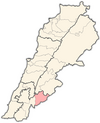
The Hasbaya District is one of the four districts in the Nabatiyeh Governorate of Lebanon. It lies in the southeast, bordering Syria to the east and Israel to the south. The capital of the district is Hasbaya, a town with a population that is mostly Druze oriented and some Christians.
33°23′55″N 35°40′58″E / 33.3985°N 35.6829°E / 33.3985; 35.6829
Municipalities
The following 20 municipalities are all located in the Hasbaya District:
- Abu Qamha
- Ain Jarfa
- Ain Qenia
- Al-Dalafa
- Al-Majidiyah
- Al-Mari
- Berghoz
- Shouaya
- Al-Fardis
- Hasbaya
- Al-Hebbariyah
- Kaukaba
- Kfar Shouba
- Kfar Hamam
- Al-Kfeir
- Al-Khalouat
- Marj al-Zuhour
- Mimess
- Rashaya al-Foukhar
- Shebaa
Gallery
Demographics
According to registered voters in 2014:
| Year | Christians | Muslims | Druze | |||||||
|---|---|---|---|---|---|---|---|---|---|---|
| Total | Greek Orthodox | Maronites | Greek Catholics | Other Christians | Total | Sunnis | Shias | Alawites | Druze | |
| 2014 | 15.86% | 8.29% | 4.28% | 2.30% | 0.99% | 51.58% | 48.75% | 2.83% | 0.00% | 32.17% |
References
| Capital | Hasbaya |  |
|---|---|---|
| Towns and villages | ||
| Other | ||
This Lebanon location article is a stub. You can help Misplaced Pages by expanding it. |


