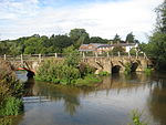
Name
Location
Type
Completed Date designated
Grid ref. Entry number Image
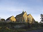
Old St Peter and St Paul's Church, Albury
Albury Parish Church
14th century
14 June 1967
TQ0632047848 51°13′12″N 0°28′44″W / 51.219939°N 0.478993°W / 51.219939; -0.478993 (Old St Peter and St Paul's Church, Albury)
1294958 Old St Peter and St Paul's Church, Albury More images
Chapel of St Catherine
Artington Chapel
Early 14th century
14 June 1967
SU9934348190 51°13′27″N 0°34′44″W / 51.224269°N 0.578768°W / 51.224269; -0.578768 (Chapel of St Catherine)
1377750 Chapel of St Catherine More images
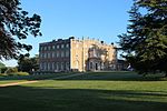
Loseley House
Artington Country House
1562-1569
18 February 1958
SU9749547149 51°12′55″N 0°36′20″W / 51.215229°N 0.605506°W / 51.215229; -0.605506 (Loseley House)
1029573 Loseley House More images
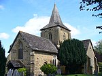
Church of St Nicholas
Compton Church
11th century
14 June 1967
SU9544547021 51°12′52″N 0°38′06″W / 51.214425°N 0.634882°W / 51.214425; -0.634882 (Church of St Nicholas)
1188621 Church of St Nicholas More images
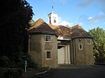
Watts Mortuary Chapel
Compton Chapel
1896-1898
14 June 1967
SU9563147397 51°13′04″N 0°37′56″W / 51.217774°N 0.632119°W / 51.217774; -0.632119 (Watts Mortuary Chapel)
1029541 Watts Mortuary Chapel More images
Church of St Thomas of Canterbury
East Clandon Church
13th century
14 June 1967
TQ0601751736 51°15′18″N 0°28′56″W / 51.254944°N 0.482181°W / 51.254944; -0.482181 (Church of St Thomas of Canterbury)
1029446 Church of St Thomas of Canterbury More images
Hatchlands Park
East Clandon Country House
1756-7
14 June 1967
TQ0673352009 51°15′26″N 0°28′19″W / 51.257264°N 0.471843°W / 51.257264; -0.471843 (Hatchlands Park)
1294970 Hatchlands Park More images
Church of All Saints
Ockham Church
14th century
14 June 1967
TQ0665056538 51°17′53″N 0°28′18″W / 51.297989°N 0.471682°W / 51.297989; -0.471682 (Church of All Saints)
1188424 Church of All Saints More images
Newark Priory
Ripley Priory
13th century
14 June 1967
TQ0417257699 51°18′32″N 0°30′25″W / 51.308883°N 0.506873°W / 51.308883; -0.506873 (Newark Priory)
1377835 Newark Priory More images
Eashing Bridge
Lower Eashing , Shackleford Bridge
13th century
14 June 1967
SU9466843811 51°11′09″N 0°38′49″W / 51.185698°N 0.646848°W / 51.185698; -0.646848 (Eashing Bridge)
1377743 Eashing Bridge More images
Church of St Mary
Holmbury St Mary, Shere
Church
1879
14 June 1967
TQ1098944426 51°11′18″N 0°24′48″W / 51.188293°N 0.413223°W / 51.188293; -0.413223 (Church of St Mary)
1029485 Church of St Mary More images
Holmdale
Holmbury St Mary , Shere Country House
1873
14 June 1967
TQ1107343800 51°10′58″N 0°24′44″W / 51.18265°N 0.412214°W / 51.18265; -0.412214 (Holmdale)
1029481 Upload Photo
Church of St James
Shere Church
12th century
14 June 1967
TQ0743647781 51°13′09″N 0°27′47″W / 51.219128°N 0.46304°W / 51.219128; -0.46304 (Church of St James)
1377794 Church of St James More images
Church of St Bartholomew
Wanborough Church
12th-century origin
14 June 1967
SU9349048903 51°13′54″N 0°39′45″W / 51.231666°N 0.662373°W / 51.231666; -0.662373 (Church of St Bartholomew)
1287038 Church of St Bartholomew More images
Clandon Park
West Clandon Country House
1725-31
14 June 1967
TQ0421051218 51°15′02″N 0°30′30″W / 51.25062°N 0.508216°W / 51.25062; -0.508216 (Clandon Park)
1294591 Clandon Park More images
Church of St Mary the Virgin
West Horsley Church
12th century
14 June 1967
TQ0883352643 51°15′45″N 0°26′30″W / 51.262566°N 0.441568°W / 51.262566; -0.441568 (Church of St Mary the Virgin)
1377828 Church of St Mary the Virgin More images
West Horsley Place
West Horsley House
Early 17th century
14 June 1967
TQ0880053011 51°15′57″N 0°26′31″W / 51.26588°N 0.441929°W / 51.26588; -0.441929 (West Horsley Place)
1188949 West Horsley Place More images
Wisley Church
Wisley Church
12th century
14 June 1967
TQ0568759610 51°19′33″N 0°29′04″W / 51.325781°N 0.48458°W / 51.325781; -0.48458 (Wisley Church)
1294423 Wisley Church More images
Church of St Mary the Virgin
Worplesdonr Church
13th century
14 June 1967
SU9729253574 51°16′23″N 0°36′24″W / 51.27302°N 0.606667°W / 51.27302; -0.606667 (Church of St Mary the Virgin)
1377735 Church of St Mary the Virgin More images
Church of Holy Trinity
Guildford Church
c. 1540
1 May 1953
SU9988149499 51°14′09″N 0°34′15″W / 51.235942°N 0.570702°W / 51.235942; -0.570702 (Church of Holy Trinity)
1029258 Church of Holy Trinity More images
Church of St Mary
Guildford
Church
c. 1040
1 May 1953
SU9961449344 51°14′05″N 0°34′28″W / 51.234595°N 0.574568°W / 51.234595; -0.574568 (Church of St Mary)
1377918 Church of St Mary More images
Former royal apartments at Guildford Castle
Guildford
Castle
Late 12th century
1 May 1953
SU9972049256 51°14′02″N 0°34′23″W / 51.233786°N 0.573075°W / 51.233786; -0.573075 (Former royal apartments at Guildford Castle)
1029306 Former royal apartments at Guildford Castle More images
Guildford Castle Keep
Guildford
Castle
Mid-12th century
1 May 1953
SU9976849312 51°14′03″N 0°34′21″W / 51.234281°N 0.572372°W / 51.234281; -0.572372 (Guildford Castle Keep)
1377881 Guildford Castle KeepMore images
Remains of shell keep at Guildford Castle
Guildford
Shell Keep
Early 12th century
1 May 1953
SU9976149297 51°14′03″N 0°34′21″W / 51.234147°N 0.572476°W / 51.234147; -0.572476 (Remains of shell keep at Guildford Castle)
1177988 Remains of shell keep at Guildford Castle More images
Guildford Castle gateway and walls adjoining to the east and south
Guildford
Castle
Mid-13th century
1 May 1953
SU9969649237 51°14′01″N 0°34′24″W / 51.233619°N 0.573423°W / 51.233619; -0.573423 (Guildford Castle gateway and walls adjoining to the east and south)
1029253 Guildford Castle gateway and walls adjoining to the east and southMore images
Guildford House
Guildford
Jettied House
c. 1660
1 May 1953
SU9982549515 51°14′10″N 0°34′17″W / 51.236095°N 0.571499°W / 51.236095; -0.571499 (Guildford House)
1180153 Guildford House More images
Hospital of the Blessed Holy Trinity
Guildford
Almshouse
1619-1622
1 May 1953
SU9986149532 51°14′10″N 0°34′16″W / 51.236242°N 0.570979°W / 51.236242; -0.570979 (Hospital of the Blessed Holy Trinity)
1029289 Hospital of the Blessed Holy Trinity More images
Somerset House
Guildford
Town House
Late 17th century
1 May 1953
TQ0003949602 51°14′13″N 0°34′06″W / 51.23684°N 0.56841°W / 51.23684; -0.56841 (Somerset House)
1029265 Somerset House More images
Guildford Grammar School
Guildford
School
1557
1 May 1953
TQ0001149575 51°14′12″N 0°34′08″W / 51.236602°N 0.568819°W / 51.236602; -0.568819 (Guildford Grammar School)
1294936 Guildford Grammar School More images
Guildford Guildhall
Guildford
Guildhall
c. 1550
1 May 1953
SU9976449492 51°14′09″N 0°34′21″W / 51.235899°N 0.572379°W / 51.235899; -0.572379 (Guildford Guildhall)
1180101 Guildford Guildhall More images



![]() Media related to Grade I listed buildings in Surrey at Wikimedia Commons
Media related to Grade I listed buildings in Surrey at Wikimedia Commons


