Commune in Nouvelle-Aquitaine, France Commune in Nouvelle-Aquitaine, France
| Moutier-Rozeille | |
|---|---|
| Commune | |
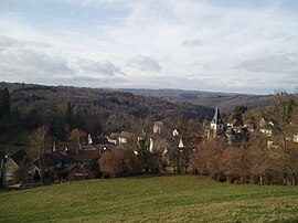
 A general view of Moutier-Rozeille A general view of Moutier-Rozeille | |
 Coat of arms Coat of arms | |
| Location of Moutier-Rozeille | |
  | |
| Coordinates: 45°55′03″N 2°11′52″E / 45.9175°N 2.1978°E / 45.9175; 2.1978 | |
| Country | France |
| Region | Nouvelle-Aquitaine |
| Department | Creuse |
| Arrondissement | Aubusson |
| Canton | Felletin |
| Intercommunality | CC Creuse Grand Sud |
| Government | |
| • Mayor (2020–2026) | Jean-Paul Burjade |
| Area | 19.66 km (7.59 sq mi) |
| Population | 433 |
| • Density | 22/km (57/sq mi) |
| Time zone | UTC+01:00 (CET) |
| • Summer (DST) | UTC+02:00 (CEST) |
| INSEE/Postal code | 23140 /23200 |
| Elevation | 437–671 m (1,434–2,201 ft) (avg. 538 m or 1,765 ft) |
| French Land Register data, which excludes lakes, ponds, glaciers > 1 km (0.386 sq mi or 247 acres) and river estuaries. | |
Moutier-Rozeille (French pronunciation: [mutje ʁozɛj]; Occitan: Mostier Roselha) is a commune in the Creuse department in the Nouvelle-Aquitaine region in central France.
Geography
An area of farming and forestry comprising a village and several hamlets situated near where the Creuse joins the Rozeille river, just 3 miles (4.8 km) south of Aubusson, at the junction of the D19, D982 and the D21 roads.
Population
| Year | Pop. | ±% |
|---|---|---|
| 1962 | 427 | — |
| 1968 | 507 | +18.7% |
| 1975 | 403 | −20.5% |
| 1982 | 475 | +17.9% |
| 1990 | 446 | −6.1% |
| 1999 | 435 | −2.5% |
| 2008 | 436 | +0.2% |
Sights
- The church, dating from the eleventh century.
- The ruins of a feudal castle at Confolent.
- The ruins of the St Hilaire church. Originally built in the mid-7th century around a Gallo-Roman mausoleum, the church has been continuously occupied until the end of the 19th century. With many graves and architectural features, the site is regularly studied by archaeologists since 2007.
See also
References
- "Répertoire national des élus: les maires". data.gouv.fr, Plateforme ouverte des données publiques françaises (in French). 2 December 2020.
- "Populations de référence 2022" (in French). The National Institute of Statistics and Economic Studies. 19 December 2024.
- "Moutier-Rozeille (23-Creuse) – Saint-Hilaire : Campagne de fouilles 2012 - CNRS / UMR ARTeHIS - Archéologie, Terre, Histoire, Sociétés". Archived from the original on 20 August 2016. Retrieved 4 July 2016.
This Creuse geographical article is a stub. You can help Misplaced Pages by expanding it. |